
Tasmania weather: Thunderstorms and flooding rain to hit Tasmania
Swollen creeks, sodden farms and flash flooding are wreaking havoc on the north and east coast of Tasmania, with more wet weather on the way this weekend. WARNINGS >>
Tasmania
Don't miss out on the headlines from Tasmania. Followed categories will be added to My News.
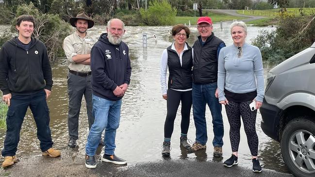
SWOLLEN creeks, sodden farms and flash flooding wreaked havoc on the north and east coast of Tasmania on Friday, with more wet weather on the way this weekend.
Glenn Traver from Craigie Knowe Vineyard in Cranbrook said they had 15mm in 15 minutes on Friday morning.
“We are swimming; we’ve had 50mm in 24 hours,” Mr Traver said. “The Swan River is in flood and one of the entrances is blocked off.”
He said they were no stranger to these kind of conditions.
“There’s been minor flooding, pretty small compared to what we normally get, we can get up 150mm. In March we had 400mm come through our cellar door.
“We’re not really worried about the vines at this stage, they’re very young, it’s just giving the ground a bit of a soaking and when the sun’s back out it should be okay.”
Gray, on the East Coast, recorded 127mm in the 24 hours to 9am Friday, with nearby St Patrick’s Head recording 53mm.
A flood watch is current for the north and north east, east coastal, south east and Huon catchments, with minor flooding developing in some areas overnight Friday into Saturday.
The Bureau of Meteorology says a low pressure system over Victoria is slowly moving southward and it is expected to move to the east of Tasmania on Saturday, bringing with it some potentially heavy falls that may lead to flash flooding.
East Coast Primary Producers Association president Anna Cotton has a sheep farm and vineyard in Swansea and said the rain had come at the right time.

“The past three months have been quite windy and dried things out quite considerably,” she said.
“We were teetering on the verge of drought conditions prior to this weather event. It has really turned this around and set us up for spring.
“We’re in the middle of lambing at the moment and coming into weaning we’ll have lots of grass for the sheep and lamb.”
Cheryl McCartie and her husband Theo van Brecht own a dairy farm at Ringarooma and are also feeling the impact of the wet weather.
She said they had been dealing with pugging damage caused by the cows to the pasture in the boggy conditions.
“It can impact the overall production and if there is damage now or in winter you can’t utilise as much pasture as you would like in the coming seasons,” Ms McCartie said.
She said they usually reach a break-even point in late September where they are able to feed their cows just on grass they have grown rather than needing supplements such as hay.
“It’s been delayed a bit because grass isn’t growing because we haven’t had enough sunlight to warm up the soil.”
Severe Weather Update: heavy rain and thunderstorms for eastern Australia. Video current 1.30pm AEST 28 September 2021.
— Bureau of Meteorology, Australia (@BOM_au) September 28, 2021
Know your weather. Know your risk.
Latest forecasts and warnings: https://t.co/VjbArDmLG3pic.twitter.com/SIs4c2Pzza
Sky News meteorologist Rob Sharpe said shower and thunderstorm activity would be felt across the eastern states on Thursday before more supercell storms hit on Friday.
“On Friday, the rain will pick up especially for the east coast of Tasmania, shower and thunderstorm activity continuing across mainland Australia, especially in southeast Queensland which is looking to be a target zone,” Mr Sharpe said.
“We are likely to see some further supercell thunderstorms developing with destructive gusts and giant hail.”

He said the weather event was likely to be on par with 2016 when there was also an exceptionally wet September across the eastern states.
Tasmania’s Bureau of Meteorology says the highest rainfall totals are expected about the northeast, where most of the rainfall is expected from Thursday afternoon through to Friday morning.
“Current two-day rainfall totals forecast to the end of Friday are 30-50mm in the northeast (60-70mm possible about higher ground), 10-30mm in the east coast, southeast and Bass Strait Islands and less than 5mm elsewhere about the state,” the Bureau said.
The rain in Spain may be mainly on the plain but the rain in #Tasmania will be mainly in the east for the rest of this week! Total rainfall sweepstakes are now open. How much do you think will fall at Gray between now and 9am on Saturday? For a hint go to https://t.co/sfzHWlZV8Dpic.twitter.com/RSZzuUeIVs
— Bureau of Meteorology, Tasmania (@BOM_Tas) September 28, 2021
Minor riverine flooding may develop at some locations from Friday morning and a flood watch is current for the north and north east, east coastal, south east and Huon catchments.
“The weather will remain unsettled for the rest of the week and afternoon thunderstorms are possible on Friday and Saturday,” the Bureau said.
“Persistent rainfall will likely impact people camping on the east coast for the school holidays but could be welcomed by locals after a dry winter.”
The rainfall is being generated by a low-pressure system slowly moving over Victoria and directing an easterly stream over Tasmania.
The low is expected to linger to the east of Tasmania on Saturday before slowly moving away to the east during Sunday.
Flood Watch
Minor flooding may develop at some locations in the flood watch area from overnight Thursday into Friday.
A low pressure system over Victoria is slowly moving southward. It is expected to linger to the east of Tasmania on Saturday before slowly moving away to the east during Sunday.
Most of the catchments in Tasmania remain relatively wet and will respond to rain events.
Widespread rainfall totals of 30 to 50mm are expected in the flood watch area during Thursday and into Friday, with isolated heavier falls of 50 to 70mm possible in the north east. The heaviest rainfall in the north east is expected from Thursday afternoon though to Friday morning.
River rises are expected from Thursday afternoon and minor flooding may develop at some locations in the flood watch area from early Friday.
The Bureau of Meteorology is continuing to monitor the situation and will issue catchment specific warnings as required.
Catchments likely to be affected include:
- North Esk River
- Meander River
- Macquarie River
- East Coastal Rivers (north of Bicheno)
- Ringarooma River
- Tamar (Launceston)
- Huon River
- Jordan River
- Coal River
- East Coastal Rivers (south of Bicheno)
A flood warning has been issued for the following catchment: South Esk River.
Keep up to date with the warnings here.
Join the conversation

Man killed, woman injured after tree falls on 4WD ute while driving
A man has died and a woman seriously injured after a tree fell on their 4WD ute while driving in Tasmania’s North-West on Saturday. The latest >>
Read more

Libs blocking access to Marinus Link business case: Labor
Labor has accused the Liberals of blocking access to a business plan for one of the nation’s biggest energy projects, the Marinus Link undersea interconnector.
Read more