
Tasmania weather: Snow falls in elevated parts of the state | Photos
The first snow of the year has blanketed elevated parts of Tassie after a strong cold front swept across the state. See the photos and the latest forecast >>

Tasmania
Don't miss out on the headlines from Tasmania. Followed categories will be added to My News.
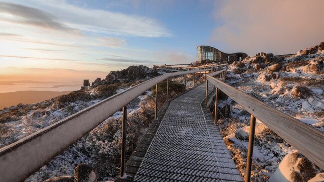
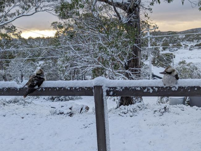
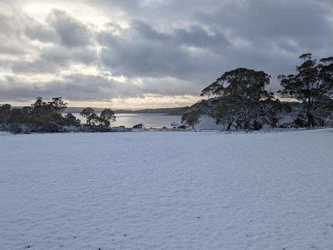
The first snow of 2023 has blanketed elevated parts of Tassie after a strong cold front swept across the state.
Great Lake Hotel manager Nicki Bowen said the first snowfall of the year for Miena was “amazing to wake up to”.
“I looked out the window and there was blankets of white everywhere,” she said.
With snow down to 800 metres was forecast the day prior, Ms Bowen said she informed her hotel guests — and those camping — to be prepared for a chilly start.
“We weren’t sure if it was going to hit because it is Mother Nature and she’s so unpredictable,” she said.
“But sure enough, it was just magical. We had a few campers who had to clean off the snow on their tents.”
The former Bendigo resident said she never gets sick of the sight of snow, counting herself “lucky” it’s right on her doorstep.
The Miena hotel already has forward bookings for winter when the chance of snow obviously escalates.
“Our accommodation has already been crazy, but winter is very popular because we have a lot of people who do chase the snow and tourists who don’t often see the snow travel up here and enjoy our fireplaces, our warm meals and watching the snow,” Ms Bowen said.
While severe weather warnings have been cancelled, the Bureau of Meteorology is forecasting gusty winds and cold temps for the rest of today and into Thursday.
The Central Plateau district will see a high chance of showers in the west, westerly winds 25 to 35 km/h and overnight temperatures falling to between zero and 5 with daytime temperatures reaching between 9 and 14 on Thursday.
The Upper Derwent Valley will see a medium chance of showers on Thursday and overnight temperatures falling to between 4 and 7 with daytime temperatures reaching between 12 and 17.
It will be another cool morning for the South East, with overnight temperatures falling to between 6 and 10 and daytime temperatures 14-19C.
Strong cold front moves in
Tuesday:
A ‘strong cold front’ will move through Tasmania Wednesday afternoon and evening, bringing damaging wind gusts, snow down to 800m and storm potential.
Tasmania’s State Emergency Service is urging the community to prepare for damaging winds, working closely with the Bureau of Meteorology to monitor conditions.
A severe weather warning for damaging winds is current for much of the state, with strong wind gusts already recorded today — the highest 115km/h at Cape Grim at 1.42am.
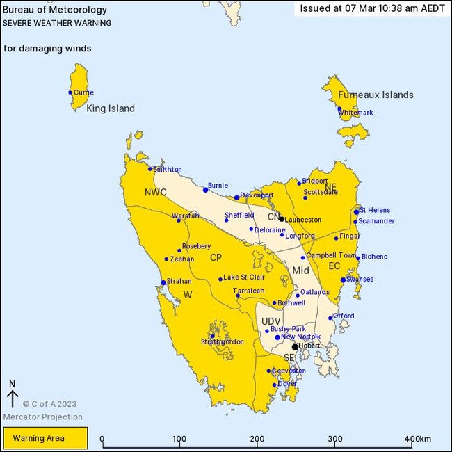
“A severe weather warning issued by the Bureau of Meteorology forecasts damaging winds over large portions of the state from mid-late afternoon today,” SES Assistant Director Leon Smith said.
“Last night Tasmania SES received several reports of trees and powerlines down. With damaging winds forecast for later today there is potential for further trees and powerlines to be brought down.
“We have SES volunteer crews prepared and ready to respond to incidents if needed and I encourage everyone to be aware of the weather forecast in their area and to take steps to keep safe.”
“Anyone planning on venturing into alpine areas is advised there is potential of snow to around 800 metres about western, central and southern Tasmania overnight, however, snowfall is not likely to settle at this time of the year.”
The warning area is currently focused on King Island, Furneaux Islands, Western, North East, East Coast, Central Plateau and parts of Upper Derwent Valley, South East, North West Coast, Central North and Midlands Forecast Districts.
Strong north-westerly winds averaging 50 to 60km/h with damaging wind gusts in excess of 100km/h likely to develop in the west from early this afternoon, extending across the northeast from mid to late afternoon.
Gusts of over 110km/h are possible over higher terrain, on King Island and the Furneaux Islands, and for exposed coastal areas.
Conditions are expected to ease from the west overnight Tuesday and during early Wednesday morning as the front moves to the east of the state, though gusty showers and isolated thunderstorms remain likely for southwestern parts into Wednesday morning.
Locations which may be affected include Devonport, St Helens, Swansea, Strahan, Geeveston and Dover.
The State Emergency Service advises that people should:
- Supervise children closely.
- Check that family and neighbours are aware of warnings.
- Manage pets and livestock.
- Secure outdoor items including furniture and play equipment.
- Be prepared in case of power outages and report any outages to TasNetworks on 132 004.
- Beware of damaged trees and power lines and take care when driving.
For SES assistance, phone 132 500. In an emergency, phone Triple Zero (000).
Join the conversation

Stadium builders ‘evasive’, economist claims
The independent economist who assessed Hobart’s proposed city stadium has accused the Macquarie Point Development Corporation of being “evasive” as cost blowout talks continue.
Read more

Further cloud gathers over Hobart’s Nyrstar smelter
The Australian operation of Nyrstar, who employs hundreds of Tasmanians at its Lutana plant, has been described as ‘uncompetitive’ and hints it could close without a lifeline.
Read more