
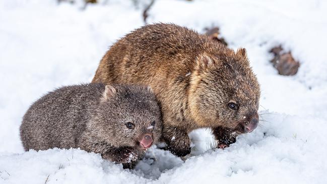
Tasmania to be hit with cold front bringing icy wind, rain and snow
Snow falling to low levels and temperatures dropping well below average — this weekend will be a frosty one across Tasmania. FULL 6-DAY FORECAST FOR YOUR TOWN + VIDEO >>


Tasmania
Don't miss out on the headlines from Tasmania. Followed categories will be added to My News.
SNOW falling to low levels and temperatures dropping well below average — this weekend will be a frosty one across Tasmania.
Sky News chief meteorologist Tom Saunders said temperatures were already “plummeting rapidly” with snow already falling on Mount Wellington and Cradle Mountain overnight just a taste of what’s to come.
“It will get colder across Tasmania tomorrow, with very cold air impacting the state for the rest of the weekend,” Mr Saunders said.
“Polar air and forecast for snow down to elevation of 500 metres is not that uncommon in spring – Tassie often gets its heaviest snow in spring.
“Springtime brings quite variable weather in Tasmania – you could have polar air and then a few days later it’s sunny and warm.”
Mr Saunders explained it was due to the ice cap around Antarctica reaching its peak in September after growing in winter.
“So the air in the south is very cold, but November you’re getting temps of up to 40 degrees inland so you get a clash – it’s a battle of the seasons really,” he said.
The experienced meteorologist said Tasmania’s maximum temperatures will be colder than normal this weekend.
“You’re looking at 12 degrees max for Hobart on Saturday, that’s on par with the average maximum for the middle of winter,” Mr Saunders said.
“Other parts of the state will be even colder, with Lake St Clair to see a maximum of just 3 degrees on Saturday.
“Saturday across the state will be cold, windy and snow down to low levels, snow clearing on Sunday but still very cold on Sunday.
“The morning is more about the minimum temperatures being very low – a low of 4 degrees on Sunday, which is the average minimum for middle of winter and Launceston is forecast to drop to just 1 degrees, about four degrees below average for this time of year.”
Full 6-day forecast
Hobart
- Saturday: Min 6 Max 12 Showers. Becoming windy.
- Sunday: Min 4 Max 13 Cloudy.
- Monday: Min 5 Max 16 Cloudy.
- Tuesday: Min 5 Max 18 Partly cloudy.
- Wednesday: Min 8 Max 19 Shower or two.
- Thursday: Min 10 Max 19 Shower or two.
Launceston
- Saturday: Min 4 Max 14 Partly cloudy.
- Sunday: Min 1 Max 15 Partly cloudy.
- Monday: Min 1 Max 17 Early frost. Mostly sunny.
- Tuesday: Min 3 Max 17 Partly cloudy.
- Wednesday: Min 7 Max 17 Showers.
- Thursday: Min 9 Max 17 Shower or two.
Strahan
- Saturday: Min 5 Max 11 Showers. Windy.
- Sunday: Min 5 Max 12 Shower or two.
- Monday: Min 5 Max 14 Possible shower.
- Tuesday: Min 3 Max 17 Partly cloudy.
- Wednesday: Min 8 Max 16 Showers.
- Thursday: Min 9 Max 15 Showers.
Bicheno
- Saturday: Min 7 Max 14 Shower or two.
- Sunday: Min 5 Max 14 Partly cloudy.
- Monday: Min 6 Max 16 Partly cloudy.
- Tuesday: Min 7 Max 15 Partly cloudy.
- Wednesday: Min 10 Max 18 Shower or two.
- Thursday: Min 10 Max 19 Possible shower.
ANALYSIS: Deepest series of cuts needed to balance cheque book
The Liberals have promised surpluses many times, but keep moving the marker on when it will be delivered, Political Editor David Killick writes.

Everything you need to know about this year’s state budget
Tasmanian treasurer Guy Barnett has delivered his no-frills first budget. WHAT’S IN IT >>