
Tassie’s biggest snowfall of the year falls across the state
Snow has fallen as low as 100m across the state to the delight of many families, but the snowline is expected to rise rapidly with sunny days ahead. Latest warnings, road closures and photos >>
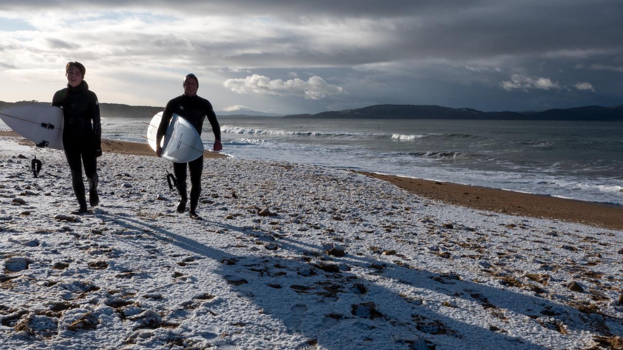
FAMILIES geared up in their winter woollies for a springtime snow romp on kunanyi/Mt Wellington after heavy falls blanketed the peak on Saturday morning.
The unseasonal falls, down to the 100m level, had snow lovers out in droves.

When Anja Boot’s 12-year-old daughter Peggy begged her to go for a drive to check out the snow she couldn’t resist.
“We’re in Strickland Avenue at 300m elevation and it is very rare that we have snow as thick as we did,” Ms Boot said.
“I saw how magical it was and how much snow there was so I called my sister and told her to put the kids in the car and come and play with us.”

Lucy Boot made the trip from Cremorne and was lucky she had snow gear in the car after a recent trip to the West Coast.
“We didn’t have much snow in winter and it’s only the second time our smallest child has seen so much snow,” she said.
“We spent a couple of hours sledding and making snowballs – it was super still and great to be there and have such a good time.”

Naomi Ortega only recently moved to Huon Rd and was over the moon to see her first blanketing of snow in her yard.
“We drove to Fern Tree at 8.30 and it was just amazing and so beautiful – a real winter wonderland,” Ms Ortega said.
“We loved it as we were rugged up and came home to a nice warm house.”


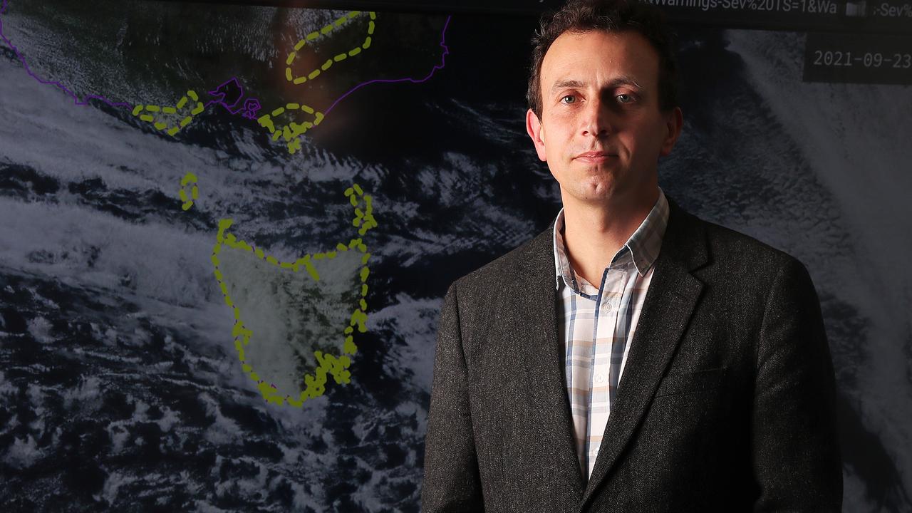
Bureau of Meteorologist duty forecaster Anna Forrest said families should enjoy the snow while it lasts, with sunnier days forecast for the days ahead.
“There’s plenty of snow out on Mt Wellington/kunyani. We saw low-level snow earlier this morning and it’s started to contract away as the day went on,” Ms Forrest said.
“We’re going to come under the influence of a high-pressure system, so frosty mornings, but nice sunny days ahead.”

Meteorologist Luke Johnston said the snow was likely to remain above the 800m level from Saturday evening onwards.
“Snow was reported to fall briefly to around 100m in the Hobart area late Friday night, but more significant snowfalls were reported in western and southern suburbs above 200m,” he said.
“Lower elevations around Hobart experienced icy, sleet-like showers during the night.
“Frost becomes a noticeable concern for Sunday, Monday and possibly Tuesday
mornings, with a warning current for Sunday and likely to be issued for Monday.”


Snow blankets Tassie as more frosty weather on the way
AFTER promises of snow as low as sea level, some Tasmanians weren’t disappointed to wake up to dustings right across the state.
A road weather alert was issued at 9.52am on Saturday for Western, Central Plateau, Midlands, Upper Derwent Valley and South East forecast districts.

Snow-covered roads above 300 metres will make driving conditions dangerous during Saturday in parts of the Western, Central Plateau, Midlands, Upper Derwent Valley and South East forecast districts.
A number of roads are closed across the state, with Tasmania Police issuing a warning for drivers to be careful of icy and slippery conditions.
Get all the latest road closure details here


And there is more blustery weather on the way, with the Bureau of Meteorology issuing a frost warning for Sunday.
Frosts with temperatures down to -2C are forecast for Sunday morning in parts of the North-West Coast, Central North, North East, Midlands, East Coast, Upper Derwent Valley and South East forecast districts.
A bush walkers weather alert was also issued on Saturday morning, with snow as low as 400m expected during the day. These hazardous conditions are expected to occur in parts of the Western and Central Plateau forecast districts.


Friday
As the mercury dropped to a single digit in the late afternoon and into the evening, some suburbs were lucky enough to see snow in their neighbourhoods.
“We’ve had observations of snow at elevated suburbs of Hobart as expected,” Bureau of Meteorology senior meteorologist Brooke Oakley said.
“Areas like Mt Nelson and Ferntree.”
Tourists Paul Erlynne and Sara Dixley were pleasantly surprised by the snow at Cradle Mountain lodge on Friday.
“It’s incredible, it’s been snowing steadily for about five hours,” Mr Erlynne said.
“We were told it was going to snow but not to the extent it has.
“We tried hiking through it, we got 1km into the hike but it was pretty heavy so we turned back.”


The couple, who had travelled from Perth WA, said it was a big change from what they were used to.
“We don’t come from a state where it snows,” Mr Erlynne said.
“It was pretty cold, we weren’t equipped for it being from Perth.
“The week before we were getting ready for the beach!”
The two plan to have an equally snow filled day on Saturday.
“We’re going back up to Cradle Mountain,” Mr Erlynne said.
“Someone said we might be snowed in so it’ll be interesting to see how it goes overnight.
Toowoomba tourists Leiscia and Richard Routley and their daughter Jessamy Routley from the Gold Coast were hoping to drive up to Mount Wellington on Friday, but were stopped in their tracks.
“We were surprised by how quick they were to close the road,” Mrs Routley said.
“We had no idea roads would just close with this tiny bit of snow.
“We’d actually like to see the view, but we might get to sneak up another day.”
Ms Routley said they family were delighted by the prospect of snow after seeing the forecast.
“It’s probably about 20 degrees colder than the gold coast and a lot less sunny but it’s cool to be somewhere else,” Ms Routley said.
“It’s good to be able to get rugged up and get nice and cosy.”
At the Great Lakes Hotel on Friday, owner James Johns said he was expecting a “fairly large dump of snow” overnight.

“They’re saying it’ll be one of the largest snowfalls this year,” Mr Johns said.
“Snow is settling on the highland side of Bothwell, we’re going to get quite a bit.
“We’ve had a couple of periods of white outs, there’d only be about 5-10 cm of snow at the moment, that’s enough for it to build upon.
Mr Johns said it would likely be tough conditions for most cars.
“I would expect highland lakes road will be shut and probably most of the roads will be shut, or probably 4wd only,” he said.


On Saturday, the temperatures in Hobart was expected to stay below 10 degrees.
Ms Oakley said it’s unusually cold for this time of year.
“We’re forecasting the snow level to continue lowering this evening and overnight,” Ms Oakley said.
“We’re expecting it to get around 100 metres but it is possible there will be snow flurries to sea levels.”
For those hoping for a snow day, seeking snow earlier in the day could be key.
“The lowest snow is occurring in the overnight period and the snow level will rise again in the morning,” Ms Oakley said.
“There might be a small amount of settled snow but this time of year, the ground is quite warm so it will melt very quickly.
“You’ll be able to see snow on Mount Wellington and if you’re on the Central Plateau you’ll see snow.
Ms Oakley said the conditions came with warnings.
“Snow could impact road conditions for people travelling around the state and a road weather alert has been issued.”
Annalisa Doedens also captured these stunning shots along Lake Dobson Road while visiting Mount Field National Park.


Although unseeable to the eyes of residents below with cloud covering the summit of kunanyi, heavy snow has also blanketed the mountain in a recent summit cam shot snapped by the Hobart City Council.
Snow already falling on the top of #kunanyi, settling about #Hobart's higher suburbs late this afternoon or evening. Snow flurries across the city are possible, but likely to occur after dark, and confined to the higher suburbs again by sunrise. @cityofhobarttaspic.twitter.com/f094v8wyVH
— Bureau of Meteorology, Tasmania (@BOM_Tas) September 24, 2021
Tasmania Police have issued a warning for slippery and hazardous roads, urging drivers to be cautious of black ice, drive with headlights on and slow down according to conditions.
“Last time this happened we had cars stranded all over the state, including on the Midland Highway at Spring Hill and the Tasman Highway near Bust Me Gall Hill.” said Tasmania Police.
“Don’t let it be you.”
A severe weather warning remains in place for the whole state with damaging northwest to westerly winds averaging 60km/h to 70km/h with peak gusts near 100km/h possible in most areas.
A Severe Weather Warning is in place for #Tas today. NW/W'ly winds will strengthen later this morning, with the potential to cause damage. Gale Warnings current for coastal waters and the South West Lakes aswell. Stay up-to-date with warnings https://t.co/NHL3HY0zFOpic.twitter.com/PbhorntCtm
— Bureau of Meteorology, Tasmania (@BOM_Tas) September 23, 2021
Crews ‘prepared’ as icy blast set to lash Tasmania
Thursday 4pm: Ferocious winds, toppled trees, and flying bins are merely a taste of what’s to come, the Bureau of Meteorology has warned.
Friday and Saturday will see large swathes of Tasmania buffeted by thick flurries of snow, especially the western and southern regions where it is slated to reach near sea level.
Senior meteorologist Simon Louis said these were highly unusual conditions for this time of year, given that winter ended weeks ago.
“We’re expecting a late spring blast of wintry weather across Tasmania with a series of vigorous cold fronts to move through,” Mr Louis said.
“There’s a high pressure system out to our west and quite a vigorous cold front moving through, and that cold front is dragging up some really strong cold air from the south and generating a lot of strong and gusty winds we’re expecting.”
State Emergency Service’s Leon Smith and his volunteer crew spent Thursday morning attending to downed trees, collapsed roofs and bin-related accidents.
On one occasion a bin full of roofing iron was picked up by the winds, sending sheets of metal raining down across the area.
On another, a bin full of insulation material went aloft, scattering across a nearby road and creating delays for drivers.
Mr Smith said their squad of volunteers were ready for deployment and prepared to take on what was sure to be a busy weekend.
“We’ve got an operational capacity of 642 volunteers, about 200 in each region around the state,” Mr Smith said.
“They’re all keen, they’ve got a smile on their faces, and they’re well and truly prepared to participate in any SES operations over the weekend if needed.”
It's all happening in the weather over #Tasmania. Windy today and Fri, with snow to low levels later Fri and Saturday morning, then morning frost Sun and Mon as the cold air lingers. Stay safe and heed warnings. pic.twitter.com/XQlSxo2ei5
— Bureau of Meteorology, Tasmania (@BOM_Tas) September 23, 2021
Police Inspector Brian Edmonds warned Tasmanians to drive safely over the coming days, especially in areas of high snowfall.
With school holidays kicking off, Inspector Edmonds said there would be more cars on the roads and a higher chance of accidents on the icy roads.
“With the possibility there’ll be some refreezing on the roads, there is the potential for some areas to have black ice which is difficult to see, so drivers need to drive to the conditions,” Inspector Edmonds said.
“With the extra number of people on the roads the advice to all motorists is to slow down, take your time, consider whether you do need to be on the roads, and always drive to the conditions.”
Hobart is expected to see some snow settling for a short period around the hills, but lower elevations may only experience light snow flurries or sleet-like showers.
Thursday saw winds of about 92km/hr in Hobart, but winds of over 100km/h are forecast for the coming days.
Mr Louis said some of the riskier roads to look out for will be Lyell Highway, the Huon Highway near the Vinces Saddle, and the Midlands Highway at Spring Hill.
Thursday, 10am:
The Bureau of Meteorology has updated their snow forecast for Friday, saying flurries are possible “to near sea level” in parts of Tasmania.
The Bureau said two cold fronts are set to cross Tasmania on Thursday morning and Friday afternoon, bringing damaging winds and very low snow.
“Snow flurries to 100 metres are possible by late Friday, after winds have died down, and snow flurries are possible to near sea level in parts of the west and south of Tasmania,” the bureau said.
Senior meteorologist Luke Johnston said an “Antarctic blast of cold air” would impact Tasmania on Friday night into Saturday, bringing snow to very low levels.
“We’re looking at seeing snowfall settling down to around 100 metres by late Friday, early Saturday morning about parts of Tasmania with snow flurries possible down to sea level about much of the west and south of Tasmania,” Mr Johnston said.
“We’re not expecting the snow to really lower to those levels until after the winds have died down so the damaging severe weather warning for damaging winds will likely be cancelled before the lowest snow arrives.”
Mr Johnston said Hobart would experience some snow settling for a short period about the hills around the city but lower elevations may only experience light snow flurries, or icy sleet-like showers during the late afternoon and into the evening.
“Some snow is likely to settle on main roads that may cause some issues around the state, so we’re going to issue a road weather alert for Friday and Saturday as well as a bushwalkers weather alerts and a warning to sheep graziers,” he said.
Hold onto your hats, we're in for a windy few days. Wind gusts to 100kmh over central and southern #Tas Thurs late morn to mid arvo, then more widespread on Fri arvo as another front crosses. Snow to low levels and flurries to sea level late Fri and early Sat. pic.twitter.com/bH6y6VmvEa
— Bureau of Meteorology, Tasmania (@BOM_Tas) September 22, 2021
The meteorologist said some roads may start to be affected late Friday over the Central Plateau connecting the West Coast over the far south particularly around Vince’s Saddle.
The Midland Highway south of about Oatlands may also see some snow falls late Friday into Saturday morning, with the colder air going to linger over Tasmania during Saturday so the snow level will very slowly rise during the course of Saturday.
“Very cold mornings” and a high likelihood of frosts are also on the cards across the weekend and the beginning of next week.
“It’s pretty rare to see snow down to near sea level in Tasmania, but it would become more possible about this time of the year in late winter or early spring where we start to see the real cold systems move over Tasmania,” Mr Johnston said.
“It’s likely going to be the lowest snowfalls in Tasmania experienced this year. We have had a couple of events for the snow to sub 500 metres during the course of this winter so far, but we haven’t had one down to sea level.”
A severe weather warning is also current for damaging west to north-westerly winds for Thursday, with gusts up to 100km/h possible about southern and central areas.
Locations which may be affected include Oatlands, New Norfolk, Bothwell, Geeveston, Dover and Huonville.
Winds are expected to ease below the warning threshold by midafternoon on Thursday but will redevelop on Friday as the stronger cold front crosses. A severe weather warning will likely be issued for Friday for a larger area.
The severe warning and confirmation from the Bureau comes as weather watchers earlier tipped the “biggest snowfall of the year” to blanket Tasmania, with one even tipping it could fall to sea level.
Weather page ‘Tasmanian Weather Watch’ posted forecast maps of the expected coverage, saying “biggest snowfall of the year is forecast to reach Tasmania overnight Friday into Saturday with low level snow statewide”.
“I’m not ruling out snow to sea level for Southern Tasmania but I’m holding back to let models chop and change over the coming days,” the page posted.
“But it’s almost locked in this will be a major snow event for Tasmania!”

“The coldest air comes over later on Friday afternoon and into the early hours Saturday morning,” meteorologist Glen Perrin said.
“It will be low enough that you’ll see snow to lowish levels across most parts of the state, particularly the southern half and Central Plateau areas.”
He said while snow through spring was not unusual, snow “to this low level is” for this time of year.
“Small hail is also a possibility in the later part of Friday and Saturday morning,” Mr Perrin said.
“There is a risk of an isolated thunderstorm as well.”
Snow is likely to stick around into Sunday too — though not to the lower levels as we’ll see overnight Friday.
Fresh and gusty north-westerly winds are also on the cards for Friday, shifting west to south-westerly in the evening.

Motorcyclist dies in three-vehicle northern crash
