
Snow, hail and bitter southerly winds recede as autumn fades out
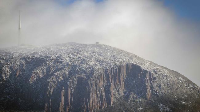
The road to the pinnacle of kunanyi/Mt Wellington has reopened as the snow slowly recedes – and it may be the last chance for a snowball fight for some time. FULL FORECAST >>

Tasmania
Don't miss out on the headlines from Tasmania. Followed categories will be added to My News.
- Everything Tasmanians need to know about snap lockdown
- REVEALED: Four hopefuls in race for Glenorchy’s top job
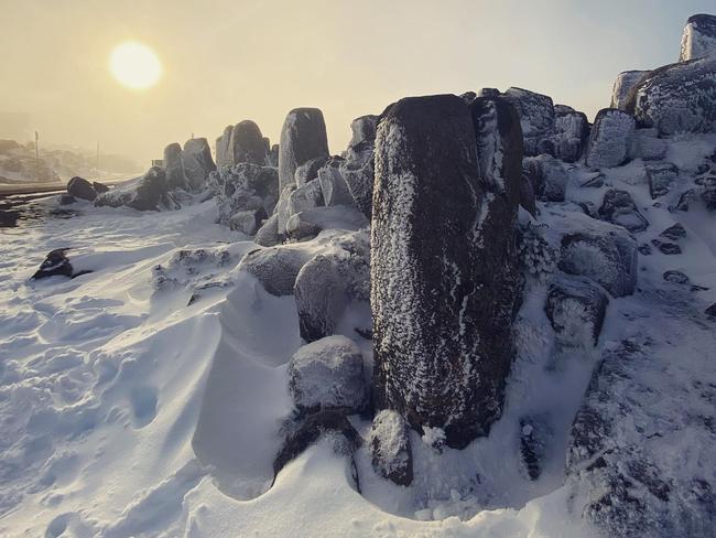
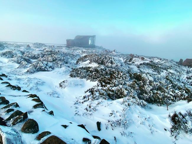
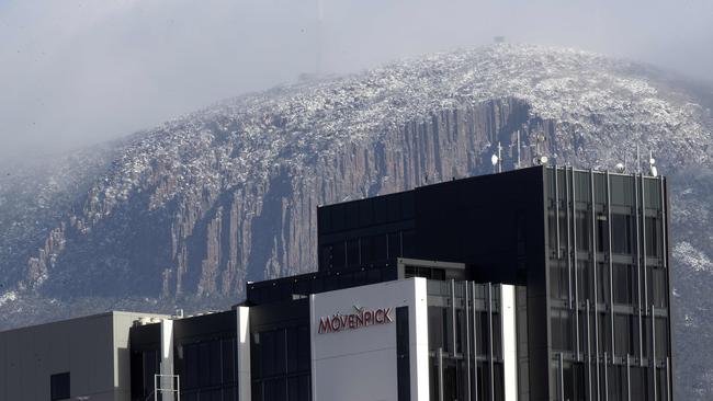
TIME is running out to check out the snow on kunanyi/Mt Wellington with last week’s massive dumping slowly disappearing.
Pinnacle Road reopened on Sunday morning and access to the summit is currently open.
A large dumping of snow fell on the south last Thursday and much of it remains at the pinnacle of the mountain, but the Bureau of Meteorology is predicting no more snow falls for at least the next week.
Monday is the last day of autumn and BoM predicts the start of winter will be a relatively mild affair.
The recent cold temperatures across the state will continue, but the mercury is predicted to rise over the first few days of winter as an increase in clouds and wind produce milder temperatures and less frost.
The Bureau of Meteorology said Tasmanians can expect a more mild start to winter than the chilly conditions of the past week, but to prepare for showers across the state in the second half of the week.

Snow, hail and bitter winds mark winter’s return
May 28
Temperatures will continue to drop today and into this weekend as Tasmanians brace for a brutal start to winter.
Hobart saw a low of 5 degrees this morning with a “feels like” temperature of minus 1.2C as south-westerly winds send a chill through the city, but Bureau of Meteorology Tasmania meteorologist Glen Perrin has said it’s only going to get worse.
“Those winds will tend more southerly on Friday, then ease later Friday,” he said.
“But we’re still going to see quite cold temperatures Friday, Saturday and Sunday with light winds on Saturday and Sunday.”
Mr Perrin said snow would fall to about 600m early on Friday before slowly rising throughout the day.
“There’s also a chance of hail (Friday) morning, particularly around western, central and southern areas, but it’s only a small risk,” he said.
“There will be very cold starts across the state on Saturday, Sunday and even Monday.”
Mr Perrin said maximum temperatures would begin warming up on Tuesday, Wednesday and Thursday to about 16C, which was above average for June.

“Sixteen is not so warm, but we are coming into winter,” he said.
It comes amid a recent announcement from BOM Australia the entire country would expect warmer than average night-time temperatures this winter.
Mr Perrin said Tasmania would also see warmer maximum temperatures for the typically cold season.
Warnings for the rest of Thursday include marine wind warnings, sheep graziers warnings at the east coast and south east area, and a bush walkers weather alert for the western and Central Plateau.

Bob Brown’s conviction appeal dismissed
A Tasmanian judge’s decision to dismiss an appeal on Thursday launched by former Greens senator Bob Brown didn’t come as a surprise to the environmentalist. The findings.

Why the National Party is targeting Tassie this state election
The state is heading to an election and parties are swarming to get a seat at the table. Is it time for the Nationals to get a foothold in the Apple Isle?