
RV Investigator’s revolutionary satellite tracks warm water leaks from Southern Ocean to Antarctica
A team of scientists on the RV Investigator is using revolutionary satellite technology to track warm water leaks from the world’s strongest current, which they say is melting Antarctica’s ice.
Tasmania
Don't miss out on the headlines from Tasmania. Followed categories will be added to My News.
A team of scientists bound for the Southern Ocean is researching the world’s strongest current, which is currently leaking warm water and contributing to ice melt in Antarctica.
CSIRO’s research vessel the Investigator, along with 54 people on board, will leave on Wednesday to travel between Tasmania and Antarctica to study the currents on a 36-day science expedition.
For the first time, scientists will validate imagery of the Southern Ocean taken by a groundbreaking satellite, Surface Water and Ocean Topography (SWOT), which was developed by NASA and French space agency Centre National d’Etudes Spatiales.
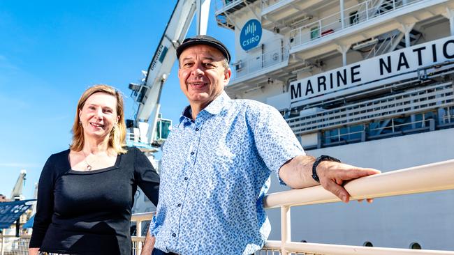
“The Antarctic Circumpolar Current generates whirling eddies and finer scale dynamics that we’re trying to understand, which are the prime suspect for warm water seeping towards the (South) Pole,” CSIRO voyage co-chief scientist Dr Benoit Legresy said.
“Its so strong that it isolates the warm water in the north here – although people think Tassie waters are not so hot – from the really cold one south in the Antarctic. It creates a barrier that keeps Antarctica cool and maintains the cold ice.”
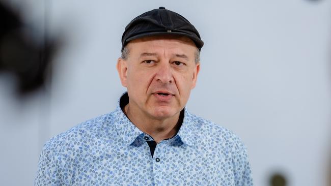
Dr Legresy said there were five eddy “heat flux gates”, which he described as wiggles, that scientists believe act as a gateway for heat leaking south.
“We’re going to track down those small features, around the Antarctic Circle, that we think explain the heat seeping into polar waters,” he said.
“SWOT is measuring the ocean topography which is the equivalent of atmospheric pressure for the atmosphere, so the weather map you look at is the atmospheric pressure equivalent for the ocean is the surface topography.”
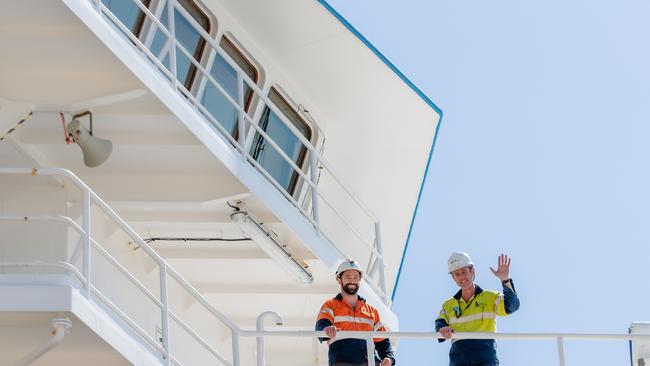
The RV Investigator crew will be running a 24-hour ship, with shift work from 2am to 2pm or 2pm to 2am.
University of Tasmania’s Australian Antarctic Program Partnership voyage co-chief scientist, Associate Professor Helen Phillips, said the satellite was breakthrough technology that exposed eddies on a finer scale.
“For a short-sighted person, you look in the distance and you can see maybe there’s a tree but you put your glasses on and you can see all the leaves and that’s the transition from our traditional satellite altimeters where we know that there are these large eddies that are really important for moving heat around in the ocean,” she said.

“But with the SWOT satellite, we can see the very fine-scale features that are breaking away from these eddies that we think actually do most of the work.
“The SWOT satellite is such an incredible revolution and we have other advances in the instruments that we put in the water, including really incredible gliders that get piloted from the ship that are measuring what the satellite’s seeing at the surface but showing us what the structure is underneath the water and that three-dimensional picture is so valuable.”


Winter’s gamble on dethroning Premier backfires
Dean Winter’s gamble on toppling Jeremy Rockliff has backfired for the Labor Party, as the premier told the tally room he would ask the Governor to ‘recommission the government’.

Explainer: Likely winners and losers, FAQs and how we got here
As the votes are being counted, David Killick, the Mercury’s Political Editor, and Bridget Clarke explain the layout of Tasmania’s House of Assembly, the current state of play and how we got here.