
Heavy rain, gusts and snow: Wild weather to lash the state
Heavy rain and wind have lashed the state, while snow has also fallen in numerous parts of Tasmania. Get the latest on the weather here.
Tasmania
Don't miss out on the headlines from Tasmania. Followed categories will be added to My News.
Heavy rain and wind have lashed the state, while snow has also fallen in numerous parts of Tasmania.
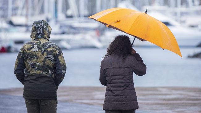
The Bureau of Meteorology warned of heavy rain and possible flooding across Southern Tasmania on Tuesday morning.
The heavy rain and flooding is expected to be followed by cold southerly winds and cooler temperatures.
“Rain falls of 30 to 60mm are expected on Tuesday across the southeast and lower east of the state with higher totals possible in some areas,” a BOM spokesman said.
“The rain is expected to intensify Tuesday morning and gradually ease from late afternoon.”
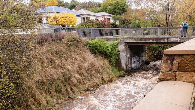
The spokesman said recent rainfall meant rivers were continuing to rise with flooding occurring in northern catchments.
Now there was also the danger that additional river rises would occur following forecast rain.
“Strong and gusty southerly winds are expected to develop along the southeast and lower-east coastal fringes on Tuesday, with gusts of 80 to 90km/h possible about those parts,” the spokesman said.
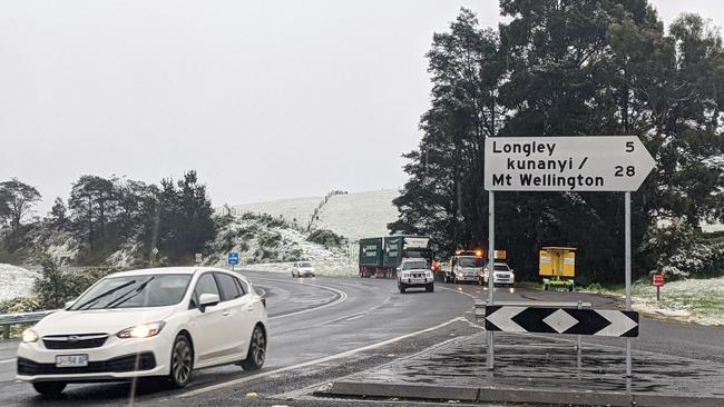
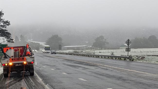
“The cold southerly winds are expected to bring snowfalls to around 700m on Tuesday and early Wednesday, with Hobart expected to reach a high of 11C on Tuesday.”
The BOM said widespread rainfall had already fallen over much of the north and east over the last 24 hours (Sunday to Monday) with 40 to 50mm observed over parts of the northeast in the 24 hours to 9am Monday and 20 to 40mm observed across the remainder of the north and east.
“The coming rain, winds and snow are being generated by a low-pressure system moving to the southeast of Tasmania during Tuesday, extending an active trough over the state,” the spokesman said.
Conditions are expected to ease late Tuesday and early Wednesday as a ridge approaches from the west.
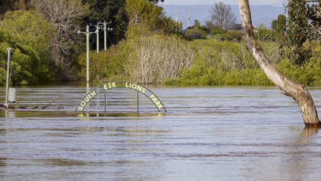
Moderate Flood warnings are current for the Macquarie and South Esk Rivers while Minor Flood Warnings were current for the Meander and North Esk rivers.
A Flood Watch is current for northern catchments and will likely be extended to cover southern and eastern catchments today.
One of the areas to receive snow overnight was the Huon Valley, with the Southern Tasmanian region waking up to a decent fall.
Heavy rainfall, possible flooding to slam state
MORE wet weather is install for Tasmania over the next few days with flood warnings already in place for parts of the north.
Meteorologist at the Bureau of Meteorology Alex Melitsis said Hobart will see around 30-55mm of rain from Sunday to Tuesday.
“On Sunday the Hobart area will see a burst of rain that will clear off in the evening,” he said.
“Then another wave of rain will start on Monday morning with showers for much of the day, which will again ease off in the evening.
“Tuesday will see a strong cold front sweep across the state with more rainfall and a high of just 12 degrees.”
Mr Melitsis said Tasmania will see low snow on Tuesday night and into Wednesday morning, with falls on elevations above 700 metres.
With catchments already saturated over much of the state, the north and east have also been put on alert.
There are currently minor flood warnings for the Macquarie River and South Esk River.
ICE CREAM SHOP CLOSES DOORS, ENDING IN TEARS
The North West, North and North East Catchments are also on flood watch.
Mr Melitsis said climate drivers La Nina and negative Indian Ocean Dipole are contributing to a wetter spring than usual.
“We can expect to see more rain than usual for the remainder of this year,” he said.
TASSIE DAIRY KING, SWISS CAPITALIST AND $3.4M DISPUTE
But Uncle Mutch cray boat deckhand Josh Parker said he will take the wet weather in his stride.
“Crayfish season officially starts on Tuesday,” he said.
“The weather doesn’t overly impact what we do but it might be a bit bumpy for the next couple of days with the rain passing through.

“The seas will be a bit rougher and we will have to avoid shallow waters which means we might miss catching some varieties, but we will do our best.”
Mr Parker said the people most affected will be those selling freshwater fish.
“When there’s heaps of rain it trickles down the creeks and too much can kill the fish as it messes with the natural make up of the water,” he said.
Hobart forecast
Monday – showers, 17
Tuesday – showers, 12
Wednesday – shower or two, 13
Thursday – possible shower, 17


Premier exploring options for approval of $5bn Marinus deal
Premier Jeremy Rockliff is exploring ways to green light Tasmania's $5bn Marinus Link project during the caretaker period despite Labor's reluctance to support the deal.

Short delay in teacher abuse trial, Crown to close case on Monday
The trial of a former Hobart teacher accused of sexually abusing multiple students over several decades beginning in the 1970s has been delayed due to the illness of key legal personnel.