Hobart Council cancels Salamanca Market and closes three parks as severe weather warning extends across weekend
Wild weather has led to parks being closed and events being cancelled, including the popular Salamanca Market. Details.

Tasmania
Don't miss out on the headlines from Tasmania. Followed categories will be added to My News.
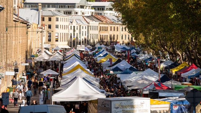
August 30, 4:45pm: The Salamanca Market will close as severe weather warnings led to emergency services urging Tasmanians to consider staying home this weekend.
August 30, 4:45pm: The Salamanca Market will close as severe weather warnings led to emergency services urging Tasmanians to consider staying home this weekend.
City of Hobart CEO Michael Stretton said the cancellation was a difficult decision.
“It is highly unusual for the Market to be closed due to weather conditions; with the only time it has occurred previously in its 52-year history being in April 2013,” he said.
“We apologise to anyone who may have travelled specifically to visit Tasmania’s most visited tourist attraction, but safety is our top priority.”
The market is expected to return next Saturday.

Bureau of Meteorology senior meteorologist Luke Johnston said the severe weather was forecast to last til Tuesday or even Wednesday, with the most damaging weather to hit Tasmania on Saturday night.
Tasmanian police attended 20 car crashes on Friday due to the severe weather event, and the SES were called out to 98 incidents in the past two days.
700 SES volunteers are now on standby across the state, with police urging the public to consider staying home to avoid the worst of the weather.
Mr Johnston said “unusually high tides” would combine with already high flood waters and “destructive” wind gusts reaching 130 km/per hour over the coming days.
Multiple coastal hazard warnings are in place on the West Coast of Tasmania where high tides and huge winds would cause “potentially damaging surf and wave events” right through the weekend.
“Abnormally high tides” were also predicted for Hobart’s Macquarie Harbour.
“This is a situation that’s evolving quite rapidly, so warnings will be updated and escalated if required,” said Mr Johnston in a press conference on Friday afternoon.
“We have a team of hydrologists working in Tasmania and actually assessing the flood situation continuously overnight.”
“All the factors in the weather are really coming together Saturday evening, so that’s when we’ll have some of the strongest winds, the highest tides, and potentially some of the biggest floods.”
2.20pm: Police have urged drivers to take caution on the Causeway at Midway Point with severe weather impacting road conditions.
Officers say the stretch of highway was being battered by high winds, causing water to spray across the road.
“All motorists travelling through that area are advised to approach with caution and to drive to the conditions,” a police spokesperson said.
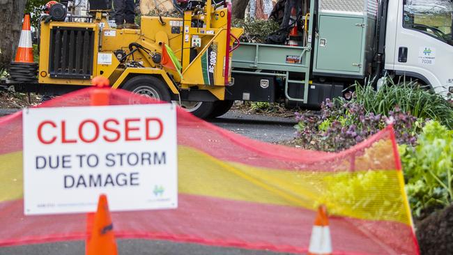
Earlier: The severe weather hitting the state has once again closed down popular Hobart parks.
The Hobart City Council has closed St Davids Park, Princes Park and Waterworks Reserve this afternoon and it is anticipated it will remain closed until Monday.
Council workers say the biggest concern is falling tree limbs and branches, which is why they’ve spurred into action.
The Bureau of Meteorology has a severe weather warning in place for damaging winds statewide that are forecast to redevelop from the west late Friday evening and continue over the weekend and into next week.
The SES have urged Tasmanians to continue to monitor the conditions and be prepared with dedicated volunteer crews at the ready.
Acting SES assistant director Cheryl Ames will be providing an update to the media on the latest conditions this later afternoon.
Last night, wind gusts of around 100km/h mixed with continual rainfall occurred across the state.
MORE TO COME


