
Mapped: Riverland pictures and flood mapping tool
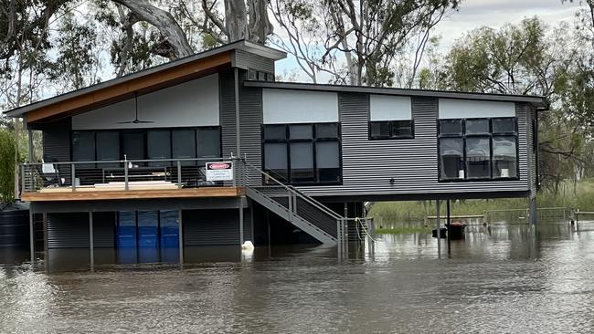
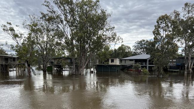
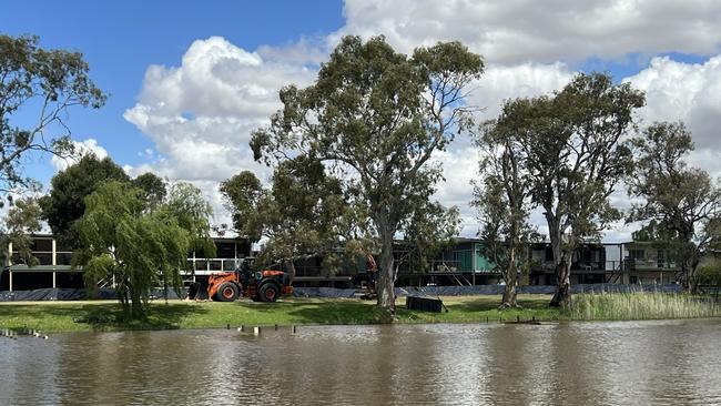
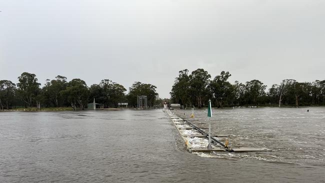
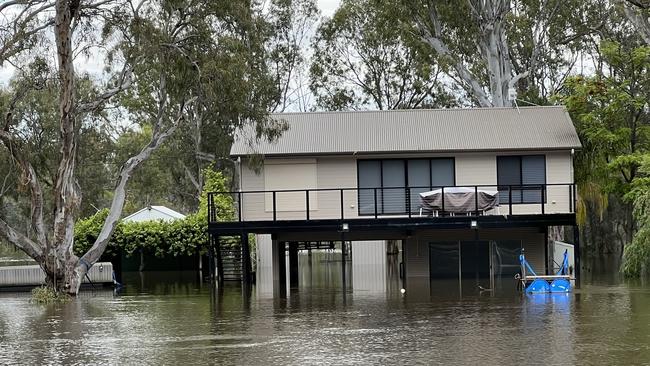
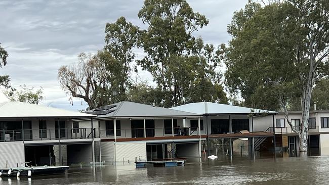
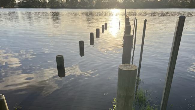
Homes from Morgan to Murray Bridge are surrounded by water with photos taken by reader James Juers showing the very real threat to properties.
SA News
Don't miss out on the headlines from SA News. Followed categories will be added to My News.
As the water continued to rise, reader James Juers moved his houseboat from Morgan to Murray Bridge, capturing these photos on the way.
It comes as authorities continue to assess whether to close roads including Bookpurnong Road, linking Berri and Loxton, as water levels threaten to spill over.
The state government is set to fund a temporary levee down the middle of Mannum’s main street as up to 4000 properties are expected to be inundated by flood waters.
SAPN Head of corporate affairs Paul Roberts said the electricity distributor had also been making urgent assessments around the potential impact on customers and infrastructure as the river rises – with about 2000 homes likely to have power cut in the coming weeks.
“We will communicate directly with customers affected where we can via our SMS system, but we are aware that many shacks will be unoccupied,” he said.
The state government’s River Murray flood mapping tool is for Riverland and Murraylands communities to check the flood risk to their home or property with a flow of 160GL or 200GL per day. You just pop in your address and then select to view 160GL or 200GL per day flow example to see where it is likely to flood.
CLICK HERE: RIVER MURRAY FLOOD MAPPING TOOL
OR EXPLORE THE MAPS HERE: 120GL, 140GL, 160GL AND 200GL DAILY FLOWS
Solar panels should be shut down in flooded area and people with batteries should consider moving them above expected flood levels. That is a job for a qualified electrician.
Properties impacted by flood waters would also need a safety certificate from a qualified electrician before power could be restored to a property.
SASES Chief Officer Chris Beattie said last week it was estimated that about 400 properties would be “inundated above the floor level” if the 165GL mark is reached.
Mr Beattie added that they were planning for 165GL a day but “have their mind open to the fact that it could be higher”.
“At the 200GL mark we are looking at approximately 4250 premises (being flooded),” Mr Beattie said.
More Coverage

Originally published as Mapped: Riverland pictures and flood mapping tool

Historic flooding at SA Outback oasis has rangers hot on yachties’ sails
Visitors flouting rules now to walk on Kati Thanda-Lake Eyre have been fined by the state government, as yachties steer clear of rangers.

Footy legend lost his toes to a nail cutting slip and he’s not alone
He didn’t realise his foot was turning black after he nicked his toe but the simple accident led to a month long hospital stay and amputation. Warning graphic content.