
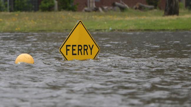
Lyrup, Swan Reach and Morgan ferries closing with others likely to follow due to SA floods risk
Up to 12 ferries across the Murray are likely to stop operating when flow levels rise higher in South Australia – with some already shutting.
SA News
Don't miss out on the headlines from SA News. Followed categories will be added to My News.
All 12 ferries across the Murray are likely to stop operating during the flood event, either because high river levels will make them unsafe or floodwaters will inundate the roads leading to them.
It comes as Riverland aged care residents in the Renmark Paringa District Hospital will be evacuated this week, authorities revealed on Sunday.
Cabinet’s Emergency Management Council will get an updated flood briefing on Monday.
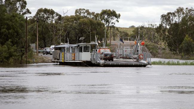
The Lyrup ferry was closed on Wednesday night, and experts predicted that the Swan Reach and Morgan ferries would be shut down this week.
Walker Flat, Purnong and the Mannum downstream ferry are set to close if local flow levels reach 120-130 gigalitres a day – which is only a matter of time – while ferries that can work in higher flows are likely to have their roads cut off.
A spokesman for the Department of Infrastructure and Transport said while Cadell, Tailem Bend, Wellington, Narrung and Waikerie ferries had all been assessed as being able to remain operational to at least 180GL per day, the risks of floodwaters impacting the roads leading to these ferries was high.
“These ferries will become inaccessible if the connecting road is closed,” the spokesman said. He said Australian Height Datum (AHD) was used to calculate the depth at each crossing for safe ferry operations.
“Once the water reaches a certain height the ferry cannot latch safely to the landing infrastructure,” he said.
“The department has measurements for each crossing based on AHD levels, however, it is most easily represented as flow rate for community communications.”
With two weeks left of term four for government schools, and just a week for some private institutions, it’s touch and go whether the floodwaters will leave students stranded before the year ends.
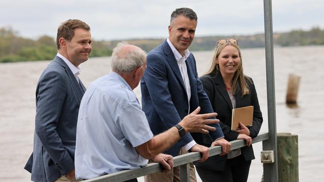
Education Minister Blair Boyer said he had been to the Riverland in recent days where he “visited a number of primary and secondary schools to again meet with principals, teachers and students to see how their school communities are coping”.
“With just two weeks left of the school term, schools are all very well prepared but our concern remains around road and ferry closures that could cut off communities,” he said.
“The Education Department is working very closely with the Department for Infrastructure and Transport to make any adjustments needed for transport to and from school and is in daily contact with school leaders so that any changes are communicated to families immediately.”
Department of Infrastructure and Transport’s manager of commercial marine-state waters Grant Sommers praised River Murray locals, saying there had been a high level of patience and understanding as ferries were shut down or earmarked to be closed.
“Feedback from the ferry operator at Lyrup has been very positive,” Mr Sommers said. “He was expecting queues of cars expecting to get on the ferry, but the community has listened to the announcements and the media and everyone has been very understanding of the situation.”
Mr Sommers said the only other ferry currently closed was the upstream ferry at Mannum.
On Sunday, authorities revealed Riverland aged care residents in the Renmark Paringa District Hospital will be evacuated this week.
Crisis plans have been launched after the Murray River levels reached that require relocation of the most vulnerable residents.
Riverland Mallee Coorong Local Health Network chief executive, Wayne Champion, said 21 of the most vulnerable residents will be moved on Tuesday from the centre that has 81 residents and up to eight inpatients.
“These 21 residents are not independently mobile and require the highest level of care and it is important that time is given to ensure relocation is done in a careful, controlled, and safe manner,” he said.
Their families have been advised.
All relocated aged care residents will be accommodated in other Riverland Mallee Coorong LHN-operated facilities, he said. The move will not hit SA Health acute services.
While authorities have confidence in the water levee, it was more difficult to quickly evacuate.
MORE FERRY, TRAVEL ROUTES CLOSE IN FLOODING RIVERLAND
The list of compromised travel routes continues to grow as the state government and emergency services have begun implementing additional safety measures throughout the Riverland.
The Department of Infrastructure and Transport confirmed two ferries would close.
Lyrup will shut from Wednesday, November 30, and remain out of operation while flood conditions remain above 120GL/day, with alternative river crossings at Paringa Bridge and Berri Bridge.
At Mannum, the upstream ferry will close from 7pm on Thursday, December 1, with the downstream ferry remaining operational.
The Morgan ferry is likely to close next week as flows and water levels continue to rise.
Bookpurnong Road linking Berri and Loxton is also expected to close – potentially from Thursday.
Once closed, all vehicles, including light and heavy vehicles, will need to use the existing detour via Stanitzki Road to Sturt Highway, through Paringa and Renmark and onto Old Sturt Highway, Berri.
As of Wednesday, Bookpurnong Road is closed to all heavy vehicle traffic but is open for two-way travel for light vehicles with speed restricted to 60km/h.
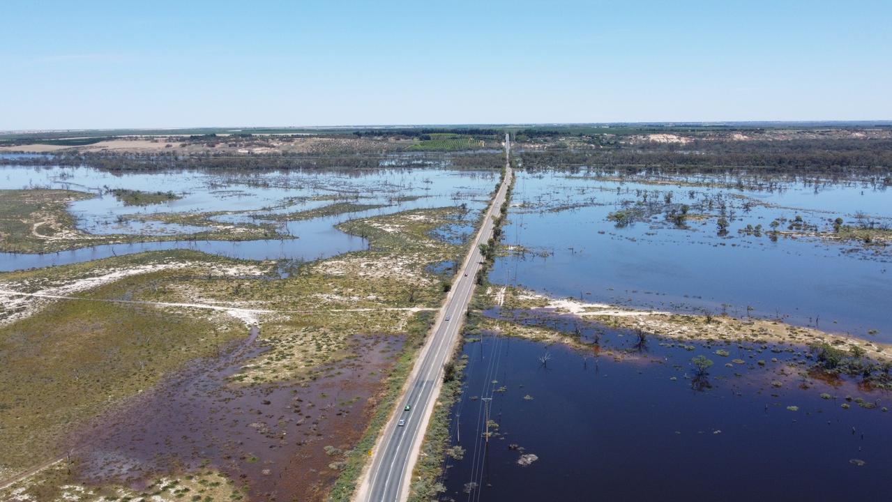
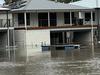
Flood mapping suggests more than 1000 homes could be inundated with water if flows hit 250GL per day.
New data shows the number of primary residences predicted to go under when the first and second water peaks hit during December.
Premier Peter Malinauskas said 1086 homes would be impacted if waters hit a peak of 250GL/day and 455 residences if flows hit 200GL/day.
Personnel from the Metropolitan Fire Service, Country Fire Service, State Emergency Service and SAPOL will begin a systemic effort to door knock those homes, starting with those most at risk.
Residents will be provided with information sheets and calling cards and will be encouraged to discuss with authorities their plans for when they are no longer able to stay at home.
A total of between 3500 and 4000 homes and businesses in total are expected to be inundated when flood waters hit.
On Wednesday, the SA SES began sending out automated messaging to more than 12,500 residents in the Riverland community to advise of the potential impacts of flooding and where they can find further information and assistance.
The message was sent to seven separate geographical areas which have been identified as being at risk of flooding.
Text messages were sent to mobile phones while a prerecorded message was sent to fixed phone lines.
SASES Chief of Staff Derren Halleday said the automated messaging provided another avenue to engage and inform communities.
“Previously this messaging has been successful in informing communities regarding the impacts of bushfires and flooding in South Australia,’’ he said.
“People in the specified geographical areas are advised of some of the risks and impacts associated with the rising floodwaters, such as potential isolation and disconnected power supplies.
“The messaging works concurrently with the doorknocking of communities currently underway and will also reach those people who may have already left the area.’’
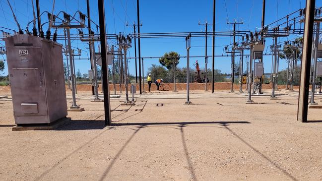
It comes as SA Power Networks (SAPN) advised nearly 2000 further disconnections will be active by the end of the week – incorporating two areas of consideration, one where there is flooding of property or it is imminent, and the other involving safe clearances under powerlines crossing flood plains or the river.
SAPN head of corporate affairs Paul Roberts said the disconnections will mainly be in low lying areas.
“While protecting the safety of the community and property is a priority, SA Power Networks does not want to disconnect one more customer than necessary,” Mr Roberts said.
He added about 50 radial supply lines that cross over the river were well clear of the water, providing safe clearance and will continue to be monitored.
More Coverage

Originally published as Lyrup, Swan Reach and Morgan ferries closing with others likely to follow due to SA floods risk

Family revelation keeps alleged killer driver out of local court
A young man accused of using his phone before allegedly slamming into the back of a family car has returned to court – which heard his dad works in the court system.

Shock as toxic algal bloom contaminates suburban lakes
The algal bloom plaguing South Australian coastlines has been detected in a popular fishing spot a few kilometres from Adelaide, with fears it could spread into other inland waterways.