
Severe storm warning active, multiple waterspouts off Brisbane after 13,000 lightning strikes overnight
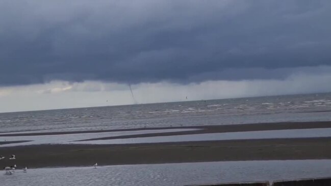
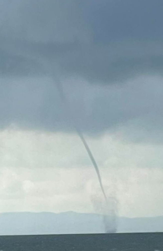
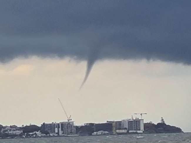
Multiple waterspouts have formed over Moreton Bay as severe storms impact South East Qld, with 100mm falling in just one hour.
Regional News
Don't miss out on the headlines from Regional News. Followed categories will be added to My News.
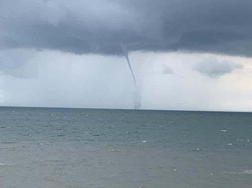
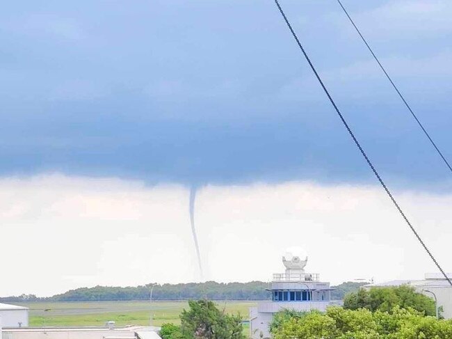
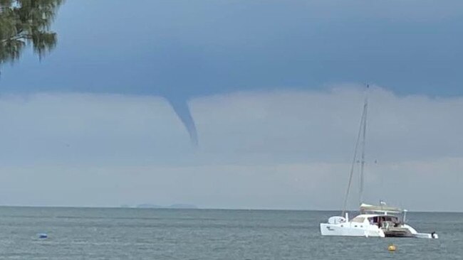
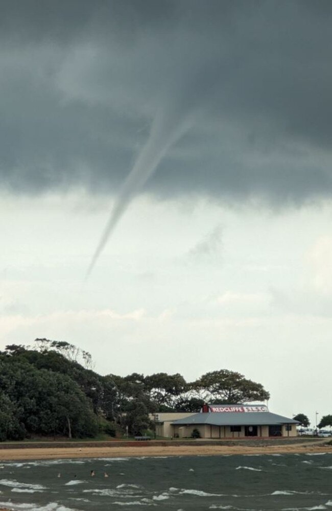
A series of spectacular images of waterspouts have been snapped over Moreton Bay, as storm activity ramps up over South East Queensland.
Multiple waterspouts have been observed across the Moreton Bay region as storm cells are set to hit South East Queensland.
At 6.50pm the Bureau of Meteorology issued a severe weather warning for parts of the Sunshine Coast hinterland.
The Bureau said a “trough moving across southeast Queensland this afternoon is triggering severe thunderstorms”.
Severe thunderstorms are likely to produce localised heavy rainfall that may lead to flash flooding in the warning area over the next hour or two.
Locations which may be affected include Cooroy and Nambour.
A severe thunderstorm warning was also issued at 5.21pm for Somerset, Sunshine Coast, Moreton Bay and Gympie areas, but conditions have since eased.
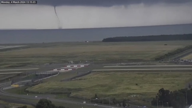
SEQ residents earlier took to social media to post multiple photos of waterspouts with some near Redcliffe, Moreton Bay, Scarborough. The water spout could also been seen all the way from Brisbane Airport.
Bureau of Meteorology forecaster Pieter Claassen said a waterspout forming was quite “rare” but there were the perfect conditions for it on Monday afternoon.
“The interesting thing in this situation is it looks like it formed along a south easterly wind surge so it was pushing northwards through Redcliffe around the time the photo was taken,” Mr Claassen said.
“Basically that south easterly wind surge would mean – so there were some storms that formed at Redcliffe – as that column of air is rising towards the storm it’s rotating thanks to that south easterly wind surge.
“It’s a very moist environment which encourages them to form so it’s essentially just a small rotating column of air that was rising to touch the water of the thunderstorm.
“Typically it has very limited impact, it’s quite transitory so they might only last for a short period of time before weakening.
Mr Claassen said there was a slight risk of a storm developing in Brisbane with potential for showers and a very slight chance of thunder. But the potential for storms was up north, he said.
“But it’s mostly shifting northwards now, the line of storms so they’re all forming along that southeasterly wind surge so moving towards Sunshine Coast and up into parts of the Wide Bay and Central Queensland over the course of the afternoon,” he said.
“There’s certainly a risk of potential severe storm activity along that southeasterly wind surge boundary.”
Mr Claassen said Mount Glorious saw more than 100mm in the past hour, but there was potential for that to continue across Central Queensland.
“So certainly quite heavy rainfall in some of those slow moving storms that we’ve seen so far but very, very localised heavy rainfall as well,” he said.
“The main risks today are heavy rainfall, also a slight risk of damaging wind gusts mostly around the central Queensland region.”
It comes as the Bureau has issued a severe thunderstorm warning for people in Brisbane, Moreton Bay and Somerset Council areas.
More than 100mm of rain has been recorded in the Mount Glorious area in the hour to 2.30pm where a slow-moving cell passed through, triggering a severe thunderstorm warning.
The warning was cancelled about 2.50pm, but residents across the South East have been warned to remain alert for further possible storms as the afternoon and evening progress.
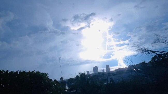
Close to 100,000 lightning strikes were recorded between noon and 3pm.
An Energex spokesman said 70,000 of those were recorded in North Queensland, and around 40,000 were recorded in the west.
“Brisbane has recorded 3000 since lunch today with the most affected regions being the Lockyer Valley and Moreton Bay area,” the spokesman said.
The spokesman said 10,000 power outages have been recorded across Southeast Queensland.
“We believe these outages have been a result of the weather today,” he said.
“At this stage, we have three reports of fallen power lines in the Moreton Bay region.”
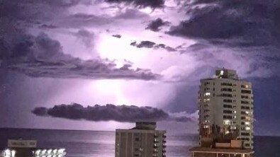
The latest storms come after an electrical storm hit on Sunday night delivering more than 13,000 lightning strikes in Brisbane.

Wynnum locals witnessed a dazzling light show on Sunday night as an electrical storm swept over Moreton Bay.
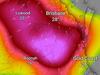
The weather radar indicated that the storms were centralised over Moreton Island and Stradbroke Island.
An Energex spokesman on Monday morning confirmed there were no power outages as a result of the storm.
However, in a separate incident, there were 729 unplanned outages at Point Lookout on Stradbroke Island.
“There have been customer reports of a wire down on Dickson Way,” an Energex spokesman said on Monday.
“We’ve got a crew heading over there now on the barge … customer reports [can be] spot on but sometimes they’re a little bit off so, but at this stage we’re treating it as a wire down.
“That just happened this morning.”
An Energex spokesman said at 11am power had been restored to customers.
This comes as the Bureau of Meteorology predicts severe thunderstorms for Monday afternoon and evening for parts of inland South East Queensland, north of Toowoomba.
Meteorologist Livio Regano said there was nothing unusual about the electrical storm last night and said lightning is not one of the classifications of a severe storm.
“There was a severe thunderstorm warning [yesterday] afternoon … that went out last night,” he said.
“Probably would have been a bit noisy and got a few lightning strikes … that number is actually not that unusual for a lot of storms, especially potentially severe ones.”
More Coverage

Originally published as Severe storm warning active, multiple waterspouts off Brisbane after 13,000 lightning strikes overnight
Join the conversation

‘Overwhelming heartbreak’: Inside flood-ravaged city’s ground zero
Incredible stories of survival and crippling costs to business can be revealed as Hervey Bay faces a months-long recovery from record floods. SPECIAL FEATURE.
Read more

‘Not wanted, not needed’: Controversial music festival stirs regional community
Southern Downs residents have laid their feelings bare about the future of a popular music and arts festival that’s 2025 event now hangs in the balance, with a majority of residents divided over the controversial event. Here’s what you had to say.
Read more