
Weekend forecast for Queensland after Friday cold snap
The second day of a bitter cold snap has brought on even colder conditions across large parts of Queensland.


QLD News
Don't miss out on the headlines from QLD News. Followed categories will be added to My News.
The second day of a bitter cold snap has brought on even colder conditions across southeastern Queensland, as the state braces for the other half of a twin polar blast.
Applethorpe dropped to 0.3C early Friday morning, while Oakey and Charleville copped a frosty 1.3C and 1.9C respectively.
Dalby dropped to 2.4C, Miles 2.2C, and Wellcamp Airport recorded 2C just before 7am.
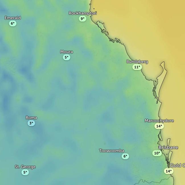
Roma locals woke up to a chilly 0.3C with an apparent temperature of -3C at sunrise.
At 7am Brisbane also dropped to 11.1C with an apparent temperature of 9.7C.
The Bureau of Meteorology’s Jonathan How said the freezing apparent temperatures and widespread frost were thanks to chilly winds sweeping across parts of Western Queensland.
“Where we are seeing a bit more wind that’s probably seeing the feels like temperature get down a little bit lower,” the senior meteorologist said.
“So certainly the ‘feels like’ temperature is in single digits for many people this morning.”
Mr How said the weekend would warm up before another cold front swept across Northern New South Wales and Southern Queensland.
“The second one comes through late tomorrow into Sunday. Monday is when we will see the coldest air push up across Queensland,” he said.
“It is quite nice this weekend, 25C tomorrow in Brisbane. But by Tuesday, Wednesday, next week, the maximum temperature will be about 20C.
“Then we will see some quite strong westerly winds. So even Monday, Tuesday, Wednesday, the ‘feels like’ temperature will be quite cool, even during the daytime across the southeast.
“Then minimum temperatures will sit around the nine or ten degree mark from Tuesday, Wednesday, and Thursday morning. So it will be sunny but still quite bracing.”
The New South Wales and Queensland border was still on track to see snow flurries from Sunday night and Monday morning as the second cold front sweeps across the southern states from Sunday.
“It depends on whether or not we do see some showers pushing through at the same time but there is a very slim chance of some flurries about the granite belt on Monday night and Tuesday.”
Originally published as Weekend forecast for Queensland after Friday cold snap

Prized dog ‘emaciated’ after master’s heart attack
An American bulldog who stayed by his owner’s side after a fatal heart attack was booted from his next home — but a tenacious breeder travelled through a flood-ravaged region to free him.

XXXX brewery wins ‘explosive’ legal battle against neighbouring church
The local arm of a church has squared off against Brisbane’s iconic XXXX brewery.