
Queensland weather: Giant hail, dangerous storm warning for Gympie and Noosa
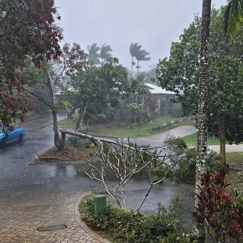
Giant hail over 6cm in diameter has been recorded on the Sunshine Coast with BOM issuing a warning for a very dangerous thunderstorm this afternoon.
QLD News
Don't miss out on the headlines from QLD News. Followed categories will be added to My News.
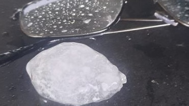
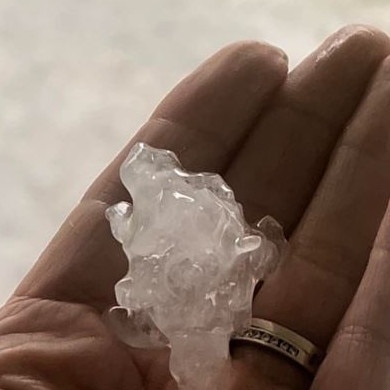
Giant hailstones over 6cm in diameter have been recorded on the Sunshine Coast this afternoon with a “very dangerous storm” warning issued by the Bureau of Meteorology.
The latest warning, activated at 2.45pm for people in the Gympie and Noosa council areas, is for a very dangerous thunderstorm that is “likely to produce large, possibly giant hailstones”.
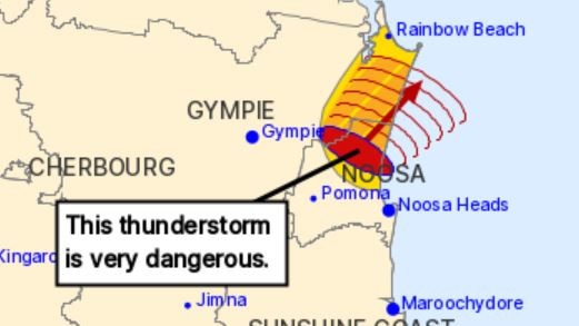
It was detected near the area north of Noosa Heads and Lake Cootharaba.
The thunderstorm is moving towards the northeast. It is forecast to affect Lake Cooloola by 3.15pm.
Hail 6cm is diameter was reported from Belli Park at 2.10pm.
.
An earlier warning was activated at 1.40pm for people in parts of the Sunshine Coast and Noosa council areas
The Bureau of Meteorology warned that “at 1.35pm, a severe thunderstorm likely to produce large hailstones was detected near Mapleton and the area northwest of Mapleton.
“This thunderstorm is moving towards the northeast.
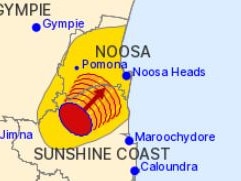
“It is forecast to affect Yandina and the area southwest of Eumundi by 2.05pm and the area southwest of Noosa Heads, the area west of Noosa Heads and Cooroy by 2.35pm.”
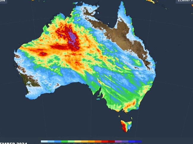
The storms come ahead of a surge of tropical moisture sweeping across Australia, which is expected to bring widespread rain to Queensland.
“Rain and thunderstorms will increase over the north of WA this weekend as tropical moisture feeds into a deepening area of low pressure,” Weatherzone’s Ben Domensino said.
“This wet and stormy weather will then spread over Central Australia on Monday before forming a broad rainband that will drench southeastern and eastern Australia between Tuesday and the end of next week.”
Bureau of Meteorology senior forecaster Felix Hanniffy said the start of next week would see cooler temperatures before the rainband reaches South East Queensland.
“By the middle of the week, the temperature will cool off, once we see that cloud band moving in so generally, temperatures cooling off across the southern half of Queensland,” Mr Hanniffy said.
“And then cloud cover is expected to spread east, so a lot more cloud for the second half of the week, across the southeast.
“As well showers we could see potential thunderstorms, probably after more like Thursday or Friday in South East Queensland.”
Originally published as Queensland weather: Giant hail, dangerous storm warning for Gympie and Noosa

‘Grandma hates it but face tatts no longer taboo at work’
A growing number of Aussies are sporting tattoos, with one in four sporting ink somewhere on their bodies. But are face tattoos accepted yet?
Read more

‘Left with a smile’: Beloved band frontman’s family grateful for law change
A beloved music legend from a popular Queensland band has chosen to die peacefully, on his terms surrounded by family and loved ones, after being diagnosed with terminal cancer. TRIBUTE.
Read more