
Alfred leaves his mark on SEQ in 24 hours of destruction
Gold Coast residents have been urged to seek shelter and Brisbane faces fresh flood alerts as rain from ex-tropical cyclone Alfred keeps coming. LATEST UPDATES
QLD News
Don't miss out on the headlines from QLD News. Followed categories will be added to My News.
Ex-Tropical Cyclone Alfred has left a lasting mark on South East Queensland in his final stand after 24 hours of destructive winds, raging floodwaters and torrential rain.
At 6pm Sunday the bulk of Alfred’s fury had zoned in on Brisbane’s south, Ipswich, Logan and the Gold Coast.
At 5.26pm Sunday an emergency alert was sent for the suburbs of Currumbin, Currumbin Valley, Tallebudgera, Tallebudgera Valley and Elanora after major flooding in Currumbin Creek and Tallebudgera Creek.
“Take action now. Go inside and up high,” the alert read.
It marked 24 hours since Alfred flared up on Saturday evening, leaving a trail of destruction from Hervey Bay to the border.
Acting Police Commissioner Shane Chelepy defended the warnings issued by police to the community, after residents in Brisbane were caught off guard by cyclonic level winds overnight to Sunday.

Queensland Police, in a media release at 5.40pm on Saturday, said emergency alerts related to ex-Tropical Cyclone Alfred had been cancelled.
“Now that the system has downgraded, the immediate threat of destructive winds has passed and all alerts relating to taking shelter have been cancelled,” a spokesman said.
But the strong gusts – higher than 100km/h in areas north of Brisbane – were yet to hit.
Mr Chelepy said police issued emergency alerts as “they were required” for the four expected stages of the natural disaster.
He then outlined a list of emergency alerts issued by police through the last few days, including for storm tide surge.
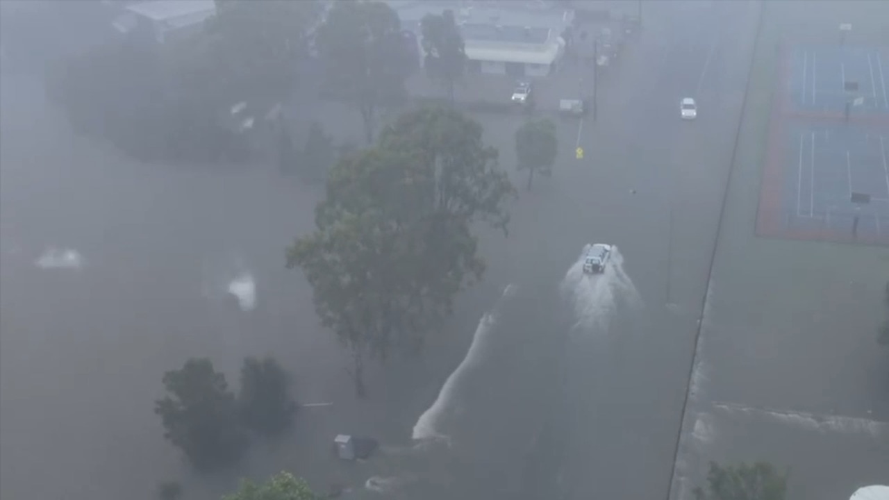
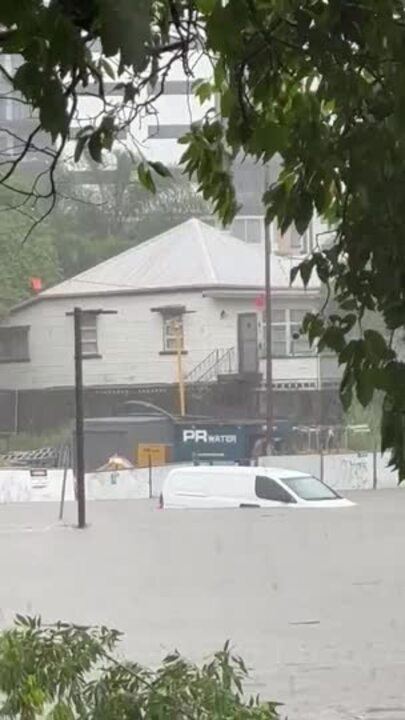
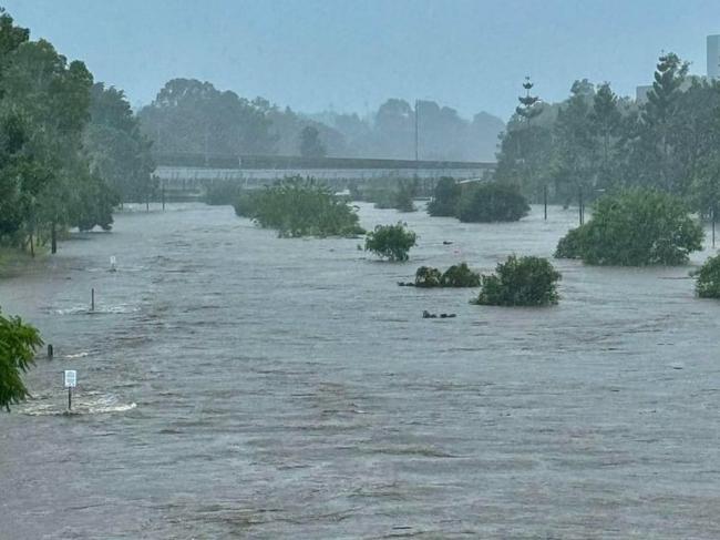
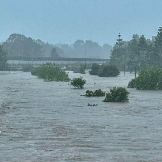
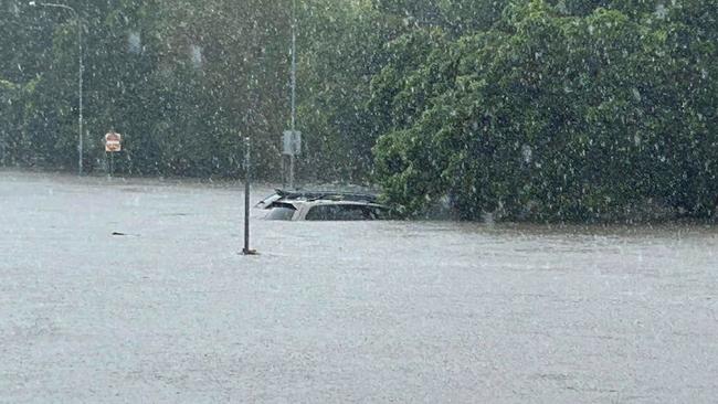
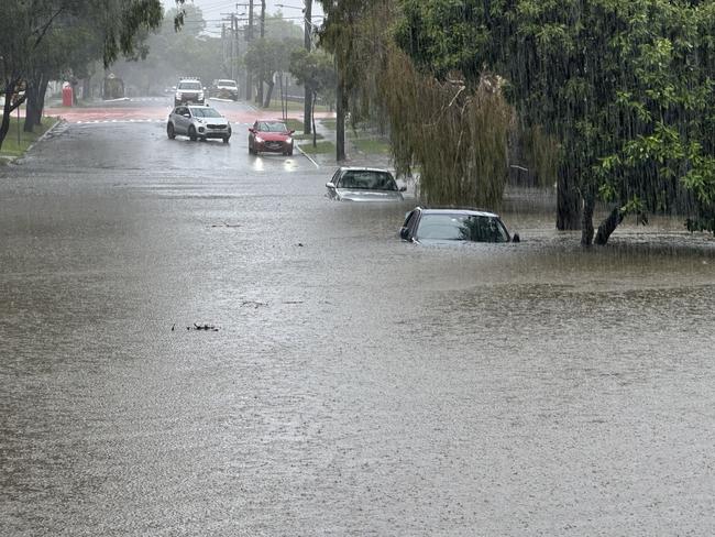
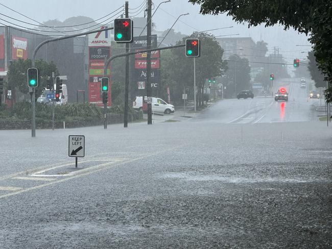
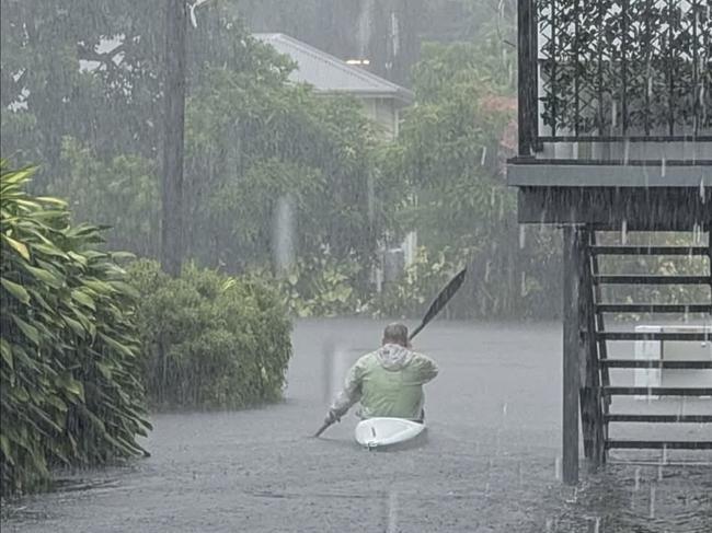
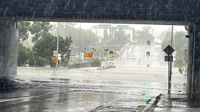
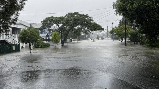
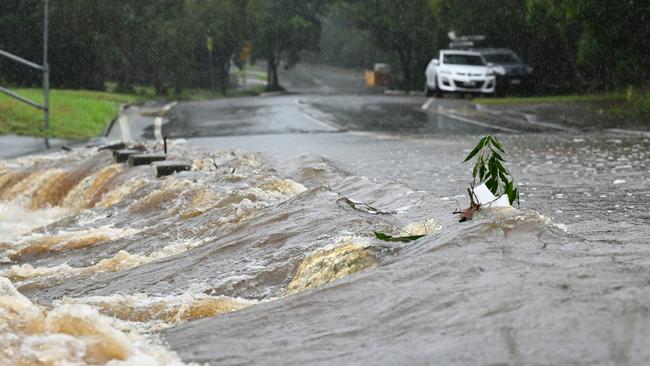
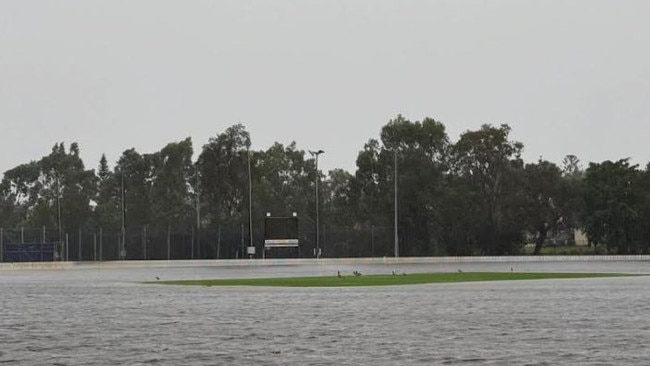
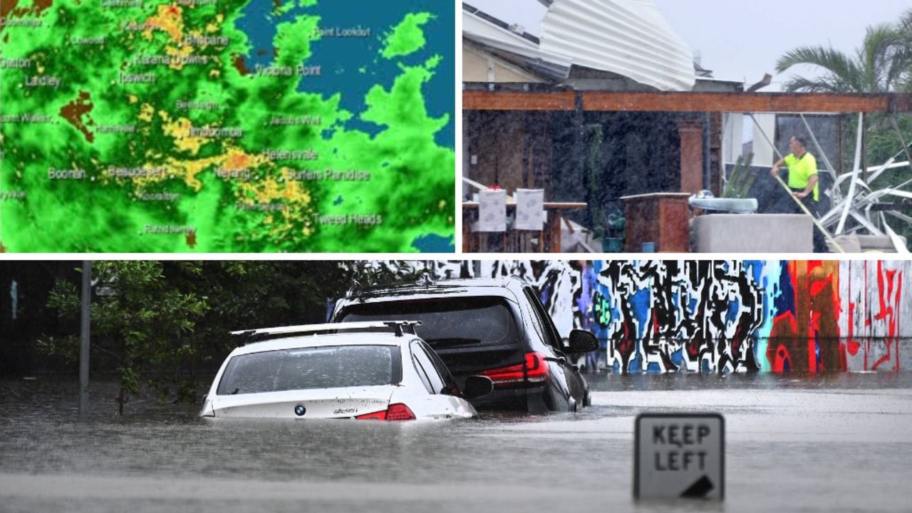
It comes while flash flooding is impacting Brisbane City with streets inundated, homes flooded and buses shut down.

The city has recorded over 150mm since 9am yesterday, with rainfall totals including 114mm at Rosalie in the six hours to 11.38am, 111mm at Holland Park in the three hours to 11.21am and 81mm at Holland Park West in the two hours to 10.10am.
Weather bureau meteorologist Sue Oates said the weather bureau was not caught off guard by high winds from ex-Tropical Cyclone Alfred on Saturday night.
“This can be a feature of these sorts of systems,” Ms Oates said.
“Severe weather warnings continued through yesterday and we were warning of damaging winds and intense rainfall.”
Significant wind gusts overnight were “quite usual” for a downgraded Tropical Cyclone, according to the Bureau of Meteorology.
But the strength of the wind “maybe was unexpected” for residents, Ms Oates said.
Ms Oates said ex-Tropical Cyclone Alfred lingered off Bribie Island for most of Saturday, and in that time mingled with a high pressure system over the Tasman Sea.
“Therefore we had those extended period of gusty winds through Saturday night and even into Sunday morning,” she said.
“Those winds were just as significant yesterday and coming from the easterly direction, and which probably for most residents, maybe was unexpected, given that Cyclone Alfred had lessened… to a tropical low.”
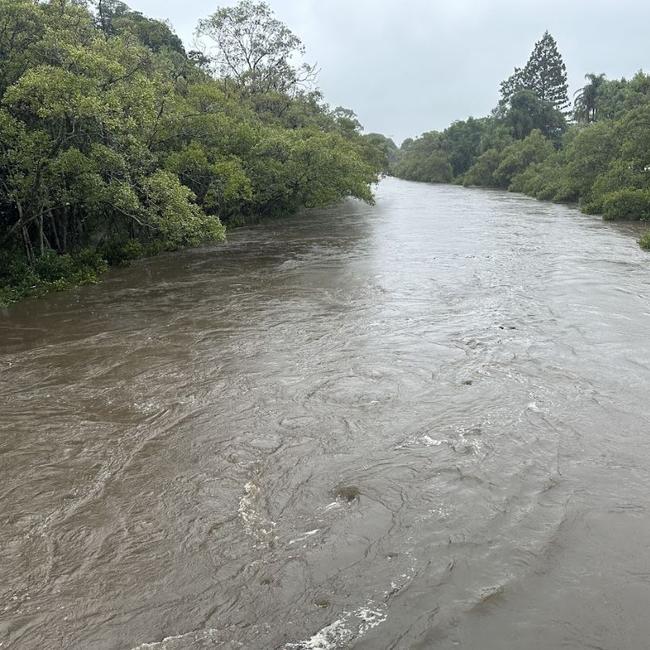
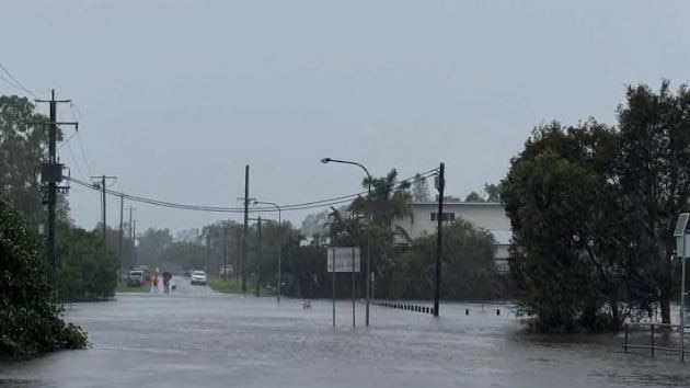
It comes as Brisbane and parts of the southeast, and further north to Hervey Bay were in the grips of a flooding emergency following relentless torrential rain.
Ms Oates warned the damage from this weather event was “still not over”.
“We are starting to see an easing of the coastal condition, and easing of the damaging wind gusts in the last 24 hours,” she said.
“But the intense rainfall will continue.
“Flash flooding is a high risk, and we expect, or it is possible, that we have six hourly totally of 80 to 130mm during the day with 24 hour totals of around 120mm to 200mm.”
WATCH PREMIER’S LATEST ALFRED UPDATE BELOW
#LIVE: I’m delivering an update on Ex-Tropical Cyclone Alfred https://t.co/CpxZ98KYsR
— David Crisafulli (@DavidCrisafulli) March 9, 2025
Premier David Crisafulli said schools which were not damaged by ex-Tropical Cyclone Alfred will reopen Monday if it is safe to do so, despite widespread flooding across the southeast.
“By 5pm today, every school will have a status of open or closed,” Mr Crisafulli said
“Where it’s safe to do so, schools will reopen with the exception of the Gold Coast.”
Mr Crisafulli said if a school hadn’t been impacted by the weather, particularly those outside the southeast, NAPLAN would go ahead as planned on Wednesday.
He said for those schools who had been impacted, there was a two-week window to complete the national tests, and an alternative date had been picked for March 17.
“That will be communicated directly by the principals, with the regional directors, as to whether a school has been impacted, and that (NAPLAN) can’t go ahead,” he said.
“That impact will be outlined this week.
“It’s important that ... testing goes ahead.
“I understand that’s very important for parents.”
Buses will run across the southeast on a limited capacity from Monday. No buses will run on the Gold Coast.
School buses will also run for schools which have reopened.
Trains will also start running on Monday, but on a Sunday timetable. Alternative bus services will run on some lines.
Public servants will return to work on Monday where it is safe to do so, Mr Crisafulli said.
Mr Crisafulli said what remained of ex-Tropical Cyclone Alfred was intense.
“As the system continues to come across the coast, there is no doubt it continues to pack a punch,” he said.
Since Friday, 450,000 homes and businesses have lost power.
More than 2000 Energex workers had already reinstated power to more than 150,000 homes.
“It’s been a really challenging day of rain and wind, and they are working to reconnect that power,” Mr Crisafulli said.
More than 240 RoadTek workers were also working to reconnect traffic lights across the city.
Mr Crisafulli said the recovery process and response would be strong.
“I want to assure Queenslanders that our resolve... to see that job through, and make sure this great state gets back on its feet, will be unwavering, and we’ll be here for the long haul.”
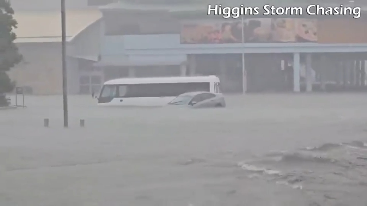
Mr Chelepy said serious flash flooding on the Fraser Coast led to multiple rescues – seven from flooded cars and nine homes.
Officers were forced to move residents of a retirement village to upper levels and evacuate the Hervey Bay watchouse to keep people safe.
SES were called to 155 jobs in Hervey Bay in the last few hours.
In Brisbane, Mr Chelepy said police had received multiple calls on Sunday for assistance with flash flooding.
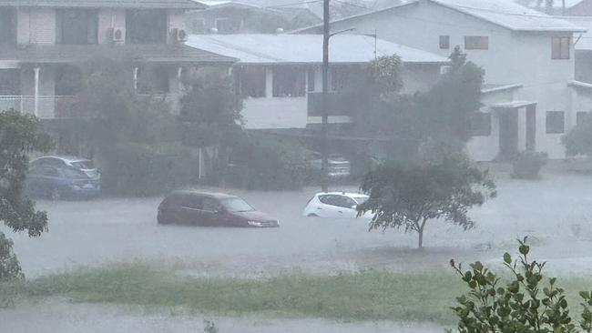
More than 100 roads were closed across the city, and doorknocking was happening in areas around Kedron Brook as yards filled with water.
Kedron Brook resembled a dangerous river as it reached minor flood levels and had cut multiple roads, including Shaw Rd in Kalinga and Widdop St in Hendra.
Enoggera Creek was also flooded and close to breaking its banks.
Norman Creek had already exceeded moderate flood levels, as well as Lota Creek at Ransome.
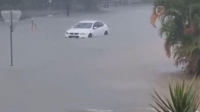
Streets and backyards were being inundated by rising creeks breaking their banks, with multiple cars already lost to water in Stones Corner and East Brisbane.
Marshall Road, Granard Road and Beaudesert Road are closed due to localised flooding.
Buses have been ordered off the road.
The Bureau of Meteorology earlier warned Brisbane City could flood on Monday or Tuesday as extreme rainfall coincides with successive high tides.
With the bureau predicting of rainfall in excess of 500mm over the next 48 hours, flash flooding is likely across Brisbane, Gold Coast, Ipswich, Sunshine Coast, Stanthorpe, Caboolture and Gympie, according to the latest advice.
The bureau expected rainfall of up to 210mm over the next six hours and possible thunderstorms.
An emergency has been declared for Hervey Bay due to flash flooding, with residents ordered to shelter indoors after 110mm fell in just an hour this morning.
The ‘rain bomb’ that dropped over 250mm across Hervey Bay could be felt in Brisbane with flood warnings in coming days.
A dangerous thunderstorm that has barely moved over the past five hours continues to hover over the Fraser Coast.
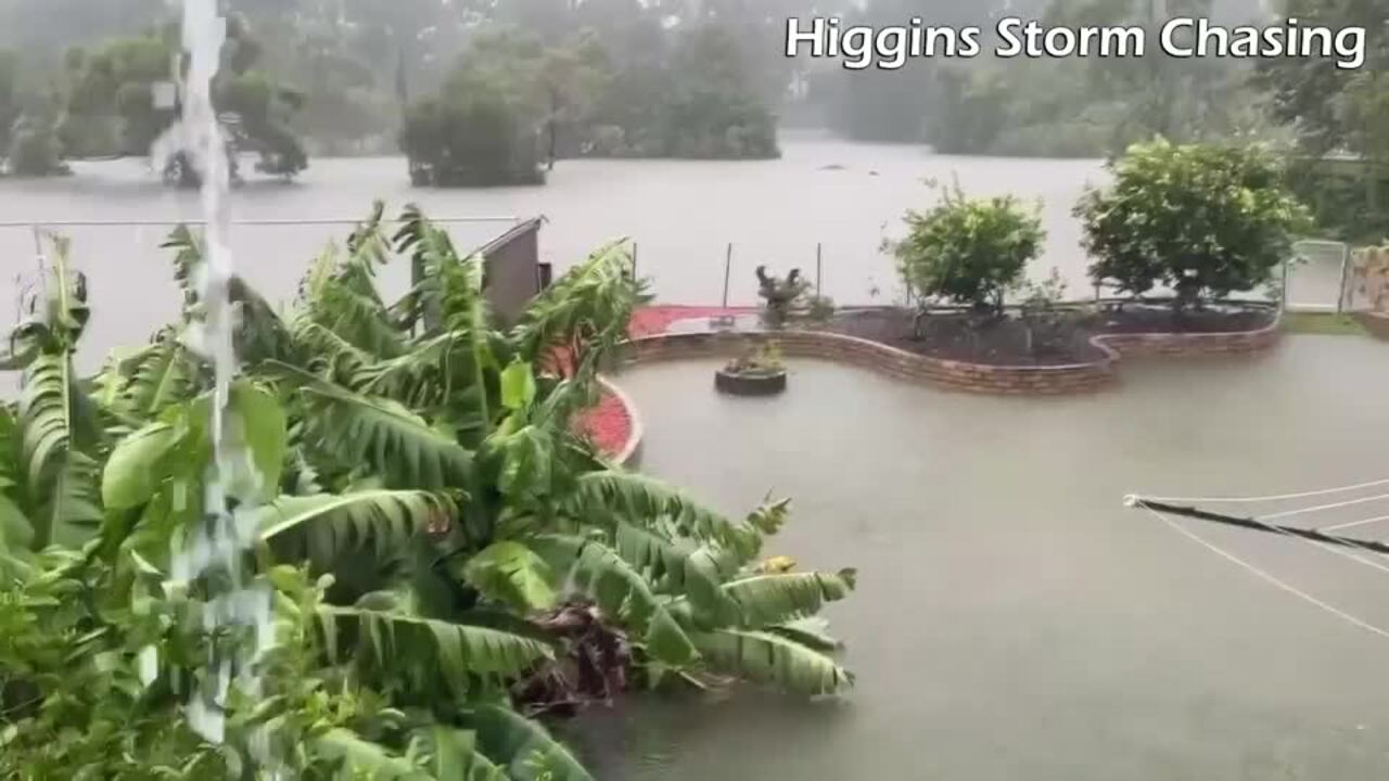
Thomas Hinterdorfer of Higgins Storm Chasing said isolated falls of over 400mm have been recorded in Hervey Bay in just six hours.
Mr Hinterdorfer said it is possible that heavy rainfalls that have been observed in Fraser Coast could be similarly felt in Brisbane.
Senior Meteorologist Miriam Bradbury said the south east coast district, Wide Bay Burnett areas and parts of the Darling Downs and Granite Belt could see over 200mm rainfall totals in 24 hours.
A new flood warning was issued for the Gold Coast at Sunday morning, with the most intense elements of the former cyclone now to the north of the city.
Heavy rain continued to cause localised flooding on the Gold Coast, where some residents have been without power for almost four days.
At 10.30am, residents living in the upper reaches of Currumbin Valley were warned to expect “moderate” flooding, with any further creek level rises of more than 30cm likely to cause major flooding.
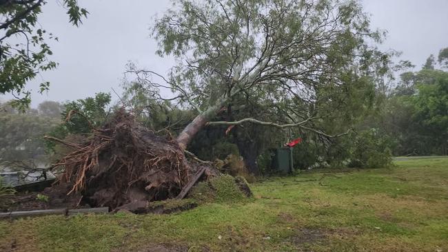
Widespread damage has been reported across Brisbane, Moreton Bay and Redcliffe where wind gusts up to 100km/h were recorded overnight, while 320,000 homes across the southeast are without power this morning.
Footage has emerged of a home at Brighton, north of Brisbane, losing its roof in the destructive winds.
The southeast could see wind gusts up to 90km/h today as Alfred moves further inland.
Prime Minister Anthony Albanese said the situation in Queensland and Northern New South Wales remained serious.
“Flash flooding and heavy winds, heavy rainfall, damaging wind gusts and coastal surf impacts are expected to continue over coming days,” he warned.
“I urge everyone to continue to listen carefully to the emergency authorities.
“Tragically, last night, it was confirmed, a 61-year-old man has died in flood waters near Dorrigo in New South Wales.
“Our thoughts are with his loved ones and the community at this heartbreaking time.”
The Bureau has also warned of minor flooding for the Brisbane River downstream of Wivenhoe Dam with the communities of Lowood and Mt Crosby put on high alert.
Premier David Crisafulli said it had been a “challenging” night.
He said there were 2000 energy workers – 1200 from Energex and 800 from Ergon – working frantically to restore power to more than 320,000 homes and businesses.
More than 112,303 were without power in Gold Coast City, almost 50,000 in Brisbane, 62,294 in the City of Moreton Bay, 39,764 in the Redlands, and 44,046 in Logan.
“Crews are out and about in full force,’ he said.
“The work they have done is nothing short of herculean.”

Mr Crisafulli said people were able to leave their homes and “go about their business”.
“We want to do everything we can to get life back to normal,” he said.
“We’re just asking people to use commonsense.”
Mr Crisafulli said he would be keeping an “eagle eye” on flooding across southeast Queensland.
“There’s no doubt when you talk about some of those potential rainfalls, you can get a combination. You can get flash flooding, but you can also get creek and river flooding,” he said.
“So people really need to keep their wits about them. But there are challenges that people deal with in this part of the world. And always do deal with it.
“So the worst of the cyclone, which was the big unknown for southeast Queensland, obviously, but people responded brilliantly to that.
“Now we move into that phase where there’s the prospect of different types of flooding, but people will get through that.
“Provided people do the little things, provided they don’t go driving through flooded water, provided, you know, if your home is in one of those flooded areas that will be a challenge that people will rise to. And we will get back on our feet.”
The Bureau last night confirmed gusts of 100km/h at Redcliffe, 90km/h at Moreton Bay, 74km/h at Brisbane Airport, 70km/h at Archerfield and 60km/h in Brisbane City and Amberley.
A category 1 cyclone has wind gusts of 63-88km/h.
Residents in the city of Moreton Bay, home to half a million people, were issued a severe weather alert around 8.45pm asking them to stay indoors.
“Dangerous winds are impacting parts of City of Moreton Bay now, especially around Redcliffe Peninsula. People should move or stay indoors now to be safe,” the alert read.
“Conditions could be very dangerous. Damaging winds have created multiple hazards in areas around homes and roads.”

Moreton Bay Regional Council is asking residents to stay off the roads as wild winds and rain continue to lash the region.
“Ex-Tropical Cyclone Alfred continues to bring intense rainfall and damaging wind gusts to the city,” the council said this morning.
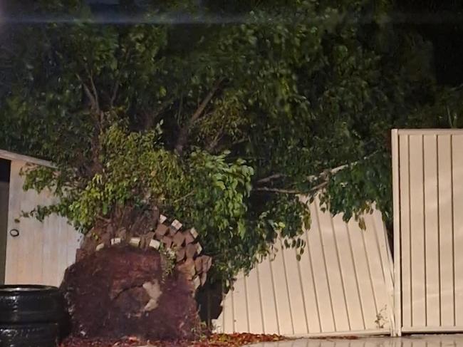
“Emergency Services, SES, Energex, and Council staff will be performing essential tasks to remove and clear debris from last night’s storm.
“Please remain off the roads, identify and report major damages or obstructions and stay out of the way.”
Fallen trees and branches can be reported to council on 3205 0555.
Overnight, planes were struggling to land at Brisbane Airport with flight tracking maps appearing to show some aborting their landings.
A Jetstar flight from Sydney to Brisbane was forced to loop around off the coast of Caloundra before coming to the airport from the east coast.
A Qantas flight from Perth to Brisbane was forced to make a drastic turn as it approached the coast and appeared to be heading toward Sydney Airport.
Several flights were showing as cancelled on the Brisbane Airport website around 9.30pm Saturday.
Bureau of Meteorology senior meteorologist Miriam Bradbury said it had been a very slow crossing but Alfred finally reached the mainland coast about 9pm.
“It really, really took its time. It was extremely slow moving through much of the day yesterday, but it did continue to direct these bands of showers and thunderstorms across much of South East Queensland,” she said.
“That meant there were patches where the showers were slightly less heavy, but then they came back and forth, as that next band moved through.
“And certainly we have seen quite a lot of flash flooding throughout South East Queensland.”
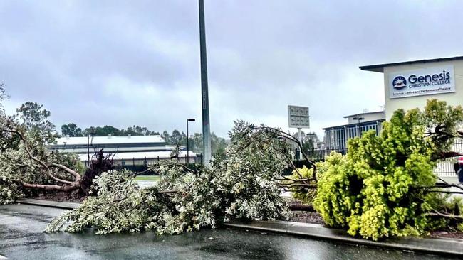
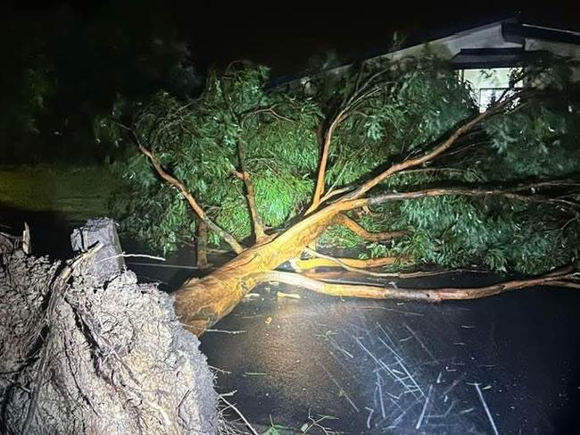
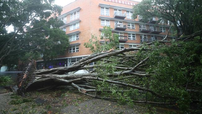
Ms Bradbury said wind gusts already reached up to 90km/h with many trees and branches down across Brisbane.
“The main message we really want communities to focus on is that the communities are well aware of this ongoing risk of rain and flooding over the rest of this weekend going into next week,” she said.
“I’d like to remind people, the category of that cyclone, even once it’s downgraded to an ex-tropical cyclone, it is only based on the wind speed, it’s not taking into account the rain and the flooding that it’s also bringing.

“So for today, we are still expecting very high rainfall totals across areas including the Gold Coast and parts of Brisbane as well, and it may sort of push down into northeast New South Wales too.
“We may see the odd damaging wind gusts as well. So damaging being above 90km/h, but it’s the flooding as well.”
Ms Bradbury said on Saturday night even though wind gusts were around 60-70km/h, it was the convergent winds that made it damaging.
“In addition to those heavy showers and storms wrapping around that low system, we’ve seen bands of convergent winds,” she said.
“Now what I mean when I say convergent winds is winds essentially being squeezed together, and when they squeeze together, they tend to get stronger.”
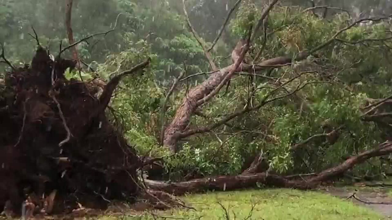
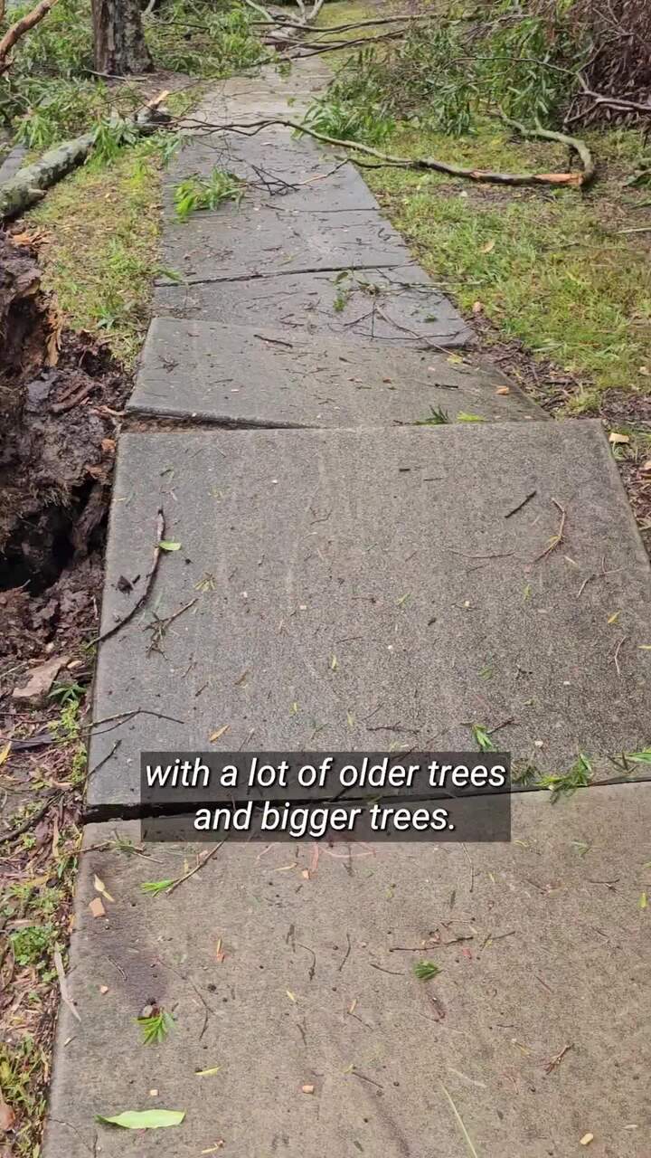
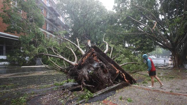
Since 5am on Saturday, March 8, there were 3136 SES calls for service with the majority of them in the Gold Coast District and Brisbane region.
Most calls were for trees down and sandbags/tarps.
Queensland Fire Department responded to 400 incidents in the past 24 hours since 5am including evacuating four people.
Crews responded to a tree that had come down and damaged a gas line and a house at Forest Lake on Glorious Way.
Residents across Redcliffe took to social media to post about multiple trees down at Margate waterfront and Redcliffe Court House.
The Bruce Highway was closed overnight southbound at Bald Hills near Gympie Arterial Rd due to a fallen tree. Police this morning were diverting traffic onto the Gateway Mwy and have urged motorists to avoid the area.
Seqwater has started releasing water from North Pine Dam due to heavy rain.
“These releases, combined with river and creek flows downstream of the dam, are likely to cause water over Youngs Crossing Road,” a social media post said.
“Please stay away from fast flowing or deep water near waterways downstream of the dams.
“No releases from Wivenhoe Dam or Somerset Dam are occurring but may begin over the coming days depending on continuing rainfall and inflows.”
Seqwater CEO Emma Thomas said it had opened the gates of North Pine Dam early Sunday morning after more than 135mm of rain fell in the catchment.
Wivenhoe and Somerset dams had received just 20mm and 35mm respectively in the last 24 hours.
“We continue to watch those catchments actively, as well as looking at what’s happening in the lower part of the Brisbane River, as creeks, streams and rivers flow in … we are just watching those systems at the moment,” Ms Thomas said.
Speaking earlier on Saturday, Premier David Crisafulli said the 330,000 homes without power at the time was “the largest loss of power from a natural disaster in Queensland’s history”.
“It’s bigger than (Cyclone) Yasi, bigger than Debbie, bigger than Oswald,” he said.
“So it shows you the scale of the destruction, because of that populated area.”
He said about 70,000 connections had been restored since Thursday night.
“It’s a big challenge, we are throwing everything at it because we understand how important that is for Queenslanders,” Mr Crisafulli said.
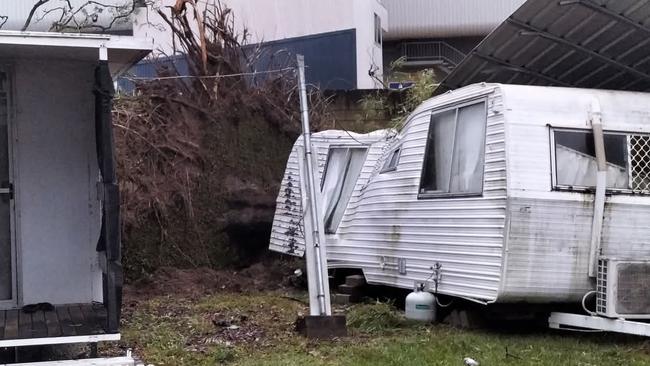
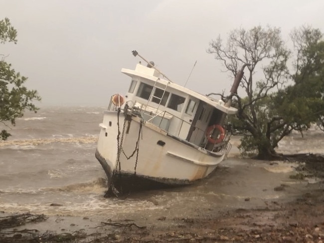
Two large boats were swept onshore at Redland Bay – one believed to have broken its mooring.
The 10m (40ft) schooner, Hidden Dragon, was lying on its side before being uprighted this morning.
A large bay cruiser also ended up onshore.
In Logan, mayor Jon Raven said the council was working to open up tips today to allow residents to remove rubbish.
Most supermarkets in Redland remain closed but all majors are open in most parts of Redland.
Originally published as Alfred leaves his mark on SEQ in 24 hours of destruction

‘Insane’ footage of Qantas landing
Wild footage was captured about 12 hours after Tropical Cyclone Alfred was downgraded to a tropical low.
Read more
Water world: More flash flooding amid zombie Alfred’s last gasp
Motorists were rescued from floodwaters at Logan, while there was more flash flooding in Brisbane and the Gold Coast overnight.
Read more