
Brisbane weather: Above average temperatures, rainfall and overcast days for May
Persistent rain and above-average temperatures will continue across Brisbane, with the Bureau forecasting more wet weather to come.

QLD News
Don't miss out on the headlines from QLD News. Followed categories will be added to My News.
After persistent rain and above-average temperatures in Brisbane, the Bureau of Meteorology says there’ll be little relief with more wet weather on the way.
Sky News weather meteorologist Alison Osborne said there had been higher-than-average temperatures across Brisbane for May this year.
The average historical maximum was 23.4C, with the current average for May this year at 24.8C.
Meanwhile, the average minimum temperature was 13.4C, with the average for May so far sitting at 15.8C.
Ms Osborne said there were a few reasons why there had been unusual, warmer-than-average temperatures.
“We obviously have that background influence of climate change, which is leading to warmer weather … for the east coast, with that wetter weather, you usually see more warmer than average nights,” she explained.
“Just because it acts a bit like a blanket and stops that heat escaping overnight. But in terms of those warmer-than-average days, with the fact that those days have been wet, that is quite unusual.”
Brisbane had recorded around 35.2mm of rain over eight days in May 2025 – on track to surpass the monthly average of 9.8 days of rain.
Ms Osborne said the reason there had been persistent rain due to the “slow-moving” high-pressure systems for autumn.
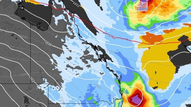
“We are seeing the system just sitting to the south of the country, and they have been very slow moving. The winds are going anticlockwise, so that translates to winds coming from the water to the coast to New South Wales and Queensland fairly persistently,” she said.
“By the time those winds reach the coast, they carry cloud and a decent amount of moisture. They push over the land, get a bit of lift and that generates rain clouds.”

It comes after record March and April rainfall in central and south western Queensland, where the once flood-ridden outback has bounced back with greenery.
Typically brown after a summer period, miles of green vegetation has sprouted and will stay around for much of the winter,
Meanwhile the Bureau of Meteorology’s Daniel Hayes said there was still more rain to come for the rest of the week.
Brisbane will expect to see up to 15mm on Thursday, which will quickly drop down to 2mm on Friday and 8mm on Saturday.
The Gold Coast region will see the most rainfall, expected to cop up to 30mm at Surfers Paradise and 35mm at Coolangatta and Robina on Thursday.
“At the moment, our current ridge is weakening. The high-pressure system down in the Tasman Sea is weakening as well and moving away. So the ridge over Queensland is weakening. So we’re seeing our winds, those South easterlies drop away,” the senior meteorologist said.
“It is becoming a little calmer around our coast, but we are looking at the development of a couple of troughs over Queensland.
“One is through the inland parts extending into southern inland later today, generating some more shower activity in those interior parts, and maybe even a little bit of thunderstorm activity through some of those areas. And we have another trough that’s developing just off the southeast coast.
“There is the possibility of some thunderstorm activity tomorrow, and some more widespread showers through the South East down around the Gold Coast area, we could see up to 30mm of rainfall activity.”
Mr Hayes said high-pressure systems meant there was no opportunity for cold fronts to move through the southern parts of Australia.
“From this time onwards, they generally start to bring through some bursts of cooler air, which can push up into southern Queensland. So we haven’t yet seen a strong cold system push up,” he said.
Originally published as Brisbane weather: Above average temperatures, rainfall and overcast days for May

Family’s shock as driver charged over fatal CBD bus crash opts for trial
A man charged over the death of a young woman in a city council bus crash in Brisbane’s CBD will stand trial.

Man hit with multiple charges after alleged stand-off shuts down streets
A man has been charged with the serious assault of a police officer after an incident that required part of a Brisbane suburb to be locked down amid fears he was armed.