
Land release report shows areas include substation, highways, health facilities
UPDATE: More and more people caught in the housing crisis are turning to the Royal Showgrounds, and there’s little hope from this week’s summit, says the man caught in the middle.
Politics
Don't miss out on the headlines from Politics. Followed categories will be added to My News.
UPDATE: THE Royal Agricultural Society needs additional resources, as more people turn to the Showgrounds for shelter, chief executive Scott Gadd says.
Mr Gadd said nothing had come out of the summit that would relieve the pressure on the Hobart Showgrounds or people who were sleeping rough.
“We’re wondering how we’re going to manage moving forward,” Mr Gadd said.
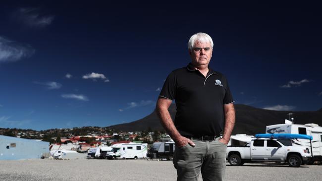
“The problem’s getting bigger, I’ve got more people coming in, more difficult cases.
“I’m wondering where the respite for the Royal Agricultural Society is going to come from, at this stage there’s nothing on the table.”
Mr Gadd said the society would not walk away from the problem, but it was stretching their resources.
He said the society was seeing up to half a dozen cars driving in late at night and leaving early in the morning, and he believed they were people who could not afford to pay site fees.
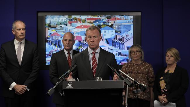
EARLIER: A HIGHWAY, a substation and a rehabilitation facility are on land identified by the State Government for release to provide affordable housing.
Following yesterday’s urgent housing summit, the Government has released a report on the broad-scale, whole-of-government review of land holdings to identify possible sites for release for repurposing into housing.
The review was announced in last year’s State Budget.
It identified 139ha of land across 28 land parcels, most of which would need to be rezoned before housing could be built.
Land was identified in Burnie, Clarence, Glenorchy, Hobart and Launceston.
MORE: WE SIMPLY NEED MORE HOUSES, SAYS GUTWEIN
Five properties were considered to have the most potential for repurposing to housing; in West Moonah, Geilston Bay and the East Derwent Highway, Kings Meadows, Burnie and Risdon.
MORE: CROWN LAND FIX FOR HOUSING CRISIS
At 32.54ha, the Risdon site was the largest area identified, located at 21 Gregson St with a reservoir onsite and near TasWater’s sewage treatment plant.
EDITORIAL: SUMMIT IS AT LEAST A START
According to the report: “Eighteen of the identified land parcels have an available area of greater than one hectare, indicating that these properties can potentially support the development of a significant number of dwellings.”
Eight of the 28 properties identified were outside high-demand areas, and four were below the 0.1ha minimum size.
Included in land identified was a 0.25ha section of the South Arm Highway, 9.22 hectares of land occupied by the Millbrook Rise rehabilitation centre in New Norfolk, and TasNetworks owned land that contains a substation.
Sorell, Devonport City and the Huon Valley councils have all identified additional land that could be repurposed.
The report says the lengthy rezoning process could mean developments on identified sites would occur in the medium to long term.
The housing summit yesterday endorsed a plan for the Government to introduce fast-track legislation in the autumn session of Parliament to enable faster rezoning of land identified for release.
The State Government said yesterday that the 139ha of land, coupled with 100ha of sites owned by Housing Tasmania could potentially unlock 3000 new homes.
Sites identified include:
62 Ashbourne Gr, West Moonah (3.03ha), Springfield Gardens Primary School
213 Cambridge Rd, Warrane (0.76ha), Warrane Primary School
8 Debomfords Lane, Geilston Bay (2.14ha), North of Lindisfarne North Primary School
21 Gregson St, Risdon (32.54ha), vacant land
196 Nelson Rd, Mount Nelson (0.12ha), vacant residential block
38 Maroubra Cres, Chigwell (0.07ha), vacant residential block
Southern Outlet (2.14ha), land locked site at top of hill exiting Hobart
Brooker Highway (0.63ha), opposite Montrose Bay High School, majority of property is road, but may be possible to subdivide to create usable land
47 Summerleas Rd, Kingston (1.81ha), residential dwelling with significant vacant land
South Arm Highway (0.25ha), majority of land is South Arm Highway, but may be possible to create some usable land through subdivision
South Arm (0.08ha), adjacent to South Arm Highway
3 Hobart Rd, New Norfolk (9.22ha), location of Millbrook Rise rehabilitation centre, with significant vacant land at property
50 Dixon St, New Norfolk (1.39ha), substation on land, some parcels may be suitable but rezone required
Hobart Rd, New Norfolk (0.09ha), adjoins previous two properties
5 Hobart Rd, New Norfolk (0.09ha), adjoins previous properties
75 Newnham Dr, Newnham (4.87ha), University of Tasmania Newnham campus

O’Byrne breaks silence in talks with ALP
Re-elected independent David O’Byrne says he’s spoken to Labor leader Dean Winter for the first time in four years as discussions continue on who will form Tasmania’s next government.

Winter fights on, in talks with crossbench
Labor leader Dean Winter has refused to concede defeat in Saturday’s election and says he’s in talks with the crossbench to form government if the Liberals can’t. The latest from politics.