
Flood housing report signed off in January but not released to public
A flood report prepared to guide the location of evacuation routes and future development has not been released to the public, leaving homeowners and developers in limbo.

NSW
Don't miss out on the headlines from NSW. Followed categories will be added to My News.
A flood report prepared for the NSW government to guide the location of evacuation routes and future development has not been released to the public, leaving homeowners and developers in limbo.
Prepared amid criticism of the government over insufficient road capacity to evacuate Hawkesbury-Nepean Valley residents, the Infrastructure NSW report was supposed to have been released to the public after being signed off by cabinet in January.
A departmental source familiar with the “flood evacuation modelling” report claimed it discussed locations of evacuation routes, based on where development might occur.
It also suggests development in Marsden Park North and West Schofields, where thousands of homes had been planned until they were paused amid flooding concerns, should not occur.
The report is also understood to address the proposed development of Penrith Lakes, where thousands more homes have been mooted, and the proposal to raise the Warragamba Dam wall.

“You’ve got this whole flood plain, then a series of smaller flood plains,” the source said.
“The modelling looks at how many people you can have in different locations and how they can be evacuated.
“For example, if you put more homes in Penrith, you can’t then put more people in, say, Yarramundi.”
Evacuation concerns were raised back in 2017, with an Infrastructure NSW report estimating that 55,000 people would need to evacuate from the Hawkesbury-Nepean Valley during a one-in-100 year flood, and up to 90,000 in a one-in-500 year flood.
In releasing a long-term plan to mitigate the flood risk for the region, the government at the time outlined a series of measures it would take to manage future natural disasters.
Along with flood evacuation modelling, the nine outcomes contained in the strategy program also included investigating raising the Warragamba Dam wall, a new land use and settlement strategy for the valley, greater research into flood behaviour, increasing community flood awareness and preparedness, and improving weather and flood predictions.
The strategy also identified the need to deliver a resilience roads package to maintain and upgrade local evacuation roads to ensure access to major regional evacuation routes.
Local flood modelling and technical assessments have been undertaken to identify and prioritise appropriate road upgrades, while a strategic-level business case has also been developed.
In 2020, former planning minister Rob Stokes paused the rezoning of Marsden Park North and West Schofields until a business case was finalised for the entire valley.
An environmental-impact statement for the dam wall raising released last year said it would provide “benefits for evacuation” by “temporarily capturing inflows”, which would reduce and delay downstream flooding.
ESSENTIAL WORKERS FERRIED TO THEIR JOBS
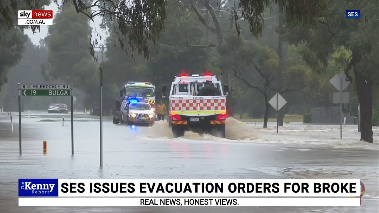
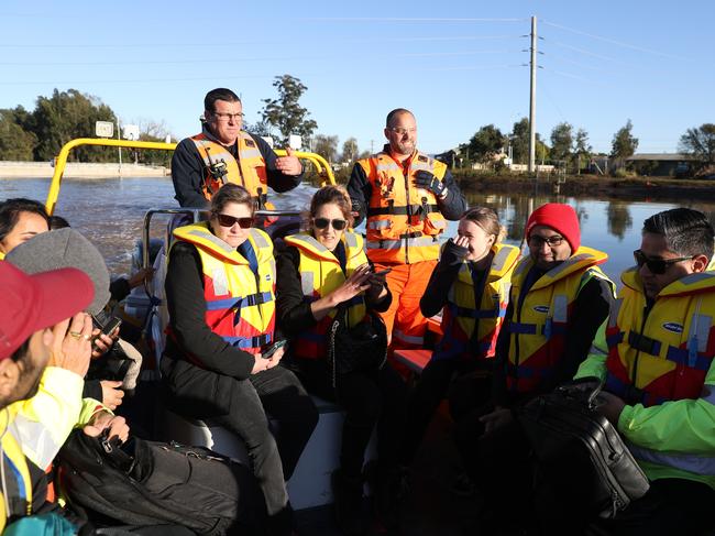
News of the secret report comes as essential workers stranded by flood waters at Windsor had to ferried to work by boat on Friday, as Premier Dominic Perrottet surveyed from the air the sprawling devastation of the NSW floods crisis.
SES volunteers filled their boats with stranded essential workers on Friday, after the Windsor Bridge and the region’s major roads were again swallowed by floodwaters, while helicopters took off from Wilberforce to deliver food, fuel and emergency supplies to families cut off.
It’s the fifth time in just 18 months that communities along the Hawkesbury have been hit with serious flooding, and the clean-up is expected to take weeks.
“People haven’t been able to work, the cost of repairs is adding up, and insurance premiums are going up,” NSW SES Hawkesbury Unit leader David King said.
“You’ve got to feel for these families who keep going through this.”
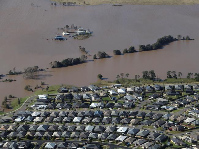
Mr Perrottet took in the swamped Hunter Valley from a helicopter with Emergency Services Minister Stephanie Cooke, before they were briefed by SES officials to get an understanding of the devastation.
The Premier said there were 67 evacuation orders in place on Friday morning, as well as 22 evacuation warnings, affecting about 47,000 people.
He said his flyover of Maitland and Singleton had made clear the “extent of the damage … and the enormity of the challenge in front of us. (Recovery) is going to require a major effort.”
As water began to recede on Friday afternoon, Singleton’s Ty Merrick began counting the cost of a drenching at his property on Combo Lane.
Running a local building business, which has been through not just floods recently, but drought and Covid, he said it has been another kick in the guts.
“We haven’t been to work since Wednesday, so loss of income, and all the wet weather, there are obviously material shortages, labour shortages, we’re now weeks behind and we can’t start for weeks because of the wet weather,” Mr Merrick said.
Crops at the family property have also been decimated.
“We’ve just sowed 20 acres of lucerne and 10 acres of oats, which is all sadly gone, and unfortunately all our established lucerne, we have 100 acres here, looks like we could be in excess of down $200,000 for the upcoming season,” he said.
He is one of many farmers who have been battered by these destructive July floods.
“The veggie farm across the road who have probably lost all their produce, ready to go to market, I’d say they’d be buggered. There are dairy farmers down Scotts Flat would have lost millions of dollars worth of lucerne crop,” he said.

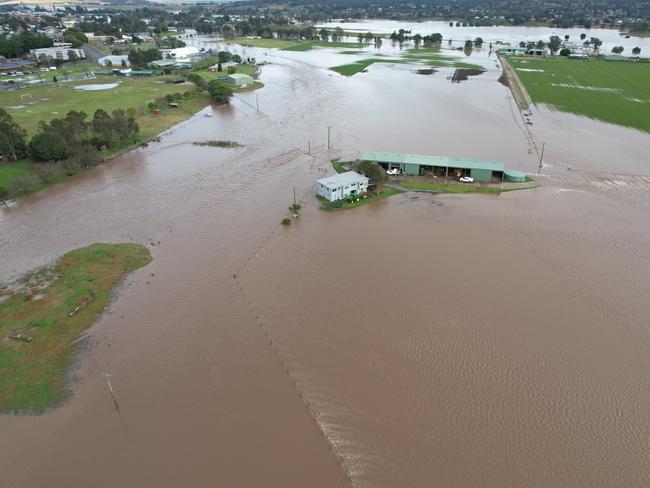
Owner and winemaker at Margan Wines, Andrew Margan, said it has been the worst flood that had ever been through the small community of Broke, which was still cut off on Friday.
“(It) went straight over the top of us, all through the winery, smashed all the vineyards, took all my fences and livestock,” Mr Margan said.
“(I’ve) no idea the dollar damage but it’s not good. It’s just left its mark.”
Left with no power and water for days, the family is also at risk of losing thousands of dollars worth of food at its popular restaurant.
Owner of the Village Shop at Broke, Rashmin Narola, who also runs the local petrol station, bakery and liquor shop in town, said they had been handing out food to locals in need.
“People in the town didn’t have any food, so instead of throwing it away we can give it to local people. Ausgrid have given us a generator now for rest of the food.”
Got a news tip? Email weekendtele@news.com.au
Originally published as Flood housing report signed off in January but not released to public
Join the conversation

Labor woos women with millions for menopause, pills and IUDs
Labor has promised women will pay less for healthcare from their very first period to menopause under a whopping $500m announcement ahead of the election.
Read more

Bitter twist toWatson’s coffee saga
The AOC and IOC recognise former modern pentathlete Alex Watson as an Olympian – but a self-appointed band of integrity guardians say he shouldn’t call himself a Games veteran.
Read more