
Evacuations, school closures and rail disruptions as rain lashes NSW Hunter and Mid North Coast
Disaster declarations are likely to be made following this week’s severe and “unpredictable” heavy rain and flooding in NSW northern - which has prompted flash floods, evacuations, powerful river flows and wild oceans.
NSW
Don't miss out on the headlines from NSW. Followed categories will be added to My News.
The NSW government has anticipated disaster declarations will be made following this week’s severe and “unpredictable” weather event.
In the past 24 hours, across the Hunter and NSW mid north coast, there have been 24 flood rescues, a majority of which are people driving through flood waters.
“I don’t know how many times I have to say this, do not drive through flood waters,” Minister for Emergency Services Jihad Dib said.
“We need people to be sensible and follow instructions and be cautious.”
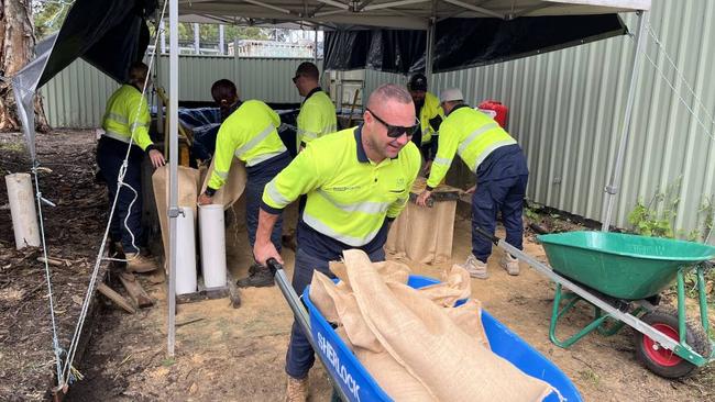
The State Emergency Service has also now turned their focus to areas across the mid north coast with evacuation centres in Wingham, Dungog, Taree and Bulahdelah.
Taree has been lashed with 267mm of rain over the past 24 hours and a staggering 190mm in a six-hour period.
Volunteers continue to doorknock highly affected areas including low lying areas of Wingham with the Manning river a concern as it continues to rise.
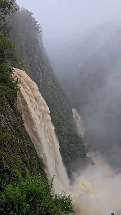
“The short intense bursts of rain that we expect will create further flash flooding and risk to the residents of the areas affected,” NSW SES Northern Zone Commander Andrew Cribb said
“This flash flooding is hitting the ground that is absolutely saturated and running downhill towards our catchments, rivers and tributaries which will prolong any flooding.
“Desperately working with communities to try and doorknock, occurring where evacuations are taking place, expecting more to open on mid north coast.”
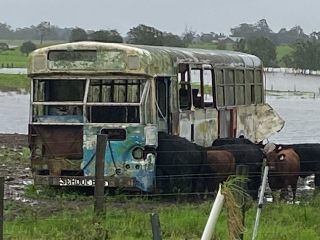
The severe storms have lashed northern NSW, triggering flash flooding, rescues, evacuations and widespread disruptions.
More than 1500 calls for assistance have been made to the State Emergency Service (SES) in the past 24 hours, with the Hunter, Mid North Coast, Northern Tablelands, and North West Slopes and Plains among the hardest-hit regions.
Taree recorded a staggering 160mm of rain in just six hours overnight, and the Bureau of Meteorology is warning of isolated totals of up to 180mm within 24 hours — raising the risk of further flash flooding.
Evacuation warnings have been issued for several communities, including Dungog, Paterson, and Forster.
At least 68 schools have been closed, and more than 1600 SES personnel have been deployed ahead of the worsening conditions, with forecasters warning the severe weather could persist for several more days.
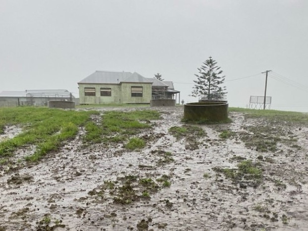
It comes as residents have been forced to evacuate their homes across parts of the Hunter and Mid North Coast as torrential rain continues to smash the regions — with more than 200mm recorded in Port Macquarie alone since Monday morning.
The NSW State Emergency Service has issued evacuation orders for parts of Bulahdelah, while roads have been inundated and key rail lines shut down due to rising floodwaters.
Train services have been suspended on the Hunter line between Scone, Dungog and Newcastle Interchange, with parts of the network underwater at Sandgate.
The Bureau of Meteorology said a deep and stationary coastal trough continues to drive the extreme conditions, with another 20mm expected in Sydney on Tuesday and locally intense rainfall threatening parts of the Mid North Coast.
“Life-threatening flash flooding is possible today between Seal Rocks and Nambucca Heads, especially across elevated parts of the Mid North Coast,” said senior meteorologist Sarah Scully.
“Since Monday morning, we’ve seen widespread falls of 150 to 250mm, with the highest so far at Taree with 267mm. Mount Barrington recorded 232mm, and Port Macquarie has already had 226mm, with more rain still falling.”
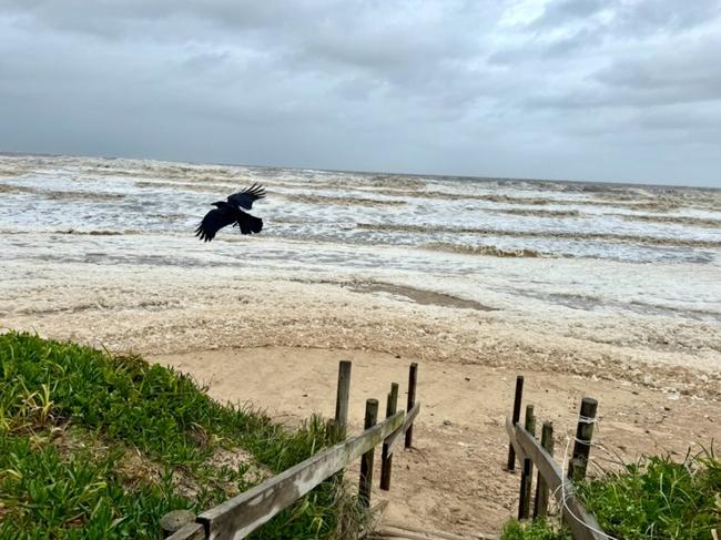
A separate hazardous surf warning is current between Cape Byron and the Sydney coast, with waves exceeding five metres forecast offshore. The public is being urged to avoid beaches and coastal areas due to the risk of coastal erosion and dangerous conditions.
“Beach conditions are incredibly dangerous. People should stay well away from the surf and exposed areas, particularly along the Mid North Coast and Hunter coastline,” Ms Scully warned.
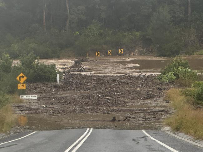
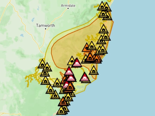
Flood warnings are now in place for multiple rivers, including major flooding for the Paterson, Williams and Goulburn rivers, and moderate flood warnings for the Hastings, Hunter and Wollombi.

On The Mid-North Coast, major thoroughfare The Bucketts Way between Gloucester and Stroud was closed on Tuesday morning after a serious landslide and widespread flooding.
The road was also closed between Hillville and Tinonee due to flooding.
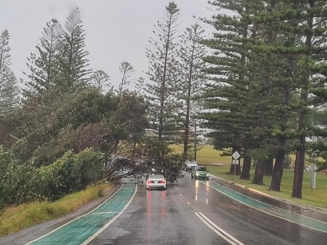
Authorities have warned conditions will remain volatile throughout Tuesday, with damaging winds up to 90km/hr, ongoing flash flooding, and dangerous driving conditions continuing to impact the region.
Do you know more? Message 0481 056 618 or email tips@dailytelegraph.com.au
More Coverage


Originally published as Evacuations, school closures and rail disruptions as rain lashes NSW Hunter and Mid North Coast

Teachers go bush to make a difference
Christened ‘Miss B’ by the children, Abby Barcham has fallen in love with Menindee Central School and its 76 students and their excitement whenever they see her makes her feel like “a rock star.”
Read more

‘I was robbed and assaulted’: The harsh reality of sleeping rough
A once homeless Sydney woman has revealed the abject fear and danger that goes with living on the street as new data shows that more than half of Australia’s most vulnerable people have skipped meals and are unable to afford prescription medication.
Read more