
Maps show true size of Australia’s bushfire crisis
More than 100,000 square kilometres of land has been wiped out by the bushfires since September. These are the maps that show the true extent of the devastation.
National
Don't miss out on the headlines from National. Followed categories will be added to My News.
These are the maps that shows the extent of the devastation that has hit Australia this bushfire season.
An estimated 104,320 square kilometres of land has been scorched since September.
That is equivalent to the entirety of Iceland, twice the size of Costa Rica, three times the Netherlands and up to 10 times the size of Jamaica.
More than 1930 homes have been destroyed so far – which does not include the more than 3000 sheds, facilities and outhouses that have perished.
A total of 278 bushfires are burning across the country – 136 in NSW, 31 in Victoria, 23 in SA, 37 in QLD, 26 in WA, 24 in Tasmania and one in the Northern Territory.
A Department of Home Affairs spokesman said fire chiefs warned fires would continue to burn for “some time” and it was important for communities to remain vigilant and follow advice from local management authorities.
“These fire conditions are unprecedented and while we are prepared, well organised and well resourced, the rapidly escalating damage and the heartbreaking human cost calls for nothing less than an all-out response,” the spokesman said.
On Monday, 30 of the fires were burning at Watch and Act level or above, otherwise known as a heightened level of threat.
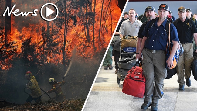
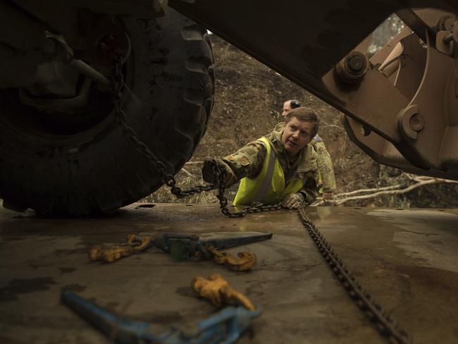
More than 4500 firefighters and support personnel are deployed to help nationwide, including 145 personnel from the US and Canada.
An additional 21 Canadian and 21 US personnel arrived on Monday, with a further eight Canadian and 59 US personnel scheduled to arrive Wednesday.
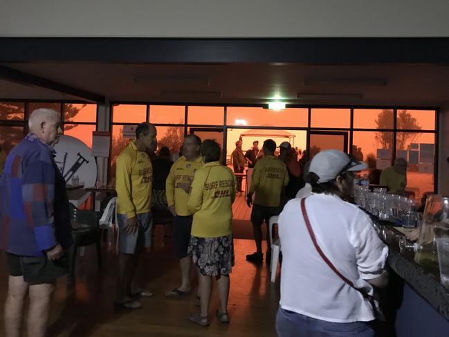
“Eighteen evacuation centres remain open in New South Wales, 13 in Victoria and one in South Australia,” the Department of Home Affairs spokesman said.
This follows the Federal Government calling on 3000 reserve forces of the Australian Defence Force for help.
The HMAS Adelaide – one of two Canberra-class landing helicopter dock ships of the Royal Australian Navy – has also been deployed to support the efforts of HMAS Choules and MV Sycamore and additional Chinook helicopters, C-17 Globemasters, C-130 Hercules and C-27 Spartans.
The department confirmed an extra fleet of water bombing planes for the states and territories has been leased and deployed as well.
Building Impact Assessment teams continue working through fire affected areas, to assess damage to properties. So far this season 1,588 homes destroyed & more than 20,000 buildings saved. Since 1 Jan, 672 homes have been lost. This figure is likely to increase. #nswrfs #nswfires pic.twitter.com/FLjafbZccv
— NSW RFS (@NSWRFS) January 6, 2020
“The Government has already processed 20,600 claims for assistance this bushfire season and delivered nearly $25 million in Australian Government Disaster Recovery Payment and Disaster Recovery Allowance,” he said.
This comes as fear of fires burning out of control and merging between states rises.
WHAT IS HAPPENING STATE-TO-STATE
NEW SOUTH WALES
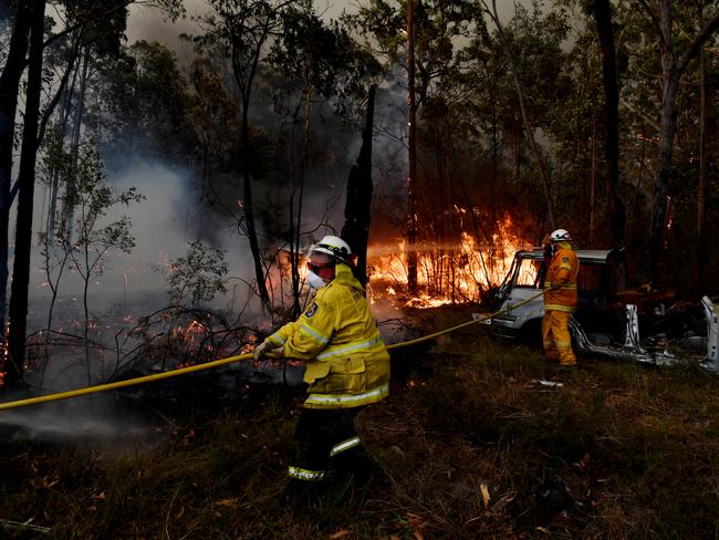
NSW Rural Fire Service’s 3000 personnel are tackling 136 fires.
Spokesman Greg Allan said the crews were on a mission to contain and slow the spread of fire ahead of “the deteriorating conditions forecast for Friday”.
Temperatures in Sydney are set to rise to a maximum of 30 degrees.
Light winds are also expected to change throughout the day – moving from northerly of 15 to 20km/h to north-easterly of 20 to 30km/h.
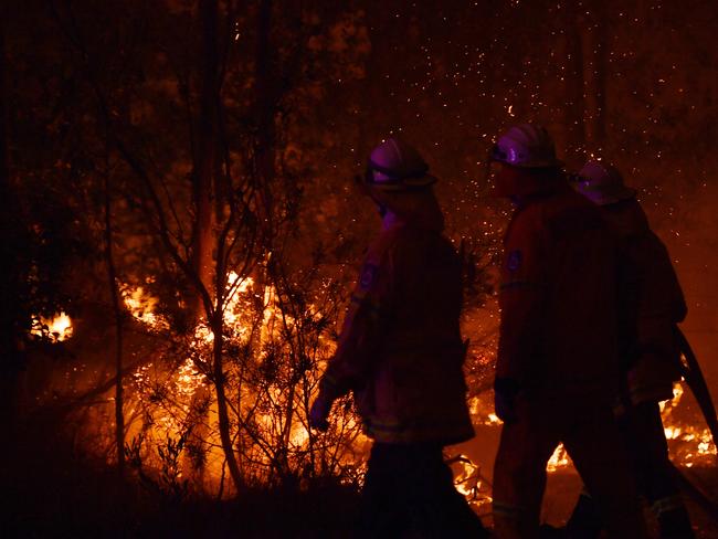
“There is a lot of fire, but what we are finding in the last 24 hours is more moderate conditions, allowing crews to get in,” he said, adding 1588 homes had been burnt down, 754 vehicles were on the ground in NSW and 20 people had died, with two unaccounted for.
“The fires in NSW are on Advice Level at the moment, which means there isn’t any threat to properties … but things can change so people still need to remain vigilant and be aware of what they should do if fires become a threat.”
Mr Allan said a number of fires have overlapped and burned in close proximity, with one from Victoria – called Border Fire – merging with another in NSW.
“Border Fire came up from the south east of our state and is heading north towards Eden. Pretty much the entire south east of NSW is on fire,” he said.
More than 6200 livestock are among millions of animals believed killed.
QUEENSLAND
Hundreds of soldiers have left their Brisbane barracks on an open-ended mission to help NSW and Victoria cope with the ongoing bushfire crisis.
A Queensland Fire and Emergency Services spokeswoman confirmed on Monday about 48 homes and 60 sheds had been destroyed by bushfire across QLD since September 2019.
About 25,000km2 had been burnt.
As of reports today, 37 fires are burning in the state’s far north, central, southeast and Central Highlands.
“Queensland Fire and Emergency Services (QFES) deployed more than 70 QFES firefighters to New South Wales last Friday (January 3),” the spokeswoman said.
“This included 54 Rural Fire Service (RFS) volunteers and 21 Fire and Rescue Service firefighters.
“This contingent will be relieved by a deployment of more than 50 RFS volunteers, who left Queensland for NSW this morning.”
VICTORIA
Twenty-seven fires are burning in Victoria, according to the Country Fire Authority (CFA).
East Gippsland has 14 active fires and more than 9000km2 has been impacted.
Hume has six active fires and more than 2000km2 has been impacted.
The disastrous blazes have already burnt more than 12,000km2 worth of land across Victoria, killing two and injuring millions of wildlife.
More than 1000 firefighters are helping to tackle blazes across the state, including 41 firefighters in East Gippsland.
An additional 70 from the US and Canada are expected to join the Victorian bushfire response on Wednesday.
CFA confirmed there have bee about 204 property losses and more than 243 outbuildings have been impacted by the fire.
SOUTH AUSTRALIA
Three people have died as a result of bushfires.
At least 2678.3 km2 has been burnt since the season started – destroying 105 homes or dwellings and 413 sheds or outhouses.
This does not include property on Kangaroo Island, where a damage assessment is yet to be complete.
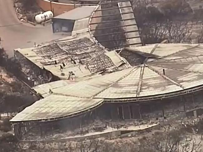
The spokeswoman said a number of wineries, cherry farms, and other iconic hills producers at Cuddle Creek have been destroyed by flames. Adelaide Hills Cheese has a lot of stock destroyed, she added, and the Flinders Chase National Park has had a lot of critical infrastructure, including the tourist information centre.
“A water treatment plant also suffered some damage,” the spokeswoman said.
“KI has had 915 fire fighters engaged in firefighting activity, these are from across CFS, Department of Environment and Water, SES and MFS.
“Currently there are 145 on the ground.”
WESTERN AUSTRALIA
About 300 people were moved through a fire zone in Western Australia where a blaze has closed the Eyre Highway for several days.
The Department of Fire and Emergency Services said the convoy to Norseman and Esperance was considered the safest way to help those stranded to the east of the fire zone.
10:28 AM - Cyclone YELLOW ALERT for people in or near communities from Bidyadanga to Wallal including Wallal in the Kimberley: https://t.co/ZSEIQCTb4B
— DFES (@dfes_wa) January 7, 2020
09:45 AM - Cyclone YELLOW ALERT for people in or near communities from Bidyadanga to Wallal including Wallal in the Kimberley: https://t.co/ZSEIQCTb4B
— DFES (@dfes_wa) January 7, 2020
It is reported 26 fires are still burning across the GoldfieldEsperance region, Wheatbelt, Perth region and southeast.
More than 17,000km2 of land has been burnt since September 2019, and one house has been destroyed.
TASMANIA
On Monday, 24 fires were confirmed to still be burning across Tasmania’s north, east and south. More than 320km2 of land has been burnt across the state, and two homes have been destroyed.
AUSTRALIAN CAPITAL TERRITORY
On Monday, one fire was burning in the Namadgi National Park, with significant smoke haze coming from interstate.
NORTHERN TERRITORY
There is one bushfire burning in Namadgi National Park at the Northern Territory. Significant smoke is coming in from interstate. Five homes have been destroyed by bushfires since September 2019.
Originally published as Maps show true size of Australia’s bushfire crisis

Murder charges laid over missing teen
The investigation into the disappearance of missing teenager Pheobe Bishop has resulted in tragedy, with police charging two people with murder.
Posties to carry protection spray
Posties will soon carry protection spray to use against dangerous dogs after new data revealed alarming escalation of incidents.