
Port Douglas braces for imminent arrival of Cyclone Jasper
Port Douglas boaties fear the arrival of Cyclone Jasper on a high tide could trigger a maritime disaster similar to the devastating storm surge impact of Cyclone Yasi at Port Hinchinbrook.


Cairns
Don't miss out on the headlines from Cairns. Followed categories will be added to My News.
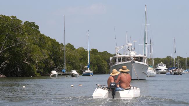
Within hours of a marine orange alert being declared at the harbour of Port Douglas most vessels had taken shelter in the mangroves of the inlet and while many were nonchalant, serious concerns have been raised about the possible convergence of high tide and expected Cyclone Jasper storm surge.
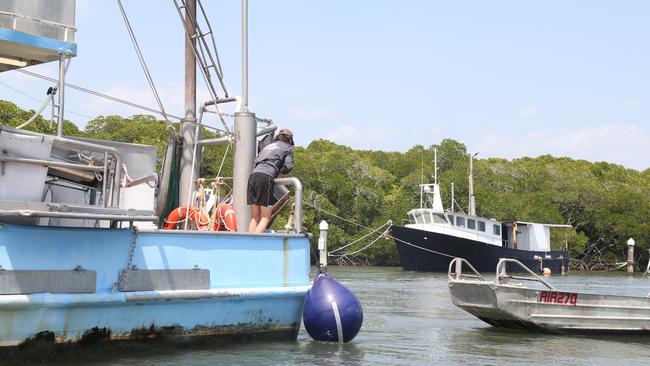
Dickson Inlet was a flurry of activity on Monday as boaties took heed of the port alert and secured vessels against the approaching storm.
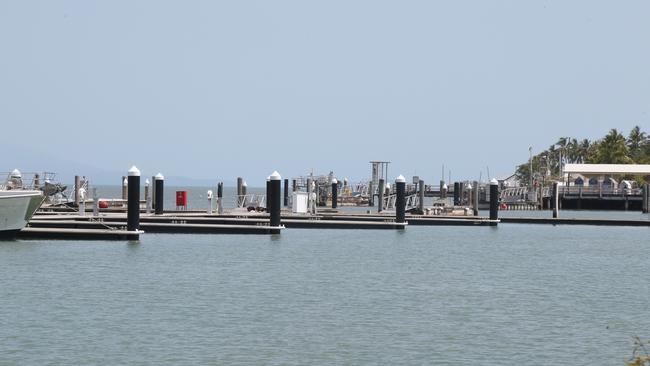
Under an orange watch and act alert evacuation of marina fingers and poles is mandatory.
By late Monday the Crystalbrook Superyacht Marina and the smaller facility near the Port Douglas Yacht Club owned by the Quicksilver Group was largely empty.
Tourist operators such as Quicksilver, Sailaway Reef & Island Tours and Shaolin have suspended trips.
Port Douglas Yacht Club member Brian Morgan said there was a general consensus among the boating community that the seaside resort town would cop a direct hit from Cyclone Jasper.
“They’re all saying it’s coming. There’s nothing you can do about it, fingers crossed it doesn’t do too much damage,” he said.
“But when he comes in and over the reef into shallow water it’s going to intensify because the waters are hotter, and then God only knows what’s going to happen.”
According to the latest Bureau of Meteorology update the system will cross the coast at Port Douglas as a category 2 system at 10am on Wednesday.

A high tide of 2.8m is expected at 9.30am on Wednesday and that had Port Douglas Yacht Club vice commodore Adam Finn concerned.
“If it comes on a high tide it’s terrible, we will be knee deep in water (at the yacht club) if it comes on the high,” he said.
âš ï¸ðŸŒ€Tropical Cyclone Watch for #CycloneJasper continues. The system weakened to category 1 this morning, forecast to cross between Cape Flattery and Cardwell on Wednesday as a category 2 system. Details and updates: https://t.co/FBmpsInT9opic.twitter.com/gBGnOweGhu
— Bureau of Meteorology, Queensland (@BOM_Qld) December 10, 2023
The big concern was floating marina fingers would rise up on pylons and float up the inlet with the storm surge crashing into everything in its path, similar to the carnage at Port Hinchinbrook when Cyclone Yasi hit in 2011.
An orange port warning at watch and act level extends from Townsville to Cape Flattery.
In the 10 years former Port Douglas Yacht Club commodore Bob Standley had lived in the Far North resort town, boats had been ordered up the inlet four times, but nothing significant had eventuated.
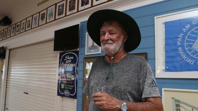
“But this time the way they have it tracking right up the river, I think we are going to get it,” he said.
In the largely deserted town of Port Douglas council employees worked to shore up infrastructure ahead of the storm’s touchdown. The dismantling of the Christmas tree outside the St Mary’s by the Sea chapel was one of many tasks to be completed before the storm’s impact.

French and Swedish backpacker buddies Julie Champagne and Sara Karlsson were staying in a rooftop tent at the Tropic Breeze Caravan Park until it was suggested they find somewhere safer.
They now have a room provided without charge by their employer Club Tropical Resort.
“I was worried yesterday before we knew where to go,” Ms Karlsson said.
“But now we have walls its better and now we have to get ready,” Ms Champagne said.
Following a meeting of the Douglas Shire local disaster management group on Monday Mayor Michael Kerr said the Daintree River ferry would be closed from Tuesday afternoon.
The ferry will be chained to pylons, with services to be suspended from 2pm.
Mr Kerr advised those living in the isolated Daintree area, which is accessible only by the ferry, to stock up on supplies now before it was too late.

Amid the frantic preparations veteran Dickson Inlet liveaboard boatie Mick Lloyd said he was not concerned.
“I’ve been doing this for 33 years or every cyclone between here and Thursday Island I have been in it, this is just a little gammin one,” he said.
Jasper is forecast to re-intensify during Tuesday as it approaches the coast, according to the Bureau, but if it lingers over water there’s a “slim” chance the system will power up into severe category 3 system before crossing the coast.
A storm force wind warning has been issued for the Cooktown Coast and Cairns Coast.
More Coverage

Originally published as Port Douglas braces for imminent arrival of Cyclone Jasper
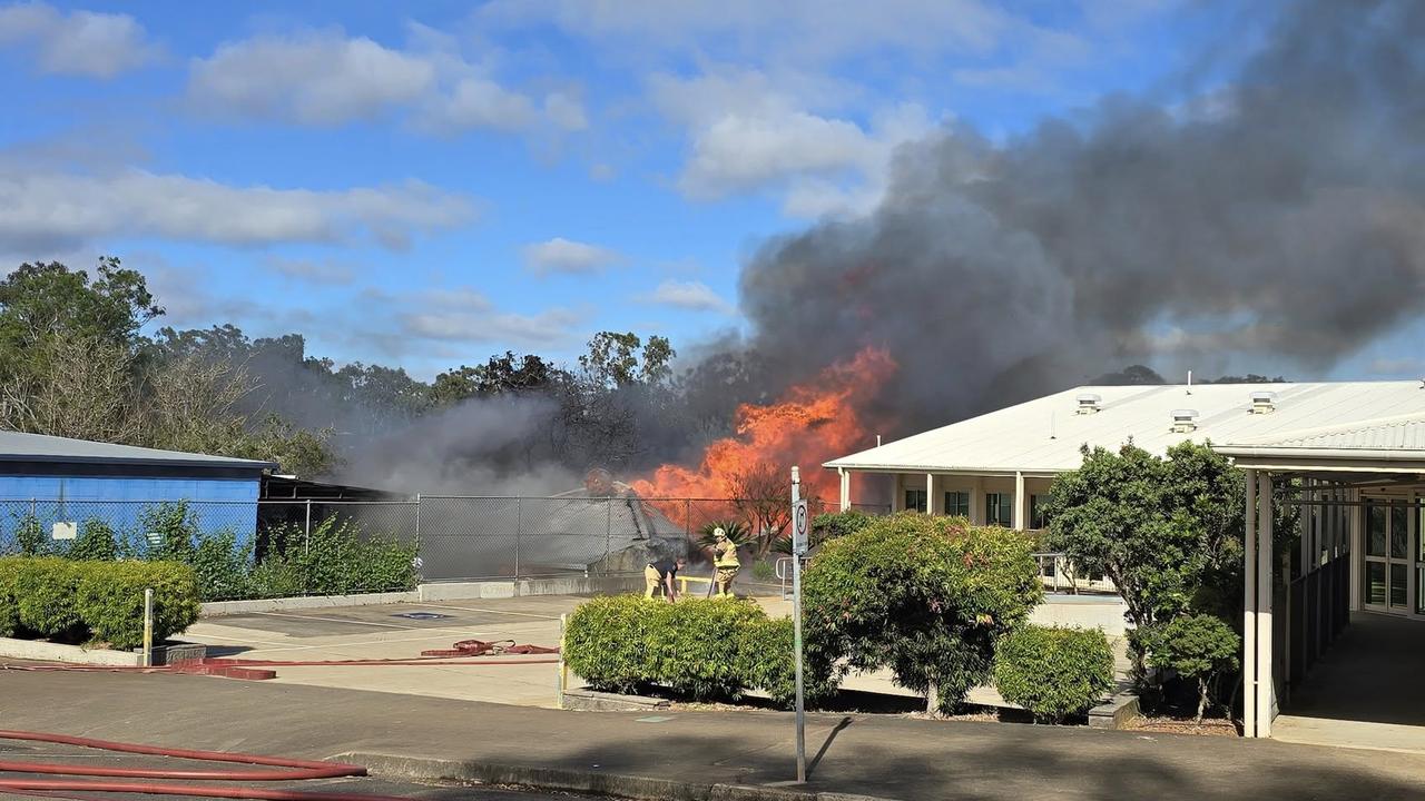
Blaze destroys fire service volunteer’s home during cancer treatment
The owner of a home destroyed in a Tablelands fire has been identified as a rural fire volunteer, who was undergoing cancer treatment when the blaze started.

‘A tragic mess:’ What’s at the core of city’s ‘complex’ social problems
A centralised healthcare scheme for Cape residents has been described as a “tragic mess” by an indigenous advocate, who says it can lead to poorer outcomes for vulnerable patients trapped in cycle of alcohol abuse.