
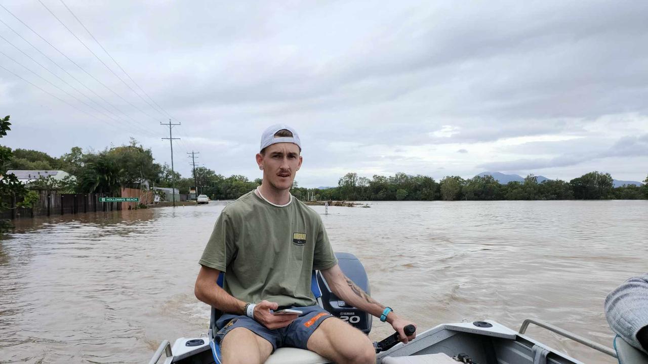
Rescue crews respond to medical call-outs, evacuate Yorkeys Knob and Holloways Beach
HMAS Cairns has joined rescue efforts in the state’s flood-ravaged north after hundreds of northern beaches residents were forced to evacuate overnight. LATEST UPDATES
HMAS Cairns has joined rescue efforts in flood-ridden Far North Queensland with emergency services evacuating hundreds overnight.
Queensland Police have confirmed they expect HMAS Cairns small vessels to join the rescue efforts in Cairns and across the Far North Queensland coast today with the navy, SES, QFES and QPS involved in 250 rescues overnight.
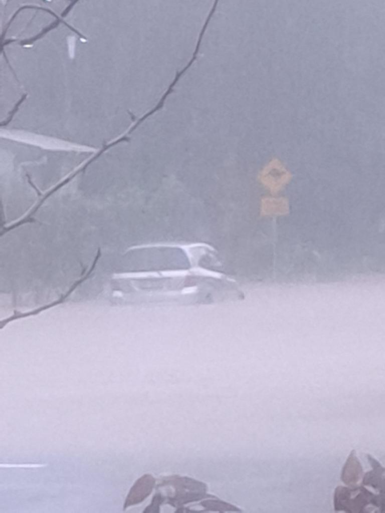
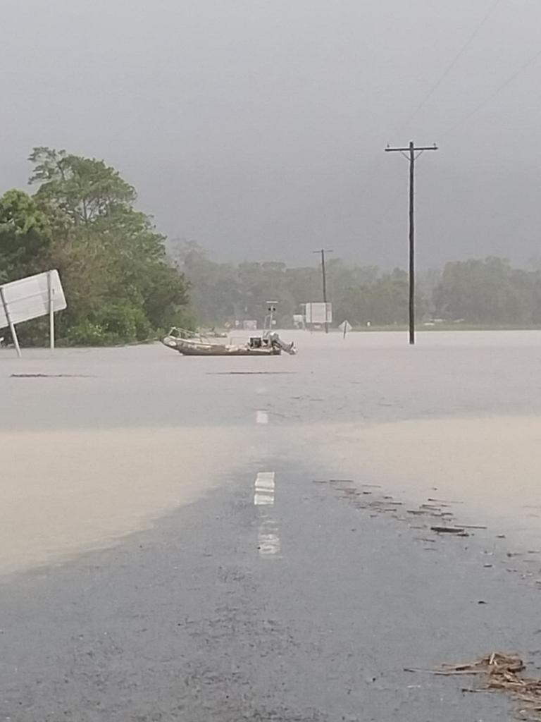
Police estimated around 200 people “self-evacuated” last night from Cairns’ northern beaches after massive flood waters swept away sections of road at Holloways Beach and the suburbs were inundated with water.
Queensland Fire and Emergency said the SES had received more than 1000 requests for assistance in the last 24 hours with fire and rescue responding to 350 calls in the same time period including evacuations and swift water rescues.
298 people are currently sheltering at the 11 evacuation centres across the region with 177 sheltering in Cairns overnight alongside 23 dogs and seven cats.
A rescue at Wujal Wujal of nine people, including a 7-year-old child, stuck on top of a roof is still ongoing while five more people at Degarra have been left stranded across three separate homes.
The Australian Defence Force will be providing additional assistance alongside HMAS Cairns.
A Defence spokesperson said they would provide transport for up to 150 emergency service personnel and additional equipment to Cairns, and provide emergency rotary wing support to the region for life-threatening rescue purposes.
“This will include deploying two Australian Army CH-47F Chinooks and two AW-139 helicopters from Townsville, as soon as possible, to support Queensland emergency authorities,” the spokesman said.
8pm, Sunday - Request for navy assistance made
A request for immediate assistance has been made to HMAS Cairns by Queensland’s State Disaster Coordinator, as an armada of emergency services, Surf Life Saving Queensland and Yorkeys Knob Yacht Club boats evacuate residents from flood-stricken northern beaches suburbs.
A request is the first step in the process, which will be considered by the Australian government and subsequently the defence force.
SDC and Queensland Police Service Deputy Commissioner Shane Chelepy said authorities had received “a lot of urgent calls for assistance” in suburbs like Holloways Beach, Yorkeys Knob, Machans Beach, and the like.
People have had to be evacuated from their roofs, Deputy Commissioner Chelepy said.
He said authorities were prioritising calls for service to lower-lying areas and for vulnerable people such as the elderly and those with chronic medical conditions.
“People calling saying they’re on roofs, we’re prioritizing them as well,” he said.
Deputy Commissioner Chelepy said that if people were feeling unsafe, they should be seeking higher ground – for instance, their roofs – and calling Triple-0.
He said the number of calls for assistance were fluctuating, but vessels from QPS, Queensland Fire and Emergency Services, SES, SLSQ, and the yacht club would remain in the northern beaches this evening ready to provide assistance for anyone who calls for it overnight Sunday and into Monday.
Deputy Commissioner Chelepy said he had formally approved the request for the federal government to activate HMAS Cairns, and was hoping the Navy would be able to deploy their small vessels to assist with evacuations on Sunday evening.
“The district commander has been speaking with the local commander at HMAS Cairns to make that happen and the State Disaster Coordination Centre has been engaging with the federal government to make that happen,” he said.
“So we’re looking for that urgent supply tonight, but obviously ongoing support (on Monday) is what we’re really keen to see.”
He said there were two key messages he wanted people to understand.
“If you need assistance, please move to higher ground and call 000. That’s the key message tonight,” he said.
“The second… is to stay in contact with all the messaging. Things are changing rapidly.”
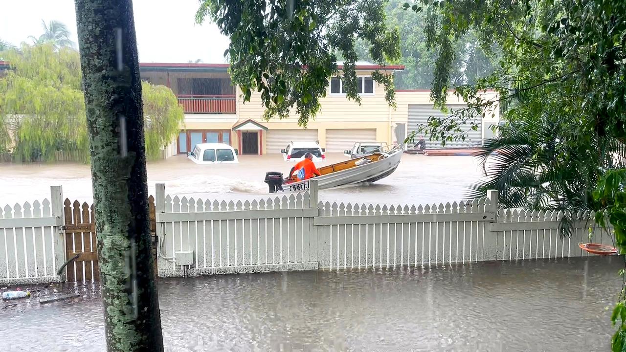
Rescue crews evacuate Yorkeys Knob, Holloways Beach
SES and Swift Water rescue crews have been evacuating residents from Holloways Beach and Machans Beach, SES Area Controller Sean McGuinness has confirmed.
“We have SES and Swift Water rescue crews at Holloways and Machans due to people waiting for evacuation in and on houses. That’s what we’re doing at the moment,” Mr McGuinness said.
It comes after reports of Queensland Fire and Emergency Service crews liaising with residents in restricted areas such as Mt Molloy and Mena Creek to give them evacuation advice as crews were unable to respond to rescue call-outs.
A QFES spokeswoman confirmed crews were doing the best they could given the high demand.
“There was an incident in Gordonvale of an elderly person requiring evacuation. QPS requested assistance doorknocking Klarwein close to tell people about possible evacuation,” she said.
“QAS required our assistance to get to someone who was having a medical episode at Mialoo last night and needed help crossing the bridge. It was deemed impassable and QFES stood down.”
The spokeswoman confirmed rescue crews attended a call-out to person who had been trapped in a car in floodwater on Sunday morning.
“One person was trapped in a car in Yorkeys Knob Road and Cattana Road earlier this morning. Two Swift Water crews made access and got the person out of the car,” she said.
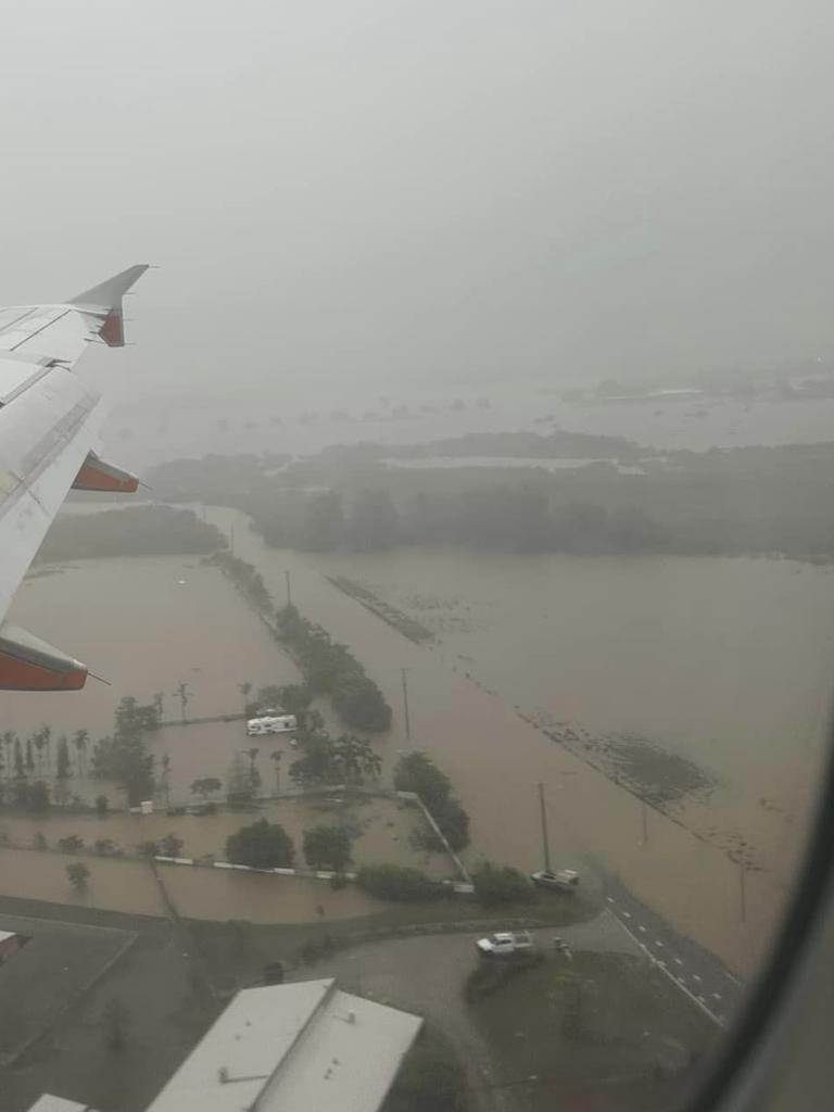
Cairns Airport cease operations; council meeting cancelled
In a statement on Sunday afternoon, Cairns Airport confirmed it had ceased operations as heavy rain continued to batter the Far North.
“Operations have now ceased at Cairns Airport. A further assessment will take place at 6pm.
“This decision has been made as we continue to work closely with authorities and stakeholders, including our airline partners,” the statement read.
“Please contact your airline directly for information about specific flights.
“Another update will be published following the review at 6pm.
“Thank you for your co-operation.”
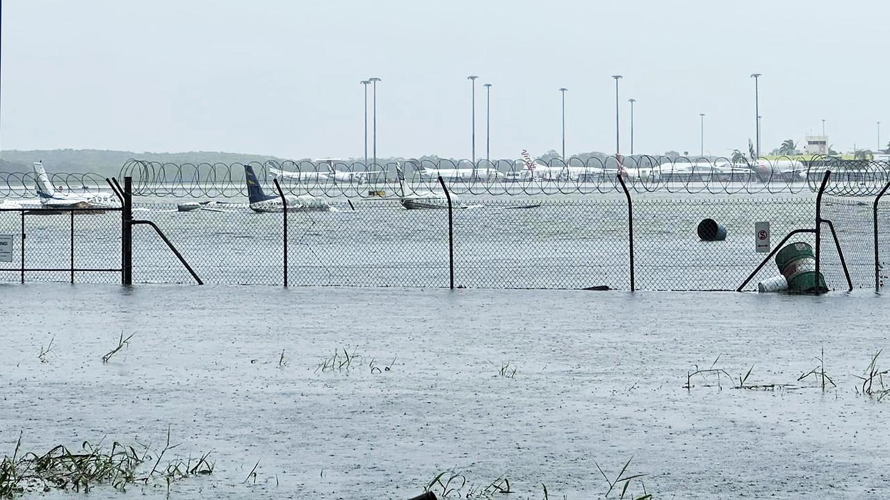
The Barron River at Cairns Airport is already above the record flood height set in March 1977 and is expected to hit 4.4m.
Planes at the general aviation section of the airport have already been half-submerged in flood water.
Bureau of Meteorology senior meteorologist Dean Narramore said unrelenting rain would continue for at least another six hours.
“There will be another six to 12 hours of heavy rain streaming in from the north, it will start to ease tomorrow with patchy rain and thunder storms, you’ll get some breaks rather than persistent non-stop rain,” he said.
Cairns airport has recorded 685mm of rain to 9am today and another 100mm since 9am.
In the past 24 hours, 309mm has fallen and 251mm at Cairns Racecourse.
Mr Narramore said BOM was forecasting the flood would be bigger than that experienced in March 1977.
He said rivers were already above 1977 levels.
He said in 1977 the peak at the airport was 3.9m and by early this evening or overnight, it would reach 4.4m.
A Cairns Regional Council spokesman confirmed council’s Monday ordinary meeting had been cancelled.
A new date has not yet been confirmed.
The council was due to vote on its new water security project, decide the next Division 4 councillor and deliver an update on its involvement with the Papua New Guinean NRL bid.
Sunday 2.30pm: Premier offers assistance to councils as water infrastructure systems stressed
The Cairns region is down to 30 hours of water supply as severe weather has prevented council crews from clearing blockages at critical infrastructure, mayor Terry James has said.
“We’re approaching critical levels of treated water,” Mr James said.
Premier Steven Miles has offered the state government’s assistance to Far North councils, according to two mayors.
Cassowary Coast mayor Mark Nolan said water supply in his LGA had been impeded.
“We’ve just finished a call with the premier. The state government is looking to step in with resources and staff,” Mr Nolan said.
Sunday, 12pm: Barron River surges
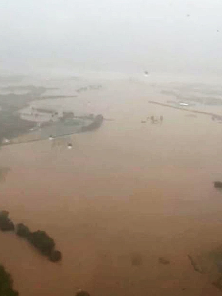
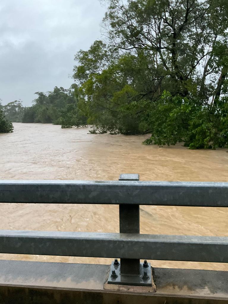
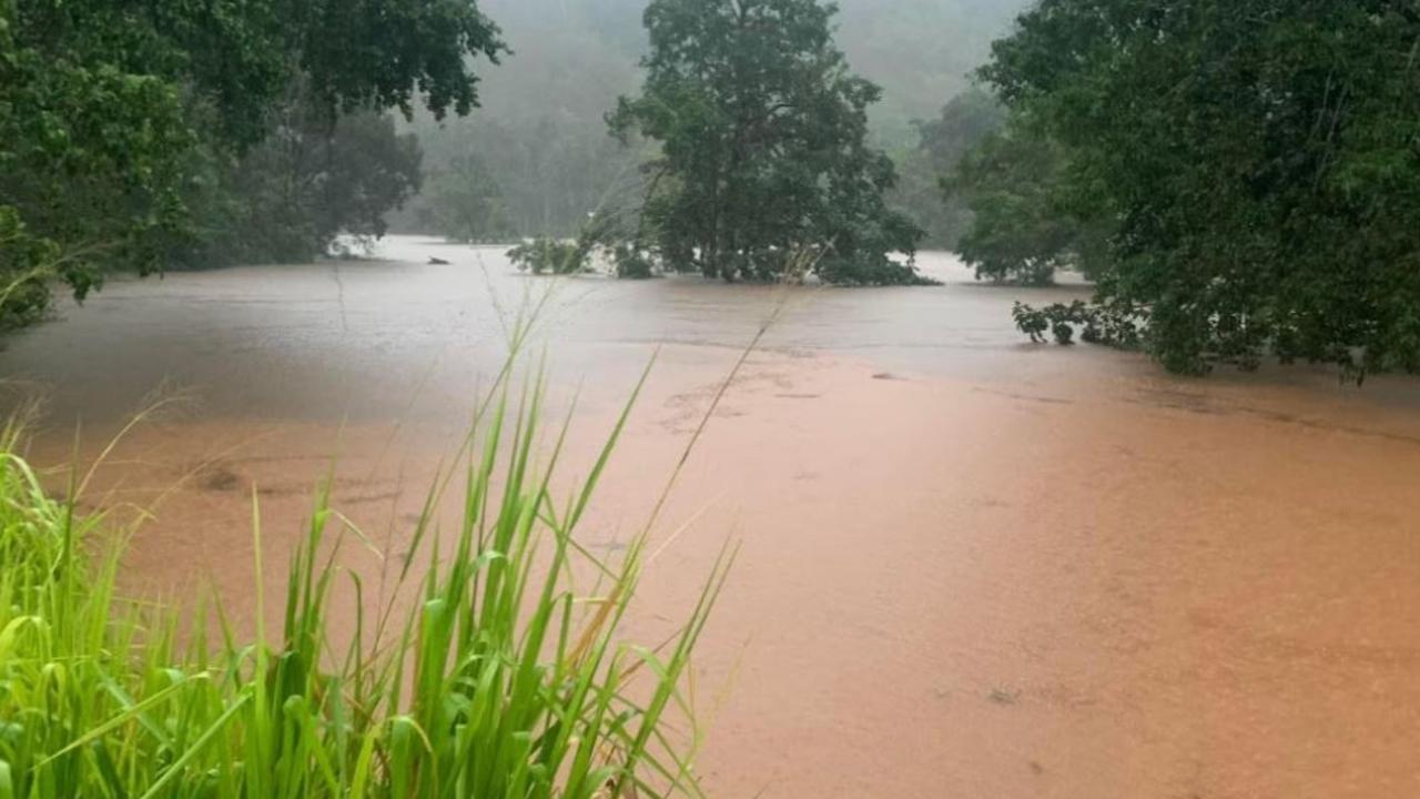
Far North Queensland is grappling with major flood levels as a result of ex-Tropical Cyclone Jasper with falls of nearly 1.5m smashing the Barron River catchment in just five days.
The Barron River at Lake Placid is currently sitting at 13.34m – 1.34m above the major flood height – and more water is pouring down towards the coast from the Atherton Tablelands.
The river is expected to rise further over the coming hours – and quickly.
BOM senior meteorologist Dean Narramore said there had been widespread falls of between 200-400mm across an already soaked Barron catchment in the 24 hours to 9am Sunday, with another 100-300mm forecast to fall as of 10.30am.
Mr Narramore said other parts of the catchment had exceeded that figure, with Black Mountain copping 582mm in the 24 hours to 9am.
Cairns Airport received 309mm over the same period, while Cairns Racecourse received 250mm.
Feeder rivers and creeks in the catchment were all reaching or exceeding major flood levels, and Mr Narramore said a major flood level at the Cairns Airport was expected on Sunday afternoon, while the Kamerunga Bridge over the Barron River was already at major flood levels.
Further upstream, Mr Narramore said flood gauges were starting to see some big rises.
Myola was sitting at 2.2m above the major flood threshold.
The veteran meteorologist said the torrential rain was a result of a convergence zone sitting “right over Cairns, and just to the north of Cairns”, creating a concentrated area of heavy rainfall.
Mr Narramore said the rain should begin easing on Monday, though showers and storms could still bring another 50-100mm.
“We just really need the remnants of ex-Tropical Cyclone Jasper to hurry up and go into the gulf, and get rid of that convergence on the north tropical coast,” Mr Narramore said.
“We should finally start to see an easing (on Monday).”
Black Mountain has recorded almost 1.5m of rain in the five days to 9am Sunday.
Myola has had 1437mm, Mona Mona 1296mm, Yandil 1275mm, Daintree Village 1176mm, Cairns Airport 685mm, Cairns Racecourse 600mm, Innisfail has recorded 490mm – most of which fell on Saturday and then Sunday morning, while Mareeba has had 597mm across the same five-day period.
“Unfortunately there’s a lot more rain to come today though,” Mr Narramore said.
Premier Steven Miles said he was monitoring the weather in the state’s north.
“I just got off the phone with the state disaster co-ordinator to discuss the situation in far north Queensland,” he said.
“There’s heavy rainfall there at the moment and that’s expected to continue.
“We’ll hold a further meeting with the mayors of the affected local government areas around midday today and I will check with them and they have everything that they need to respond to any possible flooding.”
Sunday, 10.30am: ‘No shelter, no water, no food’: Men stuck on roof for seven hours in wild weather
Two men have been stuck on a roof in the pouring rain at a remote Cape York property for more than seven hours without supplies, a police spokeswoman has said.
Police received a call from a member of the public, claiming to be a friend of one of the men, about 11.40pm on Saturday.
The informant told police the men had climbed to the roof of their ranger station building near Battlecamp Rd in Melsonby Homestead, northwest of Cooktown, as flood waters were rising.
The men reportedly do not have mobile reception and have been communicating to a friend, the police informant, via Wi-Fi.
“Last night it was too dangerous to get the helicopter out. The plan was to get there this morning, but the helicopter cannot deploy due to dangerous weather. The earliest crews can deploy is midday,” a police spokeswoman said.
“They are still on the roof and have been since 3am.
“(It’s been reported) they have no shelter, no water and no food.”
According to the spokeswoman, emergency services now believe there is an increased threat to the men’s lives and escalated the urgency of the situation about 9.55am.
The Cairns Post understands Queensland Fire and Emergency Services are readying swift water rescue crews to find and rescue the men.
“QFES are aware of the situation. We’re in contact with the helicopter pilot,” the spokeswoman said.
As floodwaters inundated council areas across the states north QFES crews were deployed to more than a dozen evacuations and rescues.
A QFES spokeswoman said multiple incidents were unfolding with the situation changing rapidly and weather conditions created challenges for crews.
She said a number of evacuations were taking place near the Bruce Hwy at Mourilyan on the Cassowary Coast, with two swift water rescue crews one at Gowrie St and one at Peregrine St.
At nearby Caster St flood waters were rising rapidly and a number of elderly residents were taken to evacuation centres.
She said at Palm Cove water rising in a Savaii Close house forced its evacuation with one crew on site there from 9.50am and residents nearby have been advised to seek higher ground within their estate as it is not safe to leave.
At Mt Molloy the evacuation of a single story house requiring air support had been delayed as the weather conditions had made sourcing an aircraft difficult.
There were 17 “public assist” jobs on the QFES dashboard and two “rescue technicals” as of 12.06pm in relation to the flooding.
8am: “Scary” situation at Goldsborough as food supplies run low
Goldsborough residents say they are witnessing the worst flooding from the Mulgrave River they have ever seen.
Goldsborough resident Heidi Healy described the situation as “scary” and said food supplies in the town were running low.
“Fortunately, we regained power yesterday afternoon, providing relief to many neighbours who were running low on generator fuel,” Ms Healy said.
“Some without generators were even between houses to access Wi-Fi to message family members.”
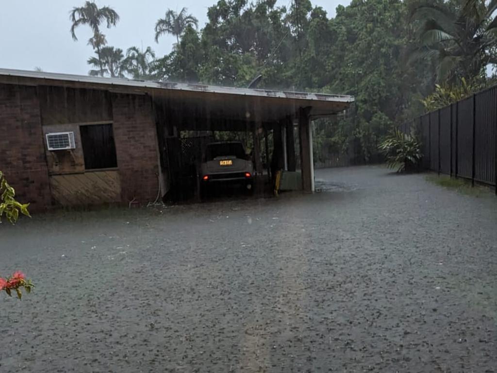
Communities in the Douglas Shire have continued to be belted by rain overnight.
Douglas Shire mayor Michael Kerr said the Mossman River catchment had received 600mm of rain since 9am on Saturday.
“Mossman is now cut off, the river is breaking its banks,” Mr Kerr said.
“Mossman High School is open as a shelter. We’ve evacuated residents near the river.
“Wonga Beach is getting smashed, too. The primary school is open there as an evacuation centre.
“We’re expecting another 100mm today.”
Port Douglas residents had also seen water levels at their doorsteps on Sunday morning.
Mr Kerr said no homes in Port Douglas had been evacuated.
“That could change once we reach the high-tide mark,” he said.
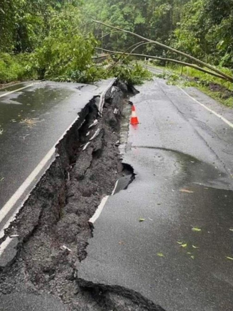
“The roads are just so dangerous at the moment. Pot holes are opening faster than we can get to them to fix them.
“Take great care on the roads.”
Saturday evening: Flood alerts for Wonga Beach, Hinchinbrook
Residents were asked to move to higher ground as emergency flood alerts were issued for Wonga Beach, north of Port Douglas, and Hinchinbrook Shire.
Emergency flood alerts have been issued for Wonga Beach and Hinchinbrook Shire, while south Cairns residents have been asked to conserve and boil water.
Queensland Fire and Emergency Services issued the alert for Wonga Beach at 6.30pm Saturday from the Douglas Disaster Management Group.
“Water levels are rising rapidly now at Wonga Beach and properties are likely to be affected. Residents are advised to move to higher ground. Wonga Beach State School is open as a place of refuge,” the alert read.
“Conditions are changing quickly and are very dangerous. For more information, listen to local radio or visit dashboard.douglas.qld.gov.au.
“Stay up to date with the latest information from the Bureau of Meteorology. If your life is in danger, call Triple-Zero (000).”
At 9.15pm, Hinchinbrook Hinchinbrook Shire Council issued an emergency alert warning residents of potential overnight floods.
The local council has urged residents to prepare their property, check in on others and prepare to move to higher ground if required as conditions could change quickly.
Residents seeking flood assistance should contact the SES on 132 500.
The alerts follow a Cairns LDMG directive for Far North residents to boil and conserve water as Cairns Regional Council works on water system reparations following cyclone Jasper.
Cairns Regional Council issued a conserve water notice to residents in Bartle Frere and Woopen Creek until further notice, as well as a water conservation notice on Saturday.
A council spokesperson said the notice was issued following the recent heavy rainfall in the region.
“Heavy rainfall associated with ex-Tropical Cyclone Jasper has increased turbidity – silt, mud and plant material – in our water supplies. This is making it difficult to treat water at sufficient volume to meet normal demand,” the spokesperson said.
“To ensure there is quality drinking water available until the raw water quality improves, residents are asked to conserve water. This is a simple as having shorter showers, turning the tap off while brushing teeth and holding off water-intense activities such as hosing driveways.
“Given forecast rainfall totals, the conserve water notice will likely remain in place until early next week.”
In addition, council also issued a boil water notice to ease demand.
“Similar to the conserve water notice, high turbidity from ongoing heavy rainfall means Council is unable to treat water for the Bartle Frere and Woopen Creek areas. Council has been supplying the area from treated reserves,” the spokesperson said.
“These reserves have been depleted requiring Council to provide raw (untreated) water to consumers, which needs to be boiled to make it safe for consumption. Council is conducting a letter box drop of all impacted residents with advice on how to make water safe.
“The boil water notice will likely remain in place throughout next week.”
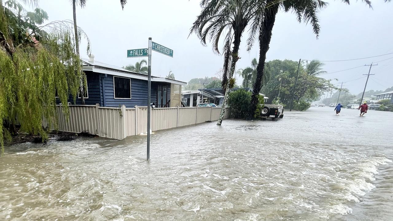
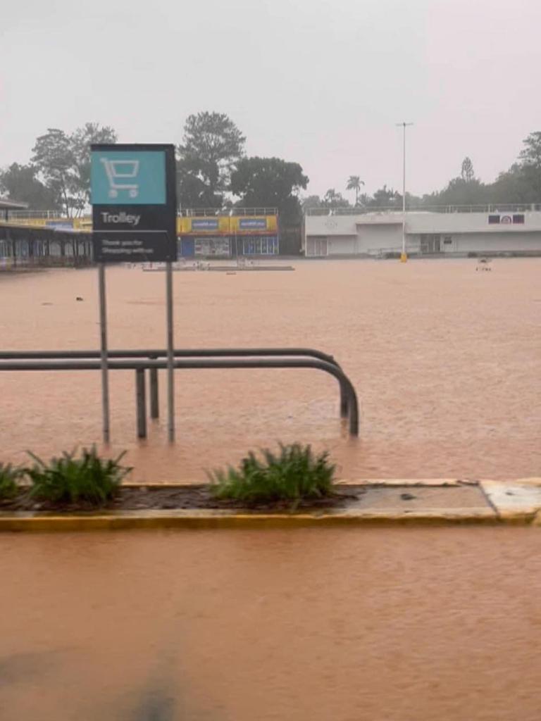
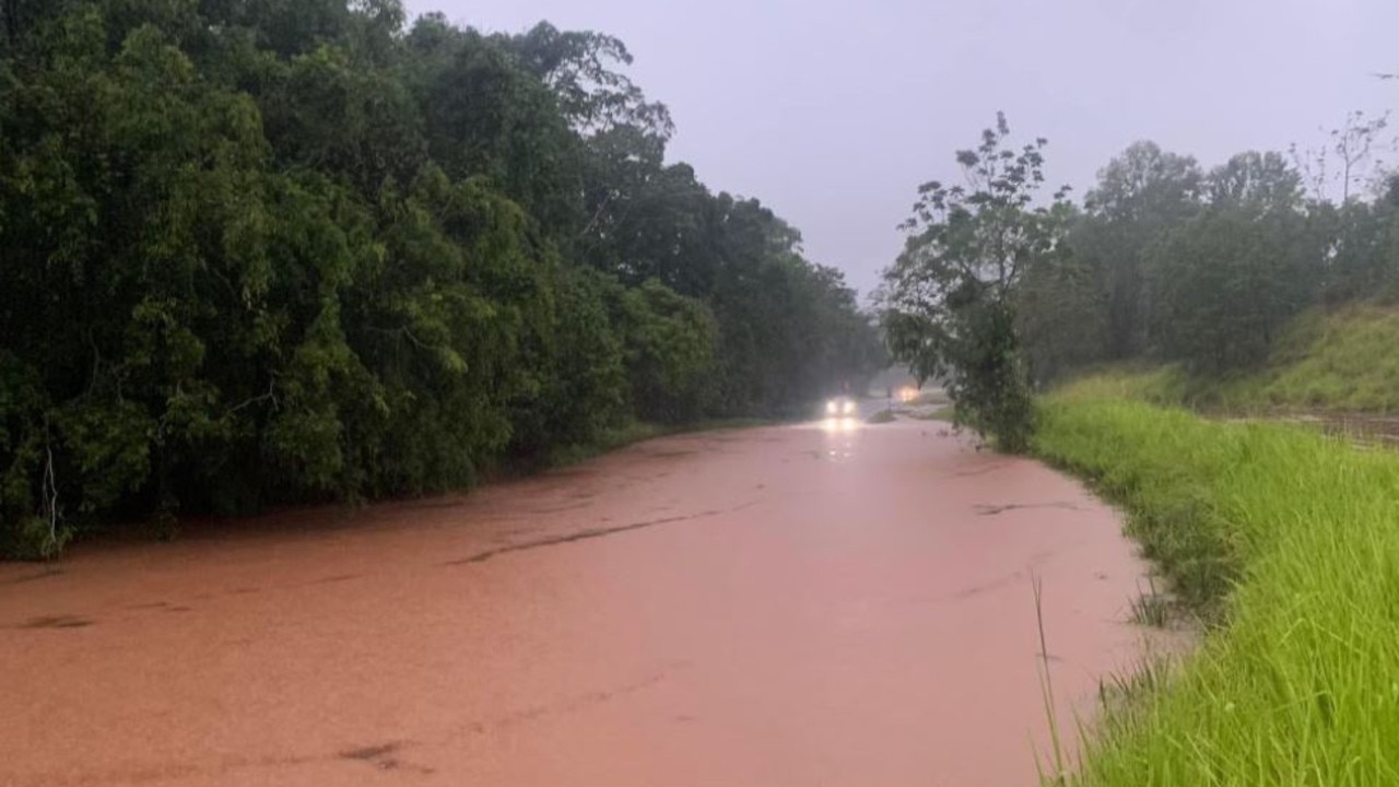
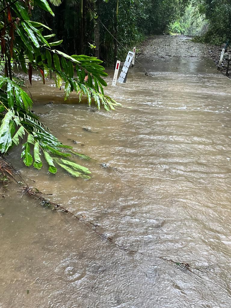
The notices follow reports of floodwater from Thomatis Creek spilling onto the Captain Cook Highway, cutting off road access on both lanes between Yorkeys Knob and Holloways Beach.
According to the Department of Transport and Main Roads, long delays are expected and motorists have been reminded not to drive in flood waters.
It comes after reports the Far North could receive another 300mm of rainfall over the weekend as isolated Douglas Shire residents battle against the weather to reopen local transport routes.
The region is not expected to see a prolonged dose of sunshine until Tuesday.
Douglas Shire mayor Michael Kerr said it was unlikely the Daintree Ferry would reopen today.
“If it does open tomorrow, it will be late tomorrow. The river is still running too swiftly,” Mr Kerr said.
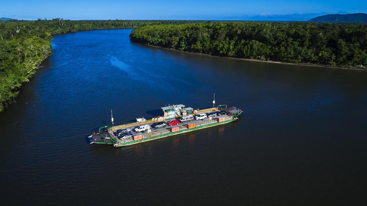
“(Daintree residents) are doing it hard at the moment because we can’t get to them. The ferry is out and the road between the ferry and them has a lot still on it.
“The locals have done a great job clearing local roads so they can get about in some places.
“Take care on the roads. There is still a lot of debris around.”
The Bureau of Meteorology predicts up to 150mm of rain could still fall both on Saturday and Sunday, swelling major reservoirs that are already breaking their banks.
The Daintree, Mulgrave, Mossman and Russell river systems were subject to further flooding, according to Brooke Pagel, a BOM forecaster.
“Rainfall and flooding are still the main risks over the next couple of days,” Ms Pagel said.
“We’re expecting the Daintree to reach 9m later today.
“We’re expecting up to 150mm across the region today … similar totals again tomorrow.
“On Monday we could still get between 50mm to 100mm. On Tuesday it’s really going to back off.”
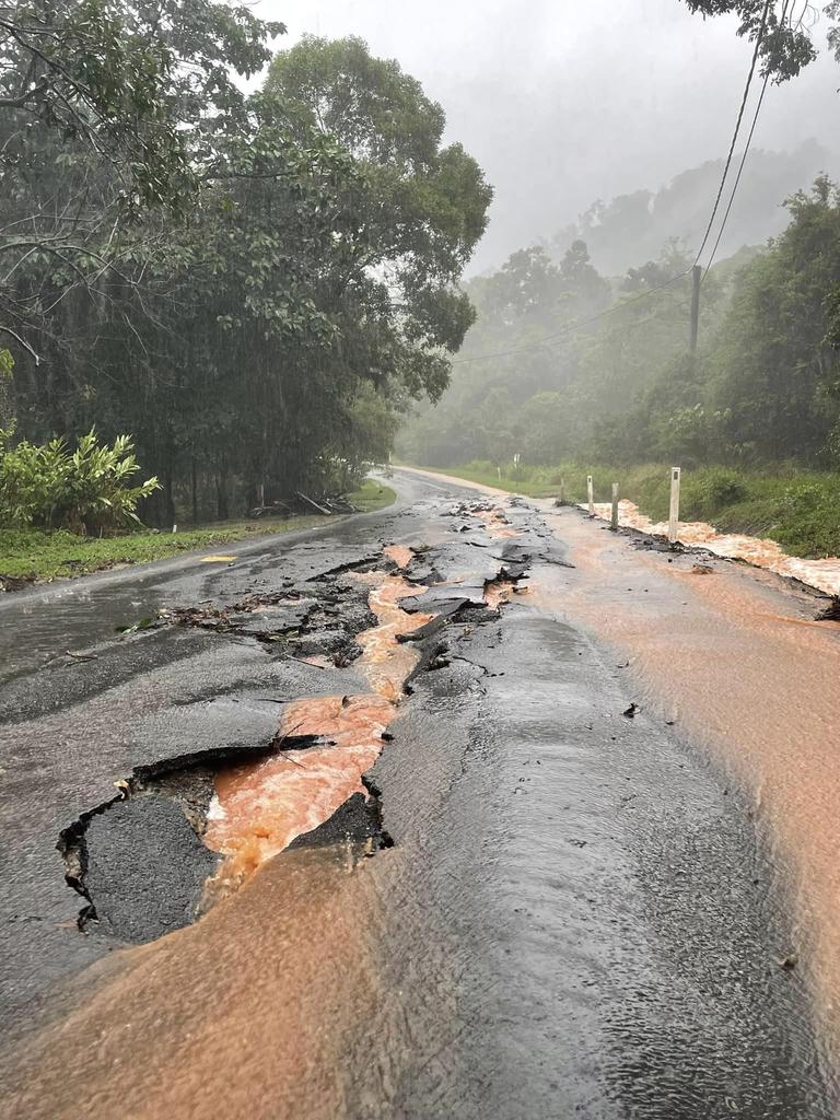
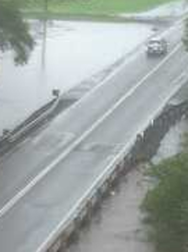
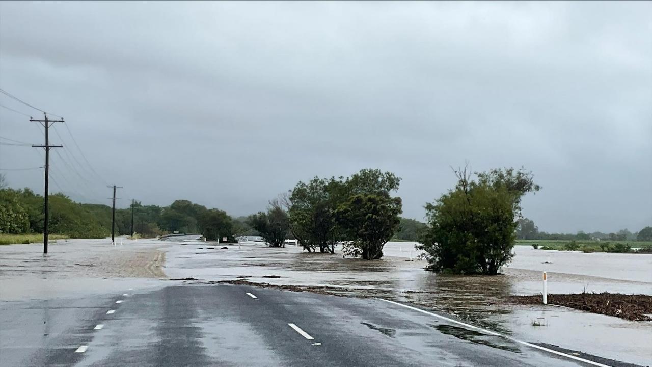
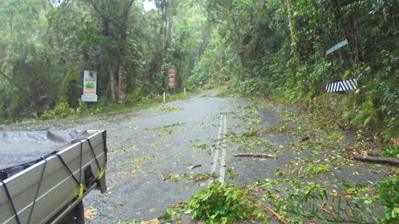
Major routes throughout the region remain closed due to land slips and localised flooding.
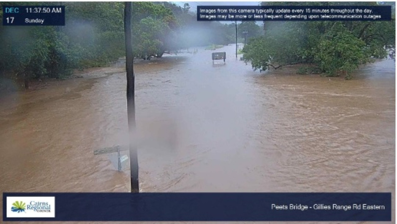
Due to safety concerns around debris left over from ex-tropical Cyclone Jasper, Queensland Parks and Wildlife Service have asked all members of the public to avoid viewing areas at Barron Falls, near Kuranda.
In a statement, QPWS said there were currently great safety concerns for the walking tracks and lookout infrastructure due to damaging weather during cyclone Jasper.
“ Several visitors have ignored safety signage around the area and the Department of Environment and Science is pleading with the public to steer clear of Barron Falls as the site remains closed until a formal inspection can be conducted,” the statement read.
“QPWS is mobilising resources from across the state to reopen parks and begin recovery works as soon as possible ahead of the busy Christmas period, to support the surrounding communities and Far North Queensland’s tourism industry.”
Visitors to National Parks in the cyclone affected areas were urged to proceed with extreme caution as access roads and walking tracks had been littered with hazardous tree debris, with many tracks underwater.
“Rangers have erected closure signs and used danger tape to rope off areas however people are ignoring these signs and exposing themselves to dangerous situations,” the statement continued.
Failure to comply with the closure signage could lead to on-the-spot fines.
Visitors were reminded to check Park Alerts before heading to a protected area, never enter closed areas and always follow signage or directions from rangers.
The Department of Transport and Main Roads has advised motorists to expect the Palmerston Hwy between Innisfail and Millaa Millaa to be closed in both directions due to debris on the road.
Similarly the Mulligan Hwy between Mareeba and Mount Molloy has also been closed near Mitchell Flats due to heavy rain.
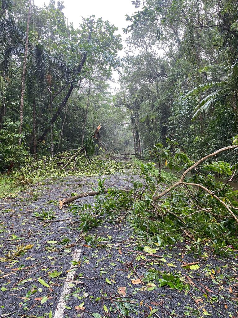
Julatten residents have been further isolated by another road closure further north on the Mulligan Hwy, near Shannonvale, due to adverse driving conditions.
Water over Pine Creek Yarrabah Road has reduced lanes and caused delays to traffic travelling in both directions.
The Captain Cook Hwy between Holloways Beach and Yorkeys Knob is also closed due to adverse driving conditions; motorists can access Smithfield and Northern Beaches Suburbs via Cairns Western Arterial Rd.
A spill has reduced the Captain Cook Hwy to one lane at Wangetti, causing delays.
A fallen tree that closed the Kennedy Hwy near the Barron River Bridge on Saturday morning was cleared, reopening the road about 8am.
More Coverage


Originally published as Rescue crews respond to medical call-outs, evacuate Yorkeys Knob and Holloways Beach

‘Curtain of secrecy’: Inquiry rejects bid for closed door testimony
