
Bureau to manage Qld Flood Warning Infrastructure Network
The federal government will fund upgrades and ongoing maintenance of flood monitoring equipment in priority disaster prone catchments throughout Queensland — starting in Cairns.

Cairns
Don't miss out on the headlines from Cairns. Followed categories will be added to My News.
The federal government will fund upgrades and ongoing maintenance of flood monitoring equipment in priority disaster prone catchments throughout Queensland — starting in Cairns.
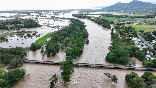
With the wet season approaching and a historic deluge still fresh in the minds of flood victims, Far North Queensland was chosen to be the first area to receive new rain gauge and river level monitoring technology in a statewide upgrade of the Flood Warning Infrastructure Network worth about $250m.
Key sites selected in the program will now be serviced and maintained by the Bureau of Meteorology.
The rain gauge and river level station at Kamerunga is one of 15 Barron River sites that will be upgraded along with flood prone catchments throughout the state.
While the Russell, Mulgrave and Tully rivers have been included in the program river catchments devastated by record flooding in December 2023 such as the Daintree, Mossman and Bloomfield rivers have not made the list of priority Queensland rivers.
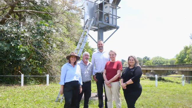
Federal Environment Minister Tanya Plibersek inspected the upgraded site at Stoney Creek Rd on Wednesday.
“This is part of a close to quarter billion dollar Australian government project to make sure that we give our communities proper flood warning,” she said.
“The reason that we’ve started with Queensland (and northern NSW) is obviously because these areas are so flood prone and so prone to extreme weather events that we need to prioritise places like Cairns.
“But this will eventually be a national program.”
JCU professor Jonathan Nott, who has a special interest in the Barron River Delta, said last week climate change was increasing the frequency and severity of disaster events in a push to factor in global warming when building weather prediction models.
Ms Plibersek agreed extreme weather events were becoming more severe and more common.
“That’s what all the science tells us,” she said.

Bureau senior officer Peter Stone said in Queensland the flood warning program will acquire, bring up to standard and then maintain assets that can be owned by councils, the state government and the Bureau.
He said local government being able to divest flood assets would relieve councils of the financial and staffing burden associated with the upkeep of critical early warning infrastructure.
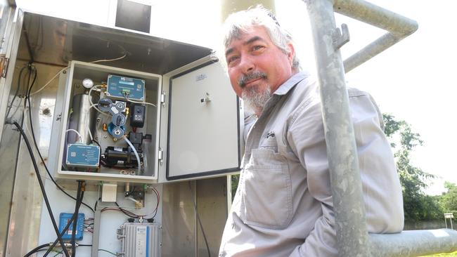
“Local governments in particular, often had trouble devoting the resources to maintaining their kit, and it was in Queensland that council ownership of assets is most prevalent,” he said.
Parts of Kamerunga river height monitoring station were washed away early during the post Cyclone Jasper flood event in December and getting the unit operational was made a priority by the Bureau.
Mr Stone didn’t believe Cairns Regional Council had neglected proper maintenance of river warning systems but rather said it was the incredible magnitude of the flood at more than 2m above previous record heights that did the damage.
“One expects some faults and washouts in those conditions,” he said.

Originally published as Bureau to manage Qld Flood Warning Infrastructure Network
Join the conversation

Review: Addams Family brings spooky charm to Cairns stage
Despite the pre-show warning of a ‘frightful’ evening, I still screamed when jump-scared by a member of the ensemble waiting in the wings to freak out the audience. READ THE REVIEW.
Read more

Qld youth crime crisis: ‘We still have a long way to go’
Six months after the introduction of the state government’s tough new laws for serious youth offenders, the results are in.
Read more