
An arctic chill is expected to bring snow to unexpected parts of the south-eastern regions
Snow is set to fall on large parts of the country as an arctic chill causes temperatures to plummet into single digits across the country.
Breaking News
Don't miss out on the headlines from Breaking News. Followed categories will be added to My News.
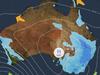
A polar blast is set to bring a burst of snow to large parts of south-eastern Australia next week as an arctic chill crosses over the nation.
While snowfall was limited to areas beyond the alpine regions of NSW, Victoria and Tasmania last winter, lower parts of the states are expected to receive snowfall from next week.
The Blue Mountains, The Southern, Central and Northern Tablelands of NSW, elevated parts of the ACT and possibly Canberra, elevated parts of Victoria outside the Victoria Alps, elevated parts of Tasmania outside the mountainous areas and even the Granit Belt of southern Queensland will likely experience snowfall.

Frigid air dragged up from Antarctica is expected to reach south-eastern Australia by Saturday, with single digit maximum likely in large areas of Tasmania, southern Victoria and up eastern coast.
South-easterly winds are expected to push the cold air mass into much of the country from the weekend.
Weatherzone meteorologist Felix Levesque said the NSW Central Tablelands could see snow flurries at higher levels around 1200m as early as Sunday night and Monday morning, with the possibility of snow increasing throughout Monday and Tuesday as more moisture arrives.
The snow level could drop below 1000m midweek as a new influx of moisture arrives.
Snow is likely to fall in the Barrington Tops, northwest of Newcastle about mid week.
It comes as a low-pressure system in the Tasman Sea will generate winds which will lead to a wind chill, with temperatures likely to feel much colder than the actual temperature across much of the country, according to a Weatherzone report.
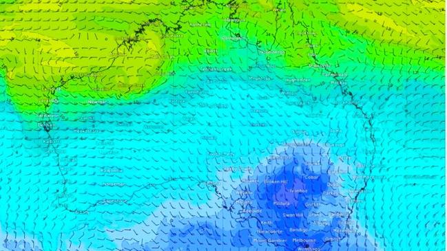
“The frigid air will be dragged from Antarctica by a cold front sweeping across the continent this weekend,” Weatherzone said.
“A high-pressure system will quickly follow in the front’s path and remain over southern Australia until at least mid-next week, prolonging this cold outbreak.”
Much of the country’s southeast is expected to be affected, with temperatures in Brisbane reaching as low as 8C into next week, with maximum temperatures hitting the low 20s.
“At this stage, temperatures over the next few days will probably be sitting around minimum temperatures … around about average, within one or two degrees,” Bureau of Meteorology’s Daniel Hayes said.


“Once that cool change comes through, on Sunday, we’ll see those temperatures drop probably at least one or two degrees below average.”
The cold snap comes after a thick blanket of fog developed over southeast Queensland Tuesday evening, with visibility at Brisbane Airport reduced to less than 200m on Wednesday morning.
📣 PSA: Widespread fog across Brisbane is also impacting BNE.
— Brisbane Airport âœˆï¸ (@BrisbaneAirport) July 9, 2024
Find out more about fog at the airport 👉 https://t.co/2v1u7WBjidpic.twitter.com/jJ3x7hJCq6
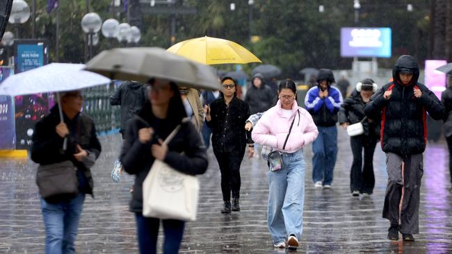
Further south, Sydney is forecast for a spell of winter sun from Wednesday after trekking through 11 rain soaked days.
The system is expected to keep temperatures two to four degrees below average, with Sydney seeing highs of just 14C, and lows of 4C over the weekend.
Bureau of Meteorology senior meteorologist Dean Narramore said Sydney could be in for a “prolonged break” from the wet weather.
“Sunshine is finally returning not just to Sydney but the whole east coast,” he said.
“(The showers are) all gone now, the low that brought that weather has now moved off to Tasmania.”
The shift comes after Sydney suffered through 58mm since the beginning of the month, which is well over halfway to the usual average rainfall for July of 97mm.
June was also very wet, with 368mm of rain throughout the month.
“Cold fronts moving through southern parts of the country, westerly winds are moving to east NSW,” Mr Narramore said.
“Wind will be coming off the land which means cool but sunny days.”
“This time of year dryer cooler and sunnier weather. That should continue into the weekend.”
Sydney will have a top of 19 on Wednesday, with similar temperatures expected on Thursday and Friday with a top of 18 and a bit of sun peaking through.
The temperature will drop down to a maximum of 16 on Sunday and into Monday.
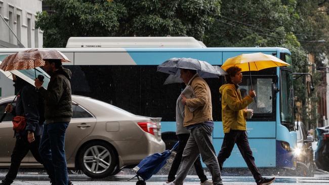
Cold fronts moving through Western Australia are bringing widespread rain and showers with the potential for thunderstorms.
“That front is going to move into South Australia tomorrow with a band of rain, as well as Victoria and Tasmania with some gusty winds and lots of rain,” Mr Narramore said.
“Coming into Friday that front will weaken and not reach NSW which is good news.”
There might be some showers and isolated storms in south east Queensland on Wednesday, however the rest of the week should be sunny.
The cold front is set to also affect Victoria, the ACT, Tasmania and parts of South Australia from Saturday.
A high-pressure system is expected to follow in its path and sit over southern parts of the country for at least five days, prolonging the colder temperatures.

Originally published as An arctic chill is expected to bring snow to unexpected parts of the south-eastern regions

Lee’s ‘learning curve’ a big help at Players Championship
Having been in contention at the Players Championship in 2023, a ‘level-headed’ Min Woo Lee is ready to pounce this year after a great opening two rounds.

Roosters star disagrees with Cleary’s comments
Ivan Cleary said that his team lost the game before it started, but Roosters winger Dom Young says his team deserves credit for rattling the champions.