
Wild pics capture moment driver pulled from floodwaters as NSW inundated with heavy rain
Rescuers have captured the moment a driver was pulled from her car amid one state’s flood chaos, sparked after a rain bomb dumped hundreds of millimetres across multiple regions.
National Breaking News
Don't miss out on the headlines from National Breaking News. Followed categories will be added to My News.
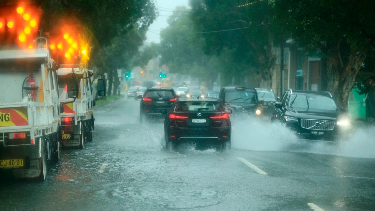
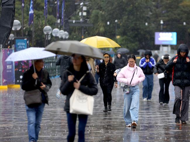
A driver has been pulled to safety from raging floodwaters in NSW’s south coast, after hundreds of millimetres of rain fell on swathes of the state overnight.
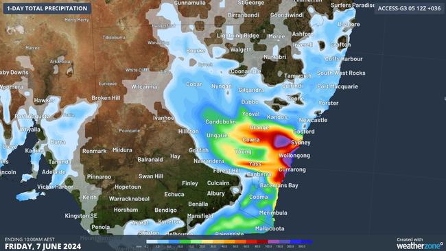
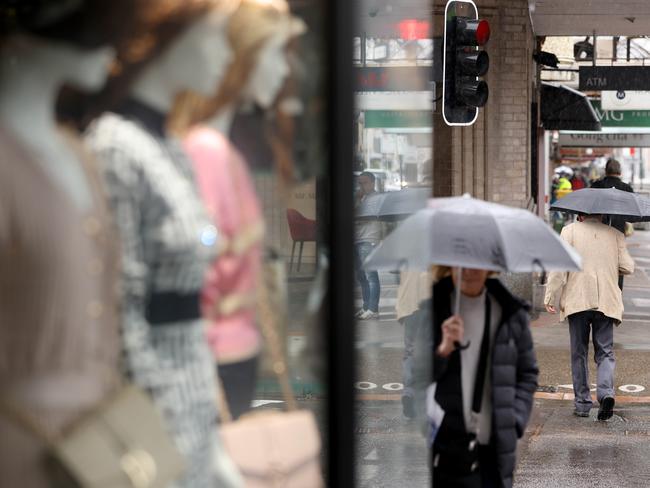
The flood chaos is unlikely to let up over the coming days, with the rain set to continue over Friday before giving way to a cold front which could leave thousands shivering over the King’s Birthday weekend.
Pictures captured by the Huskisson Volunteer Rural Fire Brigade reveal one car was trapped in floodwaters about 11.20am on Thursday, after the town was inundated by floods.
A NSW SES crew successfully removed the driver and released them to ambulance crews, the Fire Brigade posted on Facebook.
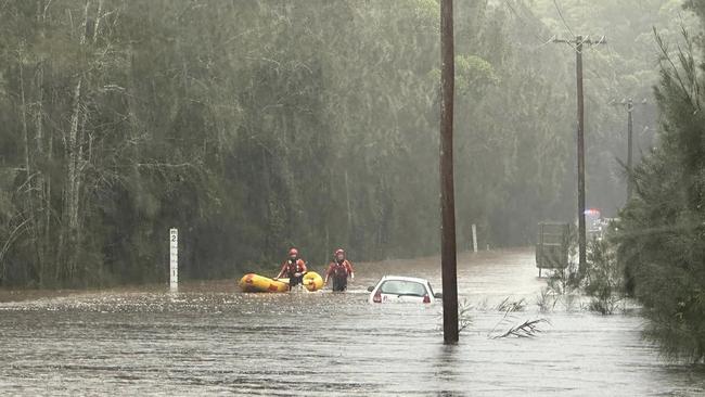
“This is a serious reminder to obey all road closures, especially during this period of severe weather,” they warned in the post.
“IF IT’S FLOODED, FORGET IT.”
Warragamba Dam was at 98 per cent capacity as of Thursday morning, which could spill the dam in the Napean River.
It follows heavy rainfall over the Illawarra, South Coast and Southern and Central Tablelands through the day.
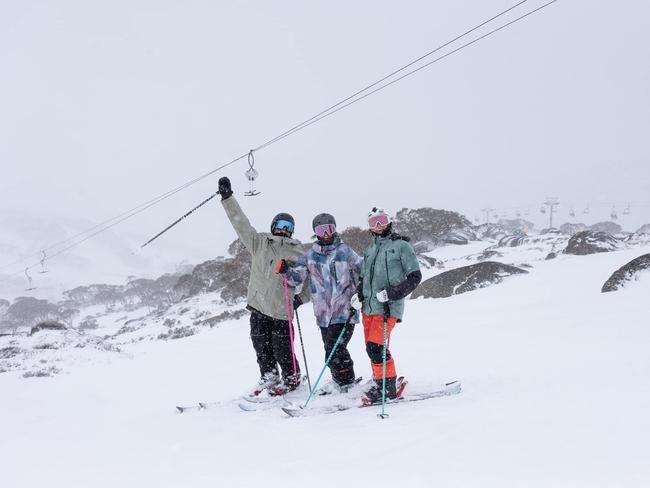
Ski season revellers in NSW and parts of Victoria face a small delay to the start of their season as a rainy weather system prepares to move offshore over the coming public holiday break.
Rainfall will continue over Friday but ease over the weekend.
Bureau of Meteorology (BOM) senior metrologist Christie Johnson said a dusting of snow could come through with a cold front on Sunday over the Victorian Alps, the NSW Southern Alps and 800m over Tasmania.
She confirmed there wouldn’t be much rain in it at all, but conditions in the snow regions would not be so favourable with not much snow about over the weekend.
Sunday and Monday will be mostly dry with an odd shower or two about the snow and coastal regions.
“If there is going to be a significant amount of snow it will likely be over Tasmania,” Ms Johnson said.
“There is just not that much rainfall expected to get up into the mountains of Victoria and NSW.
“There is a little more chance of snow with a cold front expected mid next week.
“That is where we expect to see more risk of snow, but not unfortunately for the opening of the ski season this weekend.”
While some rainfall will hang around on Saturday in the southeastern parts of NSW and eastern Victoria it should ease by the end of the day.

On Sunday, a weak front will move through Victoria and Tasmania, which will see some showers fall mostly over Tasmania, southern Victoria and potentially the NSW snow regions.
Queensland could also experience chilly mornings over the weekend with lots of fog and frost about.
A cool south-easterly surge will push across inland Queensland and the Northern Territory, which will get some of cooler conditions experienced during the Top End’s dry season.
“They will finally get some maximum temperatures below 30C,” Ms Johnson said.
A series of cold fronts are expected to hit the southwest land division of WA, with the first one crossing the coastline on Thursday night and potentially a stronger one again on the weekend.
“Thursday should be a strongish one but it will be a typical winter front,” Ms Johnson said.
“There is a risk of severe thunderstorms developing on the front, but rain or damaging winds are not expected to come with it.
“The front expected on the weekend has more chance of bringing rainfall over the agricultural district that need it, and it looks a bit stronger.
“With both of these fronts, particularly the one on the weekend there will be some fairly high seas and surf as well.”
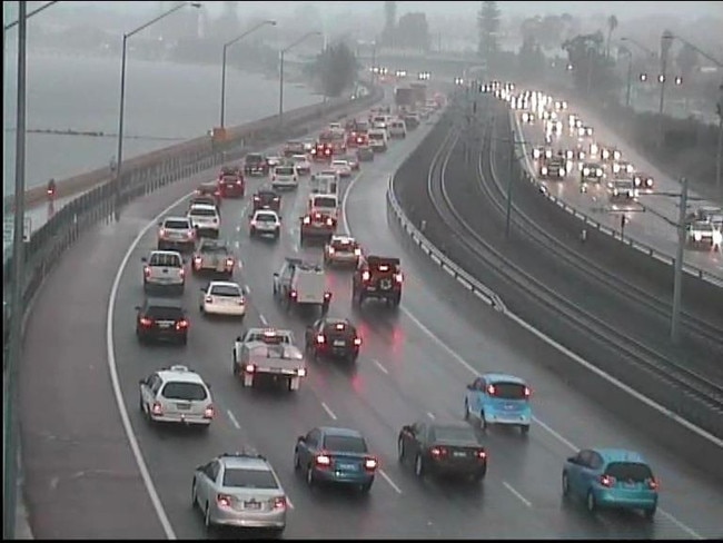
In capital cities across the country, wet weather will lash Sydney on Saturday with some showers expected around the coastal areas on Sunday, but should be dry for the remainder of the weekend.
Melbourne will be cold and wet with rain expected to drench the city on Saturday and Sunday, conditions should ease by Monday.
Adelaide will also freeze through a wet weekend with rain forecast on Saturday that will continue into next week.
Brisbane can expect sunnier conditions over the weekend, but the nights will be chilly dipping to a low of 9 degrees.
A cold front on Thursday will bring much needed rain to Perth that will continue throughout the weekend with a stronger front expected to hit the city on Saturday.
Darwin will be warm and sunny all weekend with temperatures sitting around 30 degrees.
Hobart will be cold and cloudy for most of the weekend with some rain expected on Sunday morning.
Originally published as Wild pics capture moment driver pulled from floodwaters as NSW inundated with heavy rain

Thorpe’s ‘breach’ called into question
Questions linger about what should happen next after independent senator Lidia Thorpe screamed at King Charles in an incident that made international headlines.

‘Incredible’: Rival keepers push each other on
Australia’s best wicketkeepers are in imperious form, but the pressure continues to rise on a Test stalwart.