
Cyclone Zelia made landfall in northwestern WA on Friday as one of the strongest storms in Australia’s history
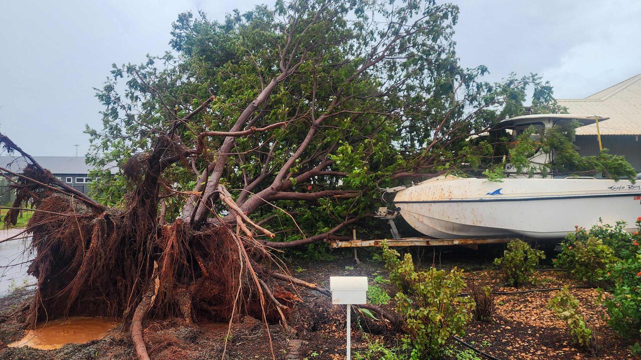
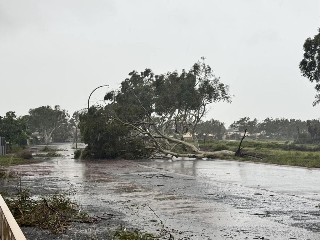
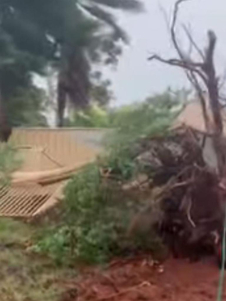
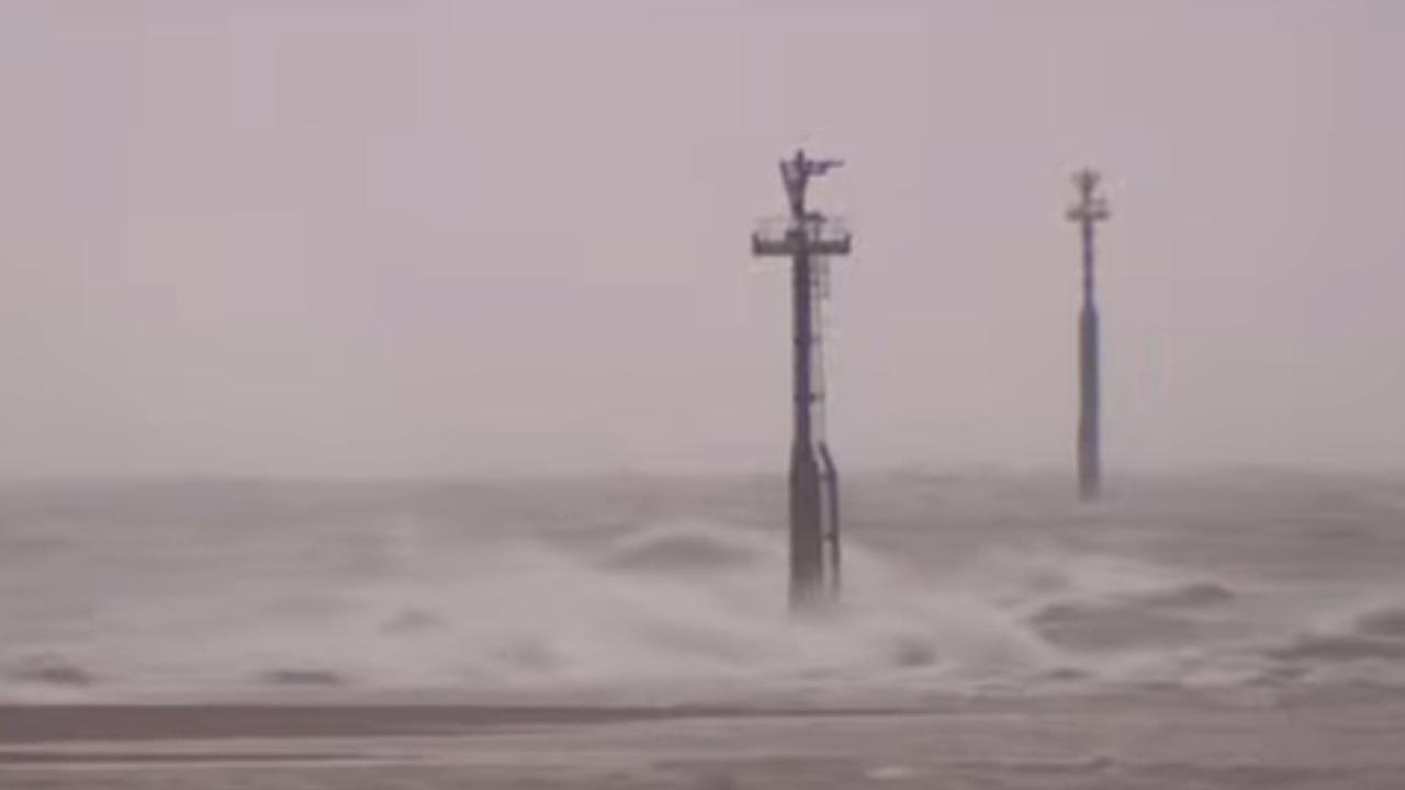
A ferocious cyclone has hit the Australian coast, with authorities warning of “destructive” winds and up to 500mm of heavy rainfall and possible flash flooding.
Environment
Don't miss out on the headlines from Environment. Followed categories will be added to My News.
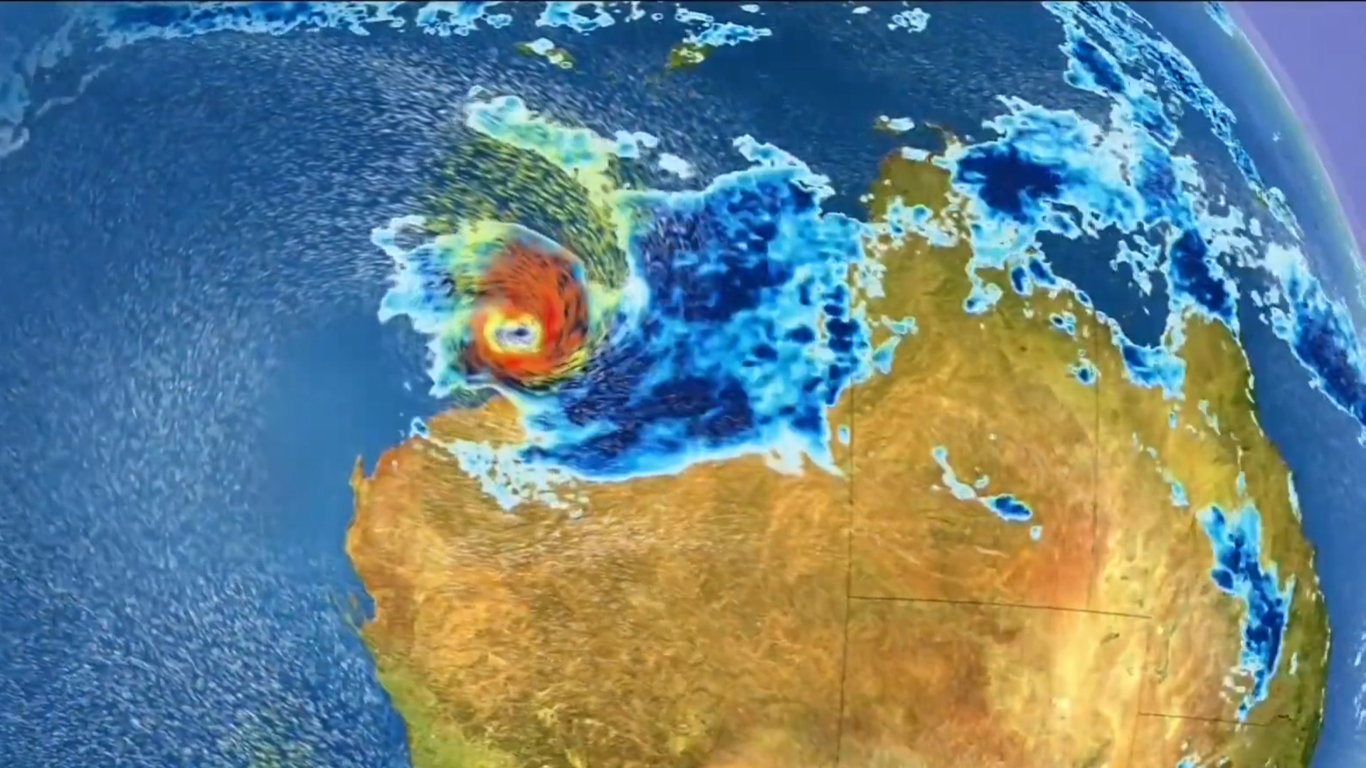
One of the biggest cyclones in years is expected to bring up to 500mm of rain over the weekend, after crossing the WA coastline on Friday as a category 5.
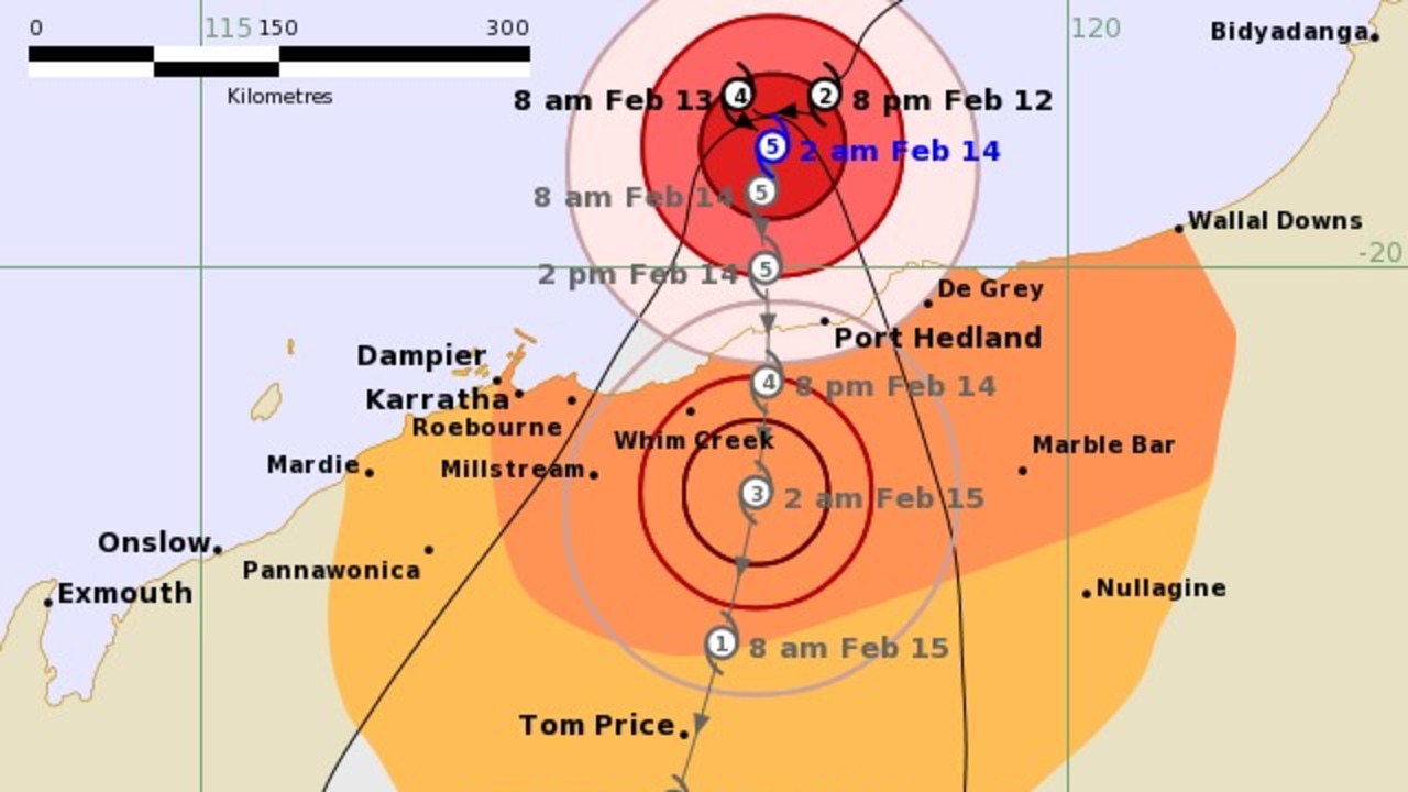
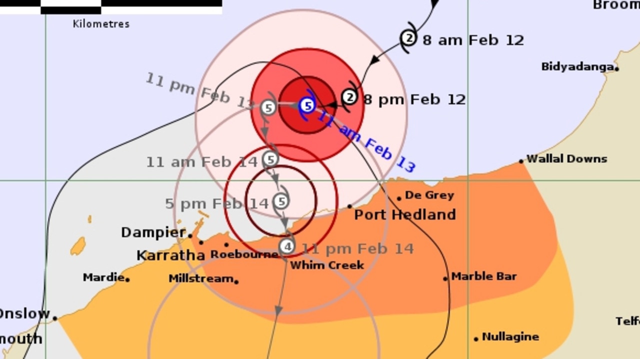
Tropical Cyclone Zelia crossed the coast to the northeast of Port Hedland around 12.30pm AWST on Friday, the Bureau of Meteorology said.
It made landfall near the De Grey River mouth at category four intensity and has since been downgraded to category three.
Zelia will now take a general southerly track overland and weaken, but authorities are warning that the danger is far from over.
Though Port Hedland was somewhat spared from the mammoth impact predicted earlier, shelter warnings still remain in place for Pardoo to east of Whim Creek, and inland to west of Marble Bar.
Intense rainfall is expected near and to the east of the centre of the cyclone.
It is expected to bring more than more than 200mm and 300mm expected over the next 24 hours and subsequent flash flooding across the Pilbara region.
Up to 500mm could fall over the next three days.
AUTHORITIES PREPARE AND RESPOND
“This is a very dangerous system that will cause significant impact and are causing impacts as we speak,” Matthew Collopy from the BOM said.
WA emergency services commissioner Darren Klemm said there was some relief the cyclone had crossed where it did, with the major centre of Port Hedland avoiding the worst of Zelia’s impact.
“Certainly the cyclone where it is crossing the coast now east of Port Hedland is a better result than what it would have been or what we thought it would have been very four hours ago,” Mr Klemm said.
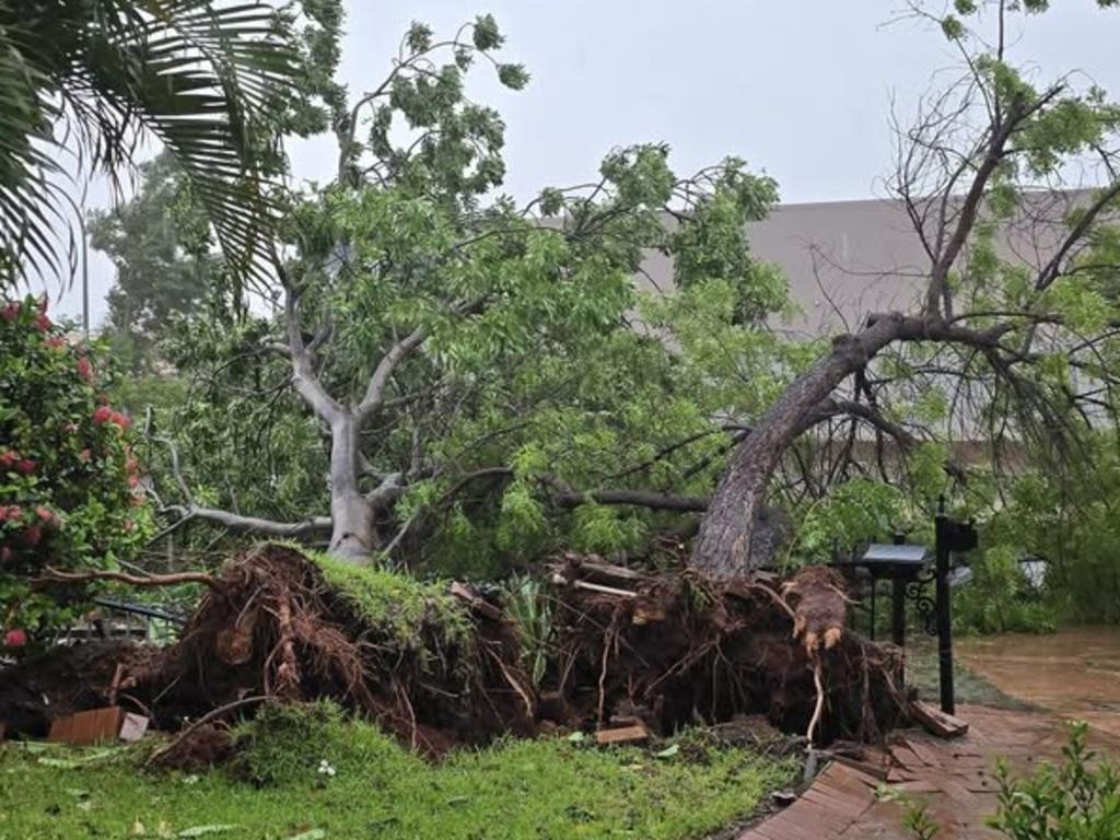
“With Cyclone Zelia crossing the coast, our emergency service focus shifts to dealing with the impact of the destructive weather from the system.”
Mr Klemm said the conditions posed a “significant threat to lives and property” and urged residents to follow all directions from authorities.
“We have significantly increased our resources in the past 24 hours in preparation,” he added.
The state’s Department of Justice has flown in extra staff to assist at Roebourne Regional Prison, with Cyclone Zelia affecting the area, the ABCreports.
“Our staff stand ready to support the community and maintain public safety during the emergency and the recovery effort,” it said.
CHAOTIC SCENES
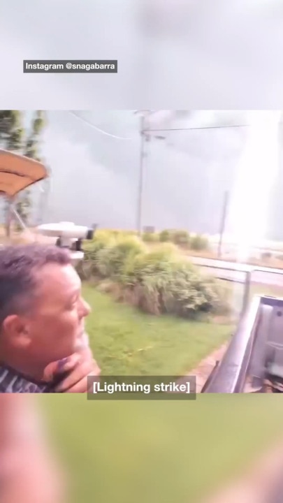
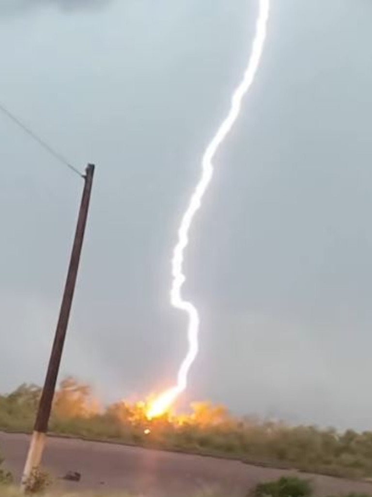
Earlier, a local content creator has captured scenes of ferocious weather in the lead-up to, which is set to lash the Pilbara region hours earlier than expected.
Snaga Barra, who runs a fishing YouTube channel, is based in Wyndham, the northernmost town in Western Australia’s Kimberley Region.
His Instagram video, uploaded on Thursday, shows chaotic scenes as Tropical Cyclone Zelia nears the coast.
Later in the video, he claims to be left with a metallic taste in his mouth after lightning strikes the ground near where he is standing.
‘INTENSE’ IMPACT OF CLIMATE
Before it made landfall, Cylcone Zelia jumped from a category 3 to a category 5 within 24 hours.
Climate Council’s David Karoly said changes in the climate meant cyclones “get ugly more quickly”.
“A warming planet means there are actually fewer cyclones forming but when they hit they’re more intense,” Professor Karoly said.
“The storm surges are much worse, the amounts of rain are much greater and the strength of winds are sometimes worse.”
In the case of Cyclone Zelia, once the system makes contact with the coastline, wind gusts of 300km/h are expected at the crossing point.
“It’s hard to fathom how strong that is, but it can take out trees, power lines and completely destroy properties and houses,” Mr Hines said.
“We won’t see winds that strong across other parts of the Pilbara, but 100km to 150km hour gusts are possible,” Mr Hines said.
Severe Tropical #CycloneZelia, a category 5 system, is slow moving to the north of Port Hedland and is forecast to move south towards the coast today.
— Bureau of Meteorology, Australia (@BOM_au) February 13, 2025
#CycloneZelia to bring very destructive winds and very heavy rain to the Pilbara coast.
Latest: https://t.co/QdjBLkJdvZpic.twitter.com/VICE9Nz2yy
It was too late on Friday to leave for residents in Pardoo Roadhouse to Whim Creek and inland to west of Marble Bar, according to Emergency WA.
Those west of Whim Creek to Karratha and Dampier, inland to Tom Price, north to Eighty Mile Beach, and east of Pardoo Roadhouse are being urged to put their cyclone plans into action.
The bureau has listed areas from Wallal Downs to Dampier as a warning zone – this includes Port Hedland, Karratha and Dampier and has been extended inland through Marble Bar, Tom Price and down towards Newman.
‘BIG, STRONG UNPREDICTABLE’
WA Premier Roger Cook said the cyclone was “going to be a big one”.
“It’s big, it’s strong and it’s very unpredictable. People in Pilbara need to be prepared, and they need to be prepared now,” he said.
There are two evacuation centres open, one in Port Hedland and the other in Karratha.
About a dozen schools have been closed in the state’s north, with numerous road and highway closures in place.
“Today is going to be a very significant day as it approaches and likely crosses the Pilbara coast,” Mr Hines said.
Major banks have come out in support of local residents and businesses affected by the emergency.
“We are thinking of everyone affected by Tropical Cyclone Zelia across the Pilbara region of Western Australia,” Commonwealth Bank Australia senior executive Angus Sullivan said.
“We are making a range of measures available, tailored to the needs of our customers.”
Originally published as Cyclone Zelia made landfall in northwestern WA on Friday as one of the strongest storms in Australia’s history
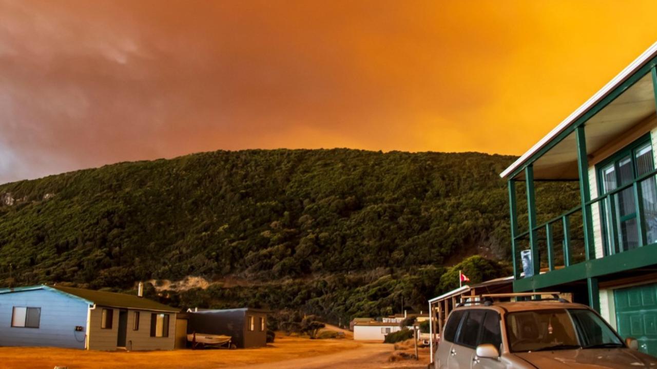
‘Volcanic’: Aussies battle raging fires
Residents in one state have captured startling photos showing apocalyptic scenes as they confront a complex web of bushfires.
Read more

‘Go home’: Albo heckled by angry mob
The Prime Minister was booed by activists fuming over wind farms while greeting supporters at a media event on NSW’s South Coast.
Read more
‘Threat to life’: Cat 5 cyclone declared in WA
Tropical Cyclone Zelia has been declared a category five system and is expected to make landfall on Friday afternoon, with winds up to 290km/h possible.
Read more
Australia’s extreme climate laid bare
The various corners of Australia are facing cyclone, fire and flooding threats on Thursday as the extremes of Australia’s climate take hold.
Read more
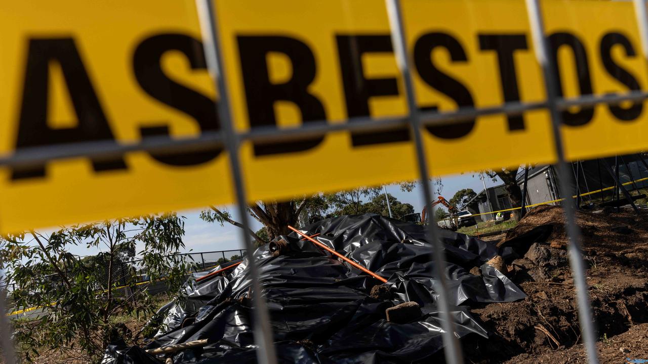
Building company fined over toxic danger
A construction company has been slapped with a hefty penalty for providing false information to authorities about dumping asbestos at a property.
Read more
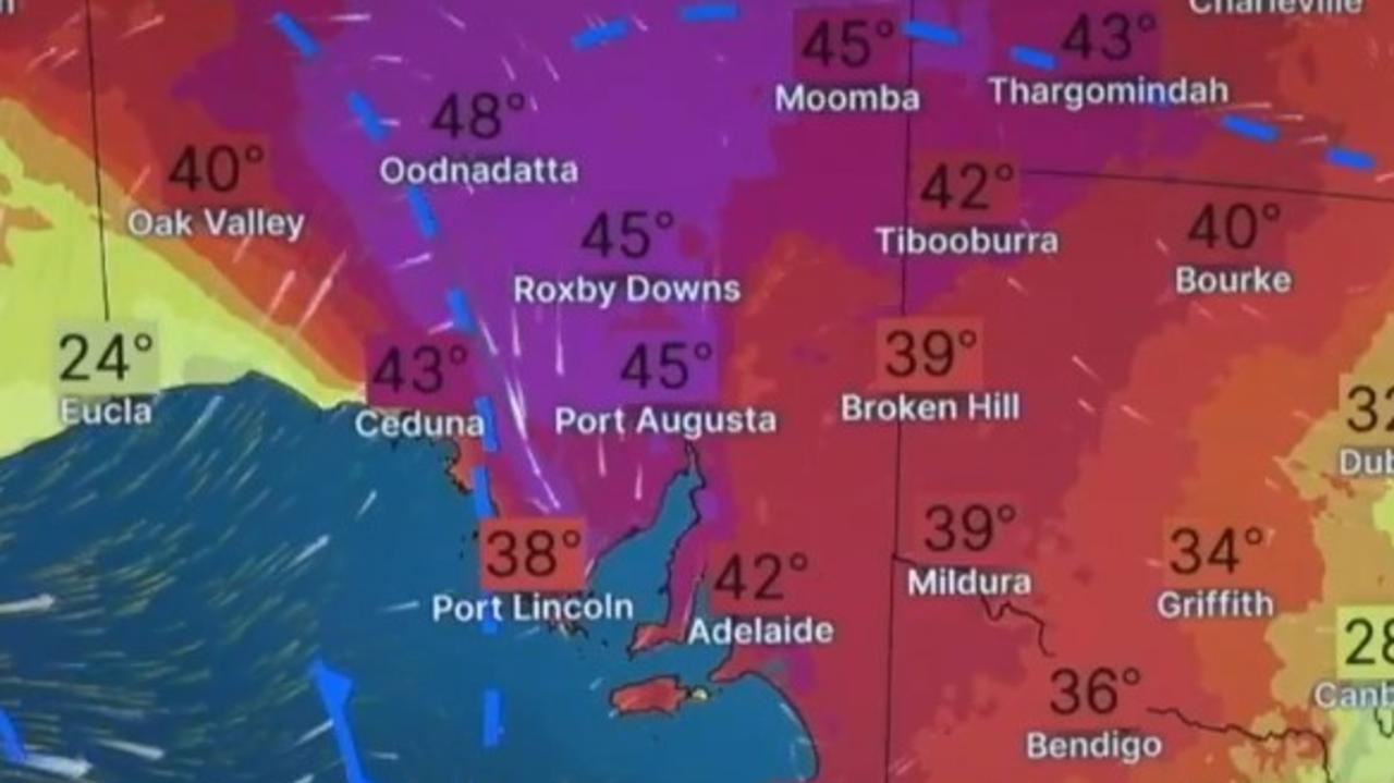
Major city swelters as temp soars to 43C
Aussies in one state are being urged to keep cool as temperatures climb above 40C while other parts of the country battle bushfires.
Read more