
NSW avoids worst of thunderstorms for now
The Bureau of Meteorology is keeping a close on the threat of thunderstorms as conditions ease along eastern NSW.
Environment
Don't miss out on the headlines from Environment. Followed categories will be added to My News.
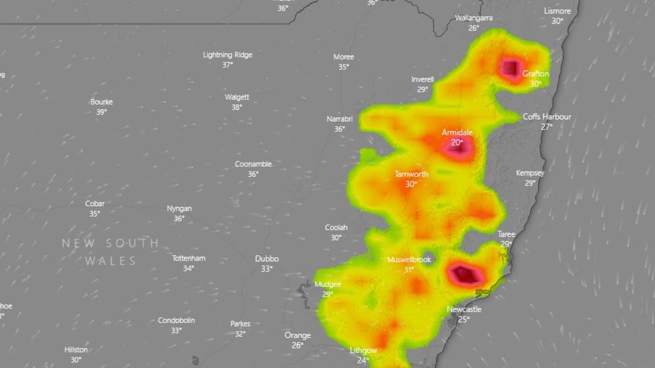
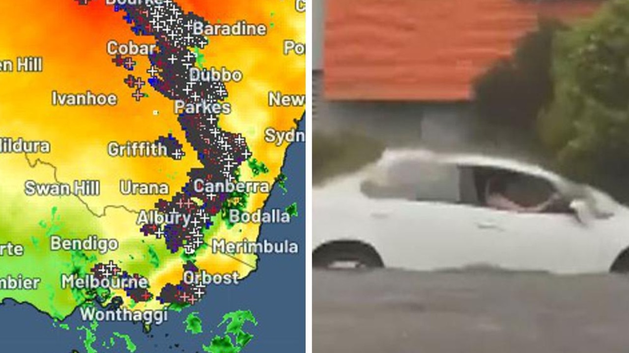
Widespread thunderstorms have hit the NSW coast this afternoon, with unstable conditions bringing large hail, damaging wind gusts and heavy rainfall.
The storms look to be confined to the east of the ranges, north of about Nowra hitting Sydney, Wollongong and Newcastle and reaching all the way up to Lismore.
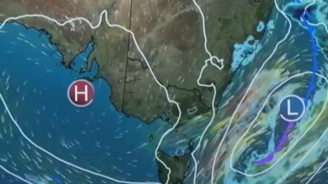
“A trough combined with a warm, unstable air mass has developed thunderstorms along the northeast ranges this afternoon which are now easing,” the Bureau of Meteorology said in an update on Monday night.
“The immediate threat of severe thunderstorms has passed, but the situation will continue to be monitored and further warnings will be issued if necessary.”
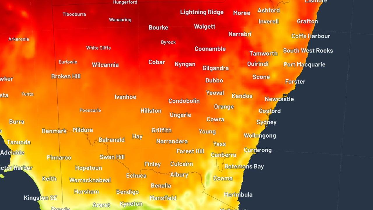
Forecasters had warned earlier on Monday of the possibility of some supercell thunderstorms developing.
Weatherzone meteorologist Joel Pippard said the wet weather was due to bring “warmth, humidity and instability all colliding along the ranges”.
“These are the most dangerous type of thunderstorms and can produce giant hail (larger than cricket balls), destructive winds (exceeding 120km/h) and intense rainfall (flash-flooding),” he said.
A southerly was making its way up the coast which was combining with the warm and humid air and causing it to turn into thunderstorms.
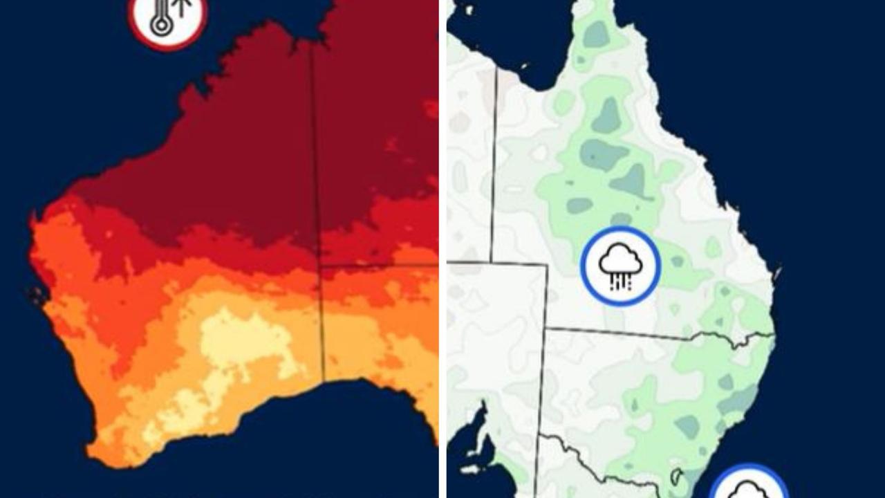
In parts of the northwest temperatures could get as high as 40C and mid-to-high 30s for the north coast.
Coolest wet season spell in Darwin
The last three days in Darwin have been the coolest wet season spell in six years and the coolest February in 12 years.
The temperature has averages 27.9C
It has also been the tenth wettest season in records history with above average rainfall reported before the season is even over.
Top End residents can damaging wind gusts, heavy rain and thunderstorms over the coming days as a tropical low develops near the Joseph Bonaparte Gulf.
The first week of March is due to bring above average rainfall which will carry into next week.
ACT
Canberra has been spared from severe thunderstorms that are rushing up the east coast of the country on Monday.
It remains hot in the nation’s capital with a top of 29C.
SA
Adelaide is still experiencing warmer conditions but nothing compared to the heatwave that gripped the southern state last week.
Temperatures are in the high 20s and there is little chance of rain for the rest of the week.
VIC
Melbourne is experiencing a rainy start to the week with a high chance of showers into the afternoon.
The showers and grey skies will stick around for most of the week with temperatures averaging no higher than 20C until the end of the week.
TAS
A cool and wetter change has ushered into Tasmania after a heatwave hit the state last week.
A late shower or two is expected over the coming days with temperatures peaking at 21C for the rest of the week.
QLD
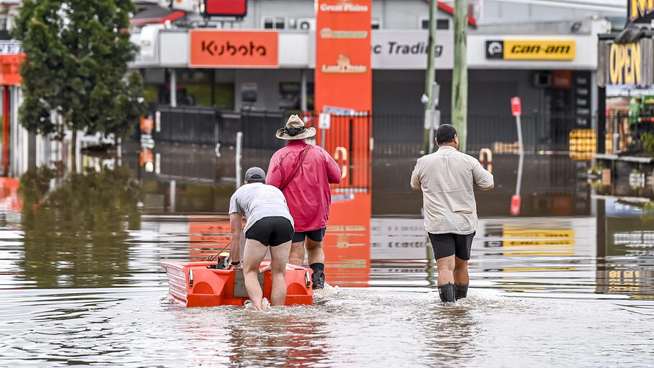
Flood warnings are in place across Queensland after huge rainfall totals drenched the state over the weekend.
A moderate flood warning is in place for the lower Flinders River, the lower Georgina River and Eyre Creek.
While a minor flood warning is in place for the Daintree and Mossman Rivers, the lower Thomson River, Cooper Creek and the Norman River.
It is partly cloudy in Brisbane with a peak of 31C on Monday.
WA
Perth is sweating through a scorcher this week with the mercury climbing into the high-30s.
Originally published as NSW avoids worst of thunderstorms for now
Shock death as storms smash southeast
Wild weather across Australia’s southeast this weekend has turned deadly – with police confirming a camper has died after being crushed by a falling tree.

‘Have a right’: Boss hits back
A boss has hit back after neighbours slammed a $200 million proposal they fear will ruin their views, saying “people have a right to develop”.
Thousands battered by storms and heatwaves
Severe thunderstorms and flash flooding have left thousands of homes without power, while another region swelters through a heatwave.

Mining giant cops huge $23.7bn disaster bill
Australia’s biggest mining company has agreed to a massive settlement with the Brazilian government over an environmental catastrophe.
‘Unusual’: Grim weather for three months
Forecasters have looked into their crystal balls and, well, for some it’s not great news for spring and early summer weather.
‘Failed too many’: Insurers lashed on floods
A parliamentary inquiry into the response of insurers to severe floods in several states in 2022 had let down many victims by failing to meet their obligations.