
New details of Tropical Cyclone Alfred’s path after upgrade to category four system
Tropical Cyclone Alfred has intensified again with huge wind gusts of up to 220km/h, as new modelling reveals more about its expected path.

Environment
Don't miss out on the headlines from Environment. Followed categories will be added to My News.
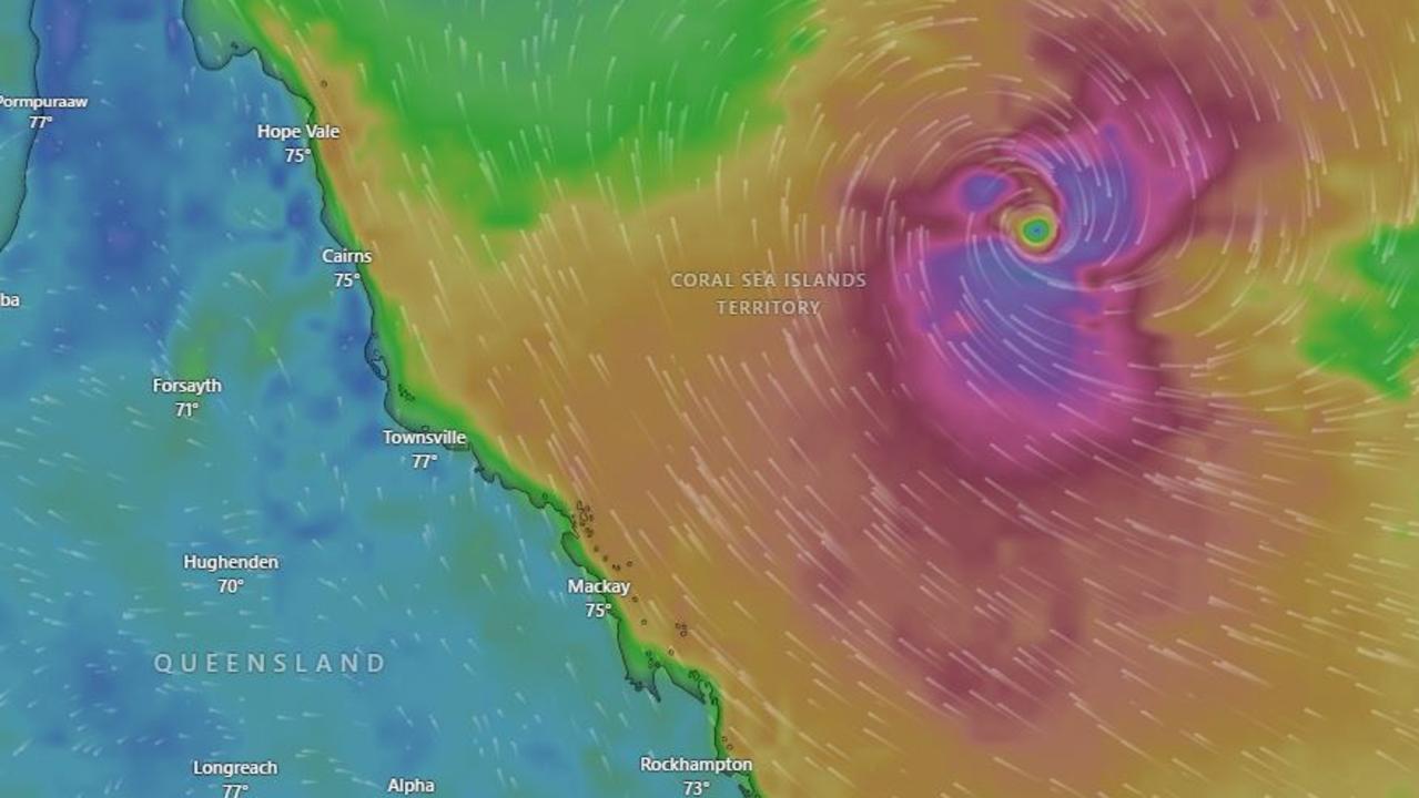
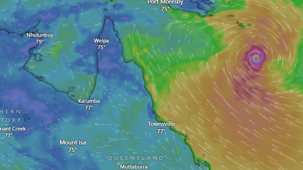
Tropical Cyclone Alfred has intensified again to a category four system amid “uncertainty” about how close the system will come to the Queensland coast.
The Bureau of Meterology said the cyclone was sitting above the Coral Sea about 750 km east-northeast of Mackay and 770 km northeast of Rockhampton as of 4am on Friday.
“Severe Tropical Cyclone Alfred is still moving south over the Coral Sea at around 9km/h, so around jogging pace, and will continue to do so through today,” forecaster Jonathon How said.
“It is still producing sustained winds near the centre of the cyclone of 155km/h, with wind gusts to 220km/h.”
The cyclone is forecast to be downgraded to a category two system on Saturday and turn southwest towards the Queensland coast, before bouncing back tot he southeast on Sunday and moving parallel to the Capricornia coast, well east of Rockhampton.
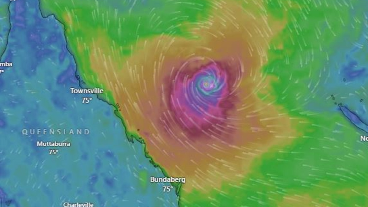
Mr How said there was “increasing confidence” Alfred would stay offshore, though uncertainty remained around how close it may come to the coastline.
“There is still a range of possibilities with regards to its exact movement and just how close it will come to the coast, and this will depend on a number of factors, including how the cycle interacts with other systems in our region,” Mr How said.
Regardless of the cyclone’s path, coastal hazards are predicted for southern Queensland and northeast NSW through the weekend.
A large and powerful to potentially damaging easterly swell and high tides are forecast for beaches in Queensland’s south from Friday, extending to northern NSW from Sunday or Monday.
Hazardous surf warnings are in place from the Capricornia Coast, K’gari coast, and the Sunshine and Gold Coasts.
The Bureau is warning residents in those areas to avoid activities such as rock fishing, boating and swimming in these areas.
Wind warnings have also been issued for these regions and coastal areas near Townsville in Queensland, as well as the Eden Coast in NSW.
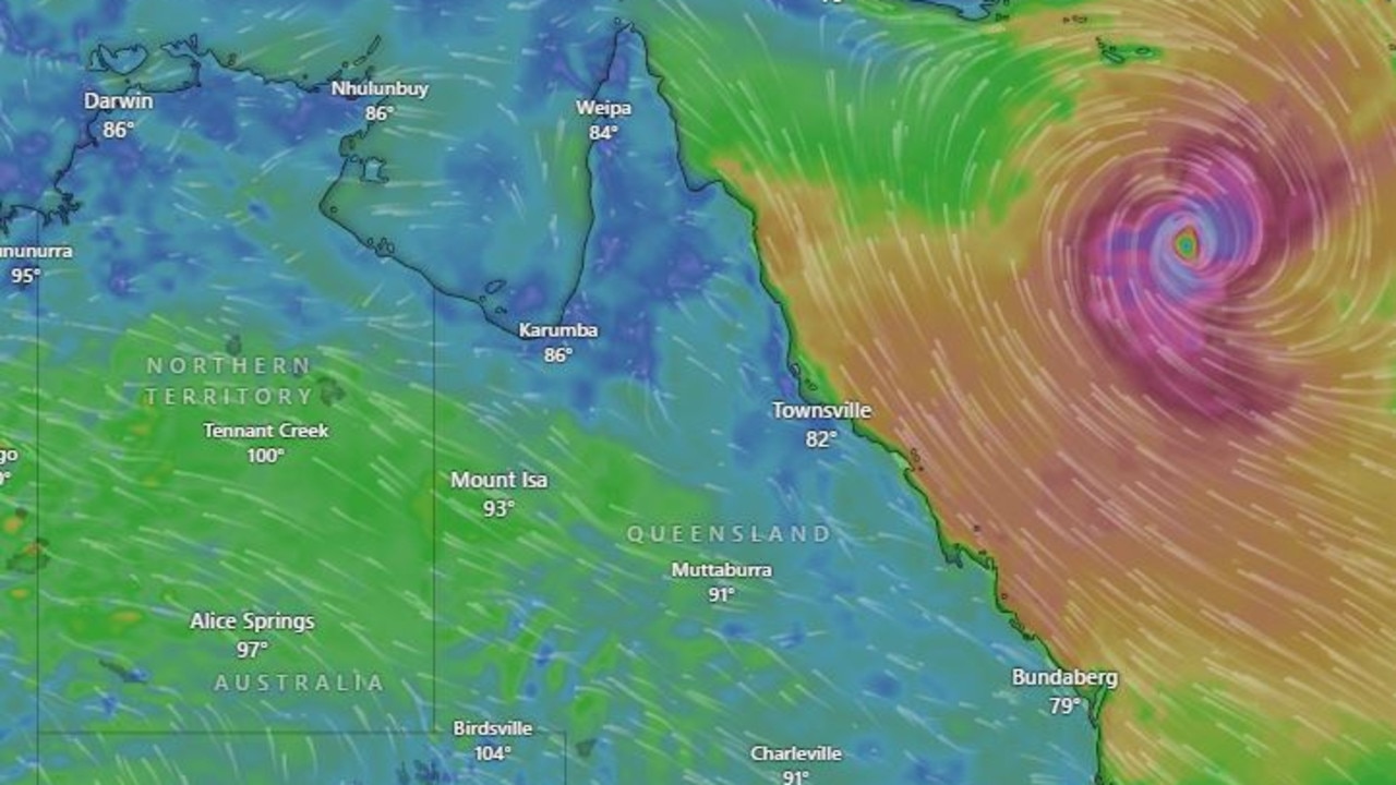
The 4am forecast map predicts the cyclone will weaken as it moves south and drop down to a category two by early next week.
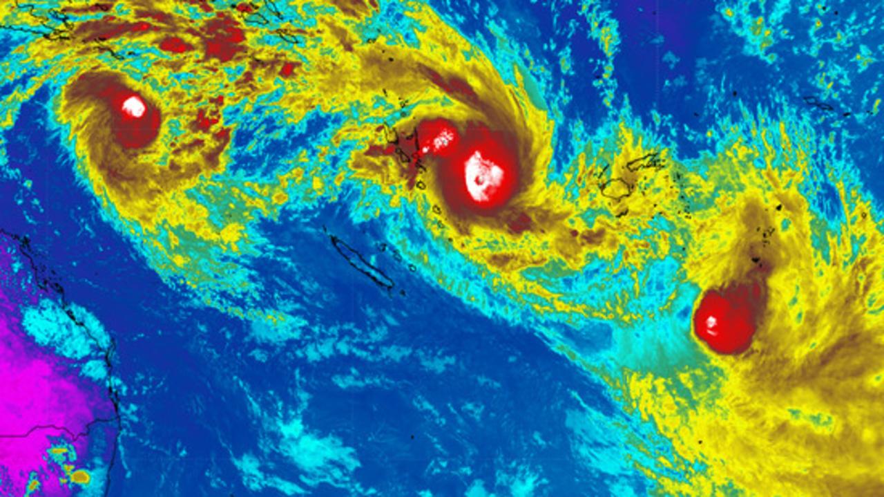
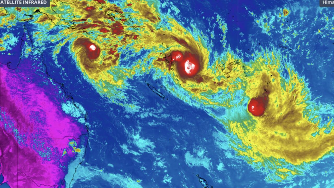
Satellite imagery published this week by Weatherzone showed two other tropical cyclones swirling over the South Pacific ocean.
Tropical Cyclone Seru near Vanuatu and Tropical Cyclone Rae to the southeast of Fiji are the neighbouring systems brewing hundreds of kilometres to Alfred’s right.
Originally published as New details of Tropical Cyclone Alfred’s path after upgrade to category four system
Rare image of three cyclones circling
A rare image of three cyclones circling over the South Pacific Ocean has been captured, as Tropical Cyclone Alfred strengthens off the Queensland coast.
Evacuations to begin as cyclone strengthens
People on a small island off the Queensland coast will begin evacuating as a highly unpredictable tropical cyclone grows stronger.
Unpredictable cyclone menaces coast
A tropical cyclone lingering off the northern Australian coast is expected to intensify to a category three system overnight as it inches closer to land.
‘Horror show’: Disturbing find on beaches
A horrific sight is littering the sand of pristine Aussie beaches in what environmental advocates have deemed a “horror show”.

Aussie street where 50 people live rent-free
A strip of abandoned homes deemed unsafe has been overrun with dozens of squatters refusing to leave despite eviction notices.
Intensifying cyclone’s path ‘highly uncertain’
Tropical Cyclone Alfred is tipped to strengthen through the week, with a risk it could move back towards Queensland’s coast within days.