
How drones could prevent another Black Summer as Australia’s next bushfire risk areas revealed
These are the areas across Australia that could burn again this summer – but fire agencies also have a new hi-tech tool in their arsenal. SEE THE AREAS AND VIDEO

Environment
Don't miss out on the headlines from Environment. Followed categories will be added to My News.
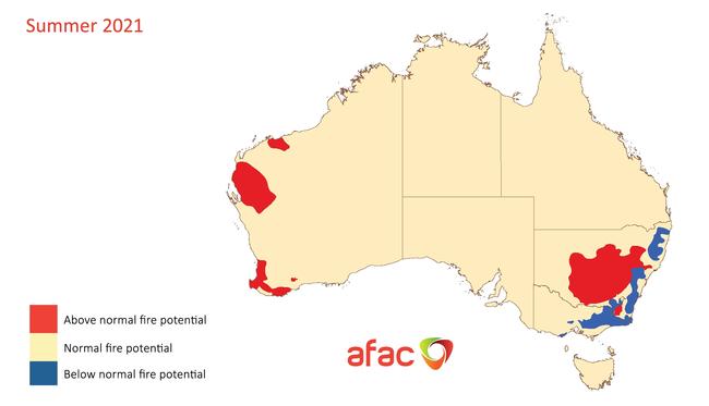
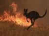
Large parts of New South Wales and Western Australia are at increased risk of fire this summer season, even with the moderating influence of the La Niña weather event, according to the latest forecast.
The Seasonal Bushfire Outlook released on Thursday shows above normal fire risk for large areas of central and eastern NSW, where decent rains have led to the growth of substantial crop and grassland fuels.
In Western Australia, above normal fire potential has been forecast for a number of regions including the Pilbara and the Swan Coastal Plain, driven by expected warm and dry conditions, as well as above average grass fuel loads.
But the Outlook also contains encouraging news for coastal communities stretching from the north of NSW and down into the Gippsland region in Victoria.
Along with the ACT, these areas have been rated as having lower than normal fire potential this summer, primarily because bush areas are still recovering from the Black Summer, but also in some cases because they are expected to experience higher than average rainfall.
Most of Australia shows normal bushfire potential for the summer, but AFAC, the national council for fire and emergency services, warned “destructive and deadly fires can still occur during normal bushfire seasons across Australia”.
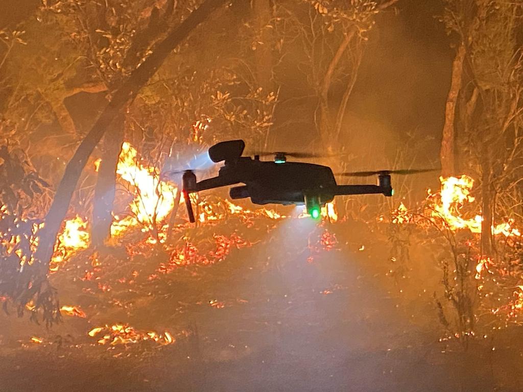
While firefighters are hoping for a quiet season, many agencies are developing their usage of drone technology in order to gain an advantage in the bushfire battles of the future.
Drones are used for an increasing range of purposes in firefighting efforts, including providing critical intelligence on firefront intensity and direction during actual blazes.
They are also used to assess risk before a fire season, and during hazard reduction operations they can help ensure fires don’t cross containment lines. After bushfires they can traverse areas that are too dangerous for human visitation to assess property damage, and the impact on wildlife and habitat.
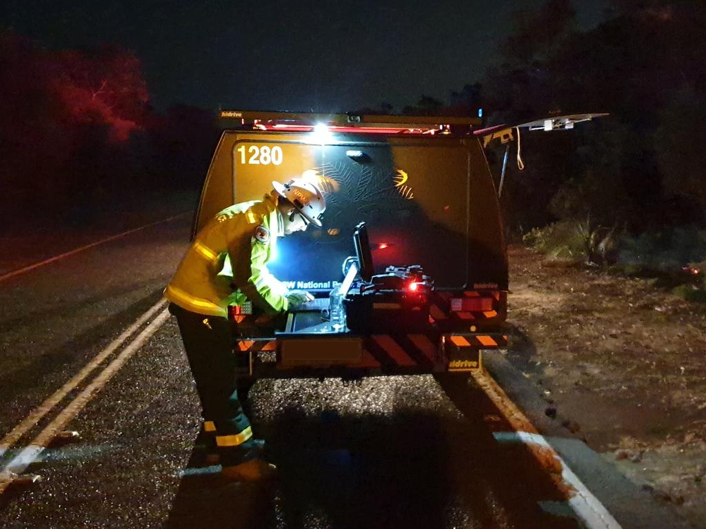
Gareth Pickford from the Fire and Incident Management Branch of the NSW National Parks and Wildlife Service (NPWS) said the agency was increasingly using “eyes in the sky” in its operations. The NSW RFS will also be trialling them, starting in January.
“Drones provide a different perspective, and giving that information, that intelligence to ground crews – you can’t put a value to that,” Mr Pickford said.
The agency’s drone operators are trained firefighters as well as being certified with the Civil Aviation Safety Authority – and while their machines can’t operate when waterbombing planes or helicopters are in the area, they can be especially useful at night, using thermal imaging to track fire progress. Using Geographic Information Systems, the drones can also provide fire chiefs with real-time mapping to help guide their decision making.
“Being able to see where the fire is progressing, how far and how fast, is incredibly valuable,” Mr Pickford said.
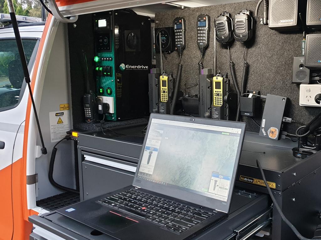
“Also we can see if there are any assets – homes or farms or livestock, things you may not have seen on the ground.”
Drones have their limitations of course – CASA stipulates operators have a visual line of sight to their machines, and battery power typically lasts about 30 minutes – but there is widespread hope they can provide a critical difference in the fight against fires.
This is especially the case for hazard reduction burns. Every year a small proportion of these operations escape containment lines, and in the worst of cases, they can go on to become blazes in their own right. Cross-agency figures on escaped hazard reduction burns in NSW show the number of these mishaps has declined from 130 in 207, to just 19 in 2020.


Jeff Schmidt from Drone Deploy, a US-based company that supplies software to NPWS and other Australian agencies, said bushfires and wildfires were a worsening problem, but technology could make a significant difference.
“I’ve lived in northern California all of my life, and fires are an annual thing now, and not just in isolated areas. We’ve got very very populated areas that are subject to these unfortunate circumstances,” he said. “It’s frequent and it’s touching people.”

Originally published as How drones could prevent another Black Summer as Australia’s next bushfire risk areas revealed
Join the conversation

Millions brace for brutal cold fronts
A fresh wave of wild weather is preparing to lash Australia, bringing freezing winds, thunderstorms and icy blasts to millions.
Read more

Update on flights after volcanic eruption
Not all Australian airlines are ready to fly again following Monday’s volcanic eruption in Indonesia.
Read more

‘Unpredictable’ threat to budget hopes
An ‘unpredictable’ factor is threatening Australia’s hopes of a third budget surplus.
Read more

New inequality putting renters in peril
With temperatures soaring every summer in Australia, renters are falling victim to a new inequality that is putting their health – and lives – at risk.
Read more

More flights axed, chaos as storm shifts
Flights have been cancelled, thousands remain in the dark and commuters face ongoing disruptions amid a freak storm – equivalent to a category 1 cyclone – in NSW.
Read more

If you live here, work from home today
Millions of Aussies have been told to stay home and avoid travelling if necessary after a freak “cyclone bomb” sparked commuter chaos and led to services being cancelled.
Read more