
Urgent evacuation warning as 400km rain band smashes Victoria, NSW and Tasmania
An emergency warning has been issued as a 400km rain band smashes parts of Australia amid fears lives are under threat by floods.
Environment
Don't miss out on the headlines from Environment. Followed categories will be added to My News.
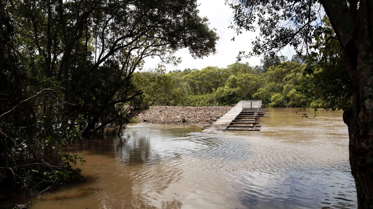
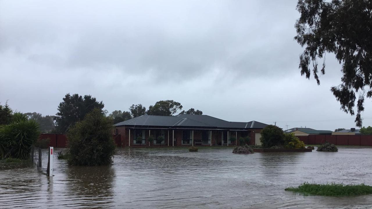
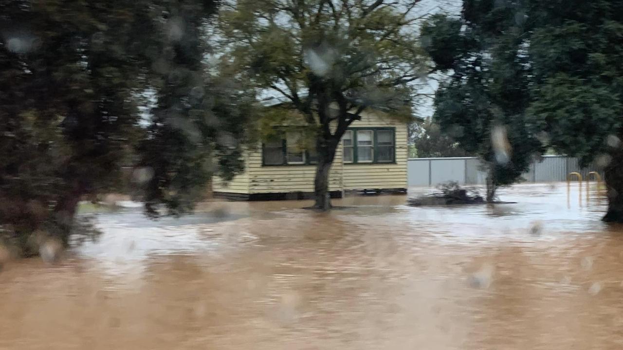
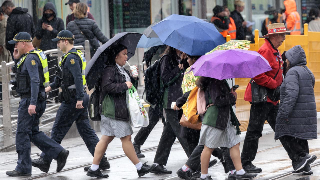
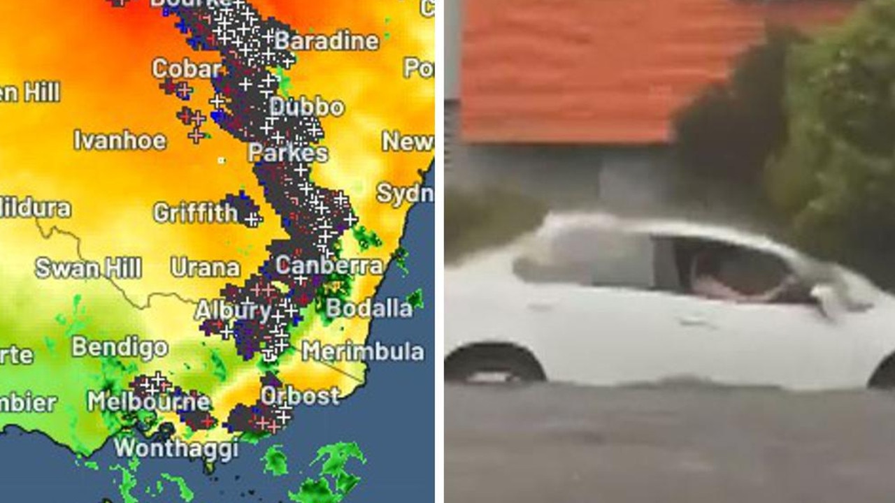
Thousands of people in Victoria and Tasmania have been told to flee their homes as a 400km-wide deluge of rain drenches Australia’s south-east, with floods threatening lives.
Residents in Rochester, in central Victoria, were told to evacuate by 3am on Friday as the Campaspe River continues to rise. It is set to peak sometime on Friday afternoon, and floods could last for 10 days, the SES warned.
People living in Seymour and Carisbrook have also been told to leave now, with floodwaters “rapidly rising”.
Dozens of Melbourne suburbs were also put on alert as the threat of flooding grew last night. Essendon, Footscray, Moonee Ponds and Keilor were among the areas where residents were told to “act now”.
“The level of the Maribyrnong River at Keilor is currently at 2.33m, and rising,” a VicEmergency alert at 9.16pm said. “Move to higher ground. Act now – immediately take actions to protect your life and property.”
In Tasmania, people living in parts of Newstead were also told to evacuate their homes for their own safety.
“Lives are at risk from flood waters,” Tasmania SES said in a statement.
Major flood warnings are in place for the Meander, Mersey, North Esk and Macquarie rivers.
And in Forbes in the central-west of New South Wales, an evacution order has been issued for about 250 homes as major flooding is predicted.
This EMERGENCY WARNING - RIVERINE FLOOD - Evacuate Immediately has been issued for Rochester
— VICSES News (@vicsesnews) October 13, 2022
The duration of the flood event is likely to be between 7 and 10 days.
If you are located in Rochester, it is recommended you Evacuate Immediately.
Details: https://t.co/eCxKEO6hTzpic.twitter.com/JgDm0kHTTK
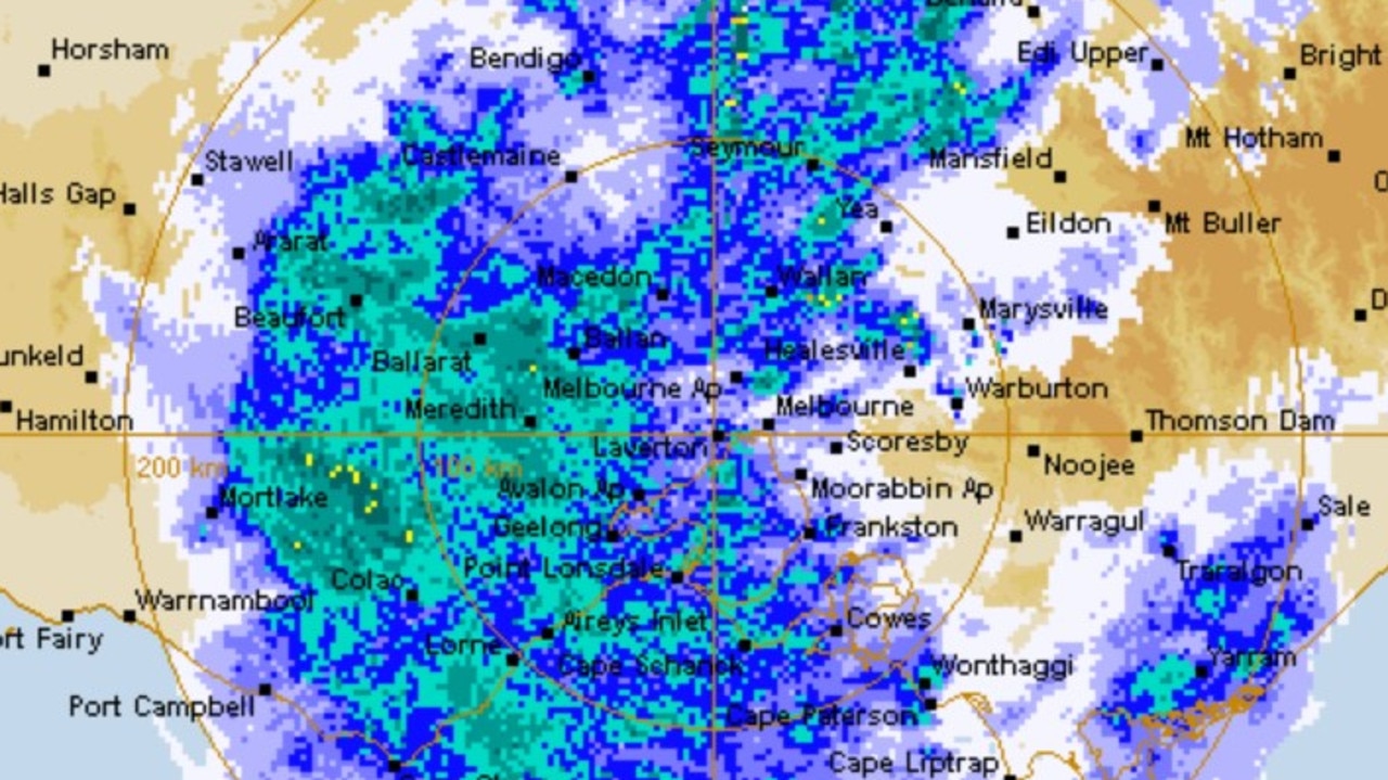
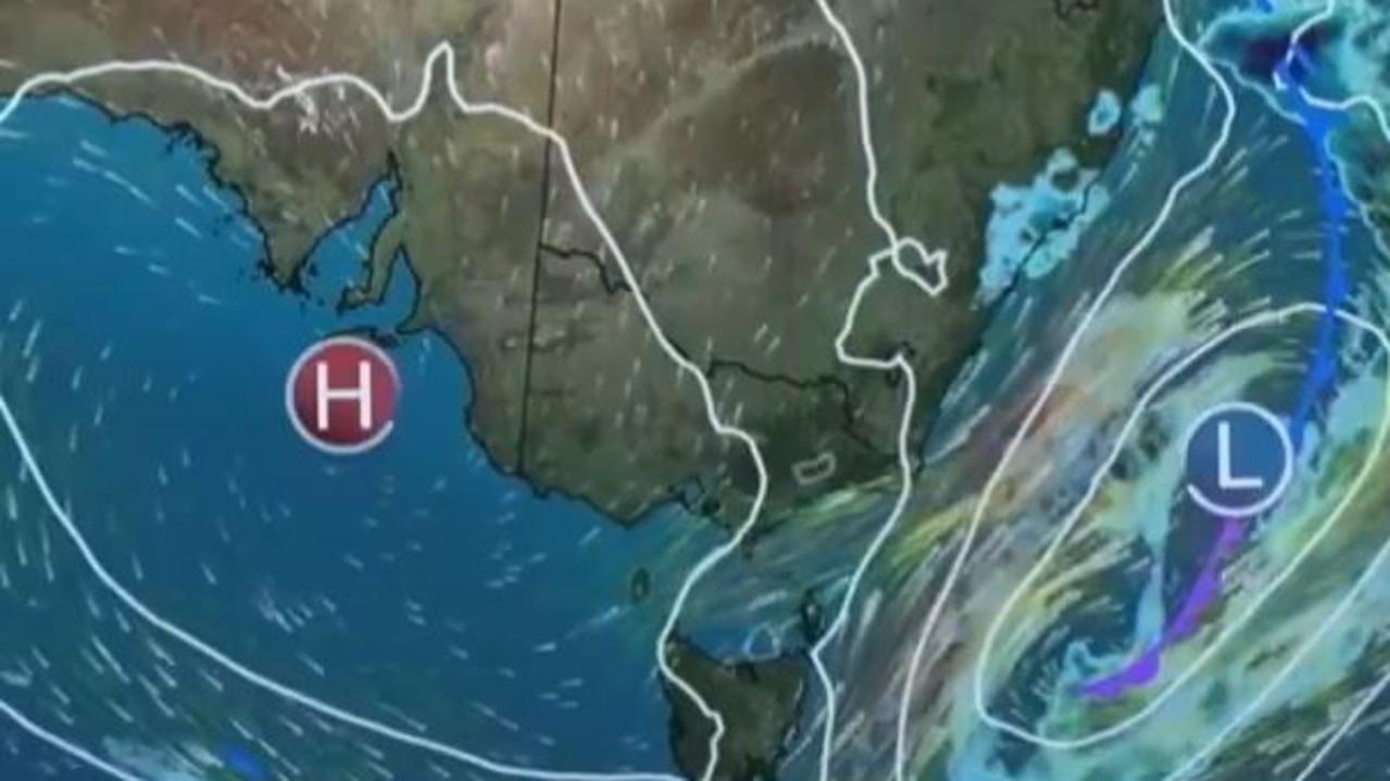
The weather event is being caused by a deep low-pressure system south of the Great Australian Bight that has combined with a deep tropical air mass to cause widespread heavy and intense rainfall across the country.
A severe weather warning for heavy rainfall and damaging winds has been issued by the Bureau of Meteorology for large parts of Victoria.
The heavy rain and damaging winds are expected to clear by Friday morning.
But Victorian emergency management commissioner Andrew Crisp also warned residents to prepare for wet conditions to hang around for over a month.
“There is another low developing, we will see that weather Wednesday and Thursday (next week),” he told 3AW on Thursday.
“The bureau is saying we will continue to see this cycle over the next six to eight weeks.
“We’ve now got a campaign flood event … we’re in this for a while.”
Six-hourly rainfall totals between 30 and 50mm are likely over western, central and northeastern Victoria as well as isolated heavier falls of 65mm.
Daily rainfall totals during Thursday are expected to reach 50 to 80mm, with isolated totals up to 120mm over higher terrain, which would be more than a month’s worth of rain for some areas.
EMERGENCY WARNING - RIVERINE FLOOD - MOVE TO HIGHER GROUND for Goulburn River Lake Eildon to Seymour
— VicEmergency (@vicemergency) October 13, 2022
More details https://t.co/RP7QseKkhB
Goulburn River Lake Eildon to Seymour could be impacted anytime from Thursday afternoon. Act now to protect yourself & move to higher ground. pic.twitter.com/k9YaeYxlt0
Nearly 70 flood warnings have been issued by Victoria SES, with major flooding possible at the Goulburn, Campaspe Ovens, King, Maribyrnong and Acheron rivers and at Seven and Hughes creeks.
An emergency flood warning to “move to higher ground” was made for the Goulburn River at 2.15pm on Thursday.
“Goulburn River-Lake Eildon to Seymour could be impacted anytime from Thursday afternoon. If you are located in low-lying areas or close to a waterway you are in danger – act now to protect yourself and move to higher ground,” the SES said.
“In the next few hours we will see Seymour come under threat of major flooding to levels we have not seen since 1974,” Victoria SES Tim Wiebusch said on Thursday morning.
“There is the potential for 187 properties to be inundated by floodwaters and a further 279 properties that could be isolated.”
Warnings to “move to higher ground” have been issued by the SES for the Acheron and Campaspe rivers and the Hughes Creek river catchment.
Water from a nearby creek is gushing onto Strathfieldsay oval near Bendigo. Lucky footy season is over… More details @9NewsMelbpic.twitter.com/IyCwhf5C1y
— Gillian Lantouris (@gillianlant) October 13, 2022
Victorian flood threats:
- Euroa on the Seven and Castle creeks system is likely flood at levels not experienced since September 2010. There’s the potential for the isolation of around 20 properties and above floor flooding at five properties.
- Rochester on the Campaspe River system is reaching major flood levels not experienced since 2011. There are 700 properties that could become isolated and the potential for above floor flooding at 250 properties.
- Shepparton is likely to flood from Saturday afternoon, similar to levels that have not been experienced since October 1993. There are around 600 properties that could become isolated and the potential for above floor flooding at 50 properties.
- Skipton on Mount Emu Creek is likely to experience major flood levels on Saturday. The highway could become cut off and around 12 properties, including the local shopping strip, could be affected.
- Maribyrnong River in Melbourne is under a major flood warning. Only a small number of properties, around three, are expected to be affected.
Bureau of Meteorology senior meteorologist Jonathan How said the flood risk to Melbourne and Victoria was “extremely significant”.
High street in Heathcote is completely submerged with road blocks in place - the CFA is here directing traffic. Definitely held my breath watching this P-plater drive through (he made it out safely). @9NewsMelb#vicweather#melbweatherpic.twitter.com/ooxy9eND8Q
— Gillian Lantouris (@gillianlant) October 13, 2022
“That is why we are really urging people to keep an eye on the flood forecasts and warnings and follow all advice from your SES as well,” he told The Today Show on Thursday.
“For those across particularly western Melbourne, we have issued a major flood warning for the Maribyrnong river and many of these other creeks will start to rise as the rain starts to come in.
“Even though the rain is forecast to ease early into Friday morning, the flood threat will remain well into the weekend.”
That message was mirrored by Premier Daniel Andrews.
“There is an element of unpredictability in this as well and there’s also a time lag. After the rain has stopped, there will still be very significant risks and waters will rise,” he said.
“That will pose a real challenge over the coming days.”
Damaging wind gusts of 90 to 100km/h are possible over elevated terrain in central and eastern areas of the state, possibly reaching up to 110km/h in exposed alpine peaks.
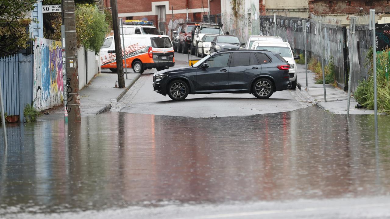
Inner Melbourne areas like Gough St, off the corner of Punt Rd in Melbourne, were covered in floodwater on Thursday morning.
Around 60 roads were closed throughout Victoria as of 12.30am, all primarily because of floods or the weather.
Closed Victorian roads:
- Wimmera Highway
- Goulburn Valley Highway
- Melba Highway
- Heathcote-Rochester Rd
- Charlton-Swan Hill Rd
- Loddon River Rd
- Yambuna Bridge Rd
- Benalla-Warrenbayne Rd
All Melbourne-bound lanes of the Hume Freeway have been closed between Benalla and Avenal due to flooding.
The SES has advised drivers to reduce their speeds, maintain a greater distance between the vehicle in front of them and turn on their headlights.
Motorists have been urged to avoid Great Ocean Rd by the SES after a landslide in the Separation Creek area near Lorne.
The public have been urged to stay away the landslide as it could continue to move for hours or even days.
Parts of Victoria’s regional train service V/Line are flooded, with buses replacing trains in both directions between Bendigo and Epsom/Echuca, and between Albury and Seymour respectively.
Echuca residents have been advised to boil their water after storm water entered one of Coliban Water’s treated water storage tanks.
Bogong Village and Falls Creek residents in the state’s alpine region were advised to evacuate the area if they do not want to be deemed stranded and unable to leave.
Bogong High Plains Road closes between Bogong and Falls Creek at midday today, with heavy rain expected to worsen an active landslip. If you need access to or from Falls Creek, you must travel prior to the closure or prepare to stay in the area until the road is open. #victrafficpic.twitter.com/ESDHXERmlh
— VicTraffic (@VicTraffic) October 11, 2022
There is a slow-moving landslide on Bogong High Plains Rd which caused authorities to close the road from midday on Wednesday. Only emergency services and essential services are allowed to access that road. A reopening date has not been determined.
Bogong High Plains is the only road out of the area, with the current advice being the earliest reopening date will be Monday.
Victoria SES has received more than 1600 requests for assistance so far. The majority were flood related; however, around 300 were for downed trees.
Authorities had performed 23 flood rescues as of 3.30pm on Thursday.
Mr Wiebusch said he was not aware of any serious injuries as a result of the weather.
More than 26,000 Victorians were without power before 2pm due to unplanned outages on Thursday afternoon, according to CitiPower and Powercor.
That number has since dropped to more than 7000. The areas being primarily affected are Romsey, Gisborne and Woodend.

In NSW, a severe weather warning for heaving rainfall and possible flash flooding has been issued for southwestern parts of the state.
Six-hourly rainfall totals between 30 to 50mm are likely, with isolated heavier falls up to 65mm.
Damaging wind gusts of around 110km/h are possible over alpine areas above 1500m from Thursday afternoon.
Evacuation orders have been issued by NSW SES for the majority of Forbes in the state’s Central West.
Residents in the CBD, east, west, south, north east and north west were told to leave before 8pm on Thursday with dangerous flood waters on the way.
An evacuation centre has been set up at the Saint Andrews Presbyterian Church on Harold St.
Nearly 80 flood warnings are active across NSW as of Thursday afternoon.
Police have resumed their search for a man in the state’s west believed to be missing in floodwaters.
The 63-year-old was last seen on a rural property on Lachlan Valley Way at Hillston around noon on Tuesday.
He told a friend he would return shortly, but he never did.
Officers will be focusing on the property and Lachlan River during their search on Thursday.
Further down south in Tasmania, a severe weather warning has been issued by the bureau for intense rainfall, damaging winds and dangerous surf in northern parts of the state.
“Locally, intense rainfall which may lead to dangerous and life-threatening flash flooding is also possible over inland parts of northwest Tasmania during this period, particularly about the Western Tiers, with six-hourly intense rainfall totals to 100mm and 24 hour totals in excess of 300mm,” the bureau said in a statement.
Huge amount of water flowing into the Mersey River. This is heading towards townships of Kimberley and Merseylea, then to Latrobe. We’ve been here for five minutes and we’ve seen the water rise in that time #tasweather@abcnewspic.twitter.com/bmWKmc7wqe
— Monte Bovill (@MonteBovill) October 12, 2022
“North to northeasterly winds with damaging wind gusts with peak gusts of around 100km/h are possible over the Western Tiers, the northeast highlands, the north coast east of Devonport, and the east and southeastern coasts, becoming more likely this (Thursday) afternoon and evening.”
A major flood warning has been issued for the Mersey River, with various minor to moderate warnings in place as well.
A flood emergency warning has been issued by Tasmania SES for Railton and its surrounding area, with residents told to prepare to evacuate.
A damaging surf warning has also been issued for eastern Tasmania with wave heights of 6m possible.
Acting Tasmanian Premier Michael Ferguson said the heavy flooding and rainfall were similar to the devastating conditions of 2016, which caused three deaths and required more than 100 rescues.
The port of Devonport closed at noon on Thursday, with the state government working on the implications this will have for commercial shipping operations.
Commercial movements have been suspended until further notice, with no timeframe given for when they could reopen.
It meant four sails of the Spirit of Tasmania between Devonport and Melbourne were cancelled as a result.
Additional day sailings will be scheduled to accommodate affected passengers.
The decision to suspend operations at the port was made by the harbour master based off weather warnings issued by the bureau and modelling advice.
âš ï¸MAJOR #Flood Warning issued for #MacquarieRover. Major flooding along Lake River now. Moderate likely around Westmoor and Cressy from overnight Thurs into Fri. Minor elsewhere. See https://t.co/V9LYfDjneQ for details and updates; follow advice from @SESTasmania. #TasFloodspic.twitter.com/KI6gcq7kC6
— Bureau of Meteorology, Tasmania (@BOM_Tas) October 13, 2022
But for Australians hoping for a reprieve when the severe weather starts to ease on Friday, Mr How had some bad news.
“We do get a couple of dry days which is great news, but then we do see more rainfall coming through next week unfortunately,” he said.
“So this pattern of big rainfall events is likely to stick around as we head into the next few months.”
Originally published as Urgent evacuation warning as 400km rain band smashes Victoria, NSW and Tasmania
Join the conversation
Two Aussie states bracing for severe storms
Two Australian states are bracing for wild weather that could lead to power outages and damage to cars and homes.
Read more

‘Whole world’: Wong’s climate demand
With Australia’s Pacific neighbours on the frontline of climate change, Penny Wong is calling for the “whole world” to cut back emissions.
Read more

Horror hailstorm leaves family with $10k bill
A family of nine have been left devastated after their roof caved in and their house was decimated by golf-sized hailstones during a wild storm.
Read more
Shock death as storms smash southeast
Wild weather across Australia’s southeast this weekend has turned deadly – with police confirming a camper has died after being crushed by a falling tree.
Read more

‘Have a right’: Boss hits back
A boss has hit back after neighbours slammed a $200 million proposal they fear will ruin their views, saying “people have a right to develop”.
Read more
Thousands battered by storms and heatwaves
Severe thunderstorms and flash flooding have left thousands of homes without power, while another region swelters through a heatwave.
Read more