
WEATHER WATCH: Toowoomba authorities ready
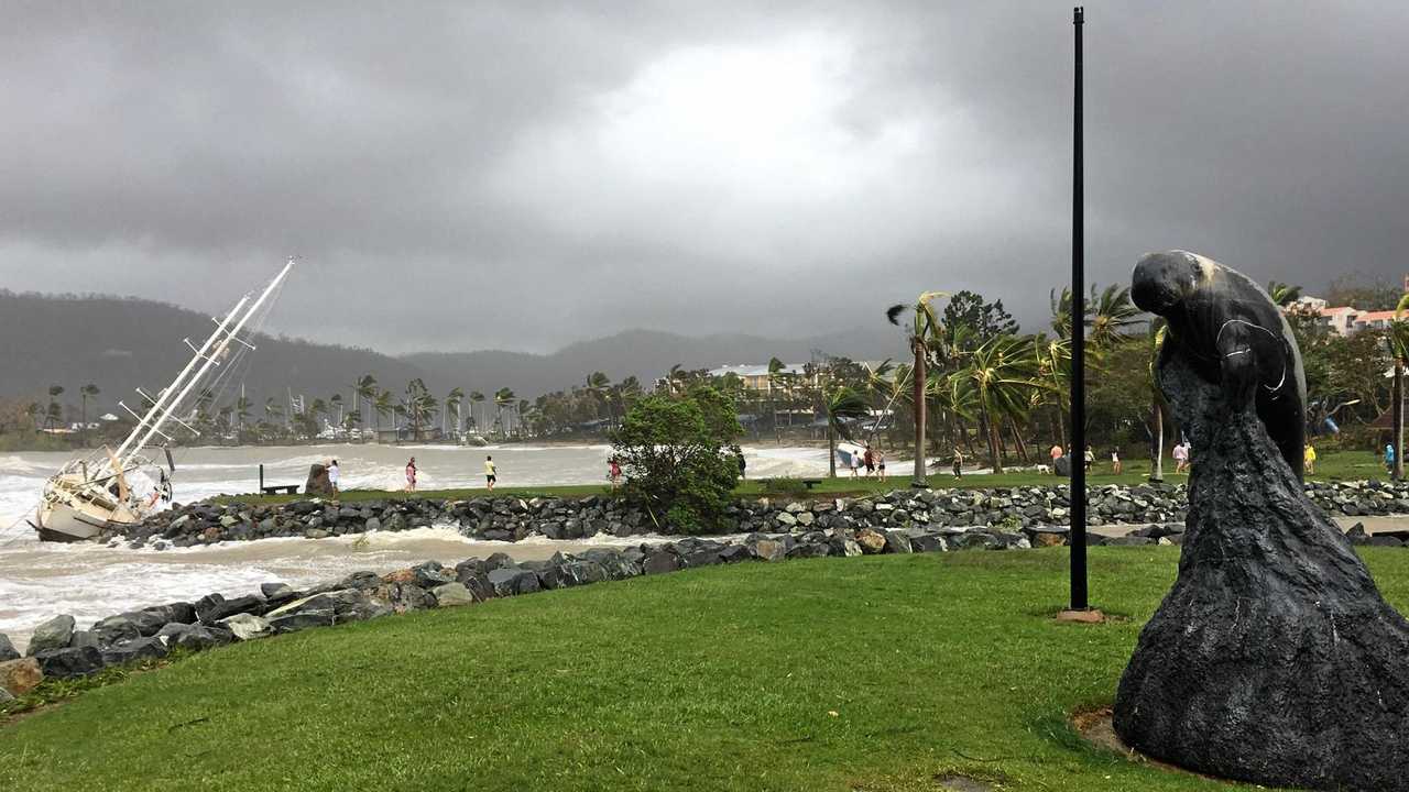
THE tropical low moving south towards the Darling Downs could result in falls in the region up to 250mm today.
News
Don't miss out on the headlines from News. Followed categories will be added to My News.
THE tropical low moving south towards the Darling Downs could result in falls in the region up to 250mm today.
As ex-Tropical Cyclone Debbie's last remnants lash the south-west area, the Toowoomba Local Disaster Management Group is urging residents to be alert but calm about the approaching weather.
It is due to hit this afternoon.
The Toowoomba group was activated yesterday in preparation for the worst case scenario - that 250mm of rain would fall in the short space of time and coincide with strong wind gusts.
"We've gone from a watching brief to an alert status, and that means it allows us to gather information,” Acting Mayor Cr Carol Taylor said.
"We're on alert, well prepared and just doing all we can.
"Since 2011, the council implemented a lot of strategies and undertaken infrastructure works to reduce the amount of flooding in and around Toowoomba.
"No two events are alike. Be alert, not alarmed.”
Toowoomba Local Disaster coordinator Kevin Wreck said flood monitoring systems had not detected significant falls in Toowoomba or the Oakey area, and soil saturation levels suggested rainwater run off was not a key concern.
Bureau of Meteorology modelling predicts the weather system to reach the inner Darling Downs by this afternoon, after dumping high rainfalls across much of the coast and inner Central Queensland regions.
BoM activated a flood watch for regions from cyclone ravaged Bowen to the NSW border, taking in the Darling Downs, Granite Belt and Maranoa areas.
Originally published as WEATHER WATCH: Toowoomba authorities ready

‘Burn to learn’: Camp Oven King shares life’s passion at outdoor expo
Thousands of punter strolled through the Toowoomba Showground gates for the Outdoor Adventure Expo, keen to see the latest in camping and off-road gear, and to learn the classics from men like Ron ‘King Brown’ Wilson, the Camp Oven King.

Qld’s hidden multimillion-dollar Native Title claims battle
There are calls for the state government to help cash-strapped Queensland councils deal with the costs of covering the multimillion-dollar Native Title claims. Vote in our poll.

‘She loved him’: Stepfather found not guilty of molesting 10yo girl
A man accused of sneaking into his stepdaughter’s room late at night has been found not guilty of molesting her two years prior.

Man who allegedly tried to burn woman to death complains bail conditions ‘inconvenient’
She was left with severe and lifelong injuries, now her accused attacker wants to go camping and attend the footy.

Three seasons: Downs to cop rain, frost and shine this weekend
A strong umbrella will be required for residents attending outdoor events on Saturday, with heavy falls set to hit the region. See the full weekend forecast here.

Lehrmann hearing twist: Lawyer will ‘refuse’ calls from police
A lawyer for Bruce Lehrmann has revealed why she will no longer take phone calls from police in relation to the former Liberal staffer’s rape allegations, in a key hearing that took a major twist.