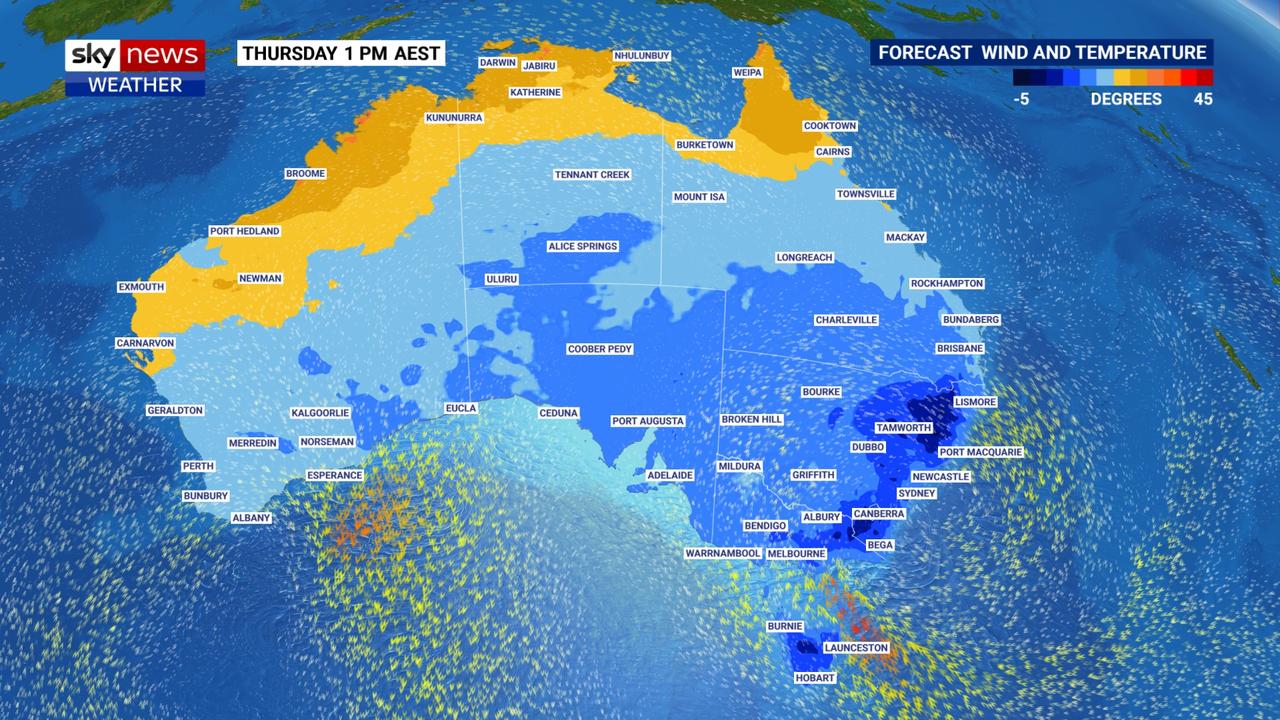
Cold snap hits region: Strong winds, rain, snow, plummeting temperatures
BoM has forecast “20 million Australians are set to shiver” thanks to a hefty surge of polar air. Toowoomba and the Darling Downs are in for a chilly few days and snow is still on the cards.
Toowoomba
Don't miss out on the headlines from Toowoomba. Followed categories will be added to My News.
Winter has arrived, with temperatures plummeting across the state and damaging winds to stick around for the next few days.
The Bureau of Meteorology has forecast a windy end to the week, with gusts of up to 45kmh today, tomorrow and Friday.
Already at 6am Toowoomba recorded wind gusts of 44kmh.
Rain also swept across Toowoomba earlier this morning, with about 7mm recorded at both of the Garden City’s weather stations, and while showers are expected today the wet weather is not expected to stick around.
Temperatures have also dropped all across southern Queensland, with a winter chill settling in.
Today Toowoomba temperatures will range from three degrees to 13 degrees but with the wind chill factor it’s likely to feel much colder.
Tomorrow will be the coldest day of the week with a minimum of three degrees and maximum of 10 degrees, but again the apparent temperature could drop below zero.
BoM has forecast “20 million Australians are set to shiver” as a hefty chunk of polar air surges up from the Southern Ocean.

Snow remains a possibility across the Granite Belt, but forecasters say a change in conditions may see Queensland miss out.
“It will be cold enough, but there’s not much moisture moving through at the right time,” Sky News Weather meteorologist Rob Sharpe said.
BoM issued a warning to sheep graziers this morning advising the cold snap along with the windy and wet conditions could cause loss of lamb and sheep.
“Sheep graziers are warned that cold temperatures, rain and showers and westerly winds are expected during Wednesday. Areas likely to be affected include the Darling Downs and Granite Belt forecast district and parts of the Maranoa and Warrego forecast district. There is a risk of losses of lambs and sheep exposed to these conditions,” it stated.
Despite this cold snap, University of Southern Queensland climate scientist Dr Christa Pudmenzky is expecting things to warm up soon, both in the short-term and long-term outlooks.
“Icy winters could become a thing of the past as long-term records show that daytime and night-time temperatures have been increasing,” she said.
“Winter heatwaves are bad news for our environment as they disturb important cycles such as lengthening the bushfire season and impacting the growth cycle of staple crops.”
The current cold snap is due to a large pool of cold air that originated near Antarctica spreading across the south eastern states of Australia.
“A polar vortex is a low pressure area that is located in the polar regions,” Dr Pudmenzky said.
“During winter, the polar vortex expands, sending cold air northward.
“This happens fairly regularly and is often associated with outbreaks of cold temperatures.”
Dr Pudmenzky said major climate drivers such as El Nino Southern Oscillation and the Indian Ocean Dipole were currently neutral.
“The outlook for June to August season is a 60 to 70 per cent probability of exceeding of the long-term median rainfall but we have to remember that this is the dry season,” she said.
“We can also expect warmer than average daytime temperatures.”


