
WEATHER: Blow up Santa disaster leaves thousands without power in Huonville and Franklin
The state’s electricity provider has issued a warning this festive season after a blow up Santa caused a mass power outage in Southern Tasmania.
Tasmania
Don't miss out on the headlines from Tasmania. Followed categories will be added to My News.
The state’s electricity provider has issued a warning to Christmas lovers this festive season after a blow up Santa Claus caused a mass power outage in Southern Tasmania over the weekend.
In what TasNetwork’s has dubbed as ‘Saturday’s Sizzling Santa’, a decoration in someone’s backyard was blown onto high-voltage lines during strong winds, triggering an outage that left around 1000 customers in Huonville and Franklin without power for an hour.
“A quick reminder to ensure your outdoor Christmas decorations are well-secured and weighed down,” said TasNetwork’s in a recent post to their Facebook page.
“There wasn’t much left of that Santa once our crews removed him from the line …”
“Fortunately, the incident happened just after 2am … so no youngsters got to see Santa unceremoniously incinerated.”
The crew said they’ve renamed the power pole nearest to the incident as the ‘North Pole’.
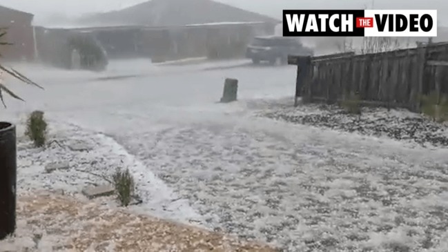
2cm hail and back to back storms hit Southern Tasmania
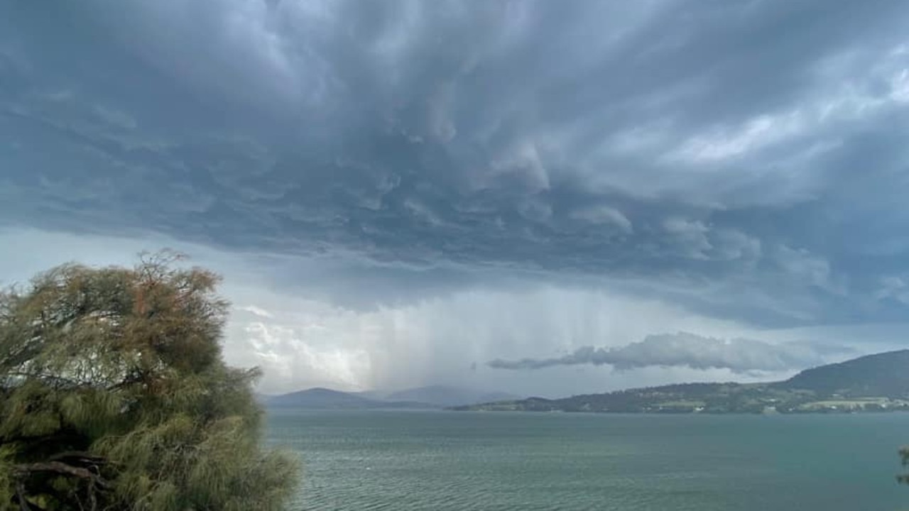
Homeowners are counting the cost of Thursday’s brief but powerful thunderstorm that lashed large parts of southern Tasmania.
Hobart received 31mm of rain, 15mm of which came bucketing down during an intense 30-minute burst.
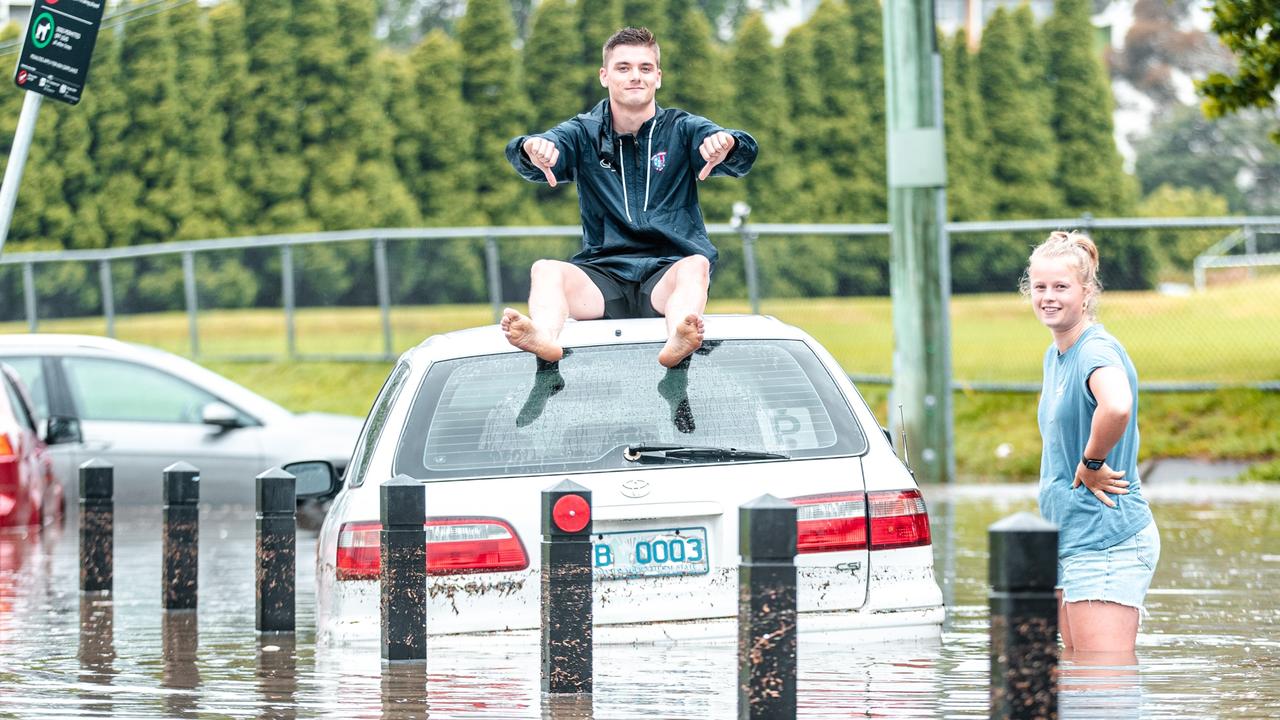
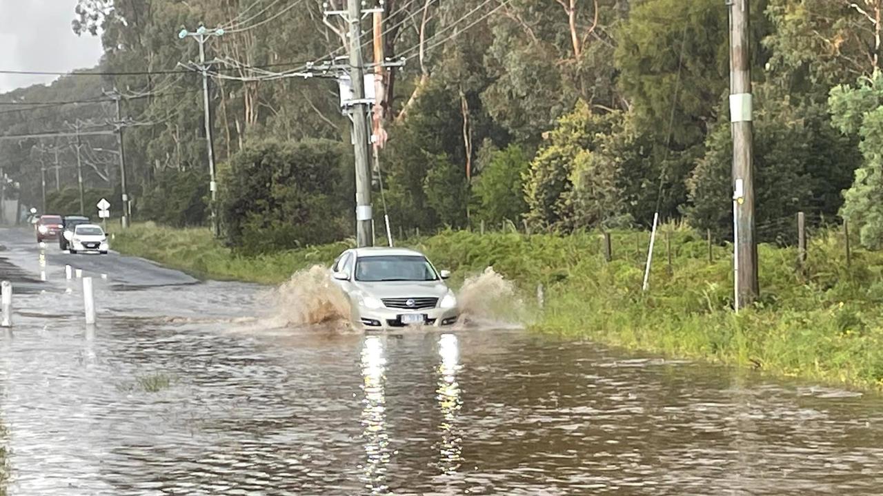
The sudden downpour overwhelmed drains and caught several drivers unprepared, resulting in multiple calls to the State Emergency Services.
Several people on Risdon Road waded through floodwaters in an attempt to rescue their cars, contrary to the warnings of police and emergency services.
SES assistant director Leon Smith said it was “extremely dangerous” to wade through flood waters due to contamination, loose debris, poor visibility and rapid currents.
“We’ve had reports of people flaunting our advice and the advice of police and traversing flood waters,” Mr Smith said.
“We’ve seen a fatality on the mainland under such circumstances with people entering floodwaters, making poor decisions, and we just can’t afford people to do that.”
SES volunteers were called to several houses that had been struck by hailstones the size of $1 coins.
In one instance, a glass house had been pelted with hail, smashing holes in its roof and walls.
Several homes had gutters blocked with hail, while others were overwhelmed by the sheer volume of water.
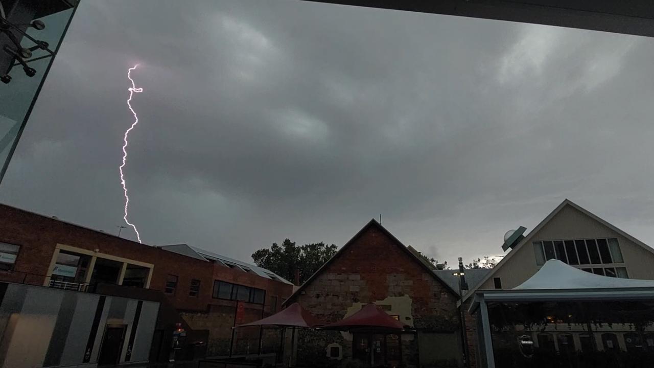
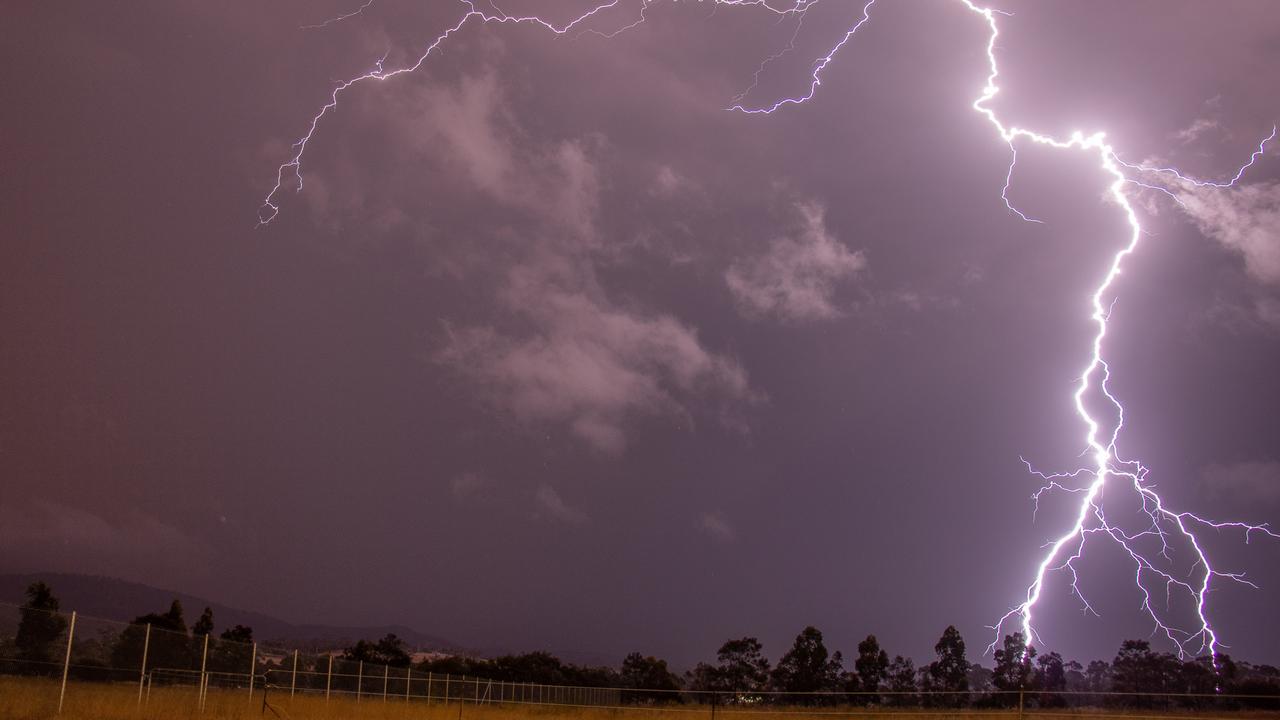
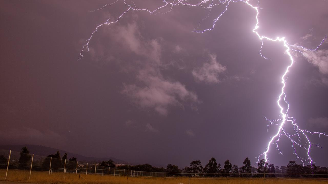
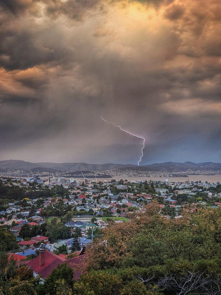
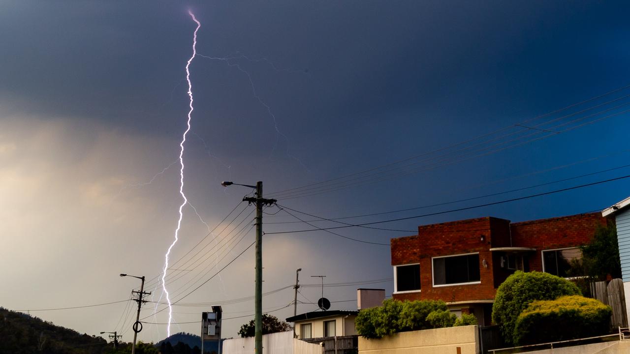
Throughout the course of the night there were 10,000 lightning strikes across the state, 2400 of which were recorded coming to ground.
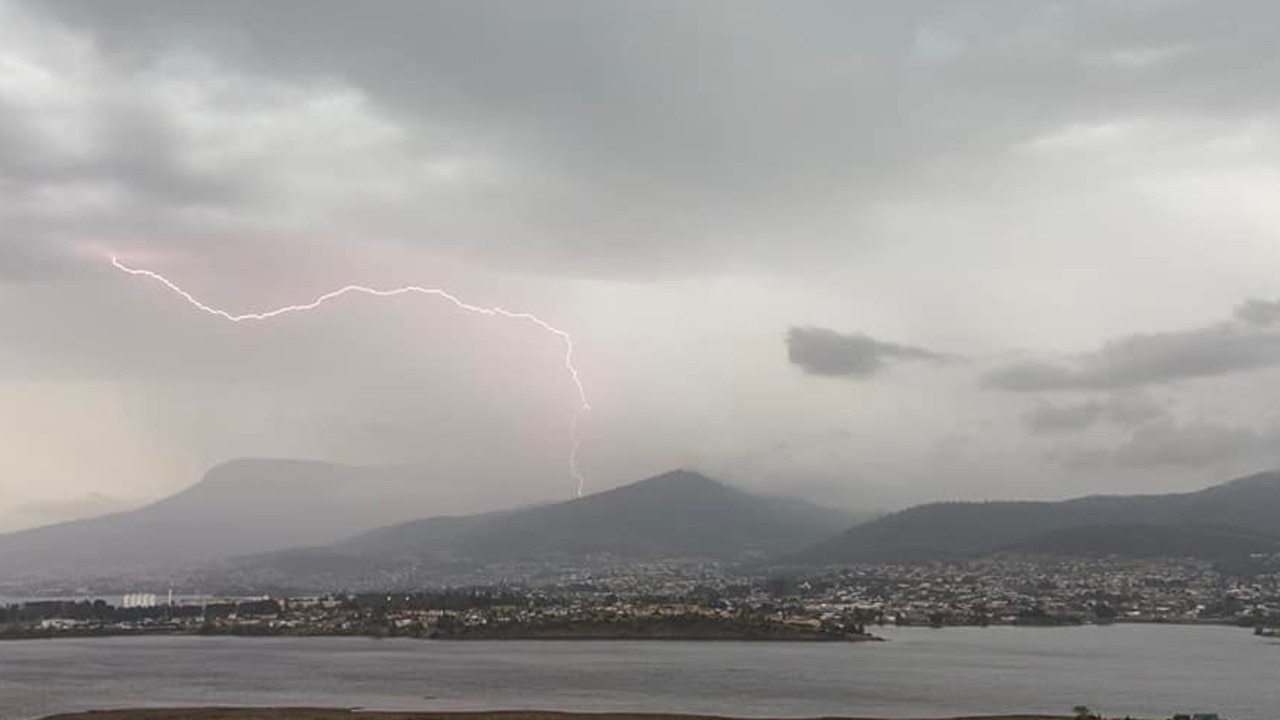
A lightning strike damaged an electric transformer on Mount Nelson, cutting power to the surrounding areas.
About 30,000 people were left without power, and workers spent Friday morning reconnecting those houses to the grid.
Bureau of Meteorology senior climate researcher Andrew Marshall said Tasmania’s spring rainfall was about 18 per cent higher than average.
Several sites experienced their wettest spring on record, including Southport with 484.8mm, Dover with 443.6mm, Eaglehawk Neck with 425.2mm, Kingston with 380.3, Margate with 371.4, and Taroona with 317mm.
Mt Wellington recorded its coldest November day on the 15th at just 2.1C, which is also the record for the coldest November day in Tasmania.
Dr Marshall said it had been an unusually rainy spring for Tasmania, and was likely to remain so for large parts of the state during summer.
“Tasmania’s East Coast experienced four significant rain events. Having so many systems passing in one month is unusual,” Dr Marshall said.
“The rainfall outlook for summer is likely being influenced by the La Nina event in the tropical Pacific Ocean and the positive phase of the southern annular mode.”
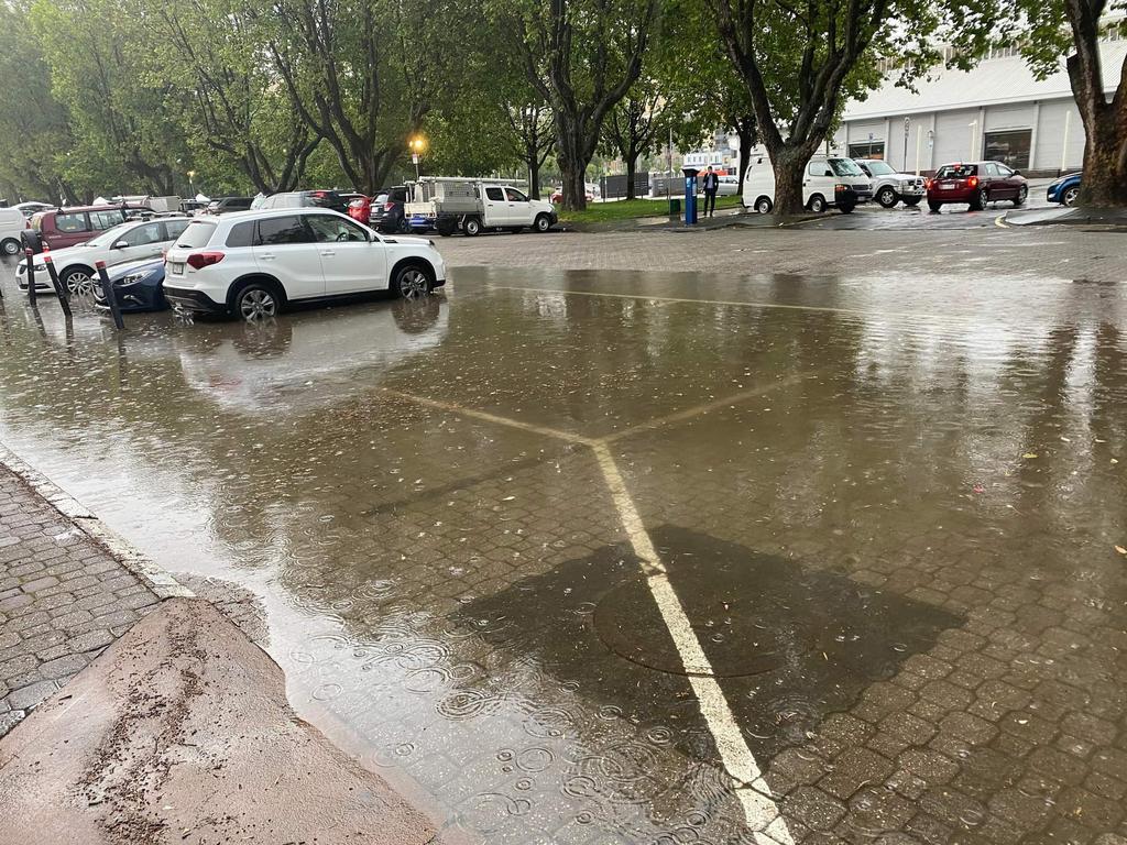
Residents took to social media to share photos and videos of hail blanketing their backyards in Huonville and cars being swallowed by floodwaters at New Town.
Heading into the weekend, Tasmanians can expect a stark contrast in conditions with a cold snap forecast for Saturday.
“The interesting thing for the weekend is that we are expecting a cold day with below average temperatures for summer and snow to around 700m in the far south – it’s a very large contrast to the above-average temperatures and storms the last few days,” said Bureau of Meteorology meteorologist Brooke Oakley said.
Hobart is expected to reach a top of 15C on Saturday with a high chance of showers before conditions heat back up next week.
Friday, 10am: Southern Tasmanian residents are beginning to mop up after a wild night of back to back storms that left over 30,000 homes without power.
345 TasNetwork customers are still without power due to severe weather and lightning strikes at Bothwell, Osterley, Ouse, Victoria Valley, Mount Nelson, Black Hills, Glenfern and South Hobart.
Bureau of Meteorology meteorologist Brooke Oakley said the weather event was “particularly intense” compared to past storms with over 10,000 lightning strikes recorded across the region.
“We received verification of hail greater than 2cm and that was verified at Midway Point, we also had anecdotes of large hail at Seven Mile and Cambridge,”
Parts of Hobart saw localised flash flooding with the CBD receiving 15.4mm in just 30 minutes while the Airport copped 21.4mm in half an hour.
Residents took to social media to share photos and videos of hail blanketing their backyards, and cars being swallowed by floodwaters.
The Bureau of Meteorology has since cancelled severe weather warnings overnight with conditions easing early this morning.
Heading into the weekend Tasmanians can expect to see a stark contrast in conditions with a cold snap forecast to hit tomorrow.
“The interesting thing for the weekend is that we are expecting a cold day with below average temperatures for summer and snow to around 700m in the far south – it’s a very large contrast to the above average temps and storms the last few days” said Ms Oakley.
A partly cloudy day for Hobart today with a top of 20C and a slight chance of showers in the late afternoon and evening.
There were #storms for much of #Tasmania yesterday afternoon and evening, with the most intense storms about the southeast (with heavy rain, large hail and gusty winds).
— Bureau of Meteorology, Tasmania (@BOM_Tas) December 2, 2021
Much more settled weather expected today. Check your forecast at https://t.co/89tUjpsH2xpic.twitter.com/9sUlBzlSZU
LATEST: THE sky turned an ominous grey and was illuminated with forks of lightning as peals of thunder rolled out in a storm that lashed parts of southern Tasmania, bringing heavy rainfall and flash flooding on Thursday afternoon.
In Hobart, almost 19mm of rain fell between 5.30pm and 6pm, leading to inundation of homes and cars, and temporary road closures.
The storm also wreaked havoc on households, and late on Thursday night there were 24 known outages affecting 2274 customers.
The largest outages were impacting the suburbs of Acton Park, Cambridge, Mount Rumney and Seven Mile Beach, with a combined 1107 homes affected.
Other outages were affecting Collinsvale, Glenlusk, Molesworth, New Norfolk, New Town, Mount Nelson and Geilston Bay.
Bureau of Meteorology senior forecaster Rod Dickson said there was intense rainfall for a short period as the thunderstorm moved through, but conditions were expected to ease.
Seven Mile Beach resident and Clarence Alderman Wendy Kennedy posted a picture to her Facebook page showing flash flooding in her street.
“In 30 years of living there I’ve never seen anything like this,” she said.
Meanwhile, soccer players from the South Hobart Football Club were caught up in the drama at the Friends Oval in New Town as the storm hit.
UPDATE, 6.15PM: POLICE say Risdon Rd is closed near the Brooker Highway due to flooding.
All motorists are asked to avoid the area until further notice, with traffic diversions in place.
The Brooker Highway is still open.
Almost 19mm of rain fell between 5.30pm and 6pm in Hobart, according to figures from the Bureau of Meteorology.
Clarence Alderman Wendy Kennedy posted a photo to her Facebook page on Thursday of flood waters on Surf Rd, Seven Mile Beach.
There are reported issues with the TasNetworks website, with an automated message suggesting it is down for maintenance.
EARLIER: MORE than 1700 homes are without power in southern Tasmania as thunderstorms sweep across the region.
TasNetworks reports 1021 customers in Mount Nelson, Sandy Bay and Taroona are without power, with the cause of the outage under investigation.
There is another outage affecting 663 homes in Bothwell, Ellendale, Hamilton, Hollow Tree, Meadowbank, Osterley, Ouse, Strickland and Victoria Valley.
It has been caused by a power pole being brought down.
Meanwhile, there are 32 customers in Primrose Sands without power, as crews investigate the cause.
A further outage affecting homes in Kaoota, Longley and Sandfly is under investigation.
For the full list of current outages, visit tasnetworks.com.au/outages
Severe thunderstorm warning issued
MULTIPLE regions across southern Tasmania are bracing for flash flooding and fallen trees as warnings are issued for severe thunderstorms and large hail.
The Bureau of Meteorology has issued a severe thunderstorm warning for the Upper Derwent Valley, Hobart and surrounds, and parts of the South East, East Coast, Central Plateau and Midlands forecast districts on Thursday afternoon.
Large hailstones and heavy rainfall can be expected over southeastern Tasmania.
“A trough is slowly moving eastwards across Tasmania with a humid air mass across the state, bringing unsettled conditions,” the BOM warnings webpage reads.
“Severe thunderstorms are likely to produce large hailstones and heavy rainfall that may lead to flash flooding in the warning area over the next several hours.
“Locations which may be affected include Orford, New Norfolk, Bothwell, Hobart, Dodges Ferry and Bagdad.”
The State Emergency Service encourages locals to move their cars under cover, and to seek shelter indoors rather than under trees in a storm
The SES also suggests avoid driving or moving through flooded areas, avoiding using phones in a thunderstorm and staying vigilant of fallen trees and power lines.
For emergency assistance, call the SES on 132 500.
For weather updates visit bom.gov.au/tas
WEATHER: Hail, back-to-back storms brewing in south
Wednesday December 1, 2021 9.03am
Tasmanians see far less thunderstorms than other Australian jurisdictions, but we could be getting our fair share of turbulent weather on the first few days of summer.
Bureau of Meteorology senior meteorologist Luke Johnston said he and other “weather nuts” were excited by the prospect of storms.
He said southern Tasmania could expect two storms in two days on Wednesday and Thursday – a phenomenon which was “a little bit unusual but still expected” at this time of year.
“We’re pretty likely to see storms somewhere in southern Tasmania,” he said.
“They might form in the Derwent Valley and stay west, or (cross to) Hobart.
“They’re very hard to forecast in Tasmania.”
Mr Johnston said Thursday could mirror the same conditions as yesterday with the addition of gusty winds.
He said recent settled weather with northerly winds was creating a build up of humidity similar to that in tropical regions.
“When you get the building heat combined with the building moisture that’s when you’re in an environment conducive to thunderstorms,” Mr Johnston said.
“The trigger this time is troughs forming over the land (on Wednesday) over southern Tasmania, and a bit more widespread (on Thursday).”
Wetter months leading into summer have seen more moisture rise from the soil in warmer weather, adding another boost to the likelihood of storms this sunny season.
“If you get all the ingredients come together, the high levels of moisture get lifted high up into the air,” Mr Johnston said.
“Eventually it reaches a point where the surrounding air is so cold it builds up a static charge.”
Unlike fast moving winter storms, Mr Johnston said summer storms usually involved heavier raindrops and more lightning.
Despite the storms, Wednesday and Thursday should reach 28C and 25C in Hobart.
Mr Johnston said a cold front would cross Tasmania after Thursday with some showers in the west and developing in the north west.
Hobart can expect possible showers on Friday with a top of 19C, and a shower or two on Saturday dropping to 15C.
“We might even have snow down to 800m in Tasmania on Saturday,” Mr Johnston said.
Hobart can then expect another spell of pleasant weather reaching 19C on Sunday, 24C on Monday and 21C with a possible shower on Tuesday.
For weather updates and warnings visit bom.gov.au/tas
Danger warning as summer sun heats up
AFTER a seemingly miserable November, Tasmanians are looking forward to enjoying the sunshine this summer.
On the last day of spring on Tuesday, many were able to get out and enjoy the sunshine, including Summer Wignall, 15, and her friends.
“Best way to end spring,” she said.
“This summer I am most looking forward to spending more days at the beach with my friends and getting out and about in the good weather,” she said.
“I have not been able to do these things in November as it’s always cold and miserable.”

But while many are looking forward to enjoying the summer sun, the heat also comes with warnings.
Tasmania Fire Service chief officer Dermot Berry said fire permits would be required from now until the end of the year.
“With much of Tasmania having experienced above average rainfall in October and November, there has been significant grassland growth, which is a potential fire hazard as we head into summer and the grass dries in warm and windy weather,” Mr Barry said.
“By introducing permits, we are implementing measures to allow TFS to monitor fires in the landscape during expected spikes in fire danger and mitigate this risk of bushfires as best as possible.”
Mr Barry said permits would not be required for campfires and barbecues, but fires must not be left unattended.
More Coverage


Originally published as WEATHER: Blow up Santa disaster leaves thousands without power in Huonville and Franklin
Join the conversation
BREAKING: Deputy Premier quits Cabinet over ferries fiasco
Deputy Premier Michael Ferguson has sensationally quit Cabinet over Spirit of Tasmania ferries fiasco. See the video >>
Read more
Loggers’ year-long discrimination case dismissed
A 16-month long discrimination case filed by logging supporters against the Bob Brown Foundation has been dismissed. What the anti-discrimination commissioner had to say.
Read more
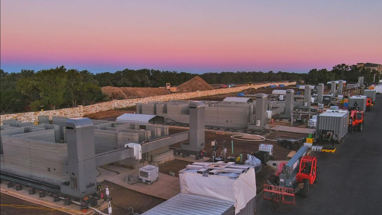
Will 3D printed houses remodel the state’s housing crisis?
After a successful trade mission in the US, the Premier has returned to the state optimistic that 3D printing could be the solution to the housing crisis. Video: See how it works
Read more

Rhodes to success: Campaigner on his fight for equality
Tasmania’s latest Rhodes Scholar Sam Watson has already packed a lot in his short life. Now, he has set his sights on what he call’s humanity’s greatest challenge, climate change.
Read more
Industry support for $65m Kangaroo Bay Hotel project
While in the midst of legal battles for the project, Kangaroo Bay Hotel developer Chambroad has received some industry support for the $65m plan: Who’s behind it:
Read more

O’Byrne pulls plug on support for Ferguson, says Premier must act
The survival of key Liberal Michael Ferguson hangs by a thread after key independent David O’Byrne declared he had lost confidence in the beleaguered Treasurer and Deputy Premier. What Mr O’Byrne said >>
Read more