
Tidal surge warning as Redland, Logan prepare for 2.6m tides, big swells, winds
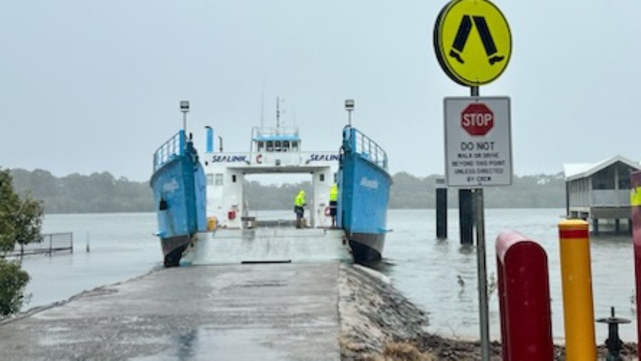
Bay island residents have been told ferry services are likely to be cut on Tuesday as coastal and riverside communities batten down the hatches for Cyclone Alfred. WATCH THE VIDEO

QLD News
Don't miss out on the headlines from QLD News. Followed categories will be added to My News.
Residents of North Stradbroke Island and the southern Moreton Bay islands will likely be cut off from the mainland from Tuesday night as ferry services are officially suspended as Cyclone Alfred hits the coast sometime after Wednesday.
Weather conditions and high winds have forced ferry operators to announce passenger services will stop on Tuesday, Wednesday and Thursday.
The cessation of all ferry and barge services to the islands follows Premier David Crisafulli’s warning to bay island residents to make a decision on Monday on whether to wait out the cyclone on the mainland.
■ The Amity Trader will run its final barge to Coochiemudlo Island from Victoria Point at 11am tomorrow and the last passenger ferry will leave Coochie at 6.45pm and from Victoria Point at 7pm.
Amity Trader advised that both services will resume on Friday depending on the weather.
■ Sealink passenger ferries to North Stradbroke Island will cease operating tomorrow with the final ferry leaving Dunwich at 10.45am.
■ Sealink car barges will continue to run on Tuesday but passengers are advised to postpone any non-essential travel. Vehicle ferries were likely not be running on Wednesday and Thursday. Sealink said it services were cancelled, it would contact affected passengers directly.
■ The Straddie Flyer announced that restricted services would apply on Wednesday and Thursday, with the possibility of no services at all from Friday through Sunday.
■ Southern Moreton Bay Island ferries are continuing to operate under normal schedules on Monday, but services are likely to be cancelled on Wednesday with Sealink telling passengers it was closely monitoring the situation, but may need to make cancellations on Tuesday and Wednesday.
“We strongly advise postponing any non-essential travel. If services are cancelled, we will contact affected passengers directly.”
With ferry services grinding to a halt, island residents face a critical decision — whether to stay and ride out the cyclone or evacuate before conditions become too dangerous to leave.
Mr Crisafulli issued the warning on Monday stressing it was time for residents of Macleay, Russell, Lamb, Karragarra, Coochiemudlo, North Stradbroke and other islands in the northern part of the bay to act before conditions worsen.
He urged island residents to finalise their evacuation plans immediately.
“We are asking people on these islands, including those living on houseboats, to now begin making their plans and considerations,” Mr Crisafulli said.
“There will come a point where you will have to make a decision, and once that window closes, we will support people in whatever decision they make — but it is important they make that decision soon.”
With ferry services still operating, the premier urged residents to make a conscious decision now about where they were going to sit out the cyclone, while there was still time with the Cyclone abut 450km east of Brisbane.
■ What should I pack? Cyclone safety guide
“Anyone who lives on those bay islands, people who are on houseboats, we’re asking them to now, begin planning in earnest and with a degree of being connected,” Mr Crisafulli said.
“We’re asking them to stay connected as necessary ferry services are continuing at the moment that that could change in the very near future.
“There will come a time where you those people have to have made that decision by the legal stage, and once that window closes, we will then support people in whatever decision they make, but it is important that they make that decision fairly soon, because that window will close.
“Storm surges are a significant concern … we are asking people in vulnerable areas to stay informed and begin their preparation now.
“This includes those living on canals, beachfront properties, and areas prone to flooding.”
Russell Island residents have already expressed concerns of a mass evacuation as they claim there would be no ferries, barges or helicopters operating.
RELATED: 1.88m properties in path of cyclone Alfred’s fury
The last passenger ferry from Coochiemudlo Island will depart on Tuesday evening.
Amity Trader Barge and Ferries have advised that the final passenger ferry from Coochiemudlo Island will leave at 6.45pm on Tuesday.
Both the ferry and barge service will not be operational on Wednesday, March 5, and Thursday, March 6, when Tropical Cyclone Alfred could make landfall.
Ferry and barge services could resume on Friday March 7, depending on weather conditions.
“There is only one barge ramp facing the mainland and a single land evacuation route along the main road,” resident Greg Hartay-Szabo said.
“Island residents are concerned that Medivac helicopters and other water transport options will be halted and evacuation vessels may also be stopped.”
Mr Crisafulli said transport services were expected to face major disruptions, with ferry and barge operators working closely with local councils to manage operations safely.
Island residents have reported that bottled water and toilet paper is out at the independent stores on the bay islands.
However, two generators have been shipped to Coochiemudlo and Russell islands.
Mr Crisafulli stressed that those who remained behind could be stranded once ferry services were suspended due to dangerous conditions.
He said extra health and power workers were pre-positioned to ensure essential services can be maintained.
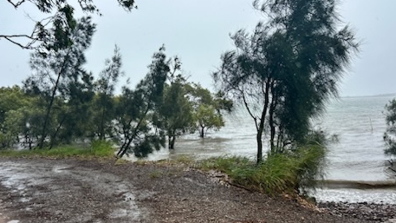
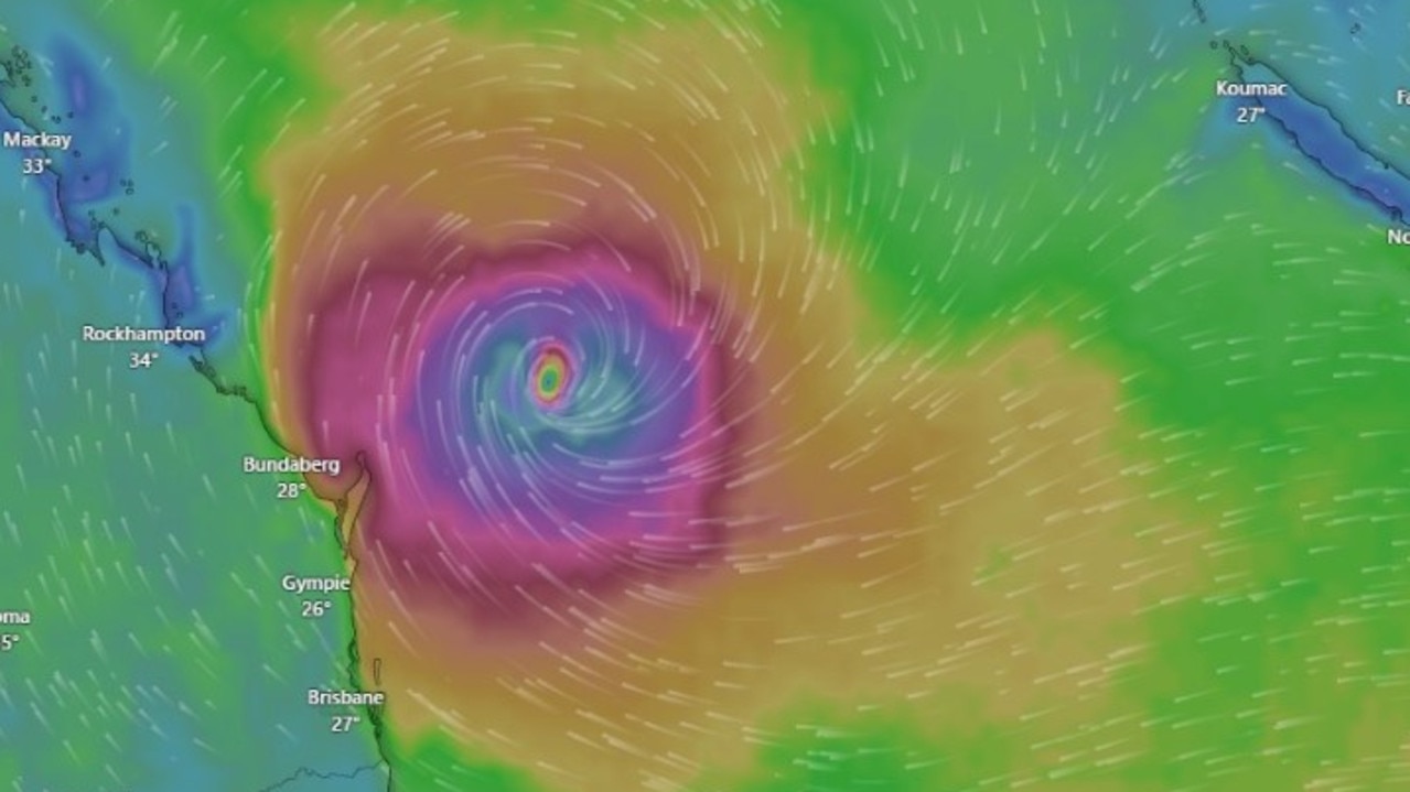
The Bureau of Meteorology has also warned that Cyclone Alfred could make landfall on a high tide, significantly increasing the threat of storm surges in low-lying areas.
Residents in Logan coastal zones have also been advised to prepare for potential evacuation, with modelling data on expected flood levels set to be released soon.
Particular concern has been raised for Golden Beach on the Sunshine Coast, where active sandbagging efforts were already underway.
Brisbane, Logan, and Redland councils have also opened sandbagging stations for those seeking to protect their homes.
Queensland’s disaster response team has called on telecommunications providers to ensure networks remained operational after the islands were left without power and telecommunication for more than 12 days in December 2023 and January 2024.
Mr Crisafulli said emergency text alerts were expected to be sent out in the coming days.
Residents are urged to stay connected through official government websites and local news updates.
He said the government was working with Coles and Woolworths to ensure that all supermarkets remained stocked – with stores advised to continue resupplying essentials multiple times a day to prevent panic buying.

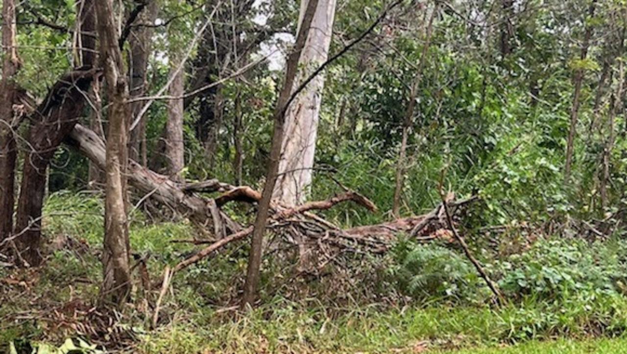
Mr Crisafulli also said councils were working to remove loose debris that could become deadly projectiles in high winds.
Transport services to the islands are also expected to face major disruptions, with ferry and barge operators working closely with local councils to manage operations safely.
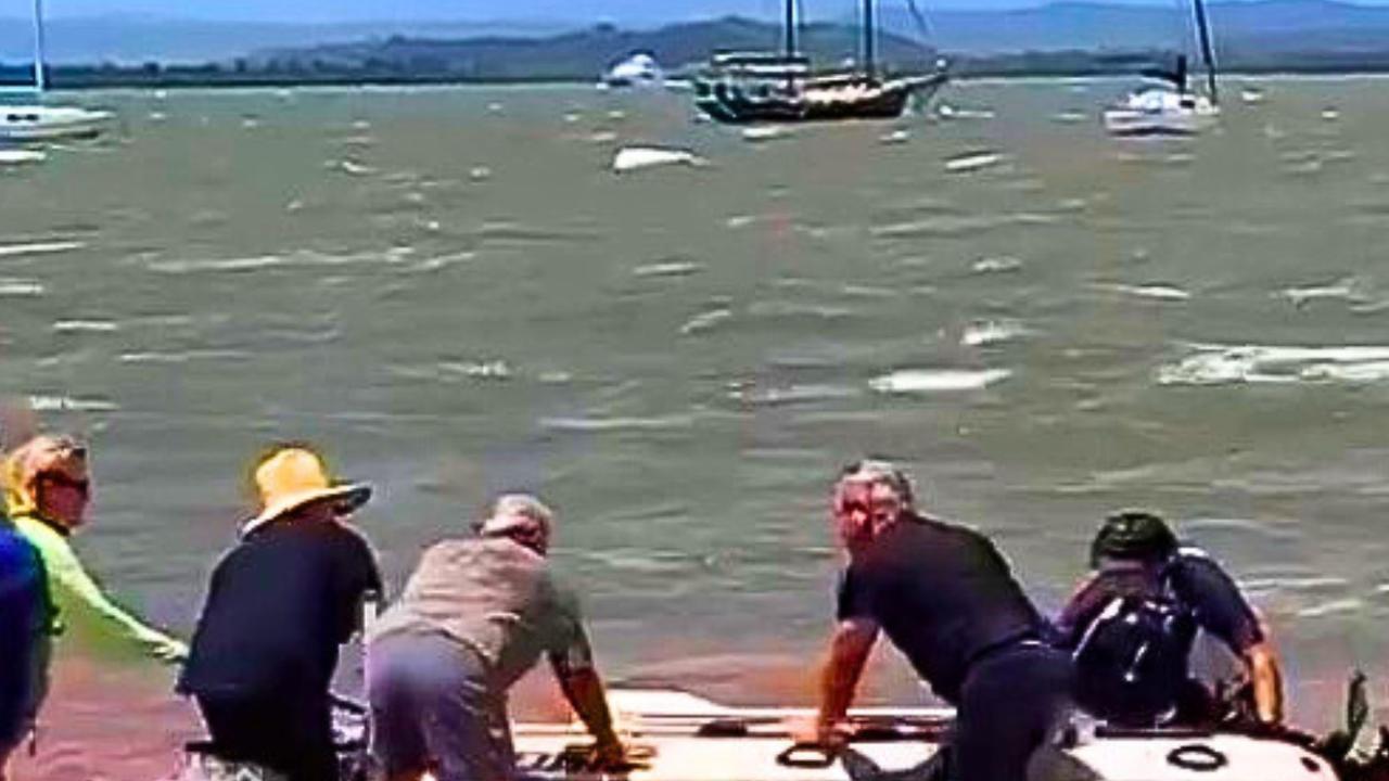
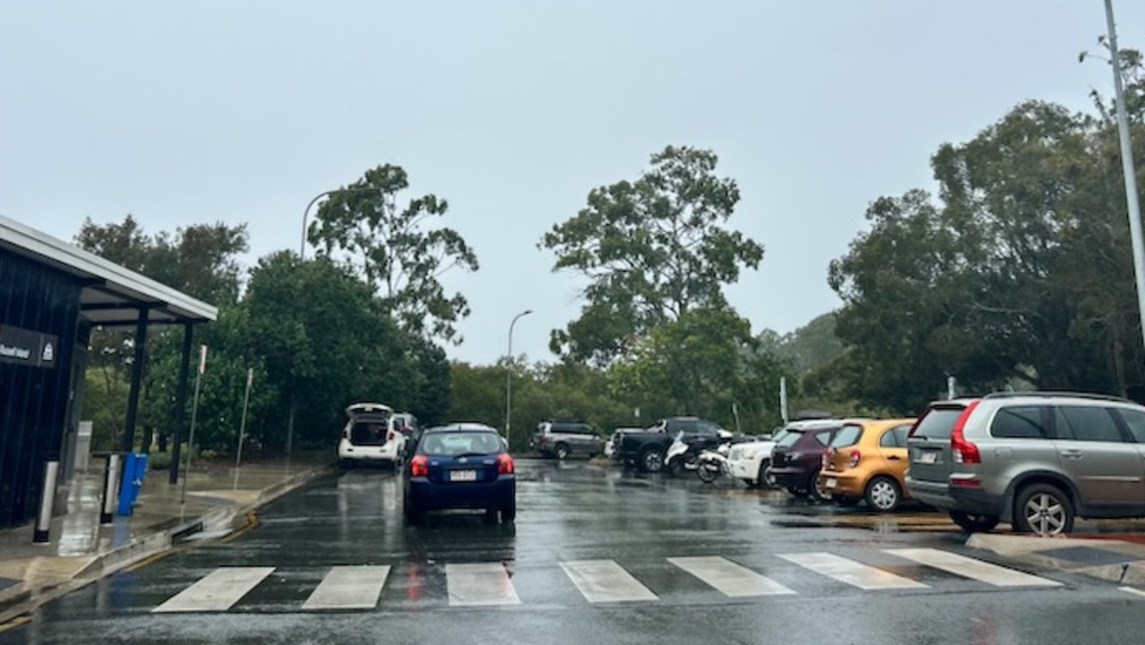
Boat owners along the Redland coastline, including those at Redland Bay, Victoria Point, Wellington Point, and all the bay islands, have been scrambling to secure their vessels ahead of the storm, with winds of more than.
Boats up on stands at Redland City Marina are being tied down with concrete blocks, while others on moorings at Redland Bay and near Coochiemudlo are being tied to mangroves or moved out of winds.
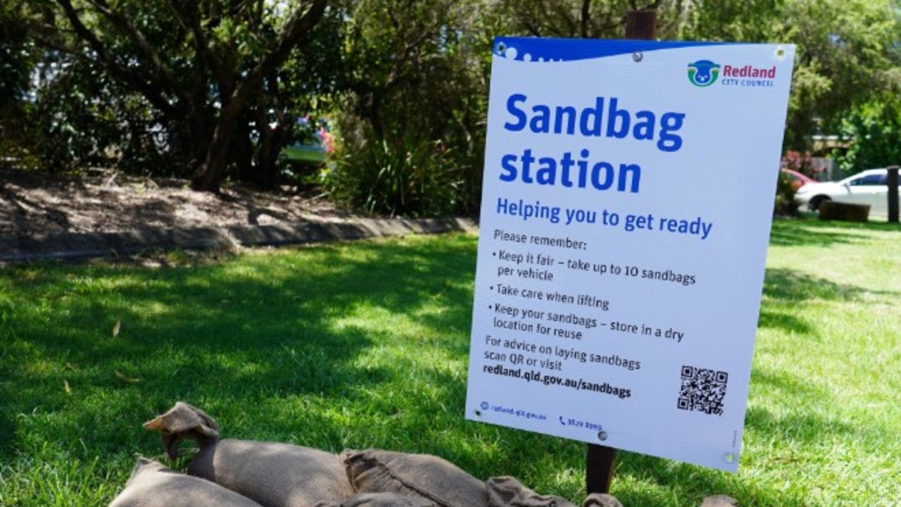
Redland City Council has urged coastal residents to collect sandbags today before the high tides hit. Today’s tides are expected to reach 2.6 metres at 12.40pm and 1.14am, while Tuesday’s tides will measure 2.4 metres at 1pm and 2.6 metres at 1.44am.
Large swells are anticipated on Wednesday, with the tide peaking at 2.1 metres at 2pm and 2.4 metres at 2.40am.

Sand bags are available at seven stations in Redland with a maximum of 10 bags per car.
Ferry operator Sealink, which services Macleay, Russell, Karragarra, Lamb, and Stradbroke Islands, has announced that its services will proceed as scheduled today.
However, Sealink general manager southeast Ben Renwick warned that disruptions could occur on Tuesday or Wednesday depending on the cyclone’s trajectory.
Sealink will continue to provide updates as more information becomes available and is set to meet with Redland City Council’s Local Disaster Management Group later today.
Residents living along the Logan and Albert Rivers are also preparing for extreme weather conditions with the Category 2 system packing sustained winds averaging 88 km/h and gusts reaching up to 125 km/h.
The Bureau of Meteorology issued a flood watch for the Logan River on Sunday, cautioning that heavy rainfall from Tropical Cyclone Alfred could cause major flooding from late Wednesday, with impacts likely to last through the weekend.
Tropical Cyclone Alfred is currently off the Queensland coast and is forecast to move southward parallel to the coastline before veering westward on Tuesday.
■ What should I pack? Cyclone safety guide
Logan City Council has issued a warning to residents, emphasising that widespread minor to major flooding is possible later this week, with significant localised flooding expected.
Heavy and locally intense rainfall is predicted from late Wednesday across southeast Queensland and northeast New South Wales, particularly south of the cyclone’s path.
The severe weather is expected to continue from Wednesday through the weekend.
With catchments ranging from dry to moderately wet, abnormal tidal surges will further elevate flood risks in coastal low-lying areas.
High sea levels and large waves are anticipated at coastal locations, exacerbating potential flooding impacts.
Minor to major flooding could develop along the Logan and Albert rivers from Wednesday night into Thursday, with the most extreme conditions depending on the cyclone’s final track.
Rapid river rises and flash flooding in smaller creeks are also likely, with widespread major riverine flooding a real possibility.
Along with the Logan and Albert rivers, catchments at risk of flooding include the Mary River, Noosa River, Sunshine Coast rivers and creeks, Pine and Caboolture Rivers, Upper and Lower Brisbane Rivers, and Gold Coast rivers and creeks.
The Bureau of Meteorology’s flood watch service warns that people living or working near the Albert and Logan rivers and creeks should closely monitor weather forecasts and updates.
The Logan Disaster Dashboard web page is providing ongoing updates, but concerns are growing about the city’s lack of an evacuation centre.
Logan currently has more than 2500 homeless residents and families living in tent communities, leaving many vulnerable as the cyclone approaches.
Community members are calling for urgent action, urging the council to push for an emergency evacuation centre to shelter at-risk individuals.
With just six days until the Beenleigh Show, many Logan residents are also hoping the cyclone’s impact will subside in time.
Redlands Coast residents are being encouraged to sign up for the Council’s free emergency notification messaging service ahead of the summer storm and bushfire season.
The Redlands Coast Alerts system provides updates on dangerous weather events, local flood warnings, and Bureau of Meteorology alerts via email.
SANDBAGS:
Main sandbagging station is at Capalaba Regional Park Car Park until 10pm with pre-filled sand bags at 13-19 Pittwin Rd N, Capalaba.
■ Redland Bay: Bayview Conservation Park, 487-503 German Church Road (Open 6:30am – 6pm daily)
■ Island Locations: Sand and bags are available at depots on North Stradbroke Island, Russell Island, Macleay Island, Lamb Island, and Coochiemudlo Island. Please bring your own shovel.
■ What should I pack? Cyclone safety guide
Originally published as Tidal surge warning as Redland, Logan prepare for 2.6m tides, big swells, winds
Join the conversation

‘Violence shouldn’t be downplayed’: Call to ban character references
Queensland’s Victims’ Commissioner has called for character references to no longer be considered by courts in all violent offences, not just rapists or those who perpetrate sexual assault.
Read more

Katy Perry swaps sequins for cartoon pups at iconic Brisbane attraction
Pop megastar Katy Perry has been spotted soaking up one of Brisbane’s most beloved attractions in between her two sold-out concerts, visiting the popular tourist attraction Bluey’s World.
Read more

‘Won’t buff out in a hurry’: Airbridge strikes plane at Brisbane Airport
A Qantas plane has been damaged after it was struck by an airbridge after landing at Brisbane Airport.
Read more

Manhunt for brazen car thief after fitness centre altercation
Police are on the hunt for an alleged car thief who stole a man’s vehicle outside a gym in Brisbane’s east.
Read more

$18m lifeline: Story Bridge footpaths to reopen
The Story Bridge’s crumbling footpaths will reopen to pedestrians, the Lord Mayor has confirmed, with funding and a timeframe locked in after they were closed with little warning in the days before Cyclone Alfred hit.
Read more

Man behind Asian mega-venue named as new Suncorp Stadium chief
The new general manager of Suncorp Stadium has been named as one of the key figures behind a brand new 50,000-seat South East Asia stadium with retractable roof, accommodation and shopping outlets.
Read more