
Severe weather system expected to bring more rain before heading south
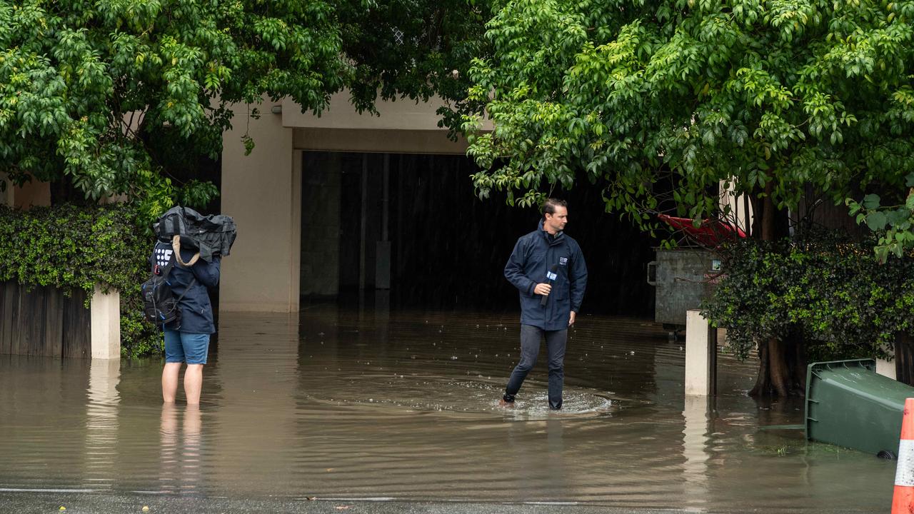
A severe weather system that caused the state’s 14th flood-related death in six weeks has dumped 350mm of rain on South East Queensland, triggering multiple emergency alerts, flash flooding and landslide warnings.
QLD News
Don't miss out on the headlines from QLD News. Followed categories will be added to My News.
Almost 350mm of rain was dumped on the southern Gold Coast on Monday, including 150mm in just six hours overnight, as a deadly weather system that claimed a man’s life near Toowoomba moved south.
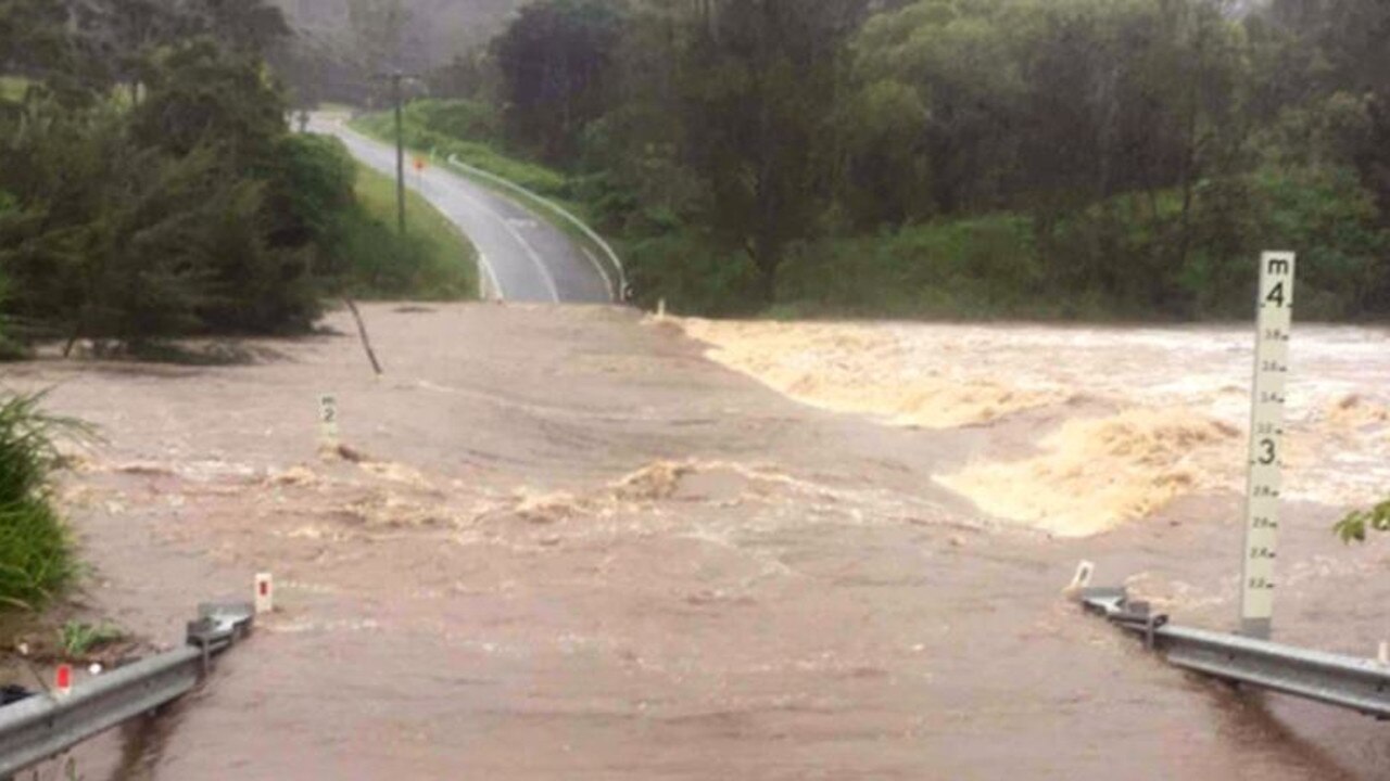
Flood warnings were issued on Tuesday morning for the Logan and Albert Rivers, and Gold Coast streams, while at 10am the Bureau of Meteorology cancelled the severe weather warning for Queensland, saying the immediate threat of severe weather had passed.
Flood watches and warnings were still current for parts of southern Queensland, and the bureau will monitor the situation as the day unfolds, with minor flooding expected along the Albert River at Wolffdene, with river rises likely along the Logan River across the day.
Major flooding is likely along the Condamine River downstream of Warwick to Loudoun Bridge.
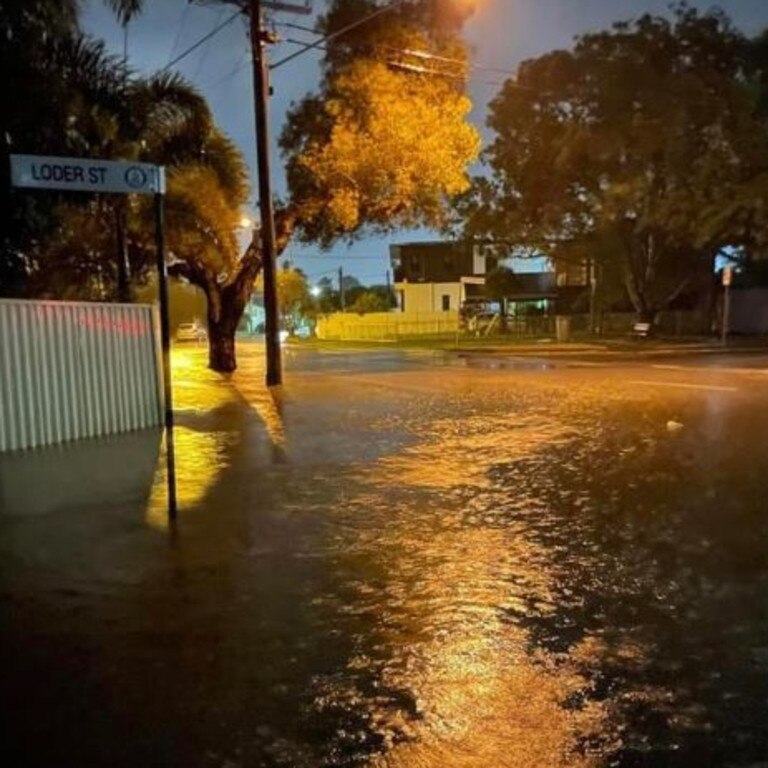
Multiple emergency flood alerts were issued early this morning, including for Loders Creek near Southport at 1.30am and Tallebudgera Valley at 1.55am.
They have since been cancelled.
There were warnings of life-threatening flash flooding across the Gold Coast, as 149mm fell at Coplicks Bridge, Tallebudgera, and 143mm at Oyster Creek, Burleigh Heads, in six hours.
Since 9am Monday, Coplicks Bridge recorded 347mm, Burleigh Waters 296mm, Tallebudgera Creek 287mm and the Gold Coast seaway 291mm.
Further north, the totals were just as extreme, with 272mm both on North Stradbroke Island and at Couran Point.
Tallebudgera State School is closed today due to major flooding in the area.
The search for a man feared swept away in floodwaters has resumed more than 24 hours after he went missing near Pittsworth, south of Toowoomba.
Just after 6am on Monday, emergency services were called to reports two vehicles had become stuck in floodwaters at a creek crossing at North Branch.
A woman in one of the vehicles was helped to safety by members of the public.
But a man in his 40s was reportedly swept into floodwaters as he tried to get out of his vehicle.
Police and swift water rescue crews returned to the scene on Tuesday morning to search floodwaters for the man.
Overnight, swiftwater rescue teams were called to three minor incidents involving vehicles in floodwater at Beenleigh, Arundel and Oxenford.
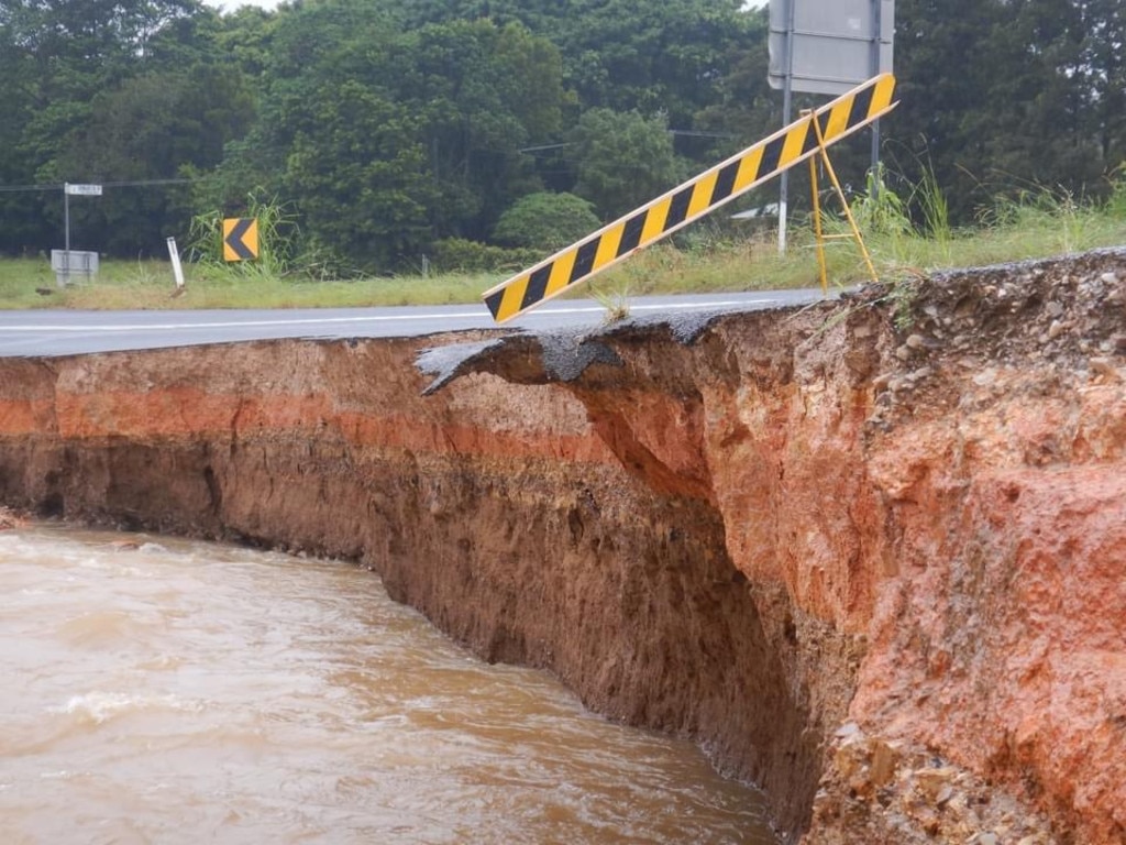
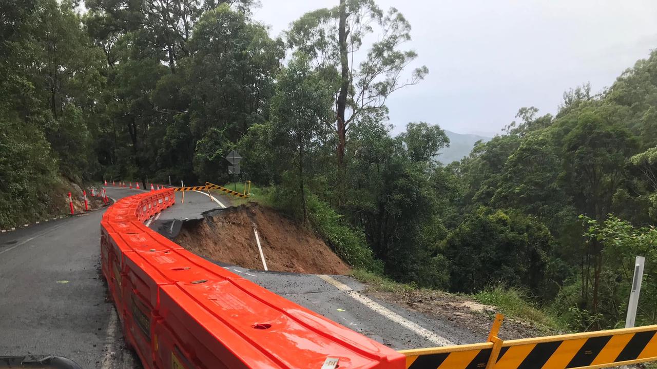
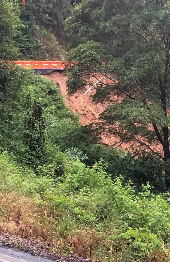
In the Gold Coast hinterland, another massive land slip hit Beechmont Rd, which was already badly damaged and reduced to one lane from last month’s flood.
“The one lane, that was sinking on Beechmont Road, recently closed, has now completely subsided,” a local warned on Facebook.
“Don’t take any risk …”
Landslips have also occurred on other roads including Tomewin Rd on the Queensland-NSW border and Scenic Drive at Bilambil Heights near Tweed Heads.
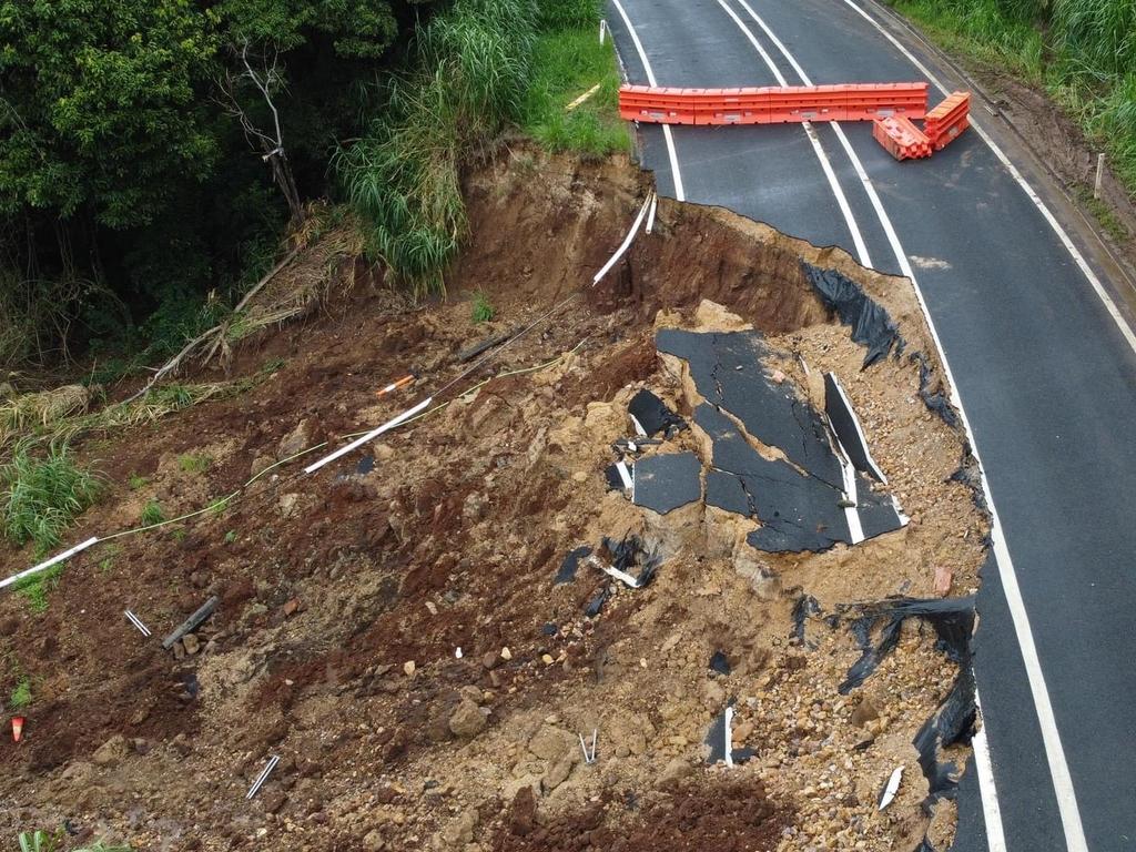
Tweed Shire Council said it planned to carry out geotechnical assessments to come up with solutions to stabilise the badly damaged road.
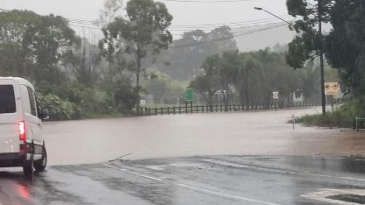
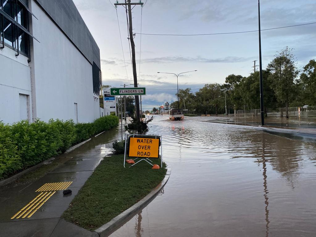
About 30 roads were closed on the Gold Coast due to flooding and more than 1400 sandbags were collected by flood-affected residents.
“City crews will be going out this morning to assess damage and begin any clean up works required,” a City of Gold Coast spokeswoman said.
The SES also received 240 calls for help across the state including more than 100 in the southeast region, 76 in Brisbane and 48 in the southwest including Toowoomba.
A Bureau of Meteorology spokesman said there were areas of the Gold Coast that received 110mm in two hours.
They said the risk remained for heavy rainfall around the Gold Coast.
“People should pay extra attention to the weather today and then first up tomorrow,” he said. “Flash flooding can occur with minor notice.”
The Bureau of Meteorology issued an updated severe weather warning at 4.55am Tuesday with heavy rain and possible flash flooding likely to continue this morning from south of Jimboomba to east of Warwick.
Coastal areas could be hammered with another 180mm of rain, with damaging wind gusts.
The ongoing intense rainfall will leave behind the risk of landslides and flooding after dumping significant totals on catchments already saturated in floods last month.
There were reports from the Gold Coast late last night of homes going under and people sandbagging properties. Others were flooded in.
Meanwhile, residents in flood-ravaged Lismore were ordered to evacuate in anticipation of returned flash flooding as the trough tracks south.
Just over the border there were reports of authorities doorknocking to tell people to prepare to leave.
Evacuation centres were open in Kingscliff, Lismore, Mullumbimby, Murwillumbah, Ocean Shores and at Banora Point.
Meanwhile in Brisbane, Moreton Bay and the Redlands, thousands of homes were without power after strong winds brought down lines.
Cleveland line trains were suspended between Wellington Point and Cleveland stations when wild weather caused a tree to fall across tracks.
Police last night said lanes of the Warrego Highway between Marburg and Minden were closed due to large rocks on the road and an accident.
Flash flooding on Monday claimed the life of a man in Queensland and several dogs found dead in a vehicle swept into floodwaters outside Toowoomba on Monday morning.
Police Acting Superintendent John Bosnjak said the NSW man had been operating a pet transportation business with a woman who was driving the vehicle.
She escaped without injury.
“They were travelling from North Queensland down into New South Wales, stopped overnight around the Toowoomba area and managed to get into floodwater,” Superintendent Bosnjak said.
“The male person was stuck in the vehicle and couldn’t get out,” he said.
It’s the 14th flood-related death in southern Queensland in six weeks.
State Emergency Services by Monday afternoon had responded to more than 80 requests for assistance since Sunday afternoon. Swift water rescue crews had conducted at least nine rescues around the Darling Downs.
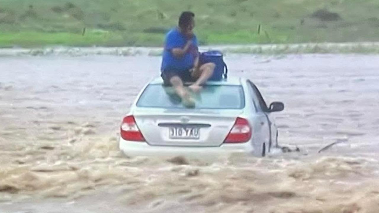
Two people were rescued early on Monday evening night after they drove through flood waters near Toowoomba.
A swiftwater rescue team saved the pair who were found sitting on top of their car on Felton Clifton Rd, between Felton and Nobby, about 6.20pm.
It took emergency services about half an hour to rescue them, bringing them to dry ground just after 7pm.
Queensland Ambulance Service attended the scene but the pair did not require hospitalisation.
Superintendent Bosnjak said it was disappointing that people weren’t heeding warnings not to enter floodwater.
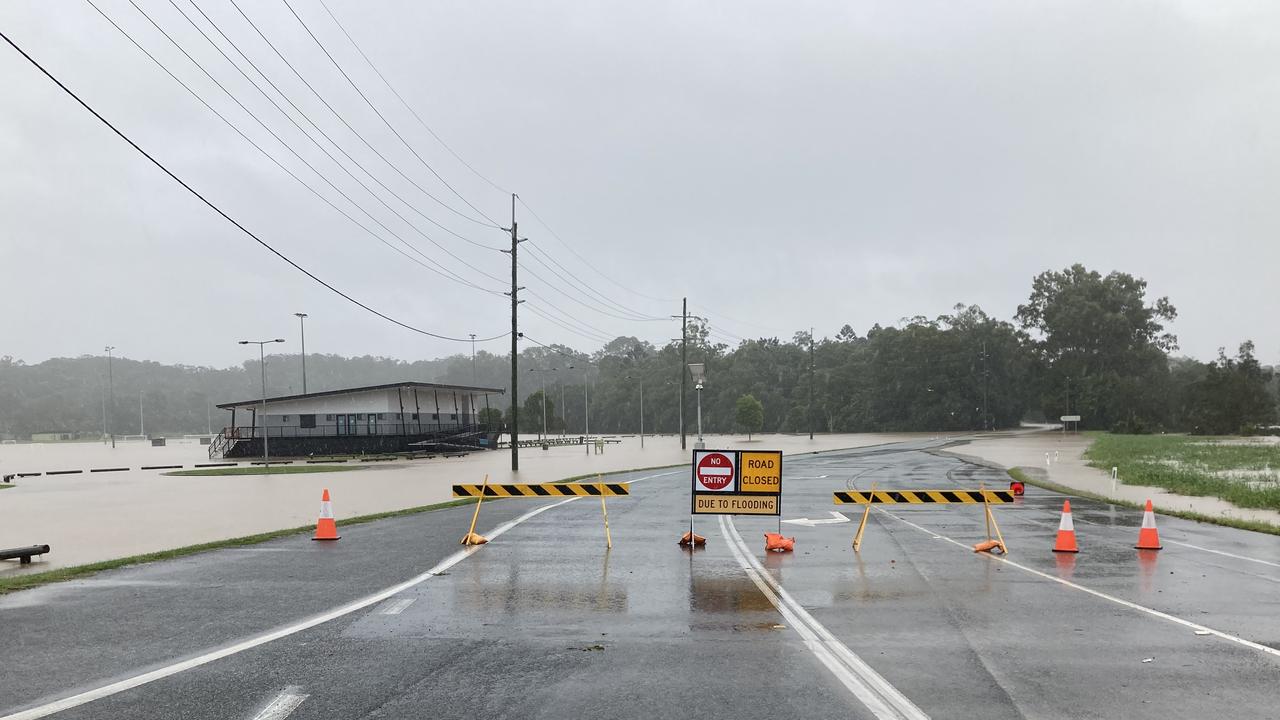
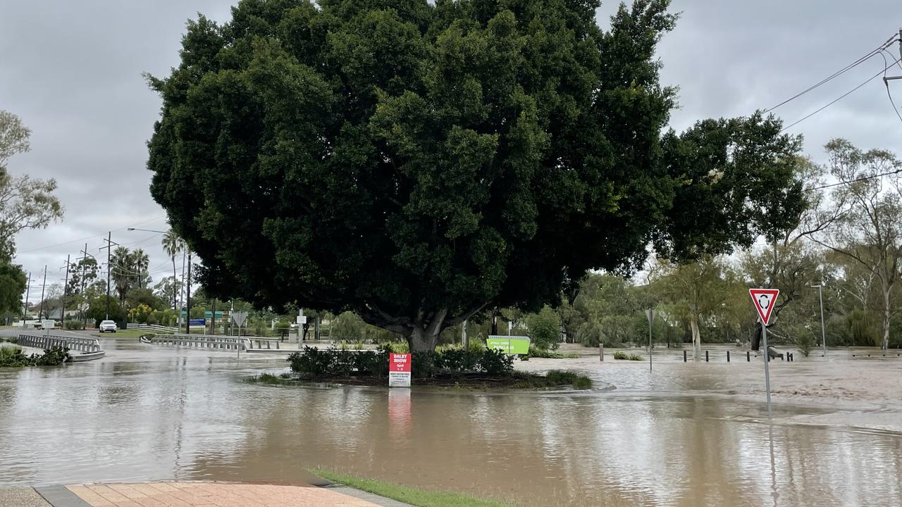
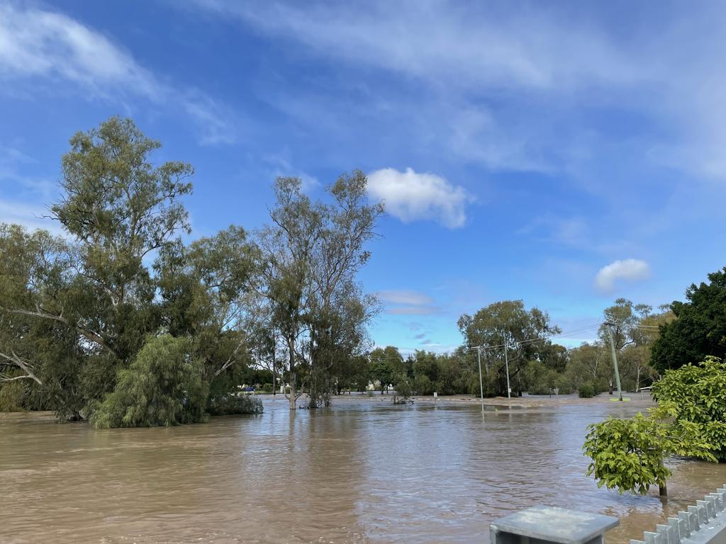
Major flooding has peaked along Myall Creek at Clydesdale and Dalby, and the water should recede this morning. Several other minor and moderate flood warnings are current.
The Western Downs Regional Council released vision of last night’s flooding in Dalby.
In a statement, the council advised the Myall Creek at Dalby peaked overnight at around 3.6 metres.
The Charles Drew Bridge is open to traffic this morning under lane and traffic control and residents needing to cross the bridge are asked to be patient and drive with caution.
There is still plenty of water around local streets and roads and residents are urged to obey all road signage and keep out of floodwaters.
As roads begin to reopen, residents are reminded to remain vigilant for flood damage and drive to the conditions.
Four homes have been inundated by floodwaters across Dalby and many residents sought refuge at evacuation centres, as Myall Creek reached major flood levels in the early hours of Tuesday morning.
Dalby residents prepared for the worst last night after receiving an emergency alert for major flood levels.
Rainfall overnight in Dalby was just 0.2mm but heavy inflows sent floodwaters spilling into the streets of Dalby impacting four homes and some businesses.
The creek was currently steady and sitting at 3.2m, and the Bureau of Meteorology predicted it may fall below the minor flood level (2m) overnight Tuesday.
The heaviest falls on Monday were recorded along the coastal strip, with up to 100mm falling within six hours at Stradbroke Island.
Jonathan How from the Bureau of Meteorology said more six-hourly totals of up to 200mm were possible overnight Monday, which could lead to flash-flooding.
“And because many catchments across South East Queensland are so saturated, there is an increased risk of flash-flooding as well as landslides across the next 24 to 36 hours,” Mr How said. “We’re expecting minor to moderate flooding through several areas and possible major flooding as well. This does include communities which were impacted by severe weather and this does include Brisbane River, rivers and catchments around the Sunshine Coast, as well as the Gold Coast.”
Thousands of people were without power late on Monday night, with wind gusts bringing down power lines.
Meanwhile, a developing low in the southern Coral Sea is expected to produce significantly easterly swell of up to 3.1m on Tuesday afternoon.
“The strength of the swell will be highly dependent on the position of the low, but at this stage the Sunshine Coast is less likely to be affected (easterly swell below 2.5 metres), with coasts south of Cape Moreton more likely to be affected,” a hazardous surf warning from the bureau stated.
Lifeguards have closed all Gold Coast beaches due to dangerous surf and flood debris washing out of river mouths and creeks.
Conditions are expected to ease by early Wednesday morning.

Originally published as Severe weather system expected to bring more rain before heading south

Little Grace was given no hope – now just watch her dance
Grace was given little chance of ever taking her first steps but the tiny battler is now miraculously dancing into the future. WATCH THE VIDEO

Aussie musician lost feeling in her limbs – you should see her now
After a devastating diagnosis, this Aussie musician has found new purpose.

Elite Brisbane school’s shock swim club call amid coach’s legal stoush
The prestigious swim club of an elite school has been sensationally axed, just months after its sacked head coach took legal action.

‘It’s too late, goodbye mate’: Dad’s devastating final call to son
The heartbroken son of a man who died of a heart attack while on the phone to him has shared his father’s devastating last words.

Bashed, stabbed and spat on: Qld’s deadly $70m bus safety fail
Queensland bus drivers are being bashed, stabbed and spat on as violence on the public transport network spirals out of control.

‘State of Origin on steroids’: Brisbane buzzing ahead of rugby showdown
Brisbane was heaving as thousands of rugby fans packed pubs and bars across the river city.