
Qld weather: Sandbag depots prepped as Brisbane braces for days-long deluge
Brisbane City Council has prepared sandbag depots with residents warned to expect flooding as an outback Qld town records its highest rainfall total in 142 years.
QLD News
Don't miss out on the headlines from QLD News. Followed categories will be added to My News.
Brisbane is bracing for a deluge of rainfall in the coming days, with council making sandbags available for residents in low-lying areas prone to flash flooding.
The Bureau of Meteorology has forecast heavy rainfall in Brisbane for later this week and over the weekend, with daily falls up to 40mm possible on Friday and Saturday, while isolated daily totals up to 120mm are possible.
Senior meteorologist Christie Johnson said there was a chance of flash flooding in parts of Brisbane.
She said isolated totals of up to 120mm were possible.
“On Friday it’s probably going to be in that 20 to 40mm range, but there could be some locally heavy falls up to 50 to 70mm through parts of South East Queensland,” she said.
“As the heavier rainfall moves south there is the risk of thunderstorms, so we could definitely see some localised flash flooding.”
Ms Johnson said while the southeast was not expecting as much rain as in the wake of Tropical Cyclone Alfred, residents were advised to be on alert.
“We may see some river rises, so we are assessing the need for a flood watch everyday as we get close to the event,” she said.
“At this stage it’s not expected to be a significant event because of the short duration, and it will probably be more localised heavy rainfall rather than widespread heavy rainfall.”
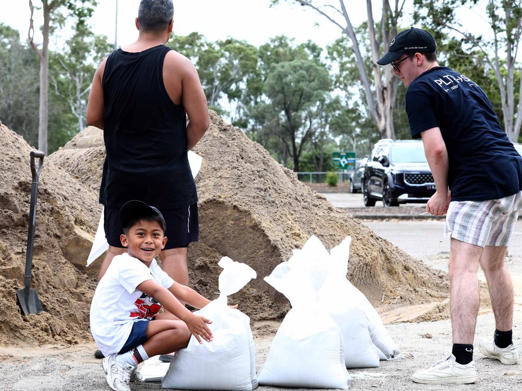
Brisbane City Council warned locals in low-lying areas that are prone to flooding to prepare, with sandbags being made available at depots including Darra, Morningside, Newmarket, Zillmere and Lota.
Operational releases are under way at Somerset Dam to transfer water to Wivenhoe Dam.
The lake level in Wivenhoe Dam is not expected to increase by more than 0.5 metres due to the operational releases, however Seqwater has not ruled out further releases into early next week.
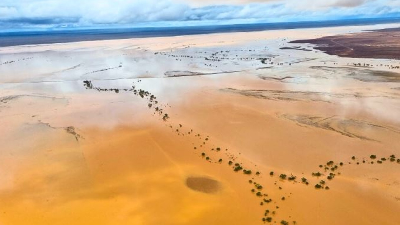
As South East Queensland prepares for the deluge of rainfall, an outback Queensland town has had its wettest March in more than 142 years of records.
In the 24 hours to 9am on Wednesday, Winton saw 158.2mm of rain, bringing its monthly rainfall tally to 279mm.
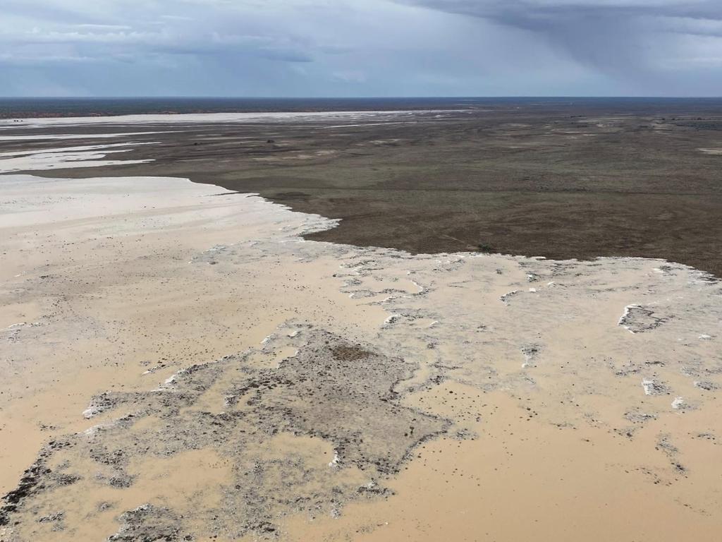
The previous March record of 249.8mm was from 2018, with records being kept in the town since 1884.
Stonehenge, southwest of Longreach, has recorded 203mm in the past 24 hours, making it the wettest day for the area, since February 20, 1979.
There were several other areas in outback Queensland that recorded significant rainfall with 230mm falling at Bogewong, which is near Longreach, while 154mm fell into gauges at Florence Creek, just south of Cloncurry, in the 24-hours to 9am on Wednesday.
Ben Hall, the mayor of Quilpie - about 1000km west of Brisbane - called for the Bureau of Meteorology to fix the “weather mapping black hole” that left vital graziers and farmers guessing what the weather will be.
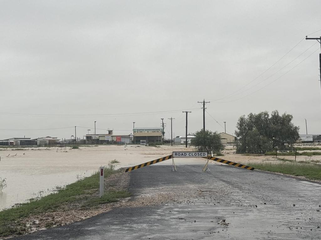
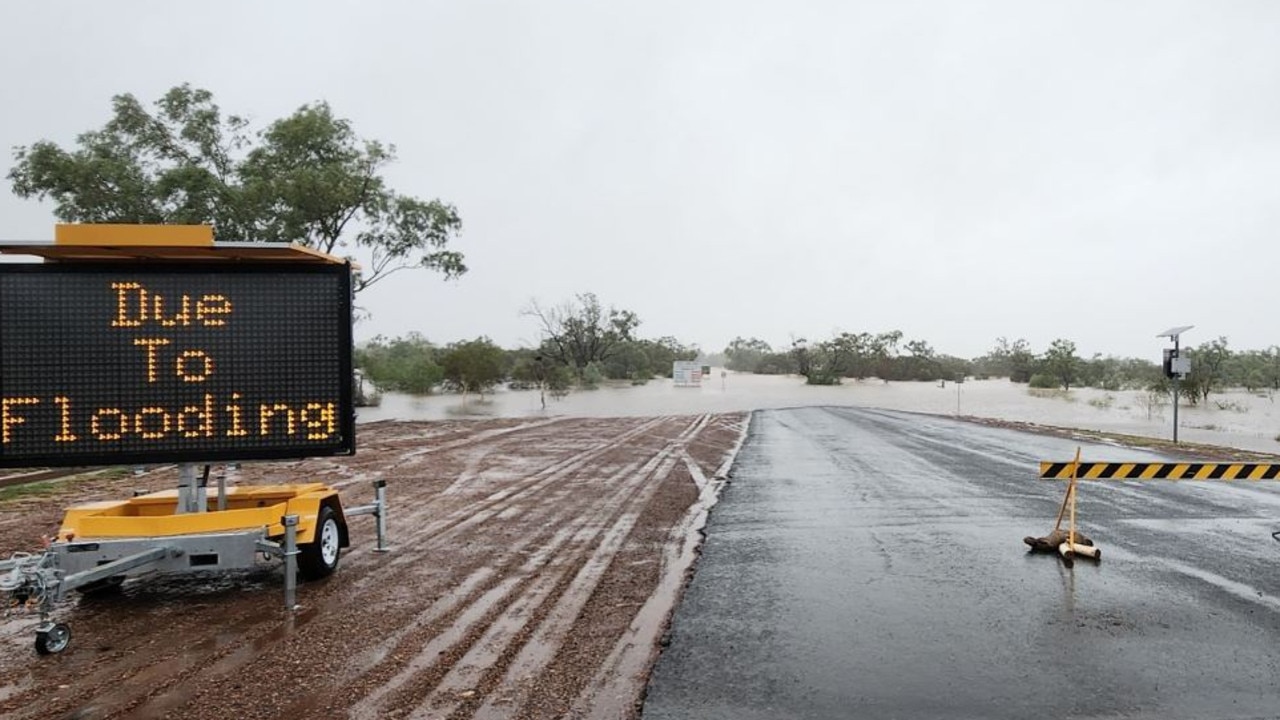
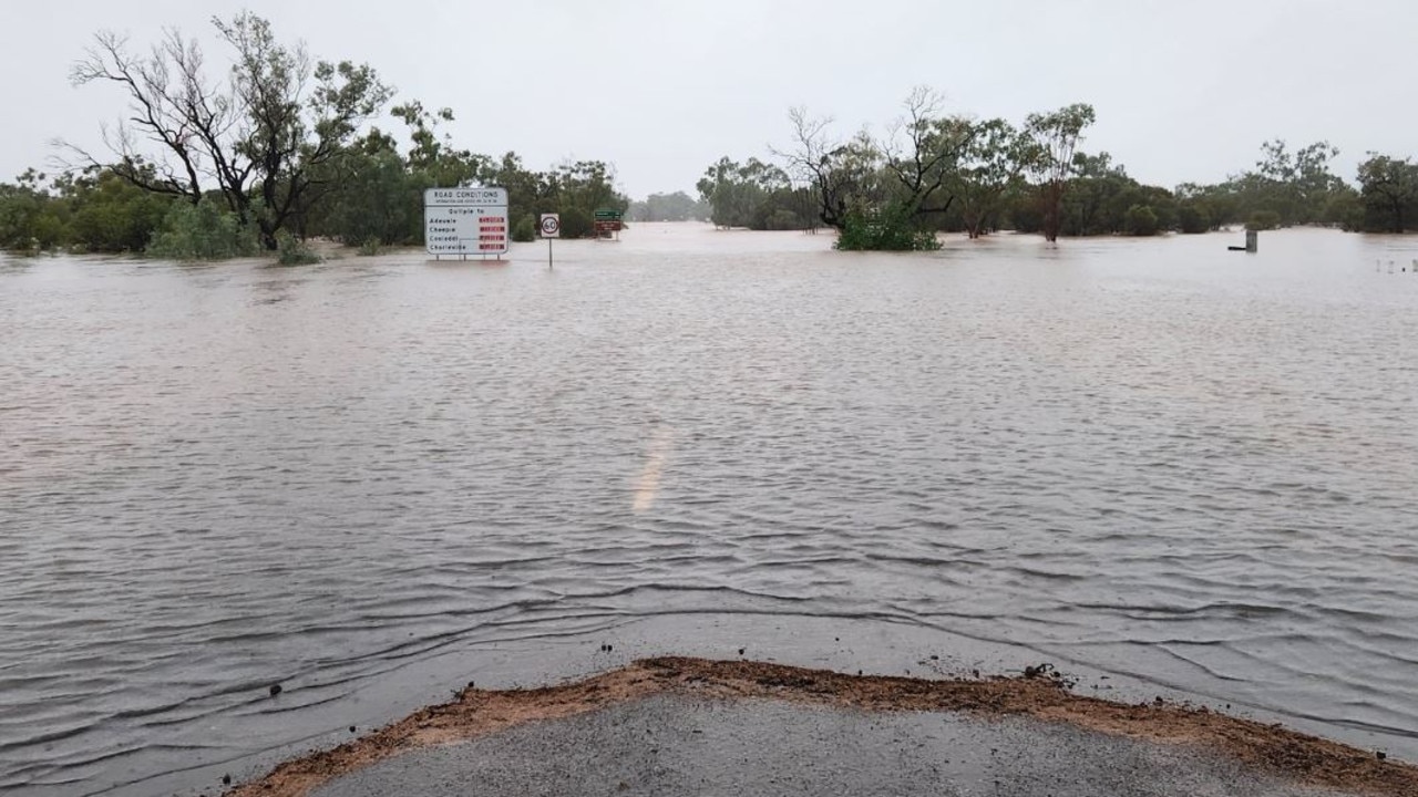
The weather bureau issued several flood warnings on Wednesday afternoon for towns in the central west, with roads closures impacting multiple regional townships.
All major roads leading out of Quilpie, Windorah, Jundah, Stonehenge, Eromanga and Birdsville are completely cut off due to flooding, while roads leading out of Charleville and Longreach are limited.
Heavy rainfall over the past few days across the Paroo River catchment has resulted in dangerous and rapid river level rises. Major flooding is likely to develop at Eulo during Thursday and moderate flooding could develop at Hungerford on Friday.
Major flooding is expected to impact Giru from Wednesday evening. The Haughton River is likely to exceed the major flood level and could reach 2.80 metres overnight Wednesday into Thursday.
Moderate to locally heavy rainfall along the Bulloo River has resulted in river and creek level rises, with major flooding now occurring at Quilpie by Wednesday night. Further rainfall is expected to continue over the next few days.
Major flooding is occurring at Stonehenge, Jundah, Retreat and Windorah, with further river and creek level rises expected.
River rises along the Western River are impacting Winton, with major flooding possible from Wednesday evening and further rises likely.
Major flooding could occur at Marion Downs from Thursday, with river and creek level rises observed along the Georgina River and Eyre Creek.
A severe weather warning remains in place for people in parts of Central Highlands and Coalfields, Central West, Channel Country and Maranoa and Warrego.
Rainfall in Quilpie began on Sunday evening with initial forecasts predicting 5-6 mm of rain and since then more than 200mm of rain has hit the region, with a catastrophic 340mm falling in nearby Belombre, more than the devastating 2010 floods.
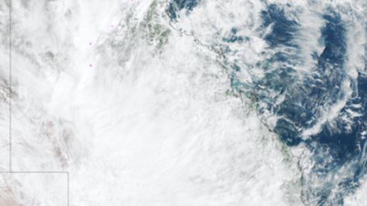
It comes after the whole state was blanketed by thick cloud amid an ongoing statewide-deluge that has seen some places receive a year’s worth of rain in just days.
As a slow-moving upper-level trough interacts with a stream of tropical moisture, cloud and rain combined to produce two main effects at ground level.
Weather bureau senior meteorologist Angus Hines said the central west had been hit the worst since 9am Tuesday.
The Maranoa and Warrego districts also received significant rainfall.
North Queensland received the heaviest coastal rainfall in the past 24 hours, with 145mm at Rollingstone and 142mm at The Pinnacles, and 115mm in Townsville.
Mr Hines said significant rainfall would move south in the coming days, with the worst arriving on Saturday.
“It could be a very wet day for coastal areas from Yeppoon all the way down to Bega in southern NSW,” he said.
“Of course this includes both Brisbane and Sydney.”
Mr Hines said major flood warnings remained in place for the Georgina, Thompson, Barcoo and Bulloo rivers and Cooper Creek in central and western Queensland.
“Most significant rivers through the centre and west of the state are experiencing or expecting some flooding today or in the coming week,” he said.
There are also moderate flood warnings in place for the Haughton River and Bohle River, which could be upgraded if further rain impacts the region.
Mr Hines said there were severe thunderstorm warnings in place for parts of Townsville overnight, and some severe warnings remain in place for inland areas.
Intense rainfall with thunderstorms is possible across the Central West, with places like Winton in the firing line.
Bogewong, northeast of Stonehenge copped 173mm in the six hours to 3am.
“It is possible that severe thunderstorm warnings could be issued if that storm activity ramps up again during Wednesday,” he said.
Originally published as Qld weather: Sandbag depots prepped as Brisbane braces for days-long deluge
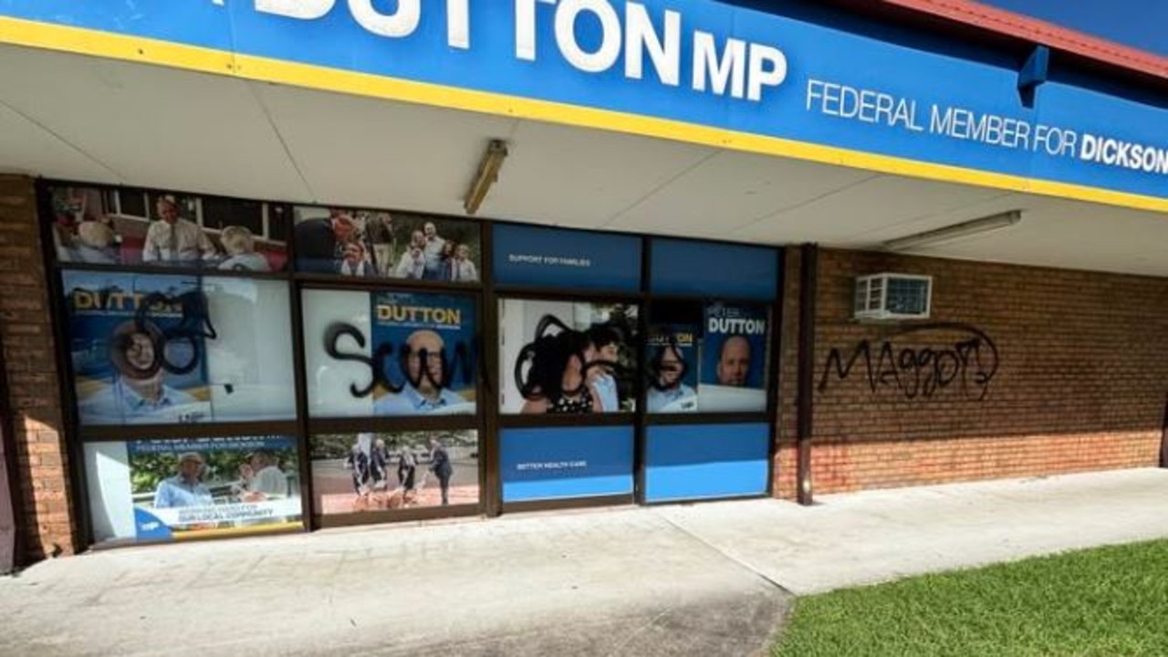
‘Maggot, scum’: Vandals target Dutton Brisbane office
Vandals have defaced one of federal Opposition Leader Peter Dutton’s electoral offices in Brisbane’s northern suburbs.
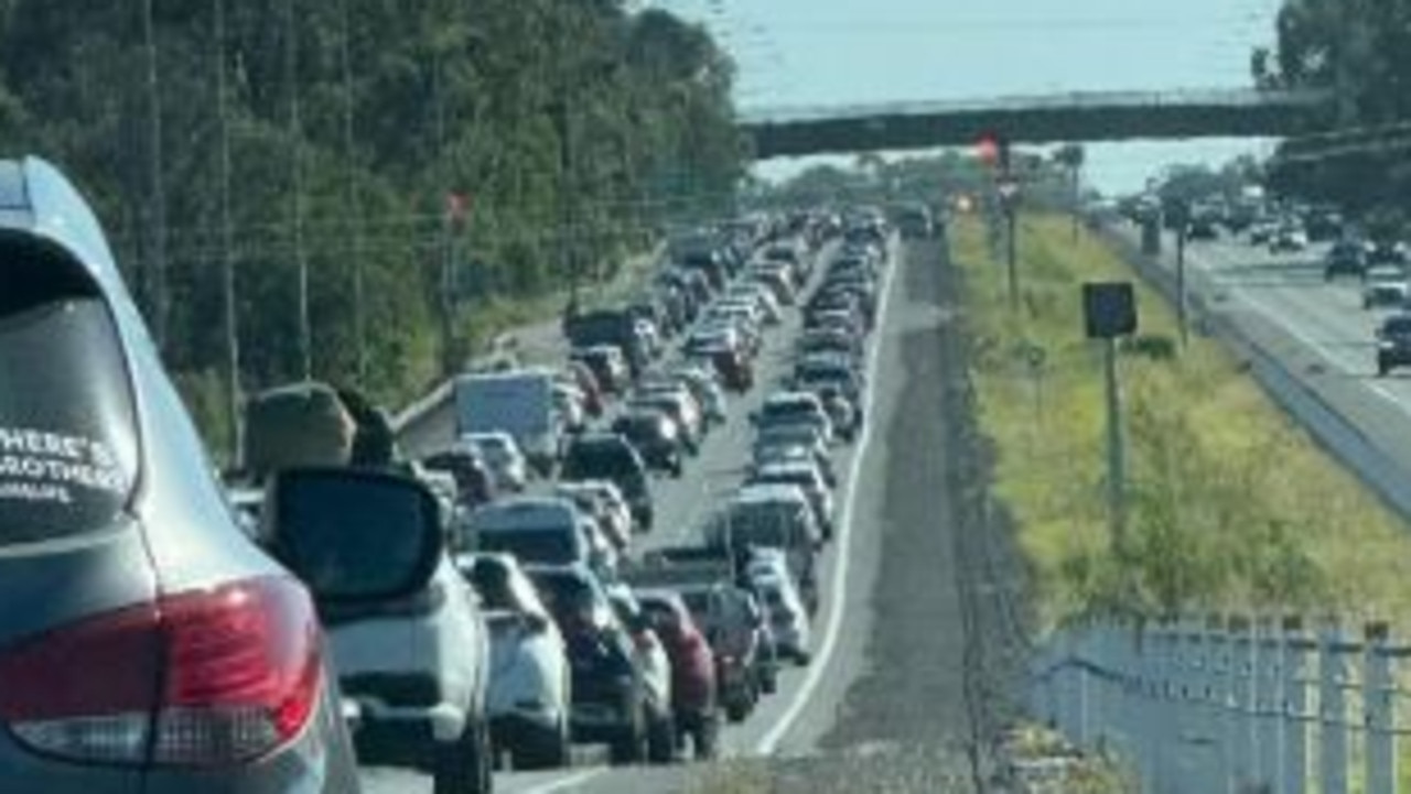
Easter traffic madness continues after Bruce Hwy crash
Motorists heading out of Brisbane are again facing massive delays after a crash on the Bruce Highway north of the city.

Watch: Accused armed robber’s hiding spot no match for police
A man charged over an armed robbery has been arrested by police at a home in Brisbane’s southwest.

Three in hospital after boat capsizes off Gold Coast
Three people have been taken to hospital on the Gold Coast after a 6.5m boat capsized off Main Beach this morning.

Gold medal maker’s return in doubt as new gig revealed
Hopes of a renowned ‘gold medal maker’ returning to lead the Queensland Academy of Sport have been dashed by her appointment to the board of another sporting body.

One hurt in caravan blaze, others injured in car crash
From an e-scooter incident to a caravan fire, car crash and buggy rollover, emergency crews in Rockhampton and Gladstone have been called out to several separate emergencies.