
Qld weather: Inside the tiny Qld town swallowed by an inland tsunami
An entire outback town is underwater after being smashed by record rainfall last week, as many other communities brace for the same.

QLD News
Don't miss out on the headlines from QLD News. Followed categories will be added to My News.
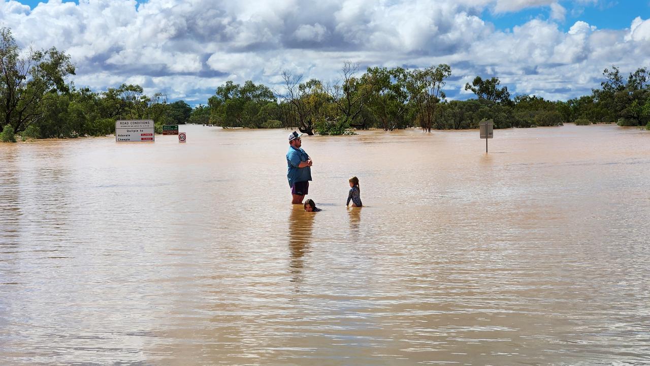
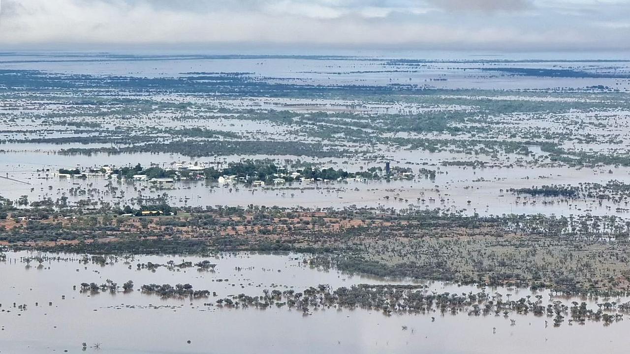
Queensland’s isolated outback communities are on high alert while the state’s southeast was drenched by heavy rainfalls causing flash flooding, multiple rescues and power outages.
Premier David Crisafulli said flooding was widespread across Queensland with communities cut off and water yet to hit many communities.
Mr Crisafulli said the small towns of Adavale and Jundah were the government’s big focus.
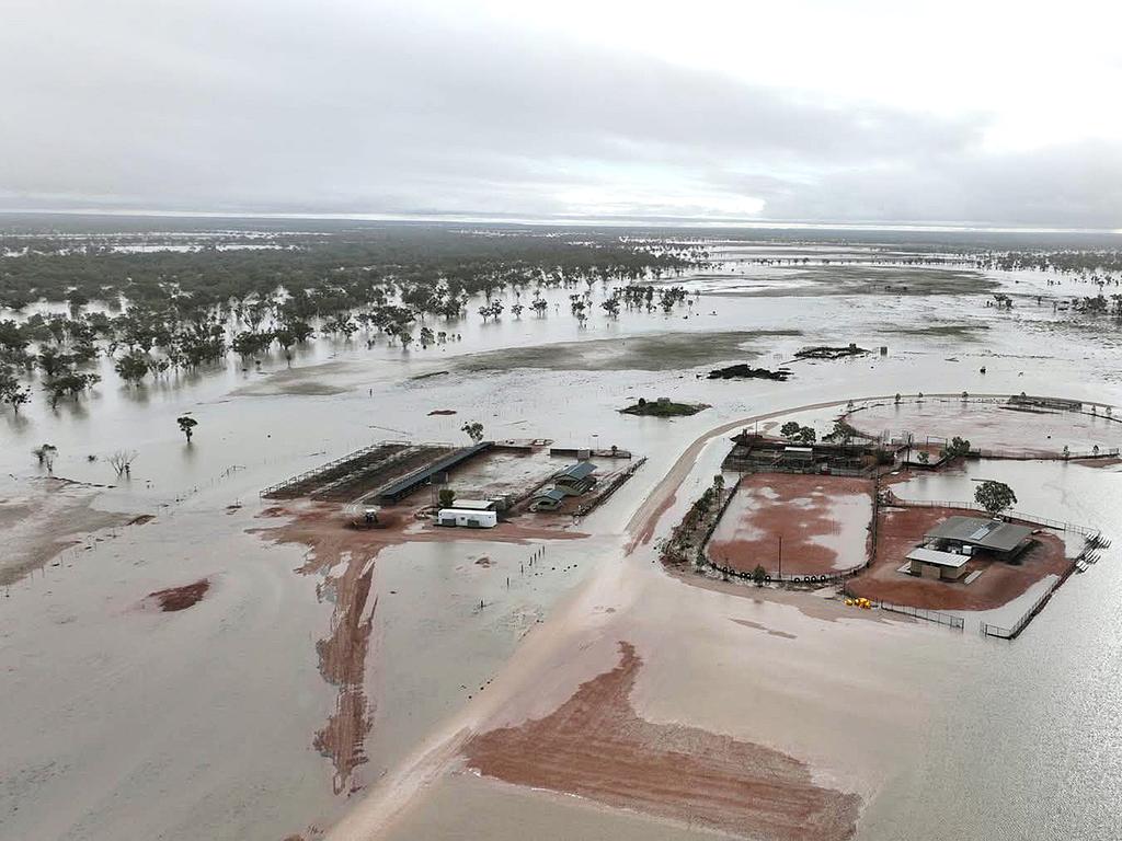
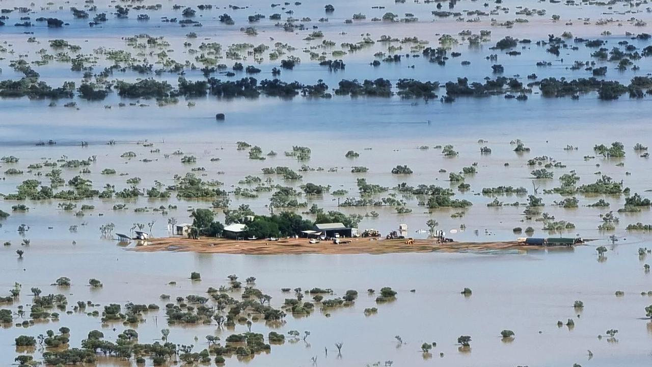
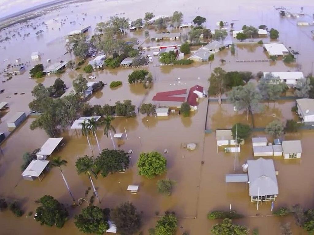
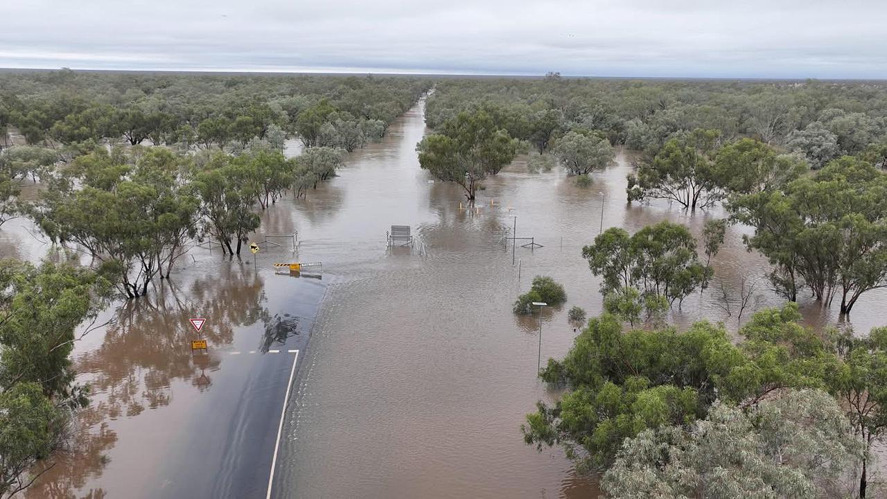
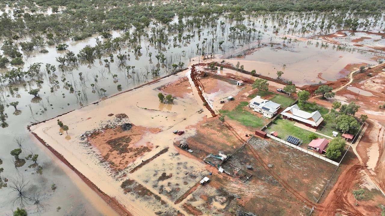
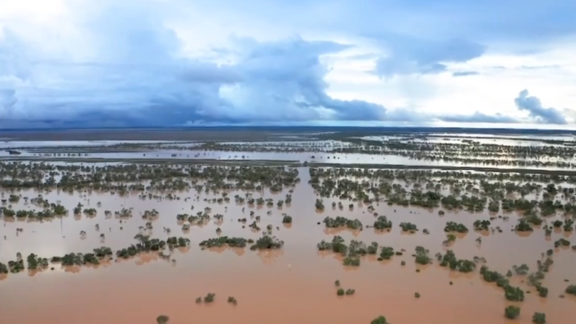
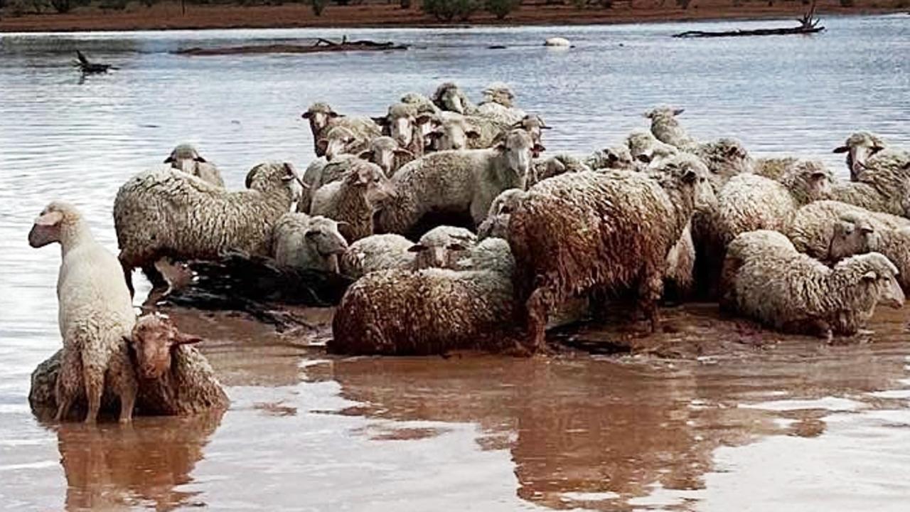
The entire town of Adavale was underwater on Saturday after being smashed by record rainfalls throughout the week – worse than the 1974 floods.
Across the region there were six schools closed and work is underway to get towns reconnected to power.
While the rain was easing Sunday morning, Mr Crisafulli said the movement of water would soon affect other communities, like Thargomindah.
“Due to the volume of water that are in many of the catchments a number of communities are yet to see the worst of the flooding event today,” he said.
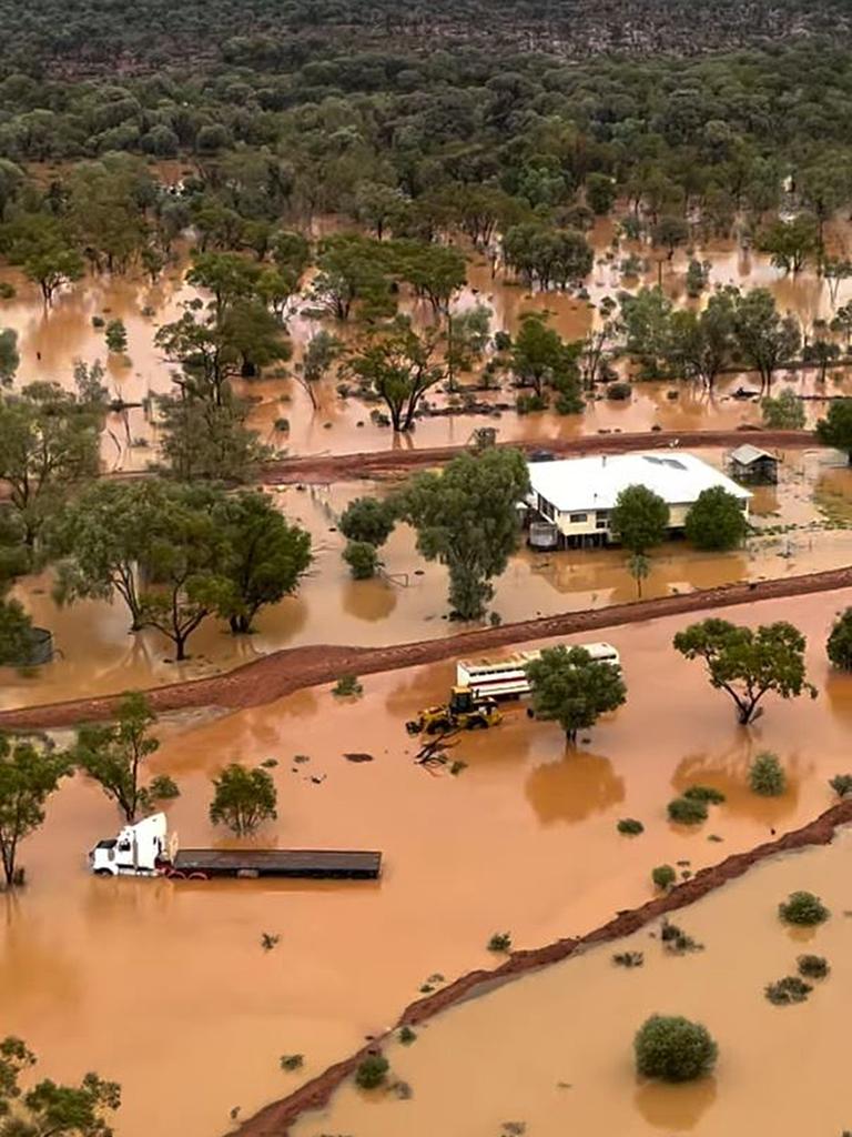
Stock losses have hit tens of thousands and fodder drops are now the government’s focus to avoid starvation.
“I have to give an incredible shout out to those private chopper operators who have been doing the power of work to make sure that wherever it’s humanly possible, they are getting fodder to those handful of dry areas, and ensuring that when the stock get to there that they have something to eat,” he said.
He said the region provided things we “take for granted” such as meat on supermarket shelves and a major contribution to Queensland’s economy.
By noon Sunday major flood warnings remained for Bulloo River, Finders River, Georgina River and Eyre Creek, Paroo River, Thomson and Barcoo rivers and Cooper Creek and the Warrego River.
The Thomson River had earlier peaked at around 9m, which is above both the 1955 and 1974 flood levels at Jundah, while Cooper Creek at Windorah may pass the January 1974 flood level and reach 9m on Monday.
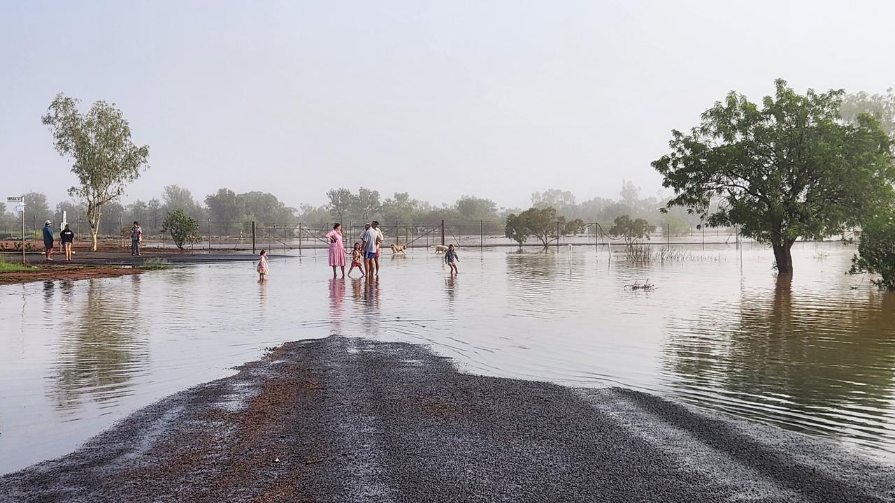
Jundah had been mostly evacuated by Saturday night but residents who decided to stay were being monitored by authorities.
The river was expected to remain above the major flood level of 5m for the remainder of Sunday and into Monday, whilst the Barcoo River at Retreat was expected to remain above its major flood level of 8m over the remainder of Sunday and into the early part of next week.
BOM predicts more rainfall across these catchments throughout the middle of next week, possibly resulting in small river and creek level rises which have the potential to prolong the current flooding.
Towns near Thargomindah were on high alert on Saturday afternoon with Bulloo Shire Council preparing a temporary levee bank.
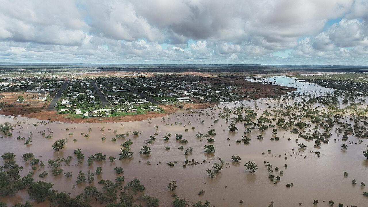
On Sunday the Bureau said major flooding was still occuring at Quilpie but slowly easing, after a major flood peak was observed overnight.
The Bulloo River at Quilpie was sitting at 6.43m just before 10am and falling. The major flood level is 5m, with the Bureau expecting the level to stay above 5m for the next few days.
Major flooding continued to rise along the Bulloo River downstream at Thargomindah and Autumnvale.
The river was sitting at 6.45m and rising at Thargomindah just before 10am Sunday. The major flood level there is 5m, with the possibility of it peaking around 6.6m Sunday evening.
By 11.30pm Saturday there was major flooding at Tiaro, where the Mary River was sitting at 12.29m. The major flood level there is 12m.
Major flooding was occurring along the Paroo River at Eulo and Humeburn
The river at Eulo was expected to peak above the 2010 flood levels (6.27m) by Monday, with major flooding continuing to rise Sunday. On Sunday morning it was sitting at 6.23m, more than 2m above the major flood level of 4m.
Major flooding was expected at Hungerford from late Monday, with 2010 flood levels possible from around Friday.
“Significant and widespread rainfall has been observed across the Paroo River catchment over the last week,” the Bureau said.
“This rainfall has resulted in dangerous and rapid river level rises across the catchment.No significant rainfall is expected over the next couple of days. Further rainfall is forecast from the middle of the week and this rainfall is likely to prolong the flood peaks currently moving through the Paroo River system.”
There was also moderate flooding at Gympie, where the Mary River was sitting at 12.66m by 11.30pm Saturday, and moderate flooding at Miva (13.07m).
Swiftwater crews rescued a man who ran into trouble in his tinnie in the Mary River at Maryborough, which by 11.30pm Saturday was experiencing minor flooding.
By late Saturday night there was also moderate flooding occurring along the Warrill Creek at Amberley, with the water level at 5.5m by 10.18pm and rising.
The Bureau had warned major flooding was possible along the Warrill Creek at Harrisville early Sunday, which was sitting at 4.84m by 10.18pm Saturday. This was above the moderate flood level of 4m, with a chance it could peak around the major flood level of 5m early Sunday.
The Bureau also warned moderate flooding was possible along the Bremer River at Walloon and minor flooding along the Bremer at Rosewood and Five Mile Bridge.
Late on Saturday, the Bruce Highway was blocked at Apple Tree Creek near Childers after a severe weather system smashed the region.
Queensland Police and Emergency Services Minister Dan Purdie said some graziers were already talking up to a million head of livestock lost, including cattle and sheep.
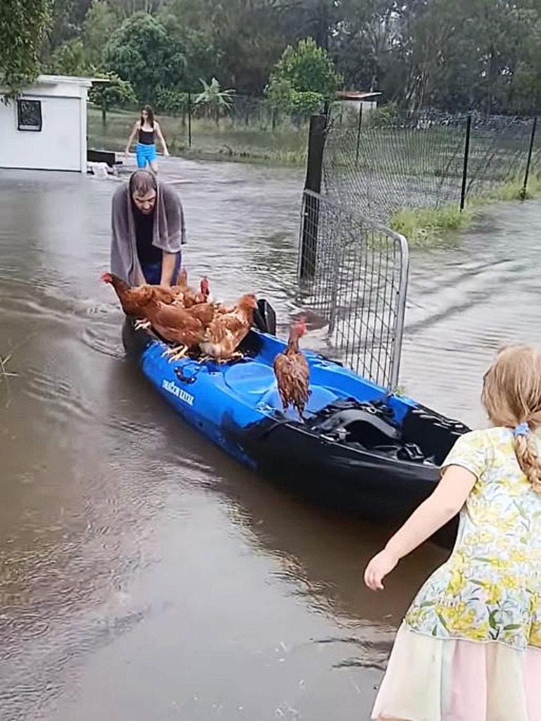
More than 3000 people around Brisbane, the Gold Coast and Moreton Bay regions were without power because of the weather by 10.45am Saturday.
Queensland Fire and Rescue Swiftwater crews responded to four water-related incidents on the Sunshine Coast in Eumundi, Cooroy, Forest Glen and Pinbarren after vehicles drove through floodwaters.
Crews were also called to cars in floodwater at Tallebudgera and Enoggera Reservoir.
The State Emergency Service had responded to more than 200 requests with 50 per cent structural, 27 per cent flooded, and 9 per cent trees down.
With the worst hit areas Gold Coast, Gympie, Sunshine Coast, Brisbane and Moreton Bay.
Mr Purdie said he wanted to remind locals in SEQ to heed the warnings.
“The QPS unfortunately in the last 24 hours responded to 35 jobs from Mackay down to the Gold Coast, every single one of them was someone who didn’t heed the warning that entered floodwaters,” he said.
“Whether that was children thinking going for a swim in the floodwaters was smart or people trying to drive through floodwaters.”
Mr Purdie attended a disaster management meeting chaired by Premier David Crisafulli on Saturday.
He said rapid damage assessments had already started in regional Queensland.
“Locals in those areas are telling us they’re seeing water in areas they didn’t back in 1974,” he said.
“But we have repositioned well. We have a lot of assets on the ground.
“We’ve done a lot of evacuations and door knocks, particularly around Adavale and Jundah.”
Mr Purdie said some graziers had lost up to a million of cattle and sheep from the flooding.
“That’s devastating for the farmers, it’s devastating to those communities who thrive off the back of agriculture,” he said. “I’m not an economist, I think we all know, but that will flow onto the market.
“We’ll just have to wait and see how that transpires, but I think an economist would indicate that when you’ve got a lack of supply, what happens, that might damage the flow effects which will probably reach the dinner table, unfortunately.”
Locals have called for the Australian Defence Force to step in but Mr Purdie said they were monitoring consciously and they had been in discussions with representatives from the Army.
Bureau of Meteorology senior meteorologist Angus Hines said southern and central Queensland would see a reprieve on Sunday.
“From places around the Central Coast, around Yeppoon southward there is much lower rainfall forecast for tomorrow if anything at all,” Mr Hines said.
“The southeast, which has been very wet on Saturday, will brighten up quite significantly on Sunday. The sun is expected to be out and temperatures are going to be quite balmy.
Mr Hines said the northern part of the state were more likely to see widespread showers, but warned it wasn’t over for the southeast.
“Around the middle of the week we could see another little spell of rain in many places on Wednesday,” he said.
“This one won’t be as long-lived or bring as significant falls as what we have had, but we could see some fairly widespread rainfall between Wednesday and perhaps early Thursday across Queensland which would give another unwelcome top-up.
“That rain is going to start in the west and move to the western district by Tuesday, and by Wednesday it will move through the central and southern interior of Queensland.
“By Wednesday night and Thursday morning, we could rain across the southeast, so Brisbane might be looking at a wet night on Wednesday.”
Originally published as Qld weather: Inside the tiny Qld town swallowed by an inland tsunami

Qlders urged to take up free flu jabs as record-breaking season looms
Queensland is bracing for a record-breaking flu season, with a Mater Hospital professor urging pregnant women and parents of young children to get vaccinated before the virus explodes.
Meat price hike in supermarkets after catastrophic livestock flood losses
Hundreds of thousands of square kilometres of the state’s west is an inland sea, wiping out livestock with the devastation to graziers to have a ripple effect on supermarket consumers.

Safe or uncertain: The Games board members on chopping block
As the Brisbane 2032 Organising Committee board looks set to shed 10 of its 24 members, the most likely, and at risk candidates have emerged.
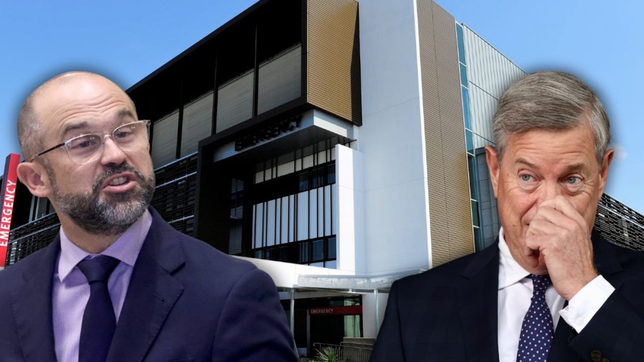
Qld’s $29bn health budget too stretched to fix broken elevators
Queensland’s $29bn health budget is in such a financially dire state, broken-down elevators are not able to be repaired at a major hospital, a top public servant revealed.

Cops taking up to three weeks to respond in undermanned district
Hundreds of requests are going unanswered each day as South East Queensland’s most under-pressure police district suffers a staffing crisis.

Listen now: Preferred option for Olympic rowing would have cost a bomb
It would have cost hundreds of millions of dollars to accommodate Olympic rowing at the preferred site in Queensland, it has been revealed. HEAR THE PODCAST