
Qld weather: Massive storm front, flash flooding, peak hour chaos for SEQ
Ceilings collapsed under heavy rain and roads were left flooded, yards blanketed in hail and crops ruined after wild storms across South East Qld yesterday.

QLD News
Don't miss out on the headlines from QLD News. Followed categories will be added to My News.
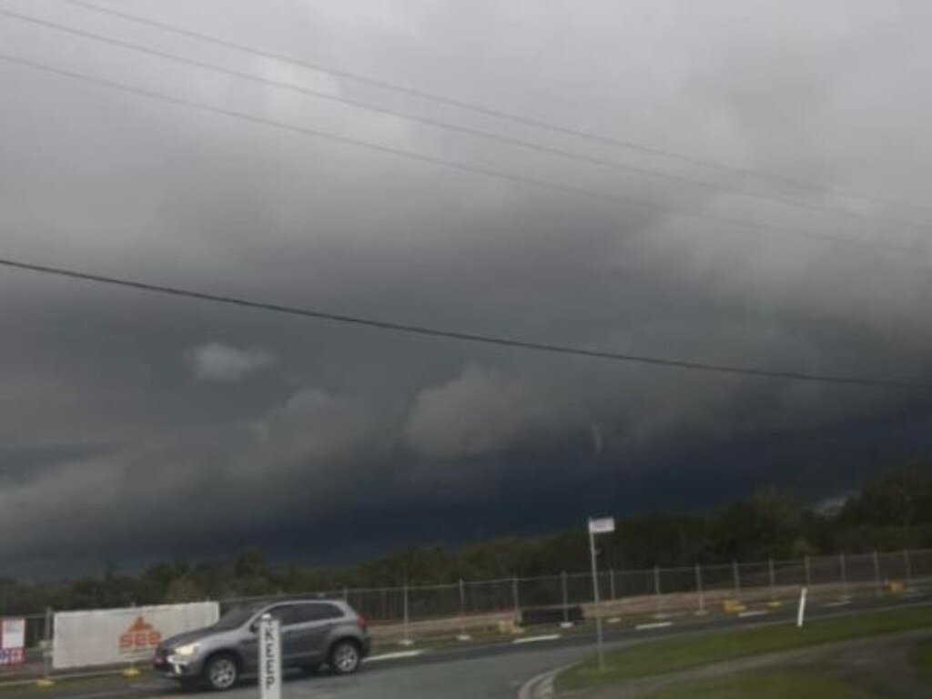
The ceilings of a supermarket and a martial arts business have collapsed and the SES have been called to dozens of properties after severe thunderstorms caused chaos north of Brisbane on Wednesday afternoon, turning streets to ice.
The clean-up is under way as widespread rain continues to fall this morning, with major traffic delays in and around Brisbane and a number of crashes.
It comes as authorities are questioned about a lack of warning alerts about the huge line of storms.
Motorists were facing delays of more than 30 minutes heading into the city this morning, and
Queensland Police said traffic lights were down in the Nundah and Wavell Heights areas due to power outages. Major roads affected included Sandgate and Buckland roads and Bage St.
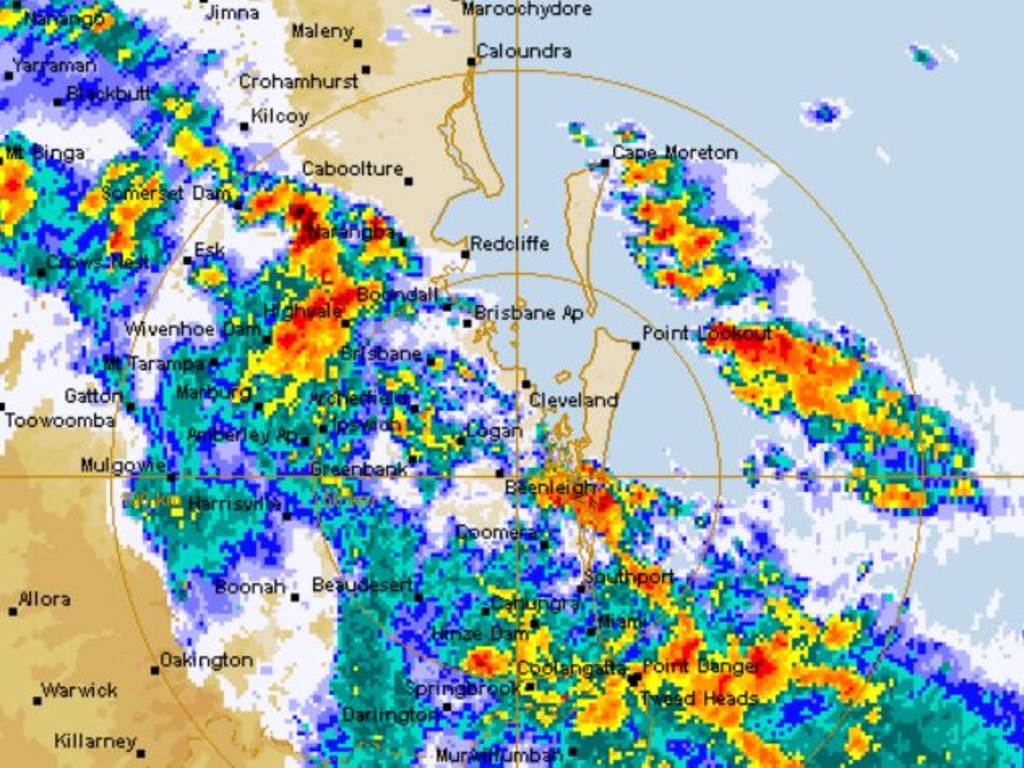
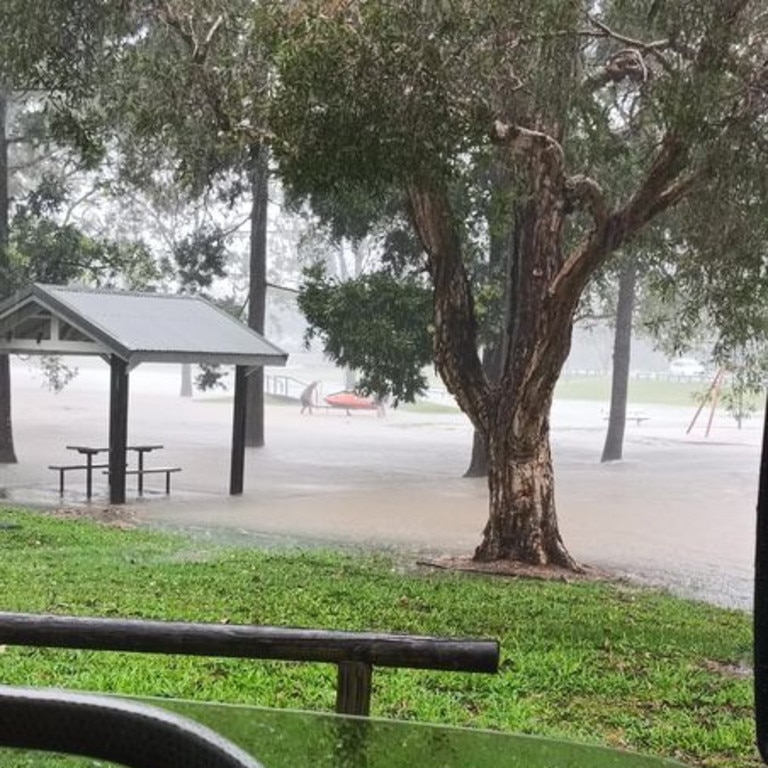
At the height of the storm on Wednesday afternoon, flash flooding was recorded north of Brisbane and on the Gold Coast, where 160mm fell at Mudgeeraba and 153mm at Burleigh Waters.
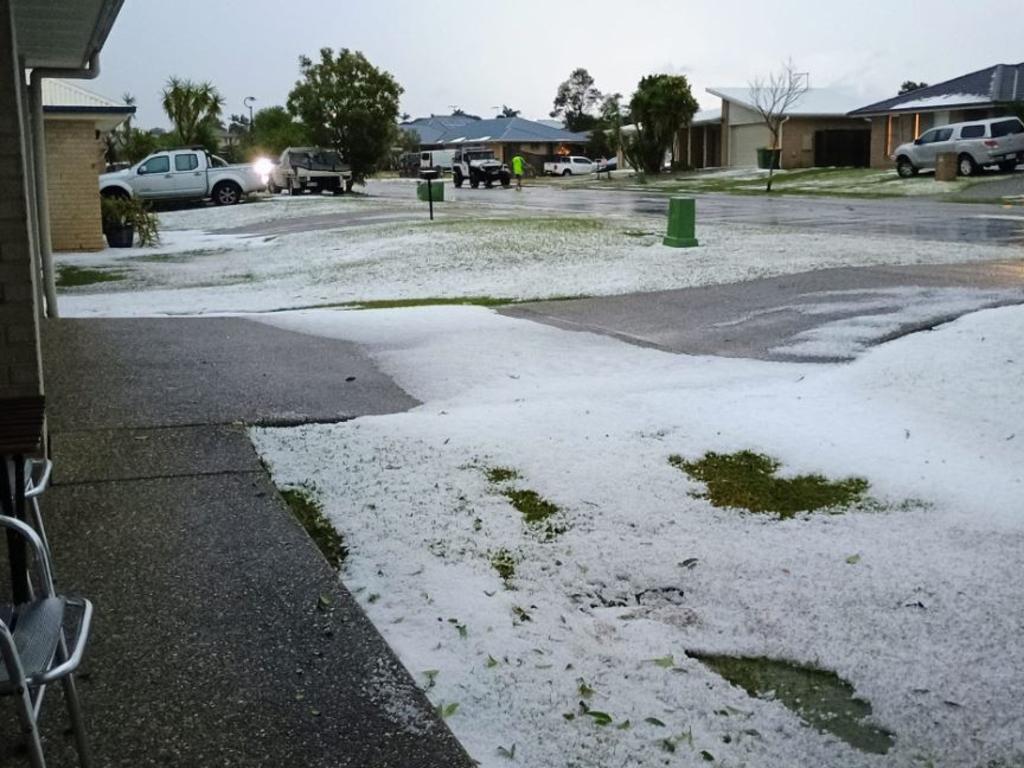
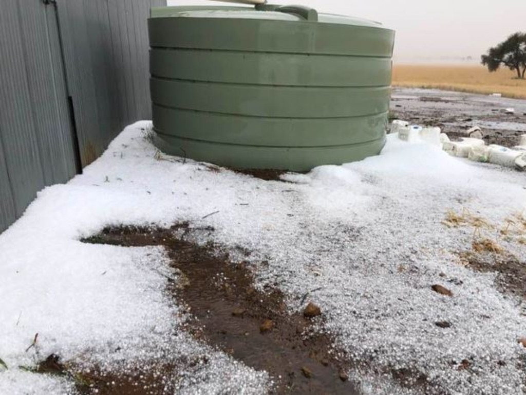
Only 9mm fell at Morayfield, but that area copped the brunt of a wild hailstorm, with chunks of seen floating across roads in the area as motorists attempted to drive home.
Morayfield Bunnings had to close and other businesses were damaged, including a Woolworths at the Morayfield Supa Centre, where the ceiling collapsed.
The Red Dragon Martial Arts School had to close after major flooding when its ceiling collapsed.
Security footage showed students and families rushing to get away as water burst through the ceiling. Teachers and supervisors worked to clear the area and direct families, children and students to safety.
Owner Brett Fenton said his business had been significantly damaged.
“Our ceiling tiles are all collapsed in the first room, our second room is safe, but we’ve still got to make it safe for entering, because you have to enter through what we call the ‘war zone’ now,” Mr Fenton told 612 ABC Brisbane.
“It’s a bit of a mess where we enter.”
Mr Fenton said a number of students of the school worked in trades and he expected they would help out with the clean-up and assessing the damage this morning.
He said he hoped to reopen next week.
“Our facility is custom built with certain things like a gymnastics floor, special mats and stuff like that, but I think we’ll be back up and running probably by Monday at the latest,” he said.
“My plan is to get in and just make it safe so we can use their facilities for what they are intended for.”
The storms caused widespread power outages in the Moreton region, with more than 7000 Energex customers were without power, including nearly 3000 in Morayfield, more than 1100 in Caboolture South.
SES crews received 90 calls for help, most relating to tarping and structural damage.
Emergency services were called to an accident at Burpengary after a car crashed into a tree. No-one was injured.
It was a white-knuckle drive southbound out of the city as storms closed in, with commuters on the Pacific Motorway facing 40 minute delays in heavy rain.
There was flash flooding on the Gold Coast itself after heavy rain.
Parts of the Gold Coast Highway, including at Miami, had water over the road and flash flooding alerts were issued.
Further west, swift water rescue crews were also called to help two people whose car had gone into flood water at Jandowae in the Western Downs.
Both people escaped the car in the incident just before 7pm and walked to safety. They were taken to Jandowae Hospital for assessment.
Farmers in that area have reported extensive crop damage.
Earlier in the day, hail up to 7cm were recorded north of Injune about 1.20pm and a destructive hailstorm also swept over the Western Downs about 3.30pm wiping out crops.
Kathy Harris, of Jandowae, reported a two-tonne an acre barley crop was destroyed in the storm. “Absolutely devastating”, she said.
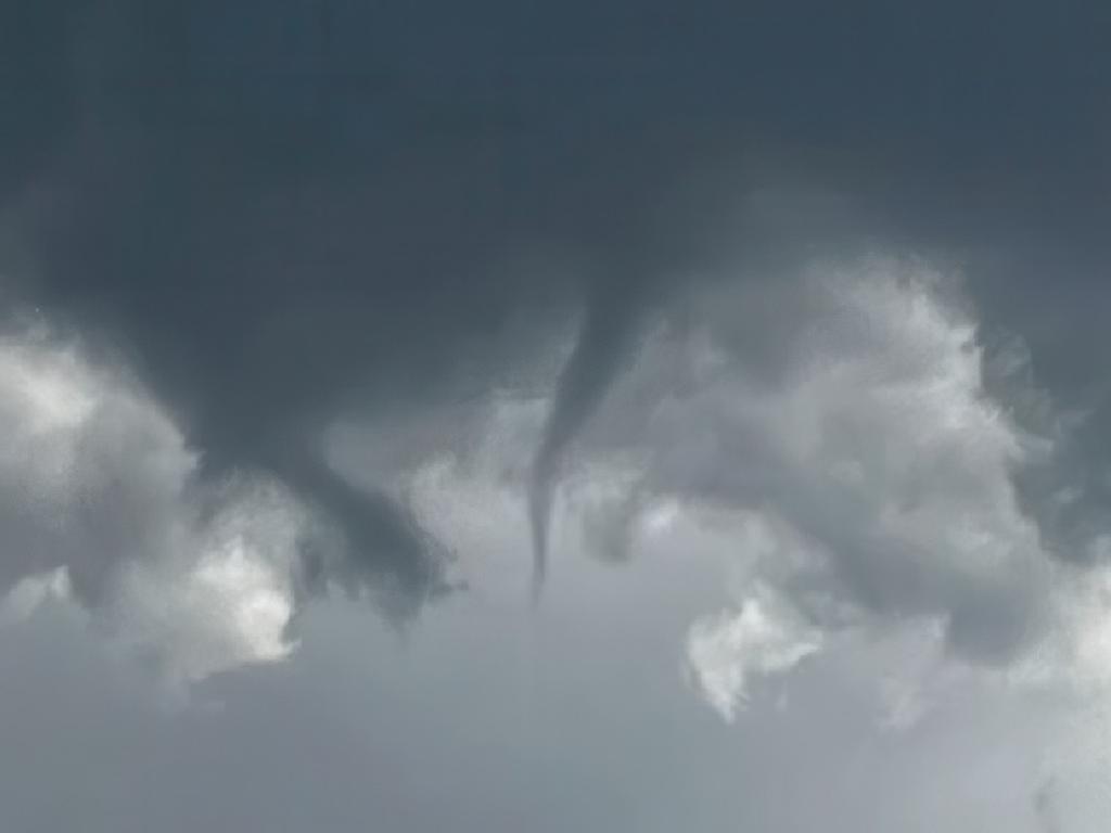
Senior Meteorologist Steve Hadley said the conditions had been ideal for thunderstorms to develop.
“We had a trough over South East Queensland and we saw some severe thunderstorms eventuate,” Mr Hadley said.
“We did get some observations come through with reports of damage from the storms yesterday, particularly around the Morayfield area.
“We saw large amounts of small hail and some roofs coming through.”
Mr Hadley said showers will continue across Brisbane this morning, before easting off in the afternoon.
“There are quite widespread showers up and down the southeast coast at the moment,” he said. “We could see fairly widespread showers continuing before that weather system moves away later in the day.
“We’ve already had falls around Brisbane up to 35mm over the last day or so, there are lots of wet roads around the place.
“There’s going to be further rain around Morayfield and the Caboolture area today, so it’s not going to be very good for trying to clean up after yesterday’s storm.”
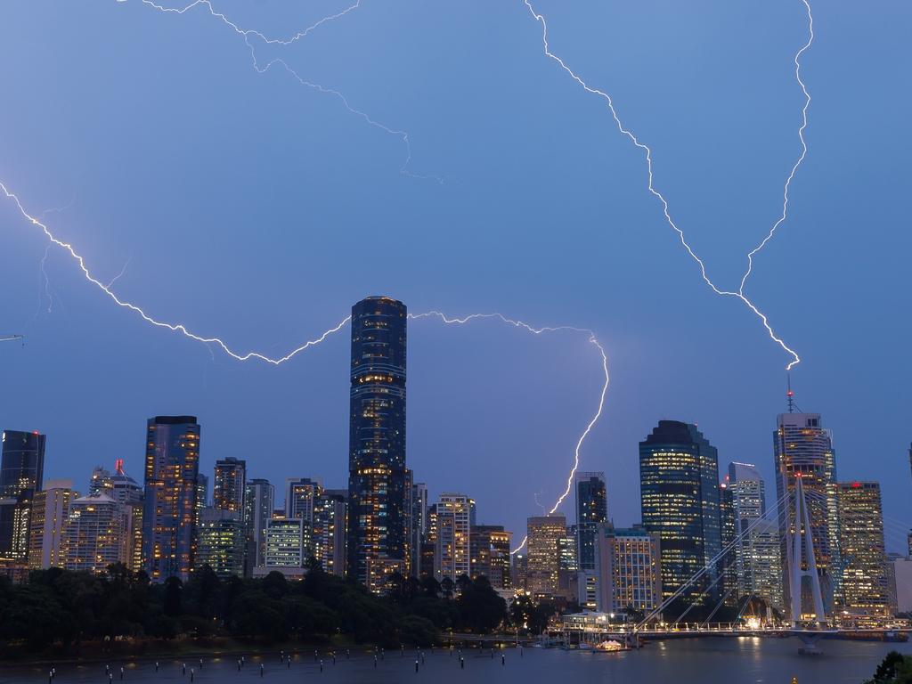
It comes after South East Queensland was on Tuesday pummelled by a supercell that delivered more than 200,000 lightning strikes and 100mm of rain on Tuesday.

Originally published as Qld weather: Massive storm front, flash flooding, peak hour chaos for SEQ
Join the conversation

‘Never take it for granted’: PM’s message to Qld’s new Federal MPs
The newest Labor MP’s, including the infamous Ali France who unseated Peter Dutton, have been warned by Anthony Albanese not to get complacent and ‘sloppy’ with their huge majority.
Read more

Brisbane’s speed shame: Drivers caught 200km/h in 60 zones
Drivers have been caught at speeds of more than 200km/h in 60 zones across Brisbane, with nearly one in six drivers ignoring slow down signs across the city.
Read more

Qld’s nation-leading chief entrepreneur role could be axed
Queensland’s chief entrepreneur role is on the chopping block as part of a government shake-up after sitting vacant for more than a year, prompting calls from the business community for it to stay.
Read more

Jet-setting Premier racks up double hours in taxpayer-funded planes
Premier David Crisafulli has logged a whopping 46.3 hours of flight time between January and March — far outstripping former Labor Premier Steven Miles and Annastacia Palaszczuk.
Read more

‘My babies gone’: Mum’s heartbreak after children, fiance killed in crash
The mother of two young children killed in a horror head-on collision has revealed ‘her babies’ and fiance died while heading home from a camping trip.
Read more

‘Tell me that’s not a croc!’: New twist on shock Noosa sighting
A fisherman who spotted what looks to be a crocodile near Noosa has revealed why he’s positive it was not a false alarm, as a new theory comes to light.
Read more