
Qld weather: 90+km/h winds, large hail as first of two storm troughs set to lash the South East
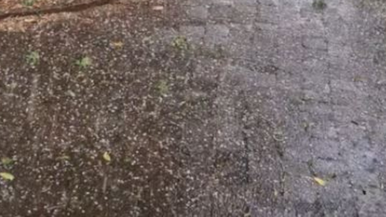
Heavy rain and hail have been recorded as a severe storm system moved across parts of the state on Thursday afternoon.

QLD News
Don't miss out on the headlines from QLD News. Followed categories will be added to My News.
Heavy rain and hail have been recorded as a severe storm system moved across parts of the state on Thursday afternoon, with warnings active until just after 7.30pm.
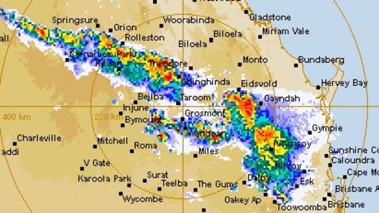
Storms started moving across the state about midday on Thursday, scattering across areas from the Sunshine Coast to the Central West and north to Capricornia.
A severe warning for the Sunshine Coast and Moreton Bay regions was cancelled about an hour after it was issued but there were reports of hail at Caloundra.
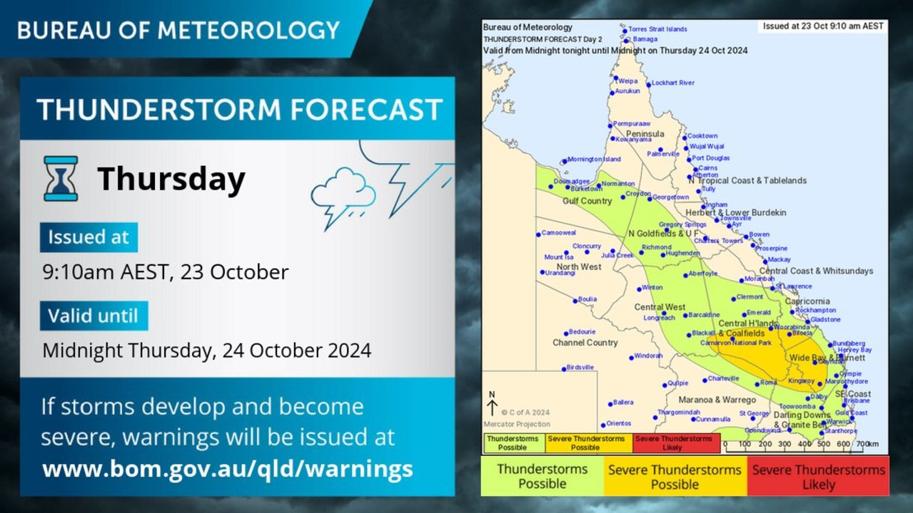
Just before 7pm, the Bureau of Meteorology issued an updated severe thunderstorm warning for people in parts of the Central Highlands and Coalfields, Capricornia and Wide Bay and Burnett forecast districts.
It said severe storms were likely to produce damaging winds and heavy rainfall that may lead to flash flooding in the warning area over the next several hours.
It said locations which may be affected include Emerald, Biloela, Blackwater, Calliope, Gin Gin and Mount Morgan. The warning was cancelled just after 7.30pm.
The Bureau of Meteorology earlier said Brisbane would likely be spared the spared the brunt of the system today.
Meteorologist Patch Clapp said parts of the western edge of the South East would experience storms from lunch time, with showers and storms expected well into the early hours of the morning.
“Later this evening from around 7pm onwards we will see these storms travel further south down through the southern parts of the Darling Downs like Toowoomba, Warwick, down through Stanthorpe and push toward the coast overnight,” Mr Clapp said.
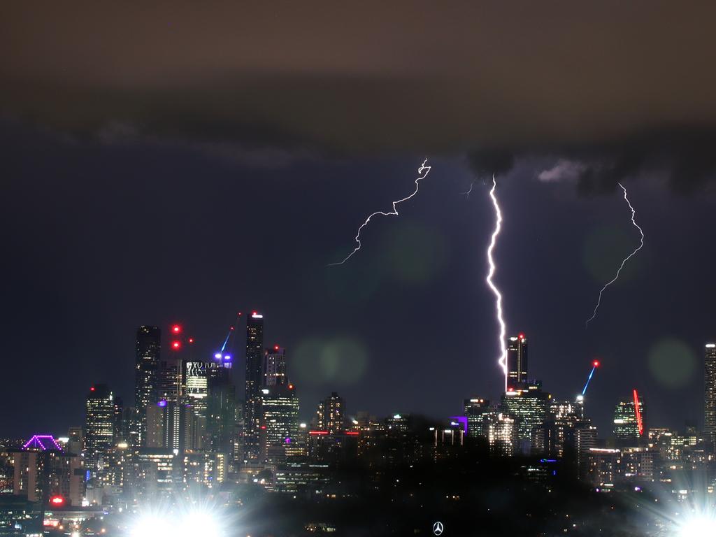
“There’s a broad area where we could see these severe storms, we’re not expecting them around Brisbane but the Sunshine Coast is on the cards this afternoon and so is the Gold Coast quite late tonight.”
Mr Clapp said a trough pushing off towards the east coast would deepen today, with the combination of instability in the atmosphere providing all the ingredients for these severe storms to develop.
“That instability is why we’re seeing that overnight storm activity that we don’t typically see,” he said.
While the damaging winds and hail are the main focus for the Bureau on Thursday, Mr Clapp said some areas could see rainfall in the double digits on Thursday afternoon.
It comes as the temperature soared in parts of the state, with the mercury climbing to 43.2C at Winton just after lunch.
It reached 42.4C in Longreach and 42.6C in Camooweal.
Closer to the southeast, it reached 35C in Dalby and 34.9C at Goondiwindi.
It got to 31.6C in Brisbane, 34.1C at Greenbank and 35.1C at Gatton.
Mr Clapp said the trough is expected to move off the coast on Friday morning, leading to a more settled day for much of the South East.
However, come the end of the weekend a second trough tracking north from New South Wales is set to bring a series of showers and storms.
“There will be more of an inland focus on Sunday, but then we’re expecting those storms heading for South East Queensland on Monday bringing a little bit more moisture,” Mr Clapp said.
The Bureau has tipped Brisbane would see widespread showers from late Sunday and into next week.
Originally published as Qld weather: 90+km/h winds, large hail as first of two storm troughs set to lash the South East
Join the conversation

Tram stop take-down: Man charged over alleged violent GC robbery
A man has been hospitalised on the Gold Coast after he was allegedly bashed and had his phone swiped in an early morning attack. Read what happened.
Read more

‘Hope is lost’: Batman dresser pedo’s chilling new charges
One of Queensland’s most dangerous sex offenders, who masqueraded as a superhero and broke into homes to abuse boys, has re-emerged in court despite decades of “supervision”.
Read more

Treasurer’s blistering attack on Labor over $8.6bn black hole
David Janetzki has revealed Queensland’s budget will remain a sea of red for years to come as the government plugs a multi-billion dollar black hole.
Read more

Chilling scream heard while man, 88, allegedly attempted to kill daughter-in-law
A woman’s chilling scream woke neighbours while she was allegedly being strangled with a piece of wire by her elderly father-in-law.
Read more

Alleged e-bike bandit bashes teen in brazen Gold Coast robbery
A teenager has allegedly been dragged from his bike and savagely beaten in a broad daylight robbery on the Gold Coast. Read what happened.
Read more

Qld Rail worker’s mindblowing cannabis reading
A man who worked in a ‘safety critical’ role shunting trains for Queensland Rail has been denied compensation for his sacking.
Read more