
Monsoon trough headed for North Queensland with possible tropical cyclone developing over weekend
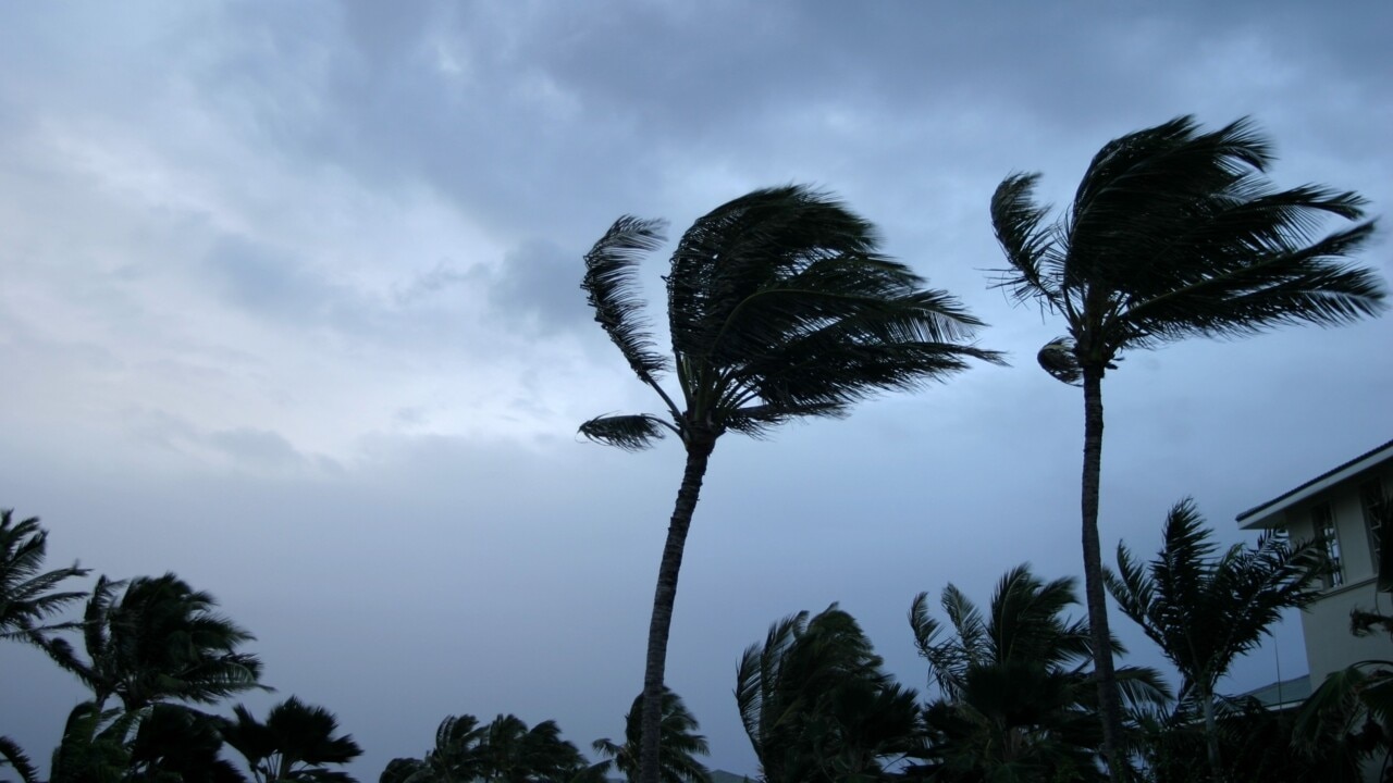
North Queensland is facing the risk of a tropical cyclone as a monsoon trough approaches the region, delivering heavy rain and dangerous conditions, while a thunderstorm warning has been issued for Gympie.

QLD News
Don't miss out on the headlines from QLD News. Followed categories will be added to My News.
Australia’s east coast is set to be lashed with heavy rain and dangerous weather as a monsoon trough sweeps into northern Queensland, increasing the risk of a possible tropical cyclone over the weekend.
Just days after ex-tropical cyclone Seth lashed the state’s southeast with large waves and abnormally high tides, Queensland’s northern tropics are now preparing for a burst of wet and dangerous winds.
The monsoon trough is set to develop over the northern Coral Sea from Thursday, with Weatherzone predicting it to hit the Cape York Peninsula as early as Friday.
“Far North Queensland could see a prolonged spell of heavy rain and thunderstorms capable of delivering several hundred millimetres of rain,” Weatherzone meteorologist Ben Domensino said.
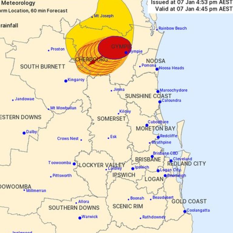
The Bureau of Meteorology warns that, at 4:45pm, severe thunderstorms were forecast for residents in the Cherbourg, Gympie and South Burnett Council areas.
They are forecast to affect the area southwest of Gympie, the ranges between Gympie and Murgon and Kilkivan by 5:15pm and the area northeast of Kingaroy, Elgin Vale and Goomeri by 5:45pm, with heavy rainfall that may lead to flash flooding is likely.
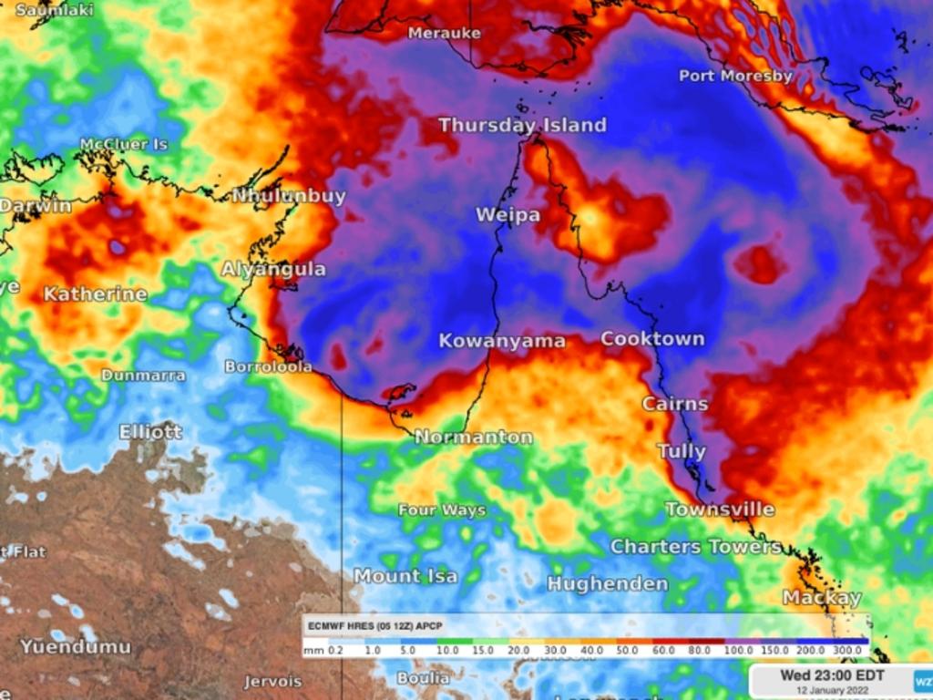
A low pressure system is also predicted to develop within the monsoon trough off the state’s east coast, with the chance of it developing into a tropical cyclone.
The massive storm front, stretching 1200km from Brewarrina south to Griffith, Canberra and Albury, was delivering widespread lightning and torrential rain and hail.
While it is still too early to know how the low pressure system will develop and where it will move, Mr Domensino said there was potential for it to become a tropical cyclone as it approached land on Sunday or Monday.
“At this stage, there is potential for the low to become a tropical cyclone as it approaches the Cape York Peninsula on Sunday or Monday or over the Gulf of Carpentaria early-to-mid next week,” he said.
Mr Domensino said there was “a lot of uncertainty” regarding the forecast.
However, he is urging anyone living north of Townsville to monitor forecasts and tropical cyclone advisories in the coming week.
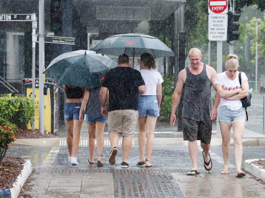
Ex-tropical cyclone Seth brought a week of wild weather to Australia’s entire east coast in the past week, with Brisbane and parts of NSW still being hit with rain.
The system created massive swells along the coast, but the Bureau of Meteorology warned it would become less severe when it hit land.
It still brings with it isolated showers for the state’s southeast as the ex-tropical cyclone comes ashore and weakens.
On Friday, a severe thunderstorm warning was issued for parts of the Wide Bay and Burnett regions, with Tiaro in the firing line.
At 2.32pm, BOM warned severe thunderstorms are likely to produce heavy rainfall that may lead to flash flooding in the warning area over the next several hours.
Heavy rain in the Wide Bay area will continue into the weekend, while Gympie and Kingaroy are expected to be drenched with more than 60mm.
A gloomy weekend is forecast for both the Sunshine Coast and Gold Coast, with isolated showers through to Monday.
Meanwhile, central parts of the state have been sweltering through extreme heatwave conditions, with the hot weather slowly moving west.
Showers and storms are expected to increase over Brisbane and much of the state’s southeast as the active monsoon moves into the Coral Sea.
Originally published as Monsoon trough headed for North Queensland with possible tropical cyclone developing over weekend
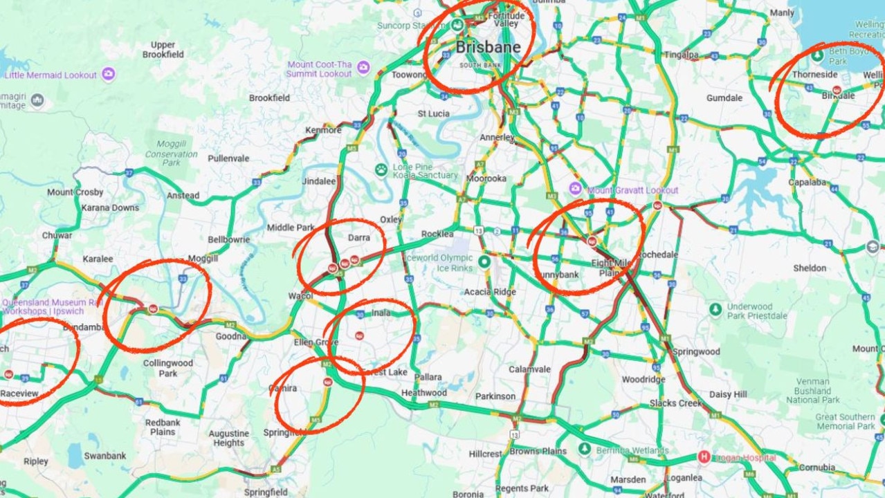
Peak-hour meltdown: Eight crashes plunge Brisbane into gridlock
Traffic chaos has unfolded across Brisbane ahead of peak-hour this morning after a spate of crashes on major arterials including the Bruce Highway and Pacific Motorway.

Miner’s alleged chop-shop car used in 17 heists
A former miner is accused of chopping up two stolen vehicles, piecing them into one and using that rebirthed car to carry out more than 17 break-ins at various businesses.

Stunning haul of illegal tobacco, vapes in biggest ‘chop shop’ raids yet
A record number of illicit tobacco and vape products have been seized in the largest crackdown ever conducted by a health authority in the country.
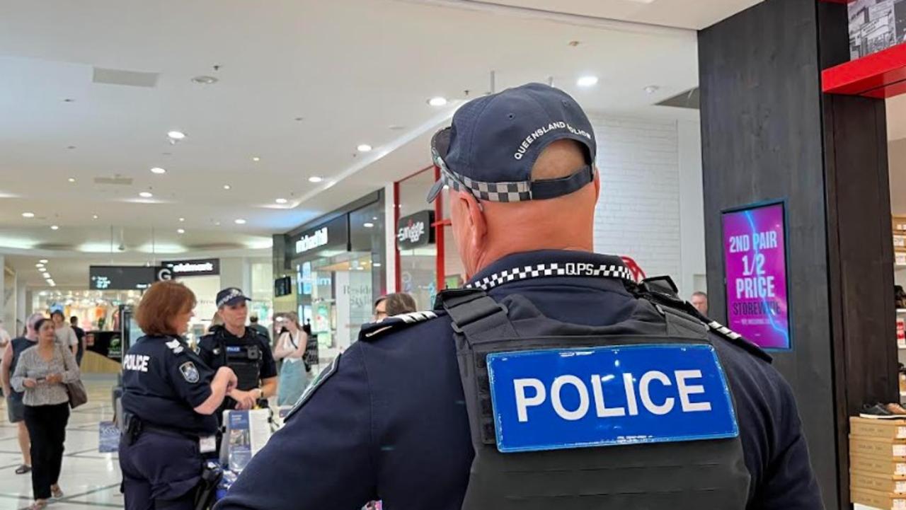
Fly-in fly-out rapid response police squads locked in for five years
A rapid response police unit flying to crime hotspots is being claimed as effective as the Queensland Government releases arrest figures from its Queensland operations.

Premier tight-lipped on threats to strip nurses’ backpay
On Labour Day it was revealed the state government had threatened to strip tens of thousands of frontline health workers of backpay if they dare exercise their legal right to strike action.

Revealed: Latest addition to steer Brisbane 2032 preparations
The new co-ordination commission chair for the Brisbane 2032 Olympic and Paralympic Games has been appointed.