
Mackay Regional Council study reveals the flood risk to homes across the district
The council has released a mammoth flood risk study that details how every home across the Mackay region will be impacted in a weather event.
Mackay
Don't miss out on the headlines from Mackay. Followed categories will be added to My News.
The results of a mammoth flood study have revealed what risk the Mackay region's homes would face in a weather event.
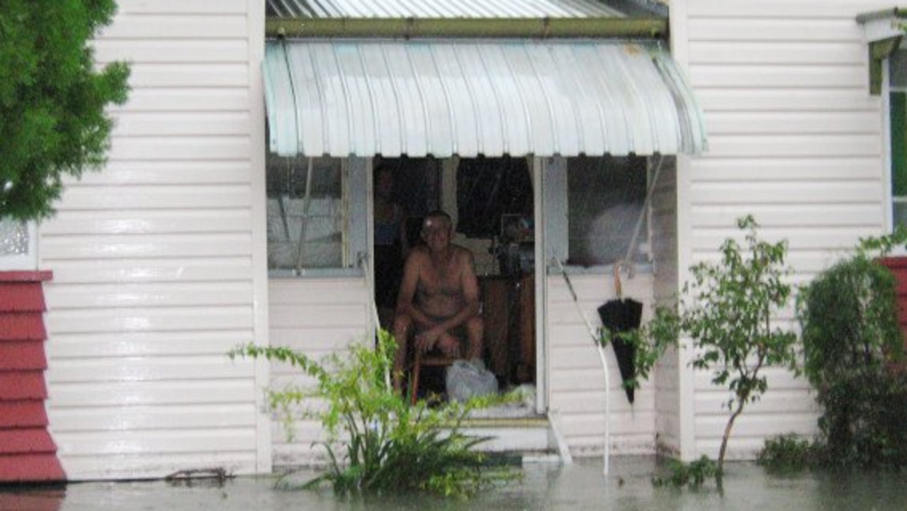
Cyclone Debbie's wrath in 2017 prompted Mackay Regional Council to carry out the largest and most complex flood risk study for the region.
Computer-based models were created to show what occurred during small to extreme flood events, as water rose from tidal surges and the Pioneer River back flowed into creeks including, Goosepond, Sandfly, Shellgrit and Bakers Creeks.
The results showed Pioneer River flooding posed the greatest risk for Mackay residents, while Goosepond Creek was also a key concern.
Mackay Regional Councillor Justin Englert said there had been a shift in perception - instead of considering floods as a one in 100 year event, they were now viewed as having a one per cent chance of happening in any given year.
Cr Englert said this was of particular concern for Mackay with the city being the second lowest lying in Queensland after Hervey Bay.
More stories:
Your say on how to revive Mackay's once-thriving city heart
Pensioners forced to report fortnightly or lose payments
The study resulted in an online tool residents can use to find out the flood risk to their property in a weather event, as well as a draft Mackay Floodplain Risk Management Study and Plan.
Residents have until July 15 to have their say by visiting the council's website.
To check out the online tool click here.
Subscriber benefits:
How to activate your free Courier-Mail subscription
How to get Daily Mercury news straight to your inbox Your dose of Harry Bruce cartoons
Originally published as Mackay Regional Council study reveals the flood risk to homes across the district

Watch replay: Remarkable Ramos leads St Patrick’s to victory
Two late tries from winger Calvin Ramos led St Patrick’s to a thrilling Aaron Payne Cup victory on Thursday, while the Schoolgirls Cup clash came to an early end. Watch the REPLAYS.

Cane field on fire near homes
Firefighters are battling a cane fire in Mackay’s west, and fighting to protect nearby homes.

Three car crash causes peak hour havoc
At least one lane has been closed causing peak hour delays on a busy Mackay street after a three car crash.

‘Digging yourself a hole’: Cops dramatically drop drug dealing case
A Qld man who was facing two dozen charges of supplying drugs is “breathing easy” after the police case against him fell apart in a spectacular court exchange.

WATCH: Girl, 3, rides pony to take home first place
A ‘keen as mustard’ three-year-old girl who has ‘been in the saddle since she was a baby’ took out the top prize at a regional Queensland show.

Health services needed to keep families, doctors, in regions
Figuring out where Qld’s huge coal royalties are being spent has been put on the agenda, with one minister saying there are regions with ‘no basic health services’ contributing billions in royalties.