
CORONAVIRUS: New Interactive map tracking Australian cases
An Australian-based map tracking cases of the novel coronavirus has launched, showing national and state-wide data updated by the hour. SEE THE MAP
Business
Don't miss out on the headlines from Business. Followed categories will be added to My News.
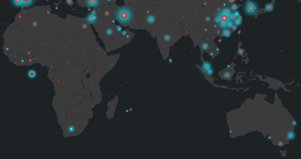
A NEW system which allows you to track the number of confirmed COVID-19 cases and deaths has been launched in Australia.
Using the same technology behind the World Health Organisation and Johns Hopkins University dashboards, the map will be updated hourly with data taken from state and territory government websites and media reports.
Created by Esri Australia, it reflects the national and state statistics of confirmed COVID-19 cases, deaths, recoveries and tests, as well as including charts showing the timeline of confirmed cases over time.
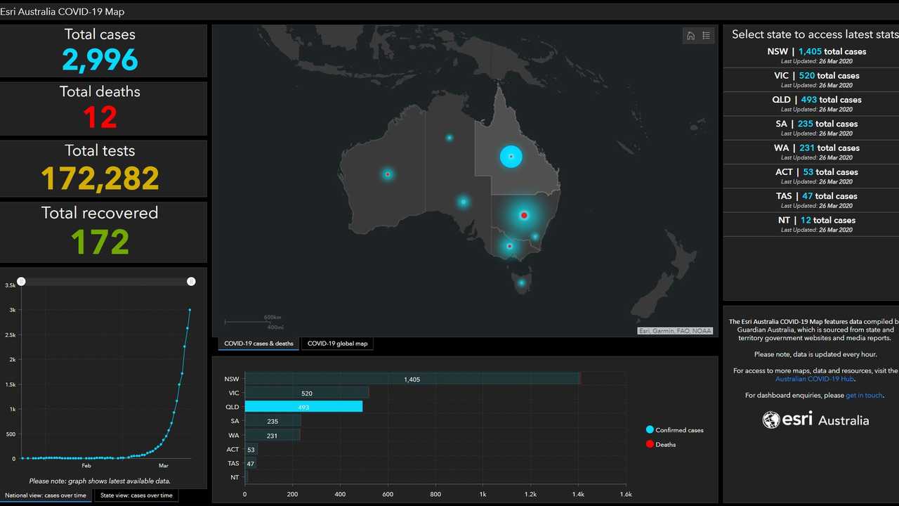
Esri Australia Principal Consultant Simon Jackson managed the build of the application and said the map is a valuable resource that government agencies and health professionals can use to accurately track the spread of the virus.
"This online dashboard is the most comprehensive publicly available map of the COVID-19 situation in country - and we will continue to update it with new data streams as they become available," he said.
"It's a localised version of the World Health Organisation and Johns Hopkins COVID-19 dashboards, which were also developed using the same Esri technology.
"It's designed to enable Australian government and health agencies to focus their efforts and gauge the effectiveness of strategies to slow or stop the spread of the virus - and also provides the general community with near real-time tracking of the virus spread."

The map also features a global function which is updated frequently.
Read more stories from Toni Benson-Rogan./profile/Tonibenson-rogan/
Originally published as CORONAVIRUS: New Interactive map tracking Australian cases
The pendulum ‘swung too far left’: BlackRock’s Larry Fink
The most powerful investor on Wall Street tells The Australian that corporate culture is ‘undergoing a reset’ away from its progressive outlook. Larry Fink is moving with the times.
Why Goodman’s AI pivot has a big message for investors
The veteran property investor is replaying the strategy that turned a small commercial property trust into a $70bn industrial powerhouse.
One and done? RBA cools hopes over fast rate relief
In delivering a long overdue rate cut, the central bank has a sobering message when it comes to more.
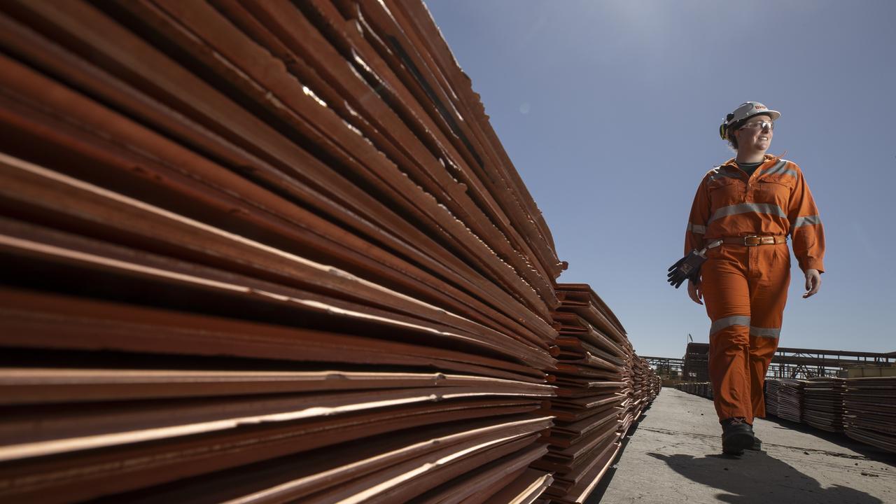
The $50bn strategic bet that’s set to change BHP forever
The BHP of the future will be less reliant on Australia and even less about iron ore as CEO Mike Henry reshapes the miner. Is it the right strategy?
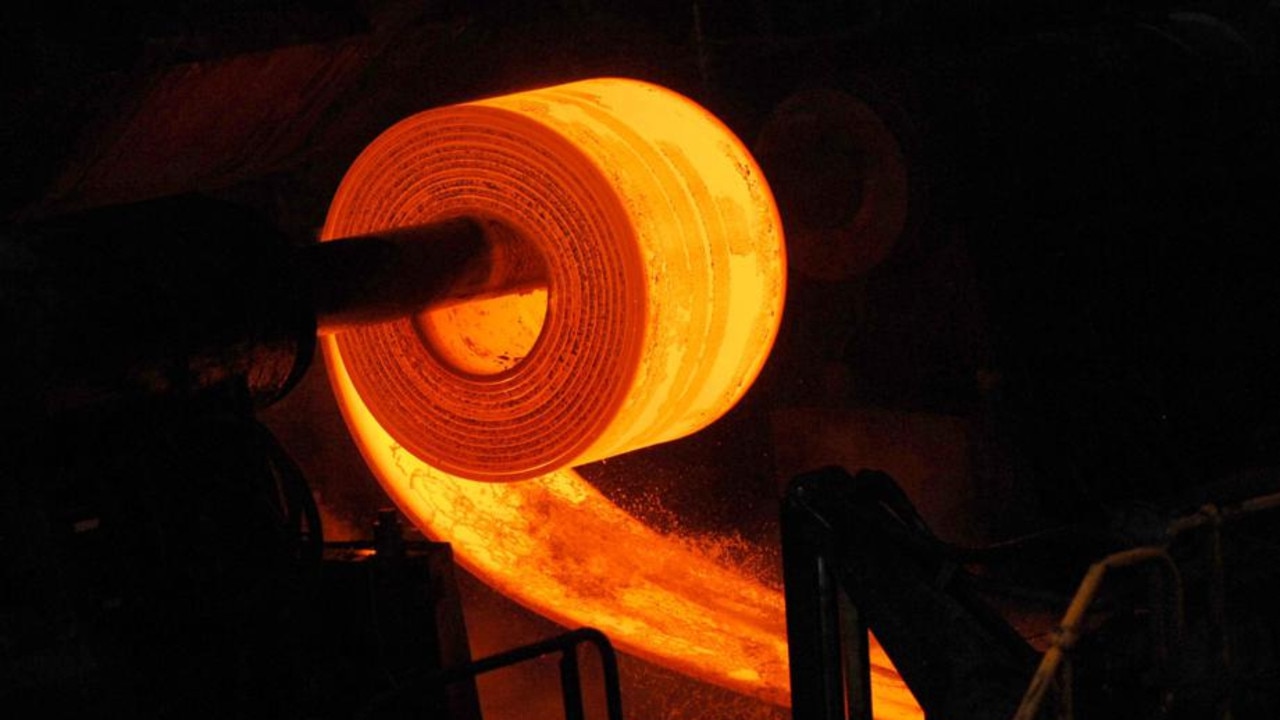
Fighting fit: BlueScope CEO’s battle plan to cut $200m in costs
Exposed to a trade war on one side and cheap steel dumping by China on the other, the boss of BlueScope goes for attack as the best form of defence.

Classy style inside and out let down by ‘agricultural’ feel
With good looks and a refined cabin, the Mazda CX-60 Azami diesel manages to impress and disappoint at the same time.