
Gympie locals furious as koala habitat destroyed at Southside and Pie Creek
Land clearing near Gympie to make way for new housing estates has been taking place in what local residents believe is koala habitat, and is driving tensions and frustrations over how to balance environment protection with progress.
Gympie
Don't miss out on the headlines from Gympie. Followed categories will be added to My News.
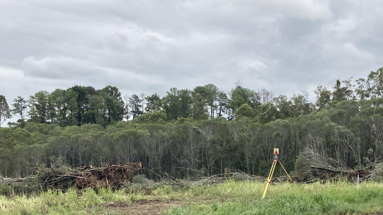
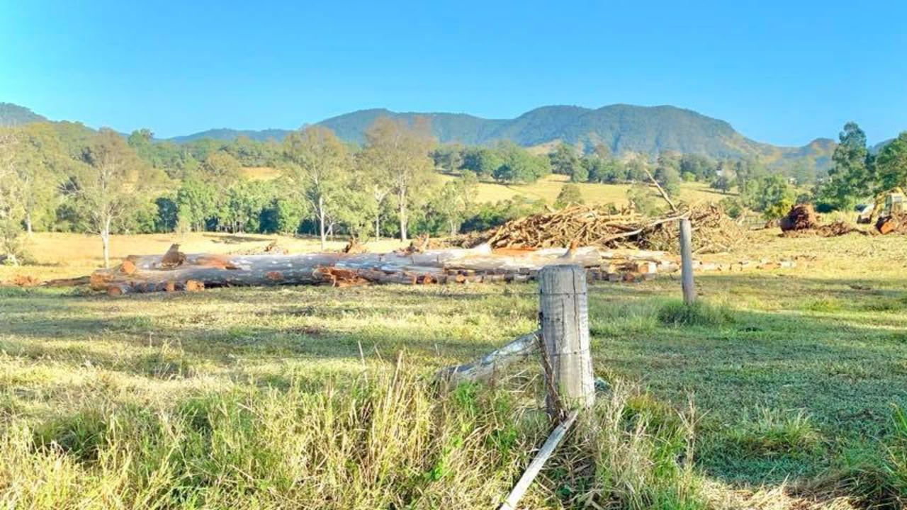
The clearing of more than 20ha of Southside and Pie Creek land in recent months continues to drive questions and frustrations over environmental protection in an area long identified as Gympie’s growth corridor.
Southside resident Krystal White is one of the voices raising concerns about the land clearing, which has happened on a number of blocks west of the city.
“I’m seeing koala habitat being destroyed … it’s quite sad,” Ms White said.
Ms White said she would often see koalas and wildlife in her neck of the woods.
The clearing meant she was no longer aware of whether they were still alive or where they had moved to.
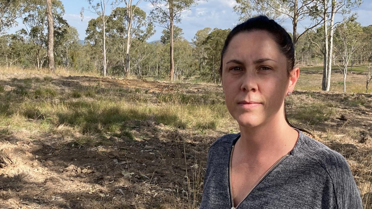
For her efforts so far she had been met with radio silence from the Gympie Regional Council.
She had also drawn the ire of one anonymous neighbour who left a letter criticising her decision to speak out about land clearing in her mailbox.
It has not deterred her from pushing for more protection.
“I know development is going to happen … but it needs to be responsibly and sustainably,” she said.
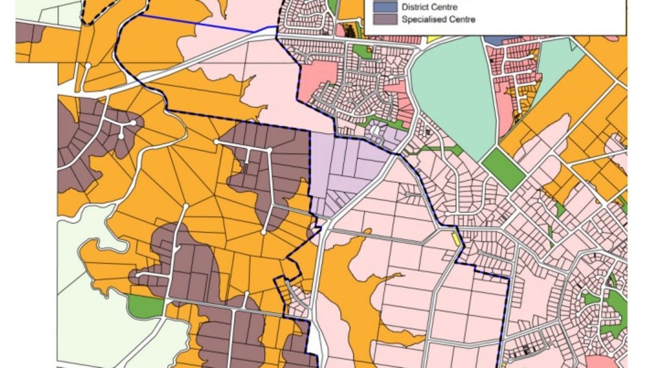
The question of balance was one the council itself has failed to answer for the area, marked for years as Gympie’s future growth hub.
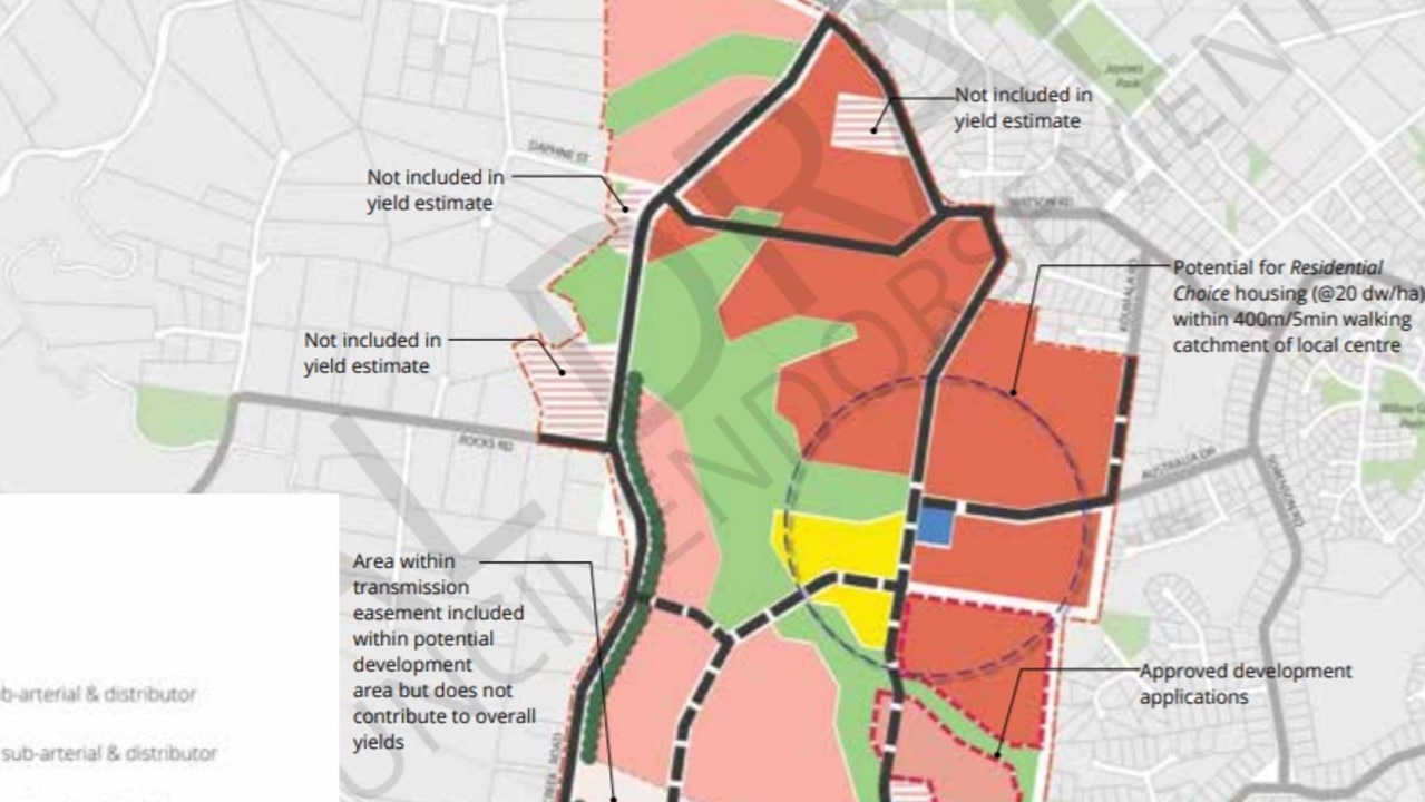
A structure plan for the Southside endorsed by the council in November 2016 outlined an area stretching from Stumm Rd to north of McIntosh Creek Rd as designated future urban residential.
The plan established housing density ranging from eight to 20 dwellings per hectare.
It estimated the Southside would accommodate 1200 new houses by 2036.
This will account for almost half the “urban area’s expected overall growth” of 2550 new houses in that period.
The plan included an environmental corridor of land running through the Southside from south of Groundwater Rd to Eel Creek Rd, with another patch around Stumm and Glastonbury Rds.
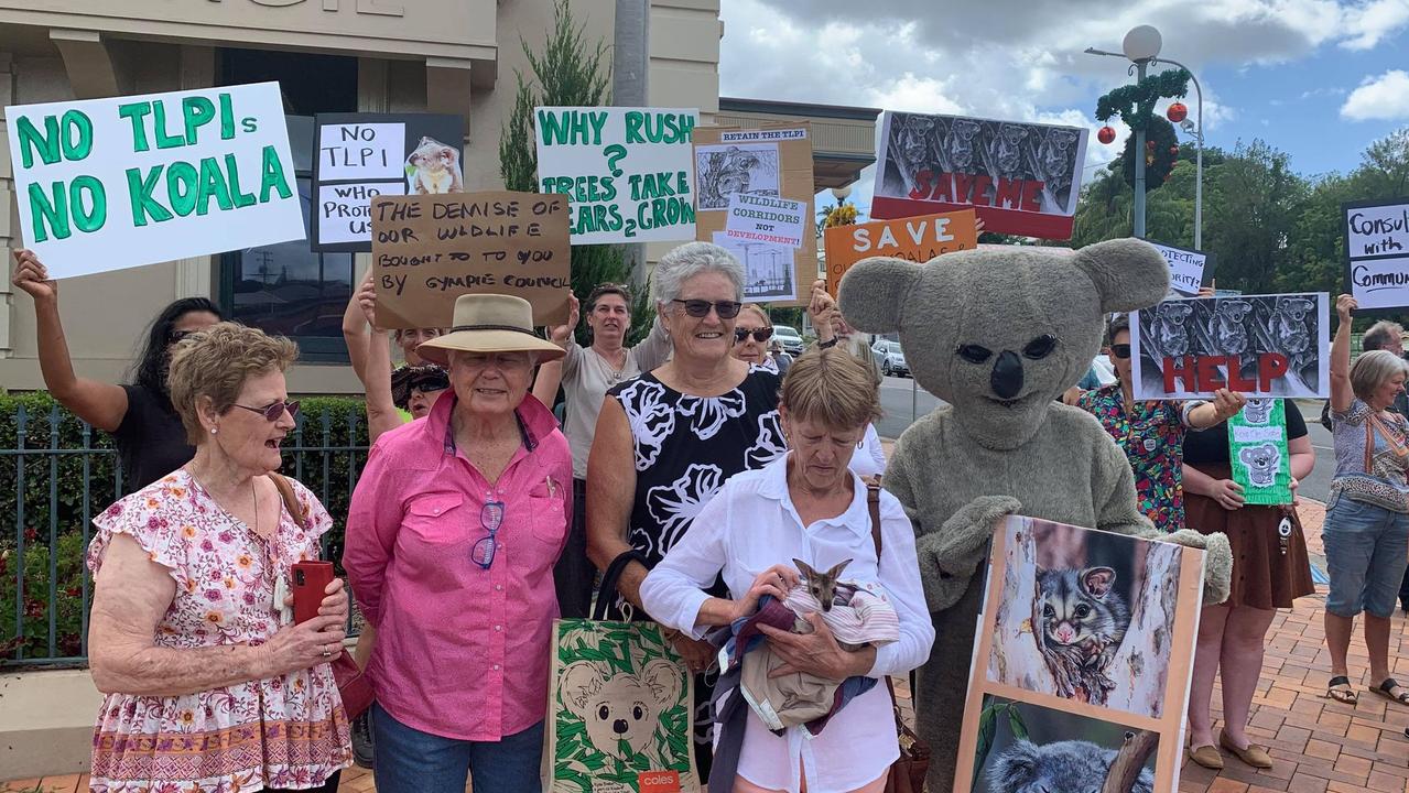
The area was later subject to one of two Temporary Local Planning Instruments brought in by the council in February 2020 and controversially removed in December that same year.
The move triggered an environmental protest outside Town Hall.
Bu landowners said the TLPIs stopped them from building on their own land without first incurring thousands of dollars in costs for environmental reports, and obliterated the value of the properties.
A council report recommending the removal of the TLPIs said, among other unintended consequences for land owners and developers, the TLPIs did not take into account the intention for the Southside to be Gympie’s “major urban growth area”.
Removal of the TLPIs also sparked a Change.org petition calling for Deputy Premier Steven Miles and Environment Minister Meaghan Scanlon to overturn the decision.
The petition has attracted more than 44,000 signatures from around the world but neither minister has intervened.
In late July, Wide Bay Burnett Environment Council regional engagement co-ordinator Mike Moller told the ABC about 20ha of land had been cleared across six blocks since March.
There has been no allegation of illegal clearing.
Mayor Glen Hartwig said the council wants to balance residential and environmental demands.
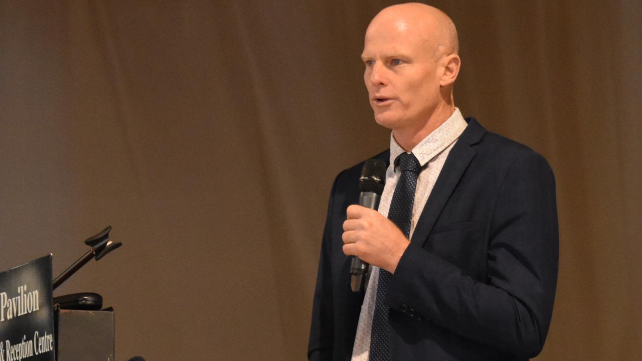
“Finding suitable land for residential development in Gympie is like finding hen’s teeth,” Mr Hartwig said.
He said the Southside was identified by previous councils as the growth centre because of its proximity to water and sewerage connections.
“Former councils spend ratepayers funds developing and identifying those places as key (development) areas,” he said.
Opening up developments further out, or on already open agricultural land, would cost the council – and ratepayers – significantly to deliver those services, he said.
The council has created a new Biodiversity and Koala Habitat Development Strategy Reference group in the wake of the TLPIs’ repeal.
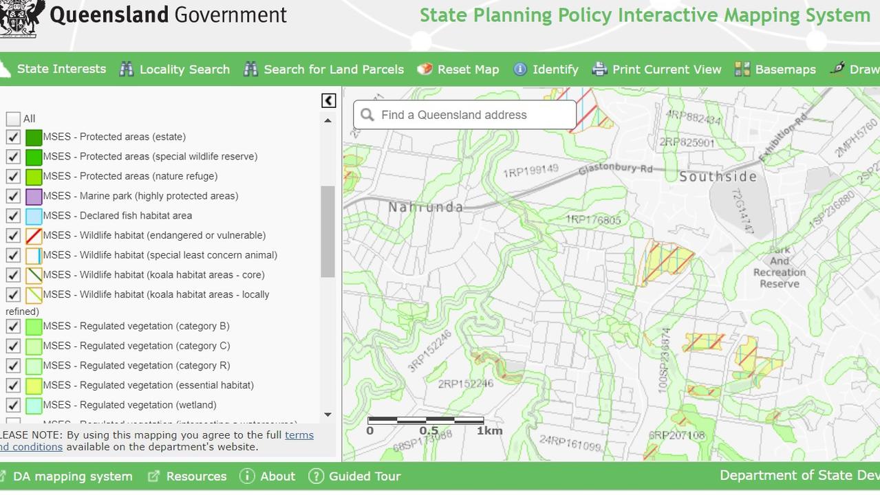
A large proportion of land on the Southside is not recognised as koala habitat under the State Government’s environmental mapping.
A State Environment Department spokesman said land clearing in Gympie, including areas marked as essential habitat, was regulated under the Vegetation Management Act 1999.
“Landholders are advised to contact their local council or the Department of State Development, Infrastructure and Local Government and Planning to check whether State approval is required for vegetation clearing,” he said.
“Community groups can engage with their local councils to advocate for the protection of important local sites through inclusion in planning schemes or through reservations, covenants and other forms of protected tenure.”
The State Government’s koala conservation strategy is limited to the southeast, stretching across the Sunshine Coast and Noosa but stopping before Gympie.
Clearing on residential land is a council matter.
Ms White said she was “hopeful” the council would step up to the plate “so there isn’t mass clearing that isn’t unregulated”.
More Coverage

Originally published as Gympie locals furious as koala habitat destroyed at Southside and Pie Creek

50+ faces: Maryborough’s FraserPop Festival in photos
The annual pop culture festival drew a colourful crowd to Maryborough State High School on Saturday. See the incredible costumes in this GALLERY.

‘Ultimate breach of trust’: Magistrate to siblings’ alleged killer carer
A carer who allegedly deliberately drove into a tree, killing two sibling clients, claims he’ll be ok if he’s released and can go back to work. *DISTRESSING*.

Woman killed in horror highway head-on collision
A woman has died, a teenager is fighting for life and a man in his 60s has been taken to hospital following a horror head-on crash on a regional highway near Gympie. Latest:

Tributes flow after shock death of guardian angel with a huge heart
From befriending rock legends in the Sydney music scene to creating a sanctuary for wounded animals and lost souls in rural Queensland, Lee-Anne Olsen never lived a conventional life, and that’s exactly how she wanted it.

‘Love it inside’: Free food, no work. Will jail time cut youth crime?
Queensland’s tough youth crime laws face scrutiny amid almost daily reports of shocking offences. Despite harsher penalties, scepticism remains about their effectiveness and whether deeper societal issues are being ignored.

‘Don’t drive when you’re angry’: Bloke blitzes speed limit on way home from gym
A young driver has told a shocked magistrate he was driving 40km/h over the speed limit on Power Road because he was in a hurry to get home after working out at the gym.