
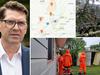
BOM’s response, explanation for Hervey Bay’s ‘rain bomb’
As a freak storm left Hervey Bay in the middle of a flash flooding disaster on Sunday, many were left wondering why they didn’t get more notice. This is what BOM said:
Fraser Coast
Don't miss out on the headlines from Fraser Coast. Followed categories will be added to My News.
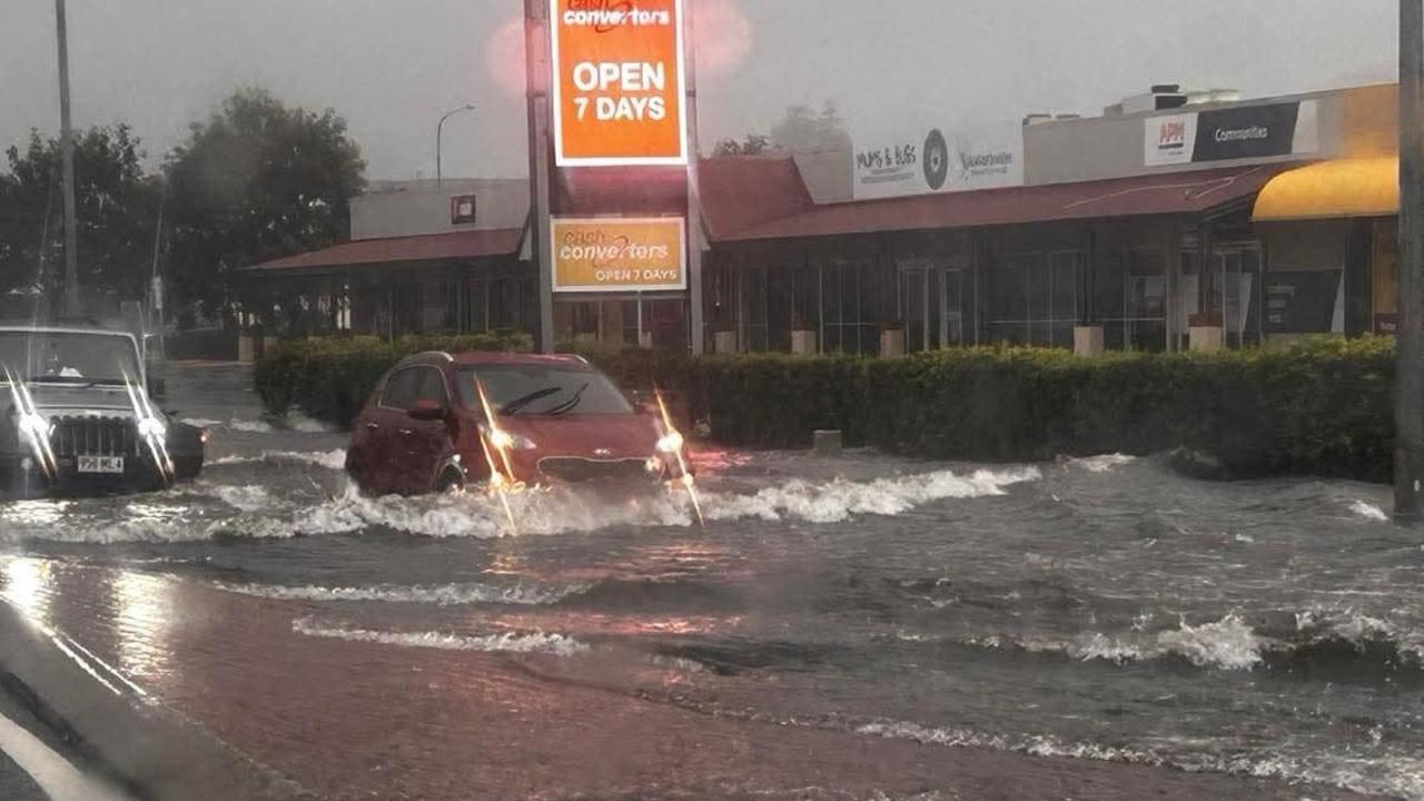
As a sudden rain bomb smashed through Hervey Bay in the early hours of Sunday morning, many residents were left wondering what had happened – and why they didn’t have more notice of what was to come.
As ex-tropical cyclone Alfred hovered off the coast of Brisbane last week, much of the focus was on southeast Queensland as the system approached the coastline.
Many in Hervey Bay had checked the weather forecast for Sunday morning, which the Bureau of Meteorology suggested would include a possible total up to 25mm of rain.
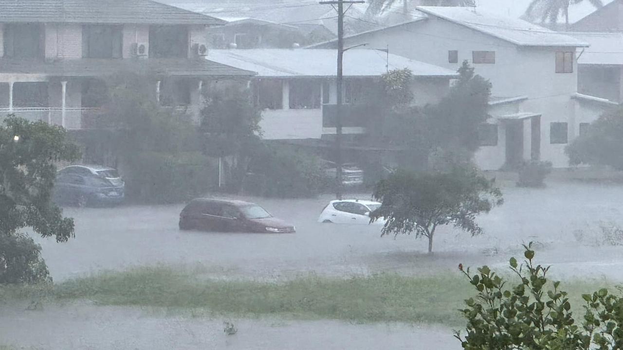
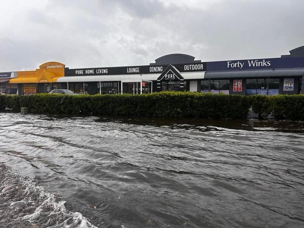
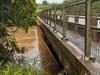
Instead, the city was hit with an official total of 261mm in a freak storm, although many with their own gauges said between 400mm and 500mm was recorded in some areas.
The flash flooding drowned cars, pushed into 1600 homes and businesses, and forced the evacuation of 32 elderly residents to a higher level of their aged care facility in the wee hours of the morning.
A spokesman from the Fraser Coast council said that on Saturday the Wide Bay region was officially declared outside the cyclone watch area.
“However, by the early hours of Sunday, March 9, the region experienced unprecedented rainfall with little advance warning from the Bureau of Meteorology,” he said.
“By 5am, intense lightning, thunder, and heavy rainfall were already in full force.
“Council crews were on-site and ready to respond by 7am, despite receiving very little notice.”
The spokesman said the Bureau of Meteorology issued a Severe Weather Warning for Hervey Bay and K’gari at 6.58am, after the region had already been inundated with record-breaking rainfall.
“At 7.30am, council activated an Emergency Warning, distributing critical information via the disaster dashboard, social media, and the District and State Disaster Coordination Centre, where it was displayed on the State disaster webpage,” he said.
“By 8am, council crews were mobilized and on the ground at the Esplanade.
“However, hazardous conditions—including flash flooding, fallen powerlines, contaminated floodwater, and floating debris — made it unsafe for staff to begin immediate recovery efforts.
“It was not until approximately 10.30am that conditions improved enough for response operations to commence.
“Despite the severity of the event, Hervey Bay Hospital has reported no injuries related to the weather.”
A spokeswoman from the Bureau responded to a series of questions from the Chronicle on Monday in the wake of the flash flooding that hit Hervey Bay.
“Hervey Bay and surrounding areas were in the Tropical Cyclone Watch region five days before the heavy rainfall that occurred 4am to noon on Sunday, March 9,” the spokeswoman said.
“A Flood Watch was in place for the Mary River catchment from Sunday, March 2, seven days before the flooding occurred on March 9.
“The potential for severe weather with ‘heavy locally intense rainfall and damaging winds’ for the southern part of the Wide Bay and Burnett forecast district, which includes Hervey Bay, was first forecast and communicated as a Severe Weather Warning at 6am on Saturday March 8, 22 hours before significant rain occurred.
“This Severe Weather Warning was updated at 10.57am March 8, via a forecast stating that “locally intense rainfall which may lead to dangerous and life threatening flash flooding may develop later today and on Sunday near and south of the system centre, and in bands of showers and thunderstorms wrapping around the system over the Southeast Queensland coast and southern Wide Bay and Burnett’.”
The spokeswoman said the Bureau continued to provide more information as it became available.
“The Severe Weather Warning was updated at 4.57pm and 10.59pm on Saturday March 8,” she said.
“The warning was again updated at 4.54am on Sunday March 9, as radar data indicated intense rainfall developing.
“The warning was updated again at 6.58am on Sunday March 9, and included the SEWS (Standard Emergency Warning Signal).
“Further updates followed at 8.19am and 10.34am on Sunday March 9.
“While the Bureau can analyse and predict when the atmosphere is likely to produce localised intense rainfall, the rapidly changing nature of thunderstorms makes it difficult to forecast their exact location with long lead times.”
Fraser Coast Mayor George Seymour addressed the media regarding the freak weather event on Monday.
“It came on very, very quick and very, very hard with the way it fell,” he said.
It had “really tested our community”.
Mr Seymour said about 1600 properties in Hervey Bay had been affected by the flash flooding.
More Coverage
Originally published as BOM’s response, explanation for Hervey Bay’s ‘rain bomb’

‘Step in and show me how’: Mum of missing teen hits back at trolls
The mother of a missing Bundaberg teenager has taken to social media to hit back at trolls who criticised her joint statement with police.

Grave fears for driver after crashing vehicle onto pole
A man has been rushed to hospital in a life-threatening condition after his car smashed into a pole, cutting power to a Fraser Coast town.
Fraser Coast sale and auction results, week ending May 31
Maryborough proved to be a hot market last week with six properties selling for a total value of $3.2 million. See the latest auction and sales results.

Neighbours speak after murder-accused mum found unresponsive in cell
A woman accused of murdering her three-year-old daughter near Bundaberg has been found unresponsive in her prison cell as neighbours, still reeling from the week’s horrific events, speak out.

Drug dealer ran red light, drove dangerously while evading police
A drug dealer and serial disqualified driver who led police on a chase through Bundaberg until they were forced to abandon it has proven himself a menace to society in more ways than one. But the law caught up with him this week:
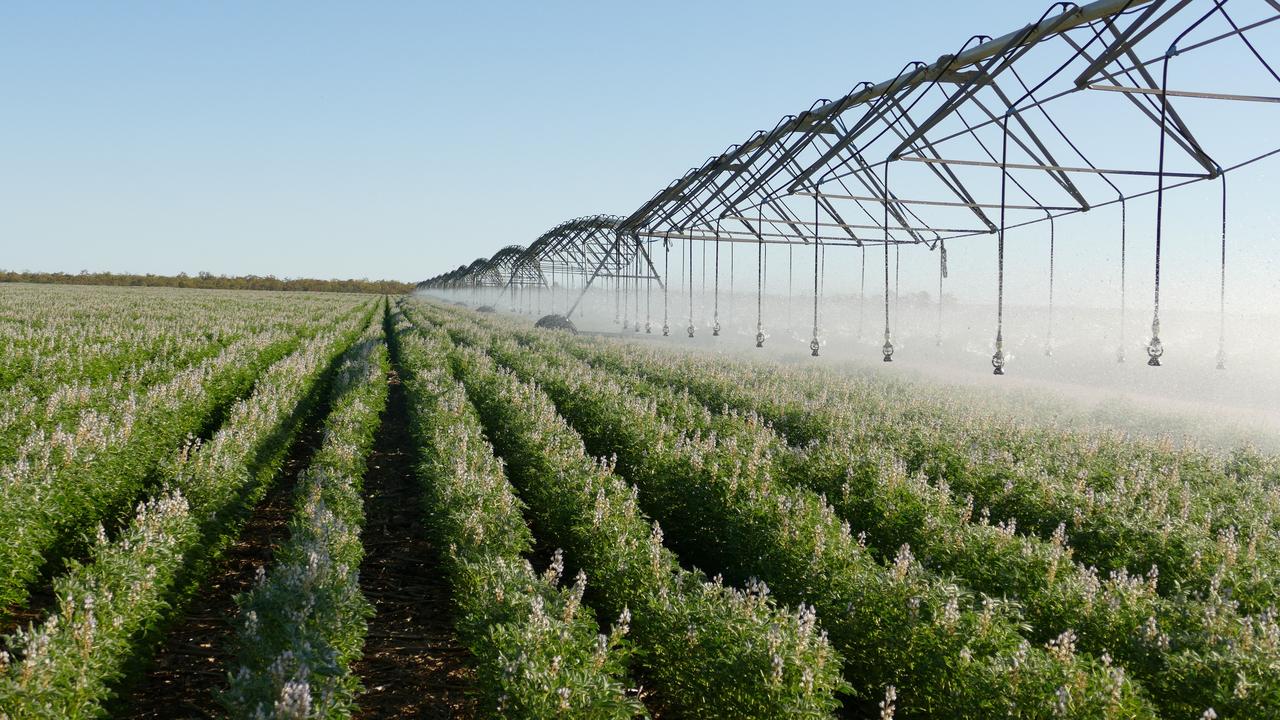
Field of dreams: Queensland’s biggest crop farms revealed
Queensland farmers feed and clothe the nation but are often underappreciated. We tracked down the state’s largest crop farms to see who’s doing the heavy lifting. SEE FULL LIST