
Queensland weather: Snow falling Spicers Peak Lodge on Scenic Rim amid cold snap
Footage has captured snow falling on Queensland’s Scenic Rim this morning as a polar blast hits, triggering damaging winds across the southeast. WATCH THE VIDEO
QLD News
Don't miss out on the headlines from QLD News. Followed categories will be added to My News.
Snow has fallen on Queensland’s Scenic Rim this morning as wild winds wreak havoc throughout South East Queensland this afternoon.
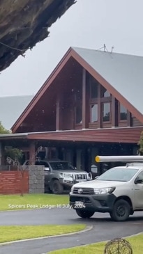
Spicers Peak Lodge posted a video to Facebook that captured light snow falling earlier today.
“Snowfall! A few hours ago, we were lucky enough to witness snow for a few minutes. The last time we experienced this was on 17 July 2015 (almost exactly 9 years ago - we’ve included images at the end of the reel.),” the post read.
It comes as nearly 20,000 power outages reported and a popular Brisbane riverside cafe forced to close due to structural damage.
Bureau of Meteorology senior forecaster Felim Hannify said widespread wind gusts of up to 60 to 70km/h were sweeping across the southeast, mainly affecting Brisbane.
“The strongest we have seen is 72km/h at Archerfield, and at Brisbane Airport we have seen a gust of 70km/h,” Mr Hannify said.
“The winds are funnelling through the Brisbane Valley... and the Brisbane area will be experiencing the strongest winds.
“The strongest of the winds are peaking now and will ease into the evening and the winds to pick up against mid morning on Wednesday with gusts 50 to 60km/h.”
Energex spokesman Danny Donald said Tuesday has been no different to a storm response, with “crews everywhere” restoring power.
“Mainly in the heavy watered areas and the coastal areas stretching from the Sunshine Coast area to the Gold Coast, so far today we have had 17,000 outages which is equivalent to a small storm; no doubt if the winds continue we will still see outages,” Mr Donald said.
“Some areas we have had whole trees over power lines and bring down power lines.
“Tree branches thrown a couple hundred meters onto power lines. It’s been a busy day, crews haven’t stopped all day.”
Mr Donald said crews had restored power to affected areas, only to moments later respond to another outage nearby.
Mr Donald urged residents to be careful around downed power lines and to be aware of lines tangled in fallen debris.
Meanwhile, Joey’s Cafe on River Terrace at Brisbane's Kangaroo Point alerted customers on social media to its snap closure following damage from strong winds.
“We regret to inform our wonderful customers that we will be closed temporarily due to structural damage caused by strong winds currently in Brisbane,” the post said.
“We are working very hard to reopen as soon as possible and apologise to anyone who has been inconvenienced by this.”

It came as subzero temperatures swept southern Queensland early on Tuesday morning.
Oakey just west of Toowoomba was the coldest place in Queensland, dropping to -3.2C at 6.20am, but it felt far colder at -5.7C.
Brisbane experienced its coldest morning in over a year as the mercury dropped to 7.4C.
However the Bureau of Meteorology’s Patch Clapp said while it would be cold this week and next, it would not likely be record-breaking.
“Brisbane had its coldest morning since July 8 last year with 7.4C this morning and the Brisbane Airport being 5.8C,” Mr Clapp said.
“At this stage it’s looking like last night may have been the coolest, but we are staying cool across the mornings in the single digit temps pretty much right through until the start of next week, generally sitting around 8 or 9C.”
He said the combination of a low-pressure system in the southeast of the country and a high-pressure system over the Great Australian Bight was driving the cold conditions.
Stinging west-south-westerly winds were resulting in even lower apparent temperatures.


Mr Clapp said this wind was playing a small role in preventing the presence of frost in the city, but after winds ease on Thursday evening, frost could be on the cards for Brisbane.
According to the bureau there have been wind gusts of up to 39km/h in the City and 59 km/h at the airport.
It is still a brutally cold morning across southern and South East Queensland, with Beaudesert dropping to 0C at 6.20am, with a feels like temperature of -2.1C.
Canungra got down to -0.3C, but felt like -2.3C, and Gatton was 0.7C, but felt like -1.3C.
It was unusually cold on the Gold Coast, with Coolangatta dropping to 4.7C at 6.20am, with an apparent temperature of 2.7C, while further Nambour was 5.2C, but felt like 3.9C, and Gympie was 1.5C, but felt like 0.3C.
Brisbane’s lowest temperature was 7.4C at 5.40am.
Michael Hudson was in Stanthorpe this morning and said he “could not feel his hands”.
“Temperatures were just below 3C at 5am, and there was a light breeze enough to numb fingers and freeze camera equipment,” he said.
“Small patches of frost are scattered about the town and there has not been any dog walkers or early rises venturing out into the cold just yet.
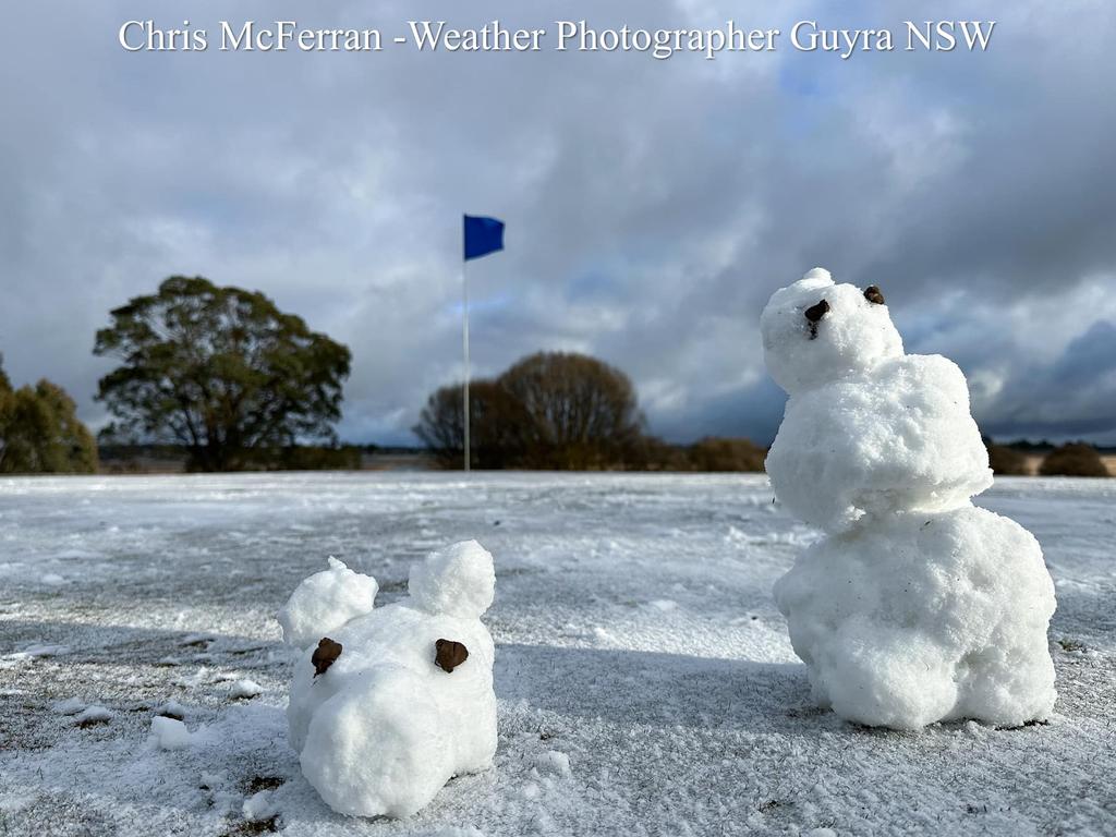
“The Granite Belt is preparing for an influx of tourists trying to get a glimpse of the snow, with travellers expected to come from all over Queensland in the coming days.”
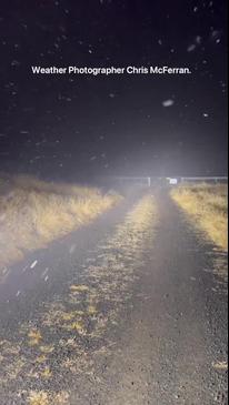
Weatherzone says light snow flurries are possible today and tomorrow in the southern parts of the state due to a cold air mass which originated in Antarctic waters crossing the border.
“The chilly air will be accompanied by sufficient moisture for occasional light showers which could fall as snow on high ground above about 1000 metres,” a Weatherzone statement read.
For footy fans heading to Suncorp Stadium for the State of Origin decider, Weatherzone has warned punters to brace for an icy evening.
“It’ll be a cold night by Brisbane standards with a low of nine degrees with maximums of 19C expected from Monday through to Thursday,” it read.
Originally published as Queensland weather: Snow falling Spicers Peak Lodge on Scenic Rim amid cold snap
Join the conversation

Unionists to rally in Brisbane in support of CFMEU
Unionists will rally in Brisbane on Tuesday in what’s expected to be another rowdy show of support for the rogue CFMEU.
Read more

‘Horrible’: Qantas flight in 6000m emergency descent
A Townsville to Brisbane flight has had to be diverted to Rockhampton after a reported cabin pressure issue forced it to drop more than 6000 metres in a matter of minutes.
Read more

Coldest morning in 10 years: Where ‘feels like’ temp dipped to -5.5C
Southern Queensland has experienced another frosty morning, with one centre experiencing its coldest September morning since 2014, but there are warnings temperatures are about to lift dramatically.
Read more

Shopping centre arrest as alleged $400m meth in juice bottle plot busted
A group of Queensland men have been arrested after federal police foiled a plot to smuggle $400 million of liquid meth into the state hidden inside bottles of juice.
Read more

More money, focus on wellbeing stems child safety exodus
Queensland’s child safety officer vacancy rate has fallen by 45 per cent in 12 months due to this fresh approach by authorities.
Read more

Two years overdue, two sites tested: ‘Unfathomable’ delay for key DV scheme
A video recording scheme preventing domestic violence victims from having to relive their trauma has not been rolled out across Queensland more than three years since an inquiry.
Read more