
Cyclone Alfred: System performs second pirouette as 24-hour countdown to chaos begins
Tropical Cyclone Alfred has been downgraded to a Category 1 system and has hit Moreton Island as the system makes a beeline for the mainland.
QLD News
Don't miss out on the headlines from QLD News. Followed categories will be added to My News.
Tropical Cyclone Alfred has been downgraded to a Category 1 system and was now predicted to make landfall at 6am Saturday, according to the latest modelling.
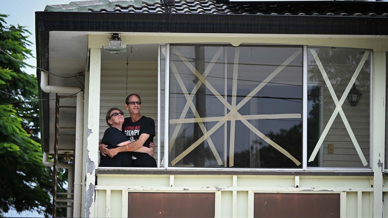
Brisbane City Council issued a warning to all residents to stay indoors at midnight Friday.
“Go to the strongest, safest part of the building you are in,” the statement said.
“This will be away from big windows. It could be a bathroom, walk-in wardrobe, or hallway. Stay there.”
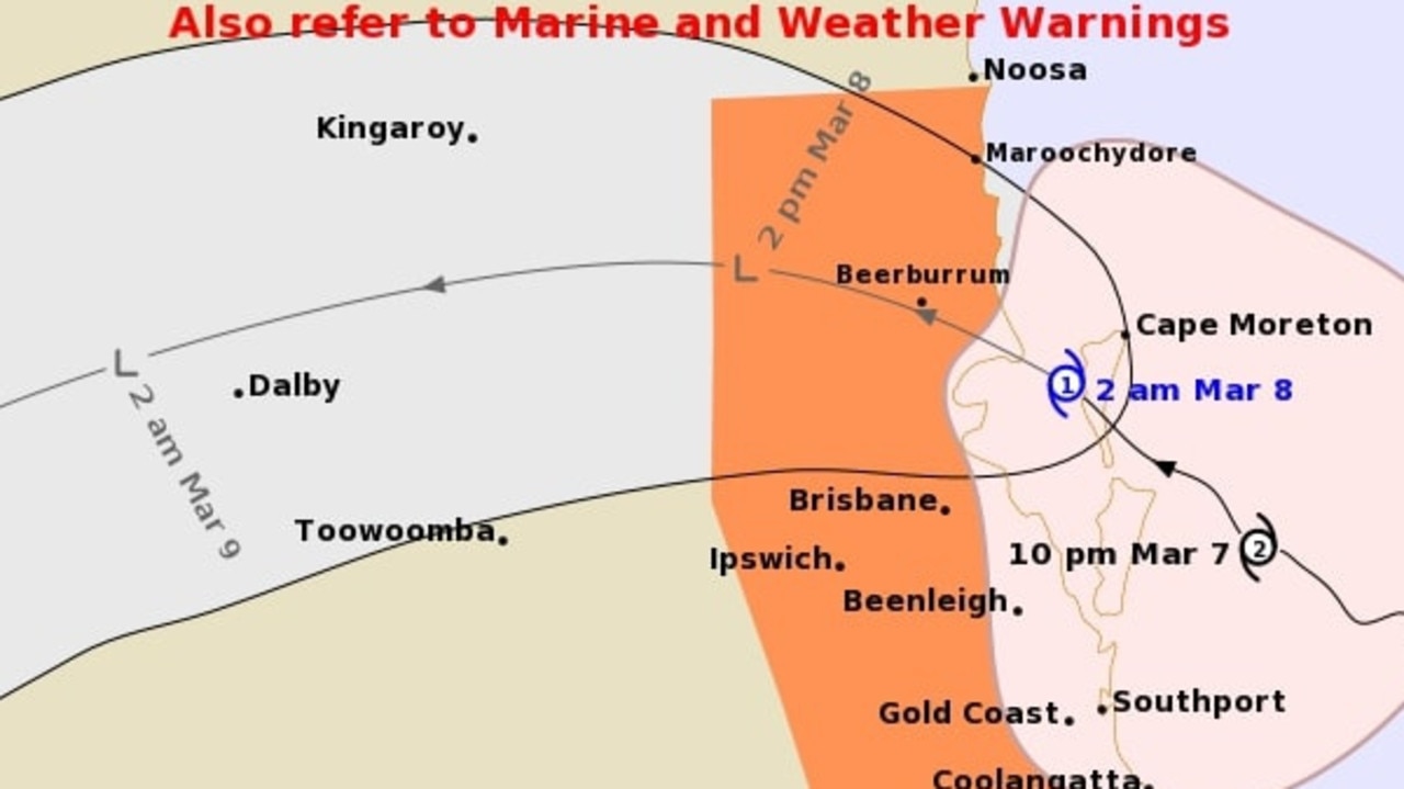
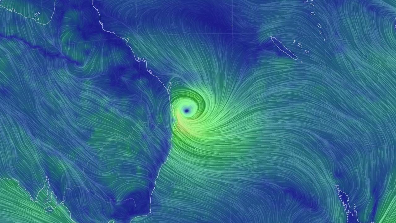
The latest tracking map for Cyclone Alfred, released at 2am, had landfall expected to occur around 6am on Saturday near Sandstone Point.
Alfred passed over Moreton Island at 1am.
Alfred has been downgraded to a Category 1 cyclone with sustained winds near the centre of 75km/h and gusts to 100km/h.
It was moving northwest at 13km/h and was expected to weaken as it moved inland late Saturday and Sunday.
Bureau of Meteorology senior meteorologist Angus Hines said Cyclone Alfred was still expected to make landfall in the early hours of Saturday.
Speaking on ABC Brisbane radio just after 2am on Saturday, Mr Hines said: “I’m not quite sure if it is on the mainland yet, it’s certainly getting close”.
“It is still out over those Moreton Bay waters...it will make its way onshore over the next few hours.
“The eye itself is starting to lose shape as it was interacting with those islands.
“There is a lot of rain to come.”
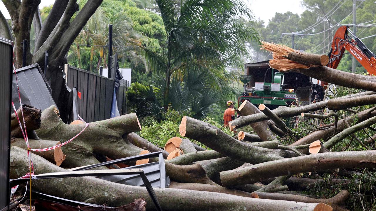
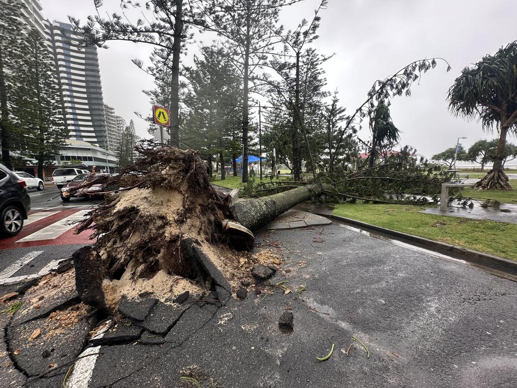
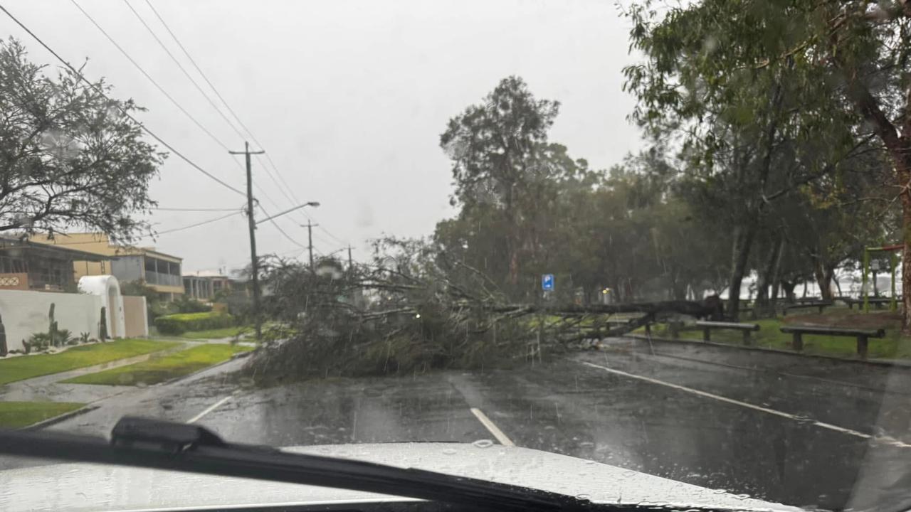
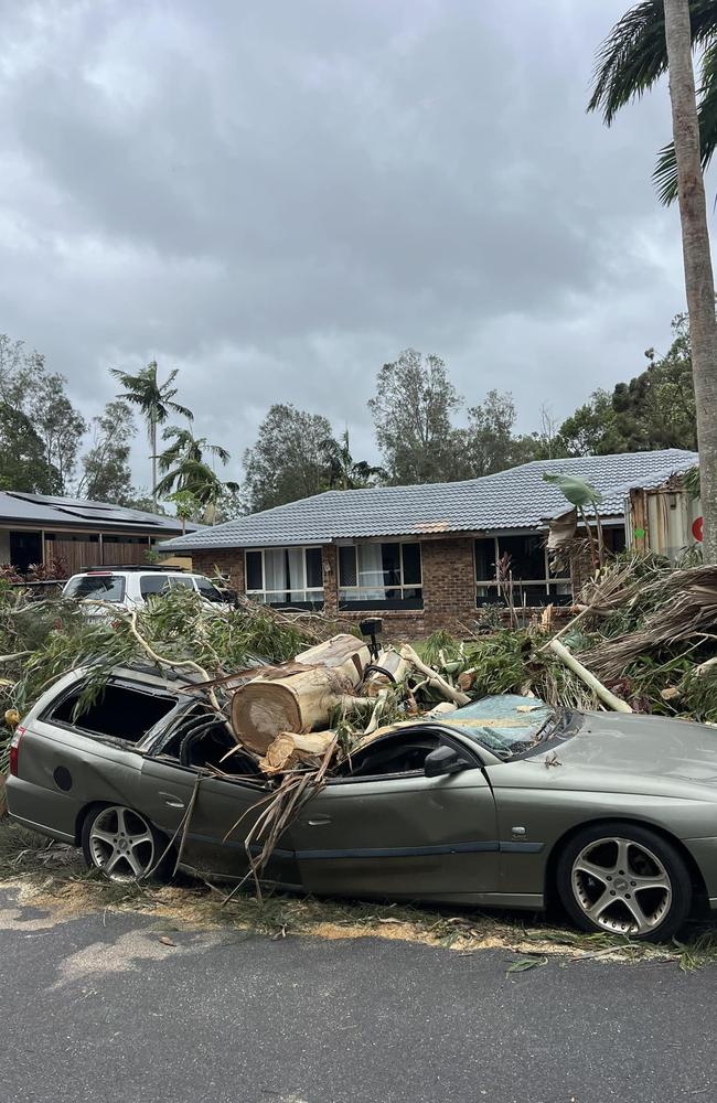
More than 200,000 houses were without power across Southeast Queensland at 1am, including 118,723 on the Gold Coast, 36,353 in Redlands, 21,153 in Logan and 20,989 in Brisbane.
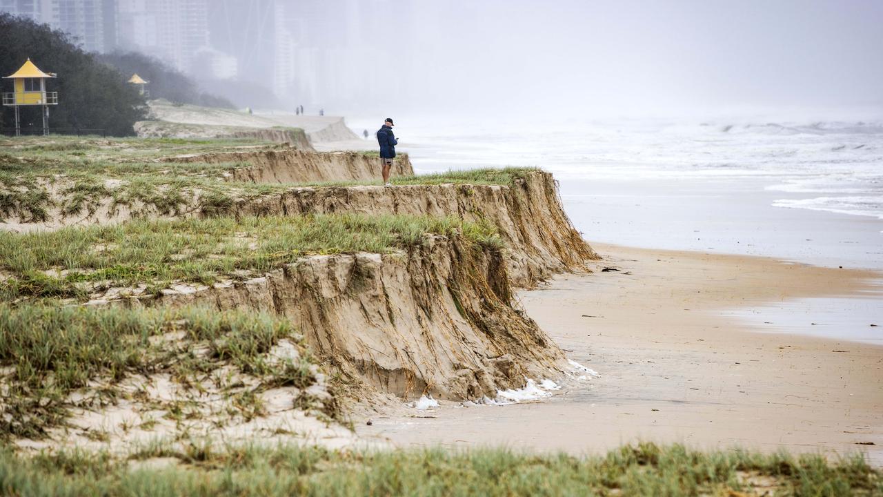
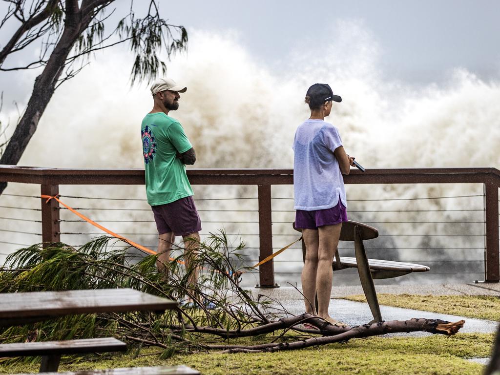
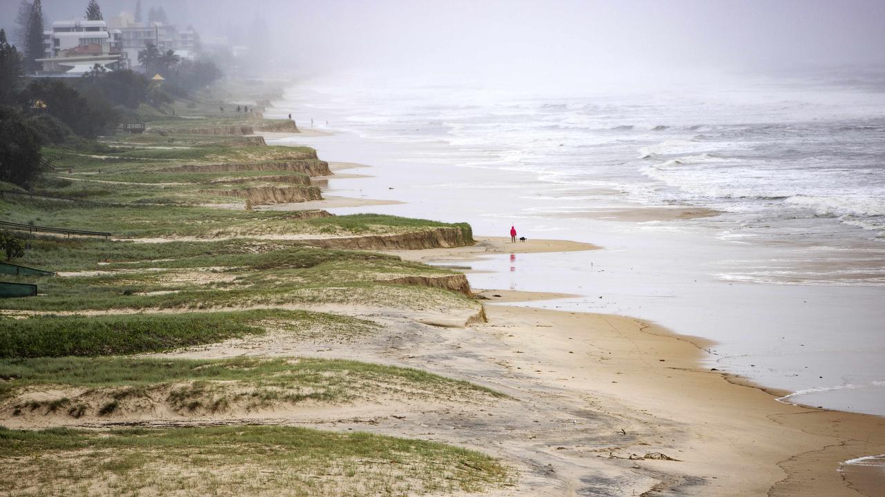
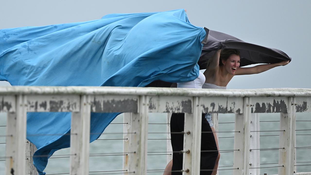
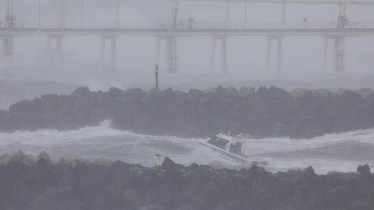
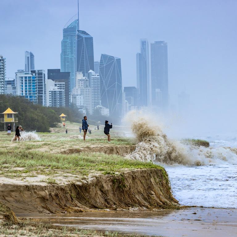
The update comes after the Gold Coast was hammered by cyclonic winds and torrential rain as Alfred unleashed fury on Southeast Queensland.
Residents were ordered to take shelter immediately via a Gold Coast City Council emergency alert just before 4pm Friday which warned of impending heavy rain, wild winds and flash flooding.
Gusts of up to 107km/h were recorded at the Gold Coast Seaway just north of Main Beach on top of sustained speeds of up to 70km/h.
At Coolangatta, the winds were sustained at 54km/h with a peak of 100km/h.
Point Lookout on North Stradbroke Island has wind speeds between 50-60km/h.
At Cape Byron in northern NSW, the sustained winds were 76km/h with gusts of 98km/h.
Brisbane’s airport had a gust of 67km/h, but the winds there remained lighter at 44km/h.
The intermittent showers from earlier in the day had also made way for unrelenting sideways rain.
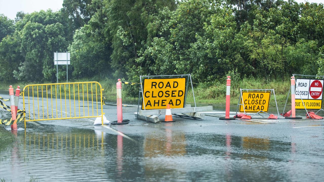
An emergency alert for dangerous flash flooding was issued for Currumbin Valley - with residents told it was too late to leave and they must get to higher ground where they are.
The dangerous flash flooding is impacting Currumbin Creek with Currumbin Creek Rd cut by floodwaters in several sections.
An emergency warning for Moreton Bay residents was issued at 9.45pm, advising residents to take shelter from Cyclone Alfred and to remain indoors until conditions had eased.
Gold Coast residents were warned to bunker down for up to 36 hours from this afternoon.
Updating media at the city’s disaster and emergency management centre, Local Disaster Coordinator Mark Ryan said it was possible people would have to “shelter in place” for 24-36 hours from 4pm Friday.
Acting Gold Coast Mayor Donna Gates asked residents to be off roads and stay at home, before conditions worsened drastically in the coming hours.
From swimmers defying beach closures to people stealing sand bags, Gold Coasters were slammed for the “pure stupidity” that placed lives at risk.
In NSW a man is feared dead after he was swept into flood waters near Dorrigo.
Emergency services responded to reports a 4WD had been washed off a bridge into fast running water, where the male driver was able to exit the vehicle and secure himself to a tree branch approximately 30m from the river bank.
Half an hour later the man was swept from the tree and seen to go beneath the water where he has not been sighted since.
Sky News Weather meteorologist Alison Osborne said while Brisbane had largely been spared on Friday, the River City would start to feel the effects of the cyclone from this evening.
“Winds are likely to increase in Brisbane as that system approaches tonight,” she said.
“The coastal crossing is still looking likely to take place between Noosa and Beenleigh, so Brisbane is still facing the threat of a direct hit during Saturday morning.
“The rain is on its way, but the more intense rain will impact Brisbane during the coastal crossing.
“We’re looking at possible 24 hour rainfall totals upwards of 150mm across the city.
“It’s been a quiet day today in Brisbane, but it does look like it’s coming.”
WATCH PREMIER DAVID CRISAFULLI SPEAK BELOW
#LIVE: I’m delivering an update on Tropical Cyclone Alfred https://t.co/6IoN5dWPLW
— David Crisafulli (@DavidCrisafulli) March 7, 2025
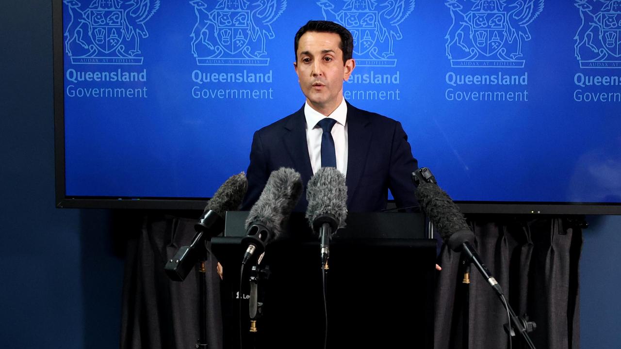
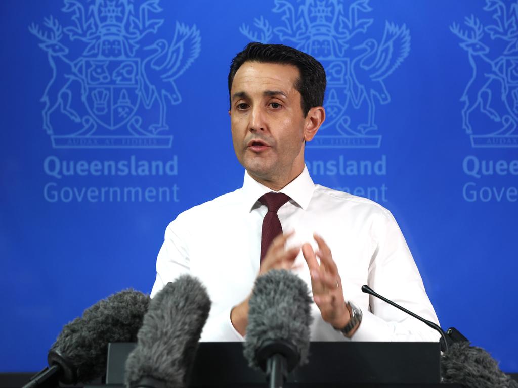
Premier David Crisafulli said there had been 307 requests for assistance from the SES since 10am on Friday.
He said there had been 36 requests in the Southern Downs, 107 on the Gold Coast and 44 in Brisbane.
The Queensland Fire Department have responded to 20 incidents today and police have had 76 calls for assistance.
Mr Crisafulli said 59 roads had been impacted on the Gold Coast.
He said 9000 homes had been doorknocked today and Police Minister Dan Purdie was out with recruits who were going home to home.
He said there was now 30 disaster refuges set up by councils.
Mr Crisafulli said since 10am the bulk of rainfall had been between 40-50mm at Scenic Rim, Springbrook and Running Creek.
He said it took their totals to about 200mm in just over 24 hours.
Mr Crisafulli said the Redlands Satellite Health Centre had been closed due to potential flood risk but medical equipment and staff have been relocated.
The Wynnum Manly Primary Clinic had temporarily closed for safety, relating to back-up power supply.
Mr Crisafulli said all hospitals remained open for emergency care.
Prime Minister Anthony Albanese said a disaster response team of 66 personnel had already been sent from New Zealand.
Speaking on KIIS 97.3FM on Friday afternoon, Mr Albanese said: “We often say that Australia and New Zealand are family … this is what family do”.
“This cyclone doesn’t recognise borders and nor should we … we are seeing the best of Australians during this difficult time.”
Mr Albanese said ADF personnel were also on standby.
He said it was important Queenslanders stayed connected and followed advice from authorities including the Bureau of Meteorology.
“I wish everyone all the best, I certainly hope people stay as safe as possible”.
Bureau of Meteorology meteorologist Matt Collopy said damaging wind gusts up to 120km had already been recorded on the coast between Cape Moreton and Cape Byron.
“The heavy to intense rainfall is expected to produce the risk of flash and widespread minor to major riverine flooding,” he said.
He said rainfall totals of up to 200mm had also been observed in the Scenic Rim and Gold Coast regions.
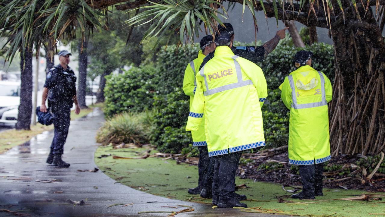
Acting Police Commissioner Shane Chelepy said there had been no loss of life or missing persons as a result of TC Alfred in Queensland.
Mr Chelepy said since 10am Friday, SES had received a further 307 jobs while the QPS had received 76 jobs.
He said police had now door knocked more than 9000 homes.
“That will continue in Brisbane and surrounds … door knocking isn’t continuing on the Gold Coast … our crews are into emergency response today,” Mr Chelepy said.
“There is still time to make a plan in those areas.”
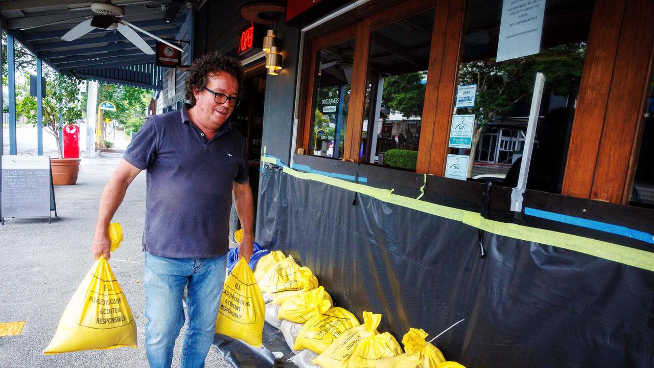
Deputy Premier Jarrod Bleijie thanked supermarket and retail workers who had kept stores open for “as long as they possibly can”.
“You will expect over the next 24 hours for supermarkets to be progressively closing from this afternoon,” he said.
Acting Gold Coast mayor Donna Gates told media she was disappointed to continually warn people to stay out of the water at beaches and revealed a disturbing new trend of people stealing the sand bags used to weigh down road closure signs.
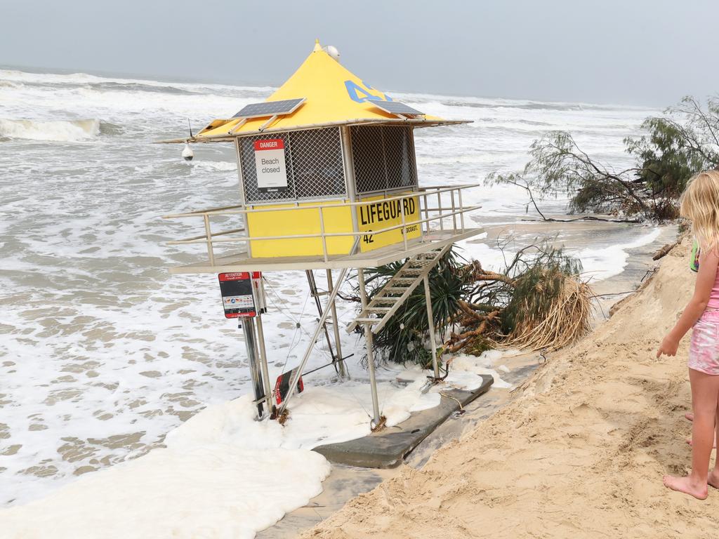
“It’s incredibly disappointing because we are in an emergency situation here and everyone has been so good, all the agencies in doing everything they can and for people to put other lives at risk is just pure stupidity,” she said.
“We’ve seen it in the water and now we’re seeing it with signage warning people of road closures because a road is underwater is blowing away because the sandbags are being removed.
“The signage needs to be there, so that people are aware of a road being closed and we certainly don’t want that signage becoming a missile and causing additional damage.
“You can’t imagine what entered someone’s head to think that that’s an okay thing to do in these circumstances.”
Acting Chief Superintendent Peter Miles from the South Eastern Region of Queensland Police said two teenage swimmers had been rescued on Friday morning while four others were spoken to by officers.
“Ninety nine per cent of people have been fantastic – it’s just that one per cent of people causing us some angst,” he said.
Cyclone Alfred coming to town. pic.twitter.com/GBKztTl1hc
— Russell Crowe (@russellcrowe) March 7, 2025
WATCH THE PREMIER’S LATEST UPDATE BELOW
#LIVE: I’m delivering an update on Tropical Cyclone Alfred https://t.co/RUvsKmhUEb
— David Crisafulli (@DavidCrisafulli) March 7, 2025
Premier’s update: Brisbane will feel the impact this afternoon
Premier David Crisafulli said Cyclone Alfred was expected to cross Moreton Bay islands on Saturday morning, with Brisbane residents expected to begin feeling the effects of the system in the afternoon.
High winds would be felt in Brisbane and to the north from this afternoon, but strong winds had already caused mass power outages across the Gold Coast, with Mr Crisafulli saying work would start as soon as possible to reconnect residents.
SUPERMARKETS, SERVOS: WHAT’S OPEN, CLOSED ACROSS SEQ
“The moment it is safe to do so, those crews will be hooking into action to reconnect,” he said.
“We are expecting some significant rainfall in the next 24 to 48 hours right across that system.
“This system remains a very broad one … it is really large and slow-moving and that does present the prospect of significant rainfall over a period of time.”
The Premier said there had been no reports of home inundation from storm surges so far.
The Bureau of Meteorology warned 800mm of rain over the next 48 hours is possible in some areas.
Bureau of Meteorology meteorologist Matt Collopy said Alfred was expected to weaken from a category two to a category one system.
“This will mean that destructive winds are unlikely for Brisbane itself,” he said.
He said major flood warnings were in place for the Logan and Albert rivers.
“We are particularly concerned about the flood risk and that risk extends beyond the cyclone crossing,” he said.
Mr Chelepy said emergency services were still “door knocking at-risk residents in flood zones” and the QPS was now preparing for “flash flooding and major riverine flooding”.
“So if emergency services come to your door to provide you with advice, please listen to that advice,” he said
“Now is not the time to be undertaking sightseeing.”
Assistant Commissioner Shane Chelepy said there had been 11 search and rescues for swimmers, kayakers and jet skiers in rough seas.
“Now is not the time to be in the surf, all you’re doing is putting emergency services at risk, and yourself at risk,” Mr Chelepy said.
Mr Chelepy said they were now preparing for flash flooding and heavy riverine flooding which was expected to impact roads later today.
State Emergency Service chief officer Mark Armstrong said in the last 24 hours there had been more than 1300 requests for SES assistance.
The SES had distributed more than one million sandbags to local governments and had more in reserve if needed.
Bureau of Meteorology senior meteorologist Miriam Bradbury said the system could take “in the order of six, eight, nine hours” to cross.
“That means those strongest winds, the heaviest rain will be across that whole duration, across that whole period,” she said.
More than 59,000 people across South East Queensland had lost power, with the Gold Coast, where 48,000 outages are being reported, the hardest hit.
Energex had suspended restoration services on the Gold Coast until after the cyclone has passed due to the ongoing danger.
“So if you’re out now, we won’t commence restoration until after Alfred passes and it is safe to do so,” a spokesman said.
Brisbane Mayor’s warning to stay home
Brisbane Lord Mayor Adrian Schrinner said now was the time for people to stay off the roads.
“The safest place for you is indoors in your home,” he said.
Cr Schrinner told 4BC the economic impact had already started.
“It’s a sad reality when employees are going home, when businesses are shutting down early or shutting down for a period of time,” he said.
“When there’s loss of power, we’ve seen that happening already on the Gold Coast. There’s a whole range of things that are happening already and cause that economic impact.”

Ms Bradbury said the cyclone would most likely cross during daylight.
“The exact time will shift around a bit as well, as it’s likely to slow down when it hits the offshore islands and stall before it hits the mainland coast,” Ms Bradbury said.
Ms Bradbury said the crossing point of the cyclone was changing often.
“The system is shifting a little further north, a little further south, as it makes its track to the coast,” she said.
“I think the thing to focus on isn’t the crossing point, it’s the warning around that crossing point.
“Those extremely destructive winds and heavy rainfall are going to be a much wider area.”

PM’s warning ahead of cyclone’s arrival
Prime Minister Anthony Albanese urged residents to be sensible and not go sightseeing.
“Please stay safe, be sensible and keep distance from these events and the impact that it’s happening,” Mr Albanese said.
“There are a number of areas where people are being asked to evacuate.
“Australians are at our best … communities come together at a time like this.
“There is no politics in any of this, no borders and we, on behalf of the Australian Government, have your back.”
Mr Albanese said the cyclone was already having an impact.
“This is a serious event. What we need to do is to hope for the best but prepare for the worst,” he said.
“We should not think that slower means better. It’s not clear that it could intensify as well as it is over warmer waters has the potential to increase the intensity.”
Mr Albanese said that climate change is having an impact on the weather patterns.
“The science tells us that there could be more extreme weather events. They would be more frequent, and they’d be more intense,” he said.
Lord Mayor says prepare for the worst
Cr Schrinner said there could be a lot of flooding and power outages.
“That’s what we’re telling people to prepare for, and also be prepared for the power outages as well,” he said.
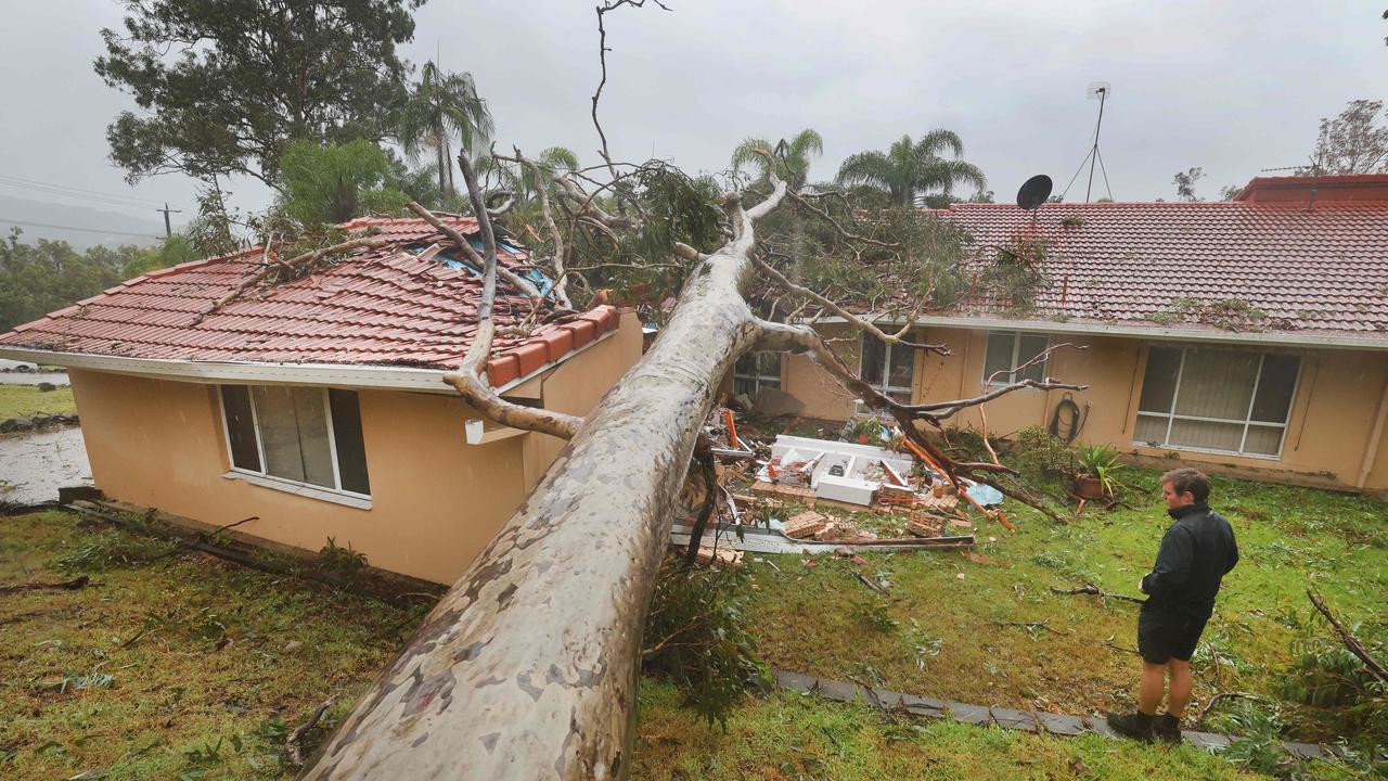
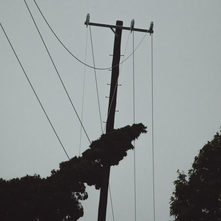
“We’ve seen more than 20,000 people impacted in South East Queensland already by power failures, and this is about trees coming down on power lines.”
Cr Schrinner told ABC Radio the refuge shelter RNA Showgrounds remained open, despite earlier information indicating that it was locked up at noon on Thursday.
He said the shelter will close its doors during the peak of the storms.
“That hasn’t happened yet, so that information was outdated before the cyclone slowed down” he said.
Mr Schrinner said the other two shelters – Chandler Arena of Sleeman Sports Complex in Chandler and Kedron-Wavell in Chermside – have not yet opened and will be used as backups.
Bureau says Alfred could intensify again
In its tropical cyclone technical bulletin, the Bureau warns the system could intensify during Friday before plateauing until the centre crosses the coast.
It says that some weakening may occur prior to crossing due to “land influences”.
“The variations the forecast landfall is likely on late Friday evening or early Saturday,” the bulletin read.
“However, due to the system’s slow and occasionally erratic motion, there is considerable uncertainty in the exact timing of the crossing.”
At 12.07pm, Alfred was located 150km east southeast of Brisbane, with wind gusts reaching 130km/h.
The modelling showed Alfred had overnight spun back around to the east for the second time.
“Tropical Cyclone Alfred continues to move slowly towards the southeast Queensland coast. Rainfall and wind impacts are expected to continue increasing during today,” the Bureau warns.
Wind gusts of 100km/h were recorded at Coolangatta overnight, with trees falling at Currumbin, while rainfall totals exceeded 100mm across the Gold Coast.
Damaging winds of up to 120km/h were developing near the coast between Cape Moreton and Cape Byron, while gales were predicted to develop across coastal and island communities between Noosa and Ballina into Friday morning.
These dangerous winds were expected to persist throughout Friday, before easing late Saturday morning.
The Bureau warned destructive gusts of up to 155km/h may develop about coastal and island locations near, and to the south of, the cyclone centre, as Alfred’s destructive core approaches the coast.
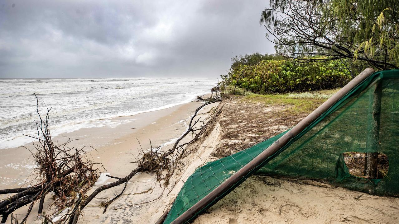
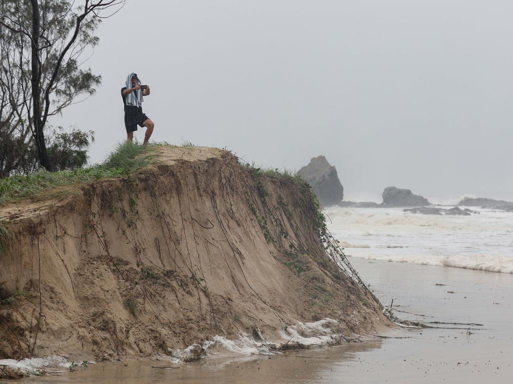
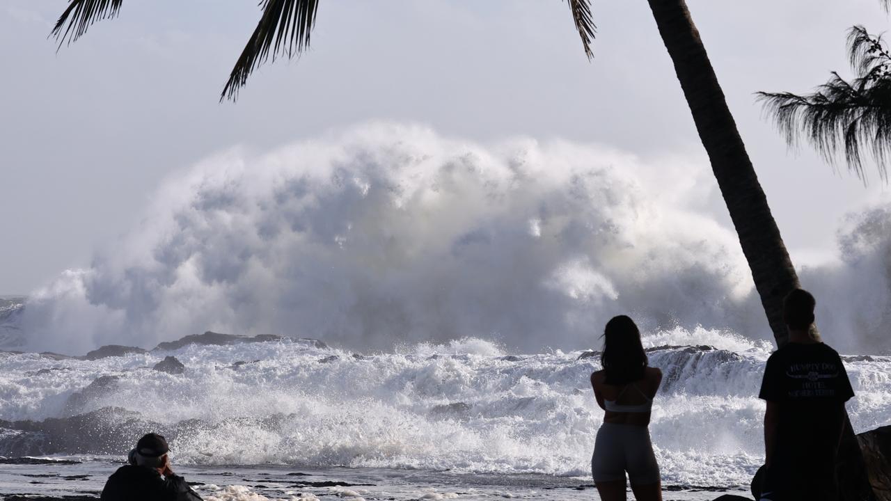
Dangerous storm tides along the coastal foreshore between Cape Moreton and Yamba are likely, with tides expected to rise far above the high tide mark and threaten to overwhelm low-lying areas.
These abnormally high tides will likely continue to cause minor flooding of coastal areas between Double Island Point and Grafton, particularly during the time of high tides early Friday morning and early Saturday morning.
Six-hourly rainfall totals between 60mm and 120mm were likely, and could increase to 180mm around Scenic Rim and Gold Coast Hinterland.
Twenty-four-hour rainfall totals between 100mm and 180mm are likely and could increase to around 300mm to 350mm for Scenic Rim and Gold Coast Hinterland.
The rainfall is expected to extend further north and west during Friday.
Premier warns against complacency
Premier David Crisafulli urged South East Queenslanders not to be complacent after Alfred stalled off the coast of Brisbane.
Mr Crisafulli warned the severe weather system still packed a punch.
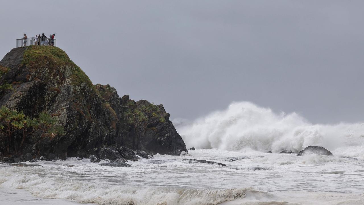
Strong winds and powerful surf were already wreaking havoc on the Sunshine and Gold coasts as well as in northern New South Wales.
The NSW SES on Friday morning said it had received more than 6300 calls and responded to more than 3400 incidents, many in the flood-weary Northern Rivers and Mid North Coast, as Alfred spun closer towards the coast.
They included three flood rescues and more than 900 incidents.
“A range of evacuations were issued yesterday afternoon and throughout the night, asking impacted communities to evacuate,” a spokesman said.
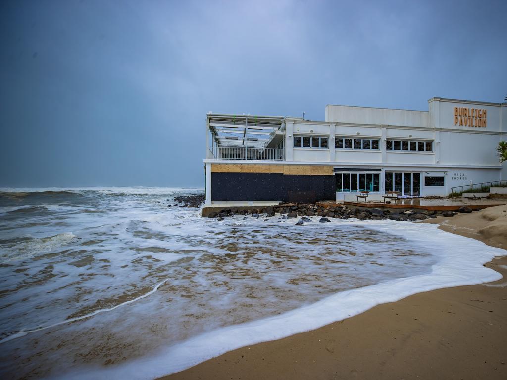
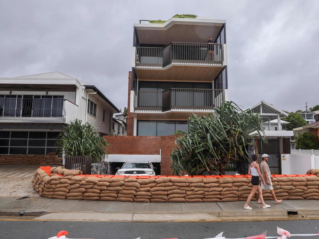
The oceanfront Burleigh Pavilion resembled a heavily fortified bunker with windows boarded up and piles of sand bags stacked around doorways and entrances.
Wind gusts of more than 63km/h were recorded at the Gold Coast Seaway on Thursday, with expectations this would increase steadily overnight to 92km/h.
Weather bureau senior meteorologist Matt Collopy said on Thursday afternoon Alfred had looped back on to itself before resuming its westward track toward the coast.
“Typically, tropical cyclones as they cross are very erratic, but we are expecting two days, perhaps two-and-a-half days’ worth of rainfall as this system both approaches, weakens, and then moves inland,” Mr Collopy said.
The meteorologist said strong winds could linger if the system stalls, but predictions indicate it would weaken as it approaches land.
He said if it crossed at high tide there was a risk of storm surges up to 1.5m.
Acting Police Commissioner Shane Chelepy said emergency services were positioned from the Sunshine Coast to the Gold Coast, ready to respond.
Sandbag stations have closed and residents in the City of Moreton must make their final preparations before the weather deteriorates.
Australian Defence Force personnel were also on standby with high-clearance vehicles and two ADF helicopters to help with search and rescue.
Twenty-five refuge locations had been established across all southeast councils.
Two thousand SES volunteers in the southeast have been bolstered by more than 100 from North Queensland.
Originally published as Cyclone Alfred: System performs second pirouette as 24-hour countdown to chaos begins

Traffic chaos, major delays on Brisbane motorways after mud spill
Motorists on two Brisbane motorways are experiencing school hour chaos after a truck crash.

Calls for Straddie probe after glamping tents cost $244k EACH
A push is under way for an investigation into funding to boost tourism on North Stradbroke Island after claims nine glamping tents were built at a cost of more than $244,000 each.

Couple homeless after taking landlord to court despite rent arrears
A pair of cash-strapped tenants who have fought their eviction despite being behind on rent since moving in, have lost a hopeless last-ditch bid to stay.

Artist guilty of insurance fraud over burnt-out $50k pink Hummer
An artist who torched her distinctive pink Hummer and claimed $30,000 in insurance has escaped immediate jail despite the 'calculated' crime.

Med student beat girlfriend, then took selfie as she bled and cried
A man waited for his peers to leave the room before he cornered his girlfriend, punched her repeatedly and then took a selfie as she bled and cried. Read the shocking details.

Controversial councillor’s ‘absurd’ conduct probes cost ratepayers $140k
Gold Coast ratepayers have forked out $140,000 to fund multiple conduct investigations into just one councillor, as she calls for an urgent shake-up of the system.