
Well above highest tides: low-lying Gold Coasters warned to prepare for flooding
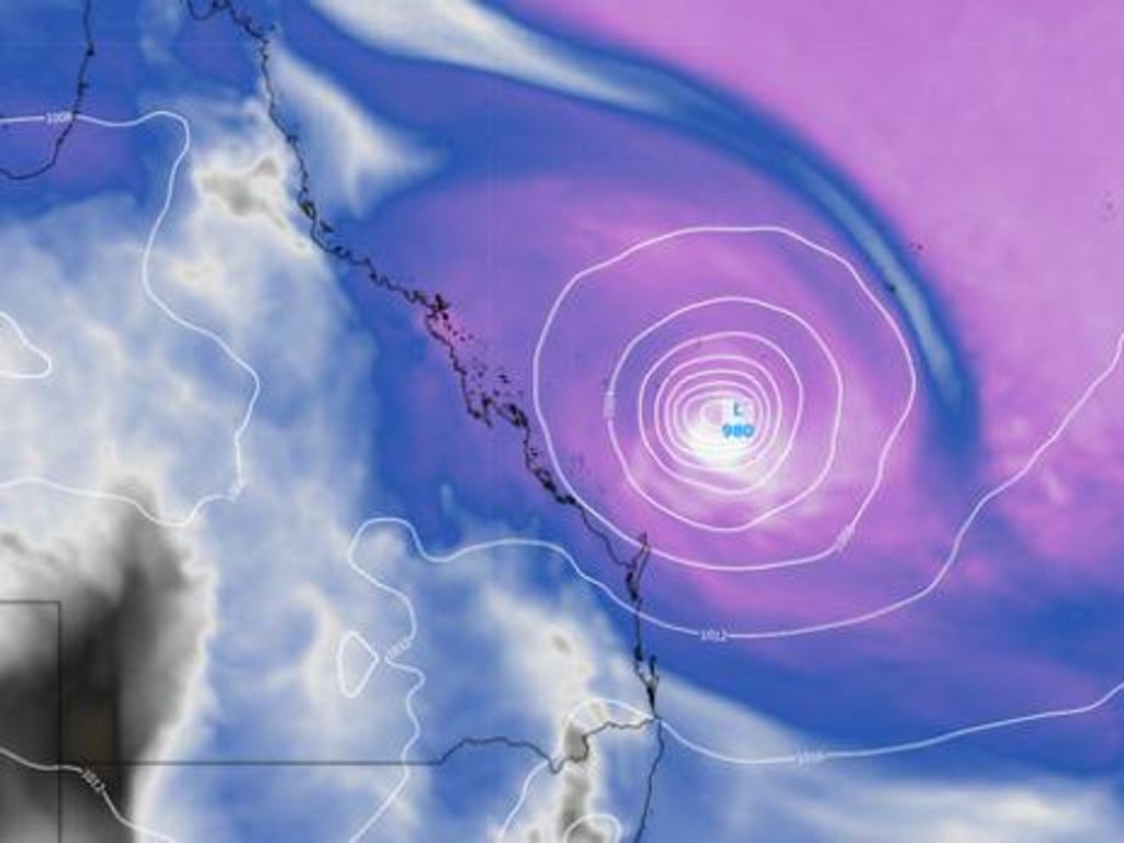
The Bureau of Meteorology (BOM) is warning Gold Coasters to brace for a rare ‘king tide’ combined with Cyclone Alfred stirring up huge surf - and is opening sandbagging stations early.
News
Don't miss out on the headlines from News. Followed categories will be added to My News.
The Bureau of Meteorology (BOM) is warning Gold Coasters a rare ‘king tide’ combined with Cyclone Alfred may raise sea levels well above normal high tides.
The City Council is opening sandbagging stations Coast-wide to help residents deal with potential flash flooding.
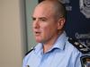
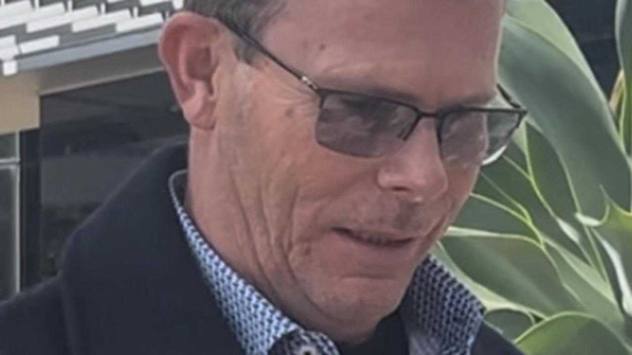
City of Gold Coast local disaster co-ordinator Mark Ryan warned residents east of the M1 and adjacent to waterways to prepare.
“That’s the highest tide of the year through tomorrow (Saturday) morning. We’re encouraging people in those low-lying areas, particularly adjacent to waterways, to get prepared now with sandbags.”
Acting Mayor Donna Gates said sandbagging stations at Burleigh, Belinga and Pimpama are opening from 8am to 1pm tomorrow and “it’s suggested anyone with concerns should get their sandbags ready”.
“There is the potential for coastal erosion and flash flooding, so we just want residents to be prepared. Our disaster management unit is prepared and we have the best people working in that area.
“We don’t want there to be a rush on sandbags over the weekend, so it’s opening at one o’clock [Friday] at those three locations.”
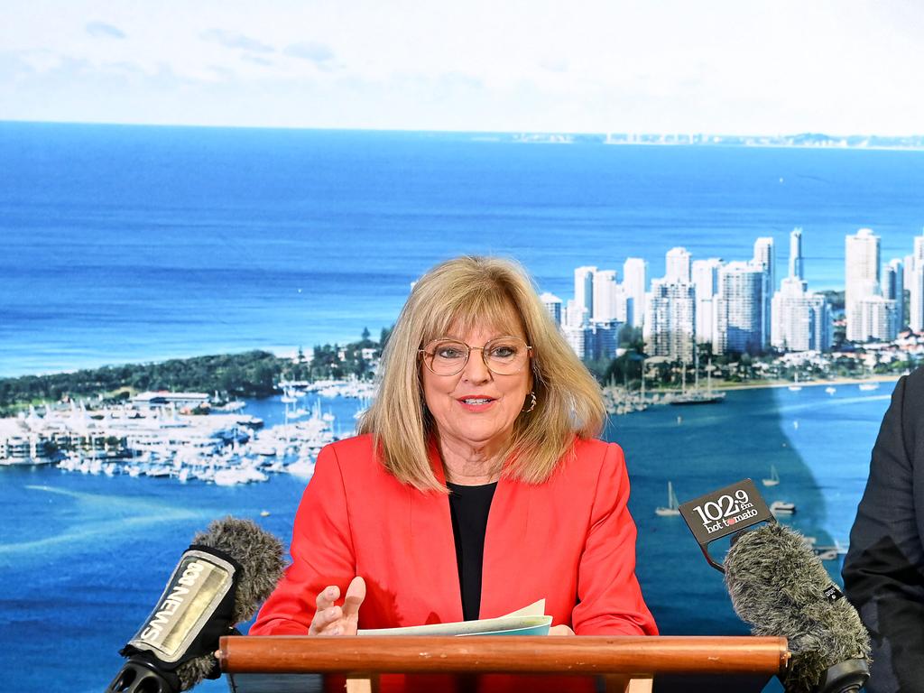
Councillor Gates said there was a “strong chance” beaches would close during dangerous conditions but added lifeguards will monitor daily if not hourly to make sure closures were well warned.
Despite Saturday being the most at risk day for flooding, Mr Ryan alerted to the possibility of strong winds continuing early next week .
“[Saturday] is the day certainly for inundation but as we head into next week, there’s potential for gale force wins late into Sunday, Monday and Tuesday, and that’s based on the current forecast.”
Tropical Cyclone Alfred is set to impact South East Queensland in coming days regardless of whether it makes landfall or not.
The BOM’s Friday update said “on Saturday [Alfred] may take a turn to the south southwest towards the Queensland coast before tracking away from the coast during Sunday”.
“There is increasing confidence that Alfred will stay offshore. However, Alfred is likely to be slow moving into next week with some ongoing uncertainty as to how close to the southern Queensland coast it may come.
“Regardless of the track Alfred takes, severe coastal hazards are likely for southern Queensland and northeast New South Wales.”
More Coverage

Originally published as Well above highest tides: low-lying Gold Coasters warned to prepare for flooding

Surprising James Bond link at Gold Coast museum
A leafy Gold Coast suburb is home to one of Australia’s most expansive war memorabilia collections. From fighter planes to real-life spy equipment which helped inspire James Bond novels, find out how you can see it all for free.

Named: Disgraced Gold Coast realtor siphoned cash for gambling
A Broadbeach real estate agent who siphoned cash from his agency’s trust fund for gambling and business costs – dudding 32 clients – is yet to repay taxpayers a year after a letter of demand.

Why Minister won’t stop Qld police whistleblower ‘witch hunt’
The Premier and his Minister have faced questions about why the Qld Police is on a Fitzgerald-like ‘witch hunt’ to silence whistleblowers in the ranks.
Motorway crash survivor flees before being struck by truck
In a terrible turn of events, a van driver who fled the scene after a Northern Rivers crash with several trucks was struck by a passing rig moments later - and is fighting for life in hospital.

Named: Psych clinic owner charged with defrauding rival of $100K-plus
The owner of a Southport psychology clinic has been charged with 18 dishonesty offences as part of an allegedly fraudulent scheme targeting the owner of a rival outfit. Here’s what we know.
Teacher fights to keep pay after suspension due to child sexual charges
A Gold Coast teacher who was charged with child sexual offences has fought to overturn a departmental decision to cut off his pay while he remains suspended. Find out whether he was successful.