
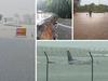
Far North Qld floods: Mossman-Mt Molloy Road, Rex Range now open
The Mossman-Mt Molloy Road, Rex Range is now open among others but traffic delays are still expected. LATEST FREE UPDATES
Cairns
Don't miss out on the headlines from Cairns. Followed categories will be added to My News.
Mossman-Mt Molloy Road re-opens
The Mossman-Mt Molloy Road, Rex Range as of 9.30am Friday has reopened to all traffic in both directions, restricted to a 42.5 tonne load limit.
Motorists are advised to proceed with caution.
Daintree River Ferry passes safety checks
The Daintree River Ferry has passed a safety check and will be available for use by emergency services and road crews today.
“We hope to open up the ferry to residents north of Daintree River between 2pm – 6pm, if it is safe to do so,” a spokesperson said.
“We will provide an update when the ferry will be open to the wider public.
“While we all look forward to the return of a full ferry service, please respect the current restrictions.
“The roads are still significantly blocked with landslides, and we need to mobilise heavy machinery, while access for local residents needs to be a priority following a long period of isolation.”
Captain Cook Highway reopens
Key parts of the Captain Cook Highway are now operational and work has begun to reopen critical access point for Port Douglas and the Tablelands.
The Captain Cook Highway between Smithfield and Stratford was reopened late last night after crews repaired damage to Barron River Bridge while work to restore the highway north of Palm Cove is underway.
“We are prioritising inspections and repair work on parts of Kuranda Range Road and the Captain Cook Highway between Cairns and the northern beaches,” a spokesperson for Transport and Main Roads said.
Kuranda Range road was opened to emergency vehicles from yesterday and was fully opened to the public this morning.
While no official reopening date has been set for the reopening of the road between Port Douglas and Cairns, MP for Cairns Michael Healy predicted it could take weeks.
“Some roads have suffered significant damage which could take an extended period to reopen to traffic, including the Palmerston Highway and the Captain Cook Highway north of Palm Cove where major landslides have occurred,” TMR’s spokesperson said.
Newly appointed Transport and Main Roads minister Bart Mellish said road crews were working “around the clock”.
“Safety is our number one priority,” Mr Mellish said.
“This has been an extraordinary weather event, and I thank everyone for their patience while TMR and other emergency services undertake the necessary work to inspect and repair our road network.
Gillies Range Road, Cairns Western Arterial and the Bruce Highway from Innisfail to Cairns are now all operational with traffic delays expected as speed limits are reduced.
“Safety is our first priority and we urge motorists to delay all non-essential travel,” TMR’s spokesperson said.
“If you must travel, please drive to conditions, obey the directions of traffic controllers and temporary signage and remember, if it’s flooded, forget it.”
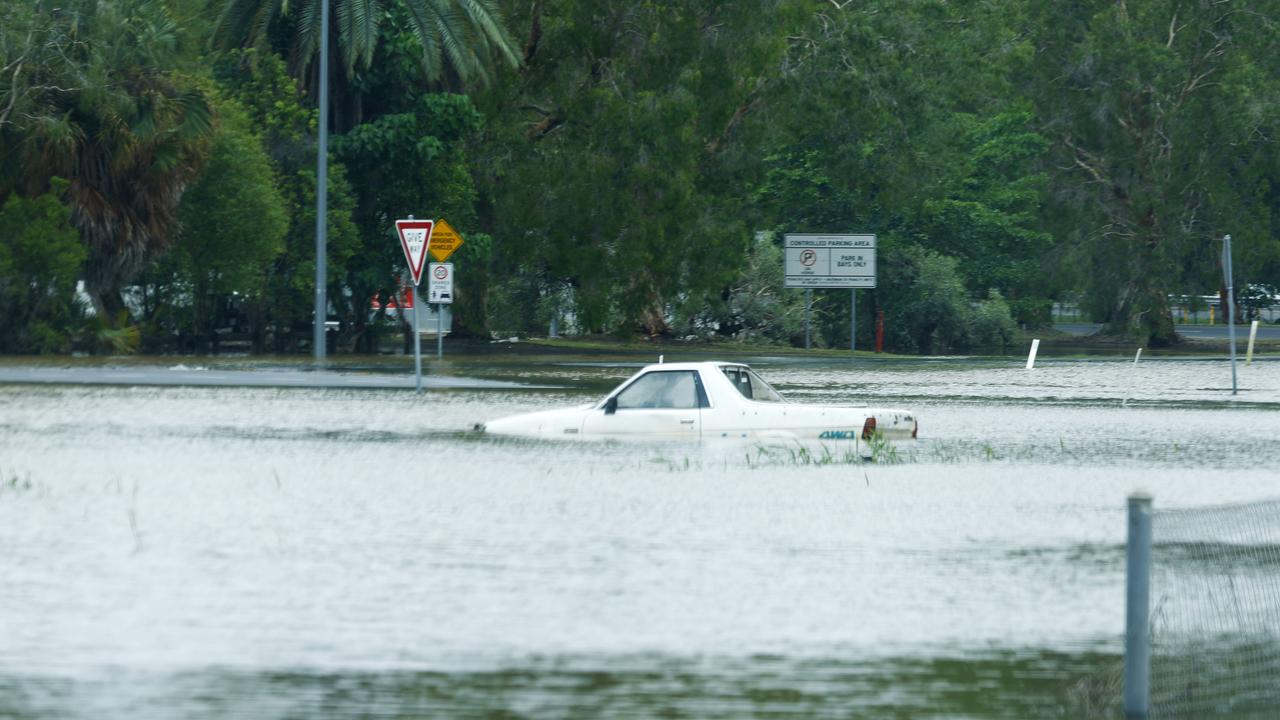
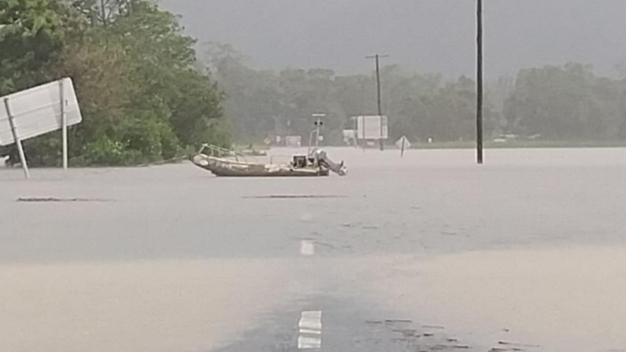
Roads closed due to heavy rain and flooding:
- Burke Development Road at Gamboola and Nolan’s Creek to Chillagoe
- Cape Tribulation Road at Daintree Ferry Terminal
- Kenny Road at Tarzali
- Moomin Road
- Mossman Daintree Road at Daintree Village
- Mossman Mt Molloy Road along Rex Range and Bushy Creek
- Mulligan Highway from Mt Molloy to Lakeland and Annan River Bridge
- Shannonvale causeway
- Shiptons Flat Road at Wallaby Creek
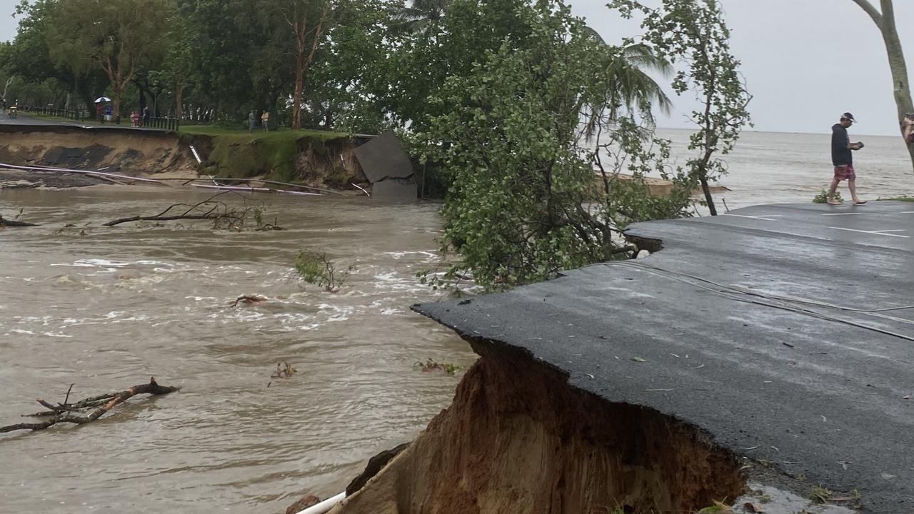
Roads closed due to road damage and debris:
- Cape Tribulation Road at Cape Tribulation
- Captain Cook Highway from Craiglie to Palm Cove and Oak Beach to Pebbly Beach
- Conch Street, Pecten Ave and Reef Street in Port Douglas
- Goldsborough Road at Fisheries Bridge
- Palmerston Highway from Millaa Millaa to Innisfail
- Peet’s Bridge at Goldsborough
- Peninsula Development Road at Laura River Bridge
- Rex Range at Julatten and Shannonvale
- Tinaroo Falls Dam Road
Severe warning cancelled, rain to ease
Severe and major weather warnings for the Far North have been cancelled as Ex-Cyclone Jasper finally makes its way out of The Gulf.
A severe weather warning and severe thunderstorm warning for the North Tropical Coast and parts of the Peninsula and Gulf Country have been cancelled as Ex-Cyclone Jasper moves upward towards the tip of The Cape.
Major flood warnings for Herbert River and Barron River, Daintree and Mossman River and Tully River have been downgraded to minor or moderate warnings and a major flooding warning at Murray River near Murrigal is expected to be reduced as water levels ease.
Showers are forecast for the North Tropical Coast from Ingham to Cooktown and inland to Atherton for the remainder of the week.
Some storm weather is predicted to reach the tip of the Peninsula near Weipa and Lockhart River but will not reach the intensity seen on the coast, according to a Bureau of Meteorology spokesman.
“It’s not like want we’ve seen is moving that way,” Community information officer Daniel Hayes said.
“In the next few days we will see shower and possible storm activity.
“But we are easing off large, widespread and intense rain,” he said.
Forecasts for Ex-Cyclone Jasper show a less than five per cent chance of re-intensification into a tropical cyclone system as it moves way over The Cape throughout the week.
Roads remain blocked, including large parts of the Captain Cook Highway from Palm Cove to Craiglie and Smithfield to Stratford and the Palmerston Highway from Millaa Millaa to Innisfail.
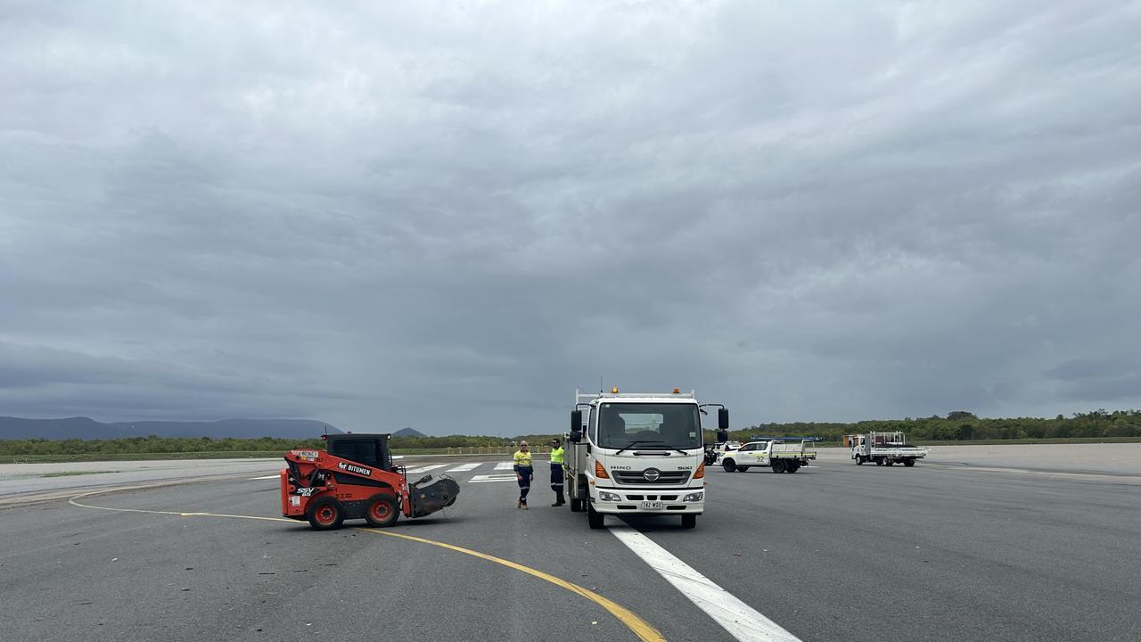
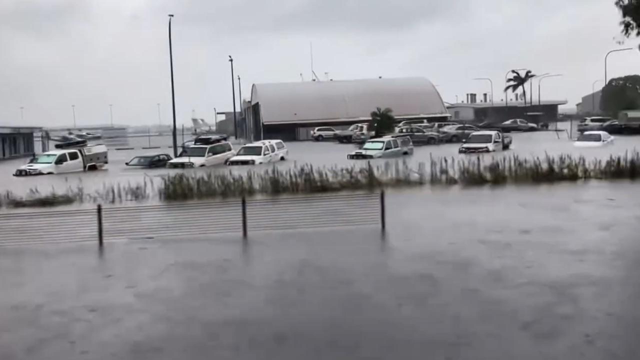
4pm: Cairns Airport runways cleared for landing
The Cairns Airport is now clear and its runway is ready for flights from Tuesday.
Cairns Airport CEO Richard Barker said it was the first time ever flood waters have made it over the airport’s levy.
“Yesterday we shut down operations with water lapping at the edge of the runway and by 10pm when I left the entire runway was under at least 30cm of water,” he said.
“We didn't think we would be in this position today as we had real fears that the domestic and international terminals would flood overnight.
“Thankfully the flooding had started to ease and we have pumped out all of the water and we had equipment cleaning the runway.
“The it is now clear and dry and we have had our first private aircraft take off this afternoon.
“I am incredibly proud of the team and all the other businesses involved and that we now have an operational airport before our busiest time of the year.”
The airport has spent the day helped by local business to pump water out from, clear, and inspect their runway along with its lighting and infrastructure.

“The runway is now clear and the runway lighting is operational, so the aerodrome is serviceable for aircraft movements,” an airport spokesperson said.
“We held a briefing with our airline partners and other key stakeholders a short time ago, and provided a detailed update.”
Airlines will now assess their own flight operations and procedures to determine when they can recommence services at Cairns Airport.
Please contact your airline directly for information about specific flights, particularly if you have a service booked tomorrow (Tuesday).
“We are grateful for your ongoing co-operation and understanding,” they said.
“The safety of the public, our community and stakeholders is our highest priority.”
The domestic and international terminals, including the car parks, have not been adversely impacted by the flooding.
A further update will be available from 7.30pm.
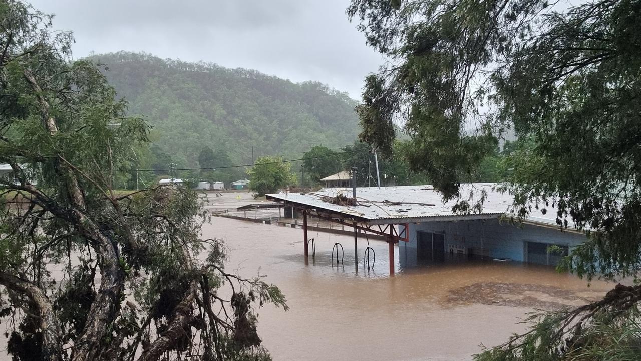
3pm: Race against time to evacuate community
Wujal Wujal Mayor Bradley Creek said authorities were in a race against time to evacuate people from the Indigenous community before high tides later today bring a fresh round of flooding.
Mr Creek’s niece and her young son were among the people trapped on the roof of the town’s hospital as floodwaters rose on Sunday night.
He said the pair, along with a nurse, doctor, the hospital boss and ambulance driver, were trapped for hours before they were rescued.
“They got a call out and next thing you know they got a shock with all the rivers coming up and quickly jumped on top of the ambulance car,” Mr Creek said.
“After the water came up past the spare tyre (on the back of the vehicle), they jumped from the ambulance roof onto the hospital roof.
“That was in the early hours of this morning.”
Mr Creek said it was now a race against time to evacuate community members by air with another high tide expected this afternoon.
He said helicopters were staged about half way between Cooktown and Wujal Wujal, ready to fly in to begin evacuating residents.
“We’re requesting that all the community should leave,” he said.
“Everyone is waiting for the helicopters to come and evacuate them to Cooktown or Cairns.
“No one can get in or out by road.”
Mr Creek said the high tide would bring a fresh inundation of water into the already soaked township.
“It’s accessible now while the water is down but they want to get out of there before 3pm because there’s a big tide over three metres coming and it’s back to flooding again.”
Mr Creek said the people rescued from roofs had been “very lucky”.
He is currently trapped in Cairns awaiting the birth of his second child and said it had been difficult not being with his community and waiting for updates.
“I have family keeping in touch,” he said.
“They said it was pretty scary. No one could see what was happening because it was dark.
“It is stressful because I can’t do much from down there, I’d like to be with my community.”
Meanwhile, Cook Shire mayor Peter Scott was preparing to welcome a significant number of Wujal Wujal residents.
The council would accommodate the residents at the community’s disaster shelter, he said.
“It’s dire straits … QFES hasn’t been able to get through.
“There are elderly, sick and a pregnant lady waiting (to be rescued).
“I understand not everyone (from Wujal Wujal) will come up but no matter how many there are, we’re ready for them.”
“When (Tropical Cyclone) Ita came through (in 2014) we had 250 in the disaster centre and that was comfortable.”
The relentless rain had left “everything soaked”, the longtime mayor said.
“The road (to Wujal Wujal) is cut in half. The Lion’s Den (Hotel) has been washed away. Our water treatment plant was underwater at on stage, so we’re conserving what we have through water restrictions.”
Earlier on Monday: Sewage leaking onto Cairns’ streets as water supply to northern beaches damaged
Cairns Regional Council is warning residents to not enter floodwaters near sewage treatment facilities due to flooded systems spilling raw sewage onto the streets.
Respite from torrential rain on Monday allowed authorities to enter infrastructure and remove debris that was blocking water supply to treatment facilities, which had almost totally depleted Cairns’ water supply by Monday morning.
But massive damage to water infrastructure at the northern beaches suburbs means residents of Holloways Beach are likely to be reduced to bottled water only.
“The water situation has improved greatly … we’ve now just started to manufacture treated water,” Cairns’ mayor Terry James said.
“We have given priority to reservoirs that service the CBD and in particular the two hospitals. They are now receiving treated water.”
Mr James said the damage and water cuts were confined to suburbs within the Barron River delta, including Holloways Beach, Machans Beach and Yorkeys Knob.
He said there was some damage at Palm Cove, too.
“Unfortunately we’ve got a lot of breaks in the northern beaches, water is leaking out … we will run out of water in the northern beaches unfortunately until some time the water recedes and we can assess the damage under the roads. In some cases the (infrastructure) has just disappeared completely.
“We’ll work on a plan for the northern beaches. It may be bottled water in the interim, until it can be repaired.
“We’re asking people to conserve water.”
Mr James said DTMR had advised council travel would soon become possible on some major highways.
“The Kuranda Range Rd should probably come back online tomorrow, one lane, at this stage. It’s the same with the Gillies Hwy,” he said.
“The road north to Port Douglas will unfortunately take quite a long time. There’s one rock that’s come down that’s larger than everybody’s house.
“They’re still working on the Bruce Hwy, it is still cut down south somewhere.”
Mr James said there was damage to the sewerage infrastructure in Cairns.
“Our sewerage infrastructure is flooded. Don’t go in water around the sewage treatment plants because there is raw sewage in there.”
Cairns Regional Council operates sewage treatment plants at McGregor Rd in Smithfield, Greenbank Rd in Aeroglen, Machonachie St in Woree, Swallow Rd in Edmonton, Rushworth Rd in Gordonvale and Clyde Rd in Babinda.
Critical water shortages due to blocked pipelines
Water supply has reached critical lows across Cairns as residents are warned what’s remaining is likely to disappear soon.
Cairns Regional Council have warned residents to conserve water as they work to repair the water treatment plant at Crystal Cascades, with treated supplies in the reservoirs now depleted and some residents already without water.
Mayor Terry James said the water intake had been blocked by debris caused by the severe weather which had prevented water from being treated for days.
“Major flooding has caused a major blockage at the Crystal Cascades intake which supplies the water treatment plant at Tunnel Hill,” Mr James said.

“This morning our crews navigated very challenging conditions and landslides and had to climb their way into Crystal Cascades to access and clear the debris from the intake to the treatment plant.
“Work to restore water supply is ongoing. We are hopeful of clearing the blockage today.”
The mayor also clarified council had not shut off the supply at any point.
“Council has not turned water off, as many are reporting,” Mr James said.
“We have simply run out of processed water.”
Supplies will remain limited, even if crews are able to restore services today, until the reservoirs are replenished.
Mr James said it was crucial for residents to conserve water and only use remaining supplies for drinking water, personal hygiene or medical reasons.
“The co-operation of the Cairns community in conserving water during this challenging period is crucial,” Mr James said.
“We do not want to see people outside hosing their driveways.”
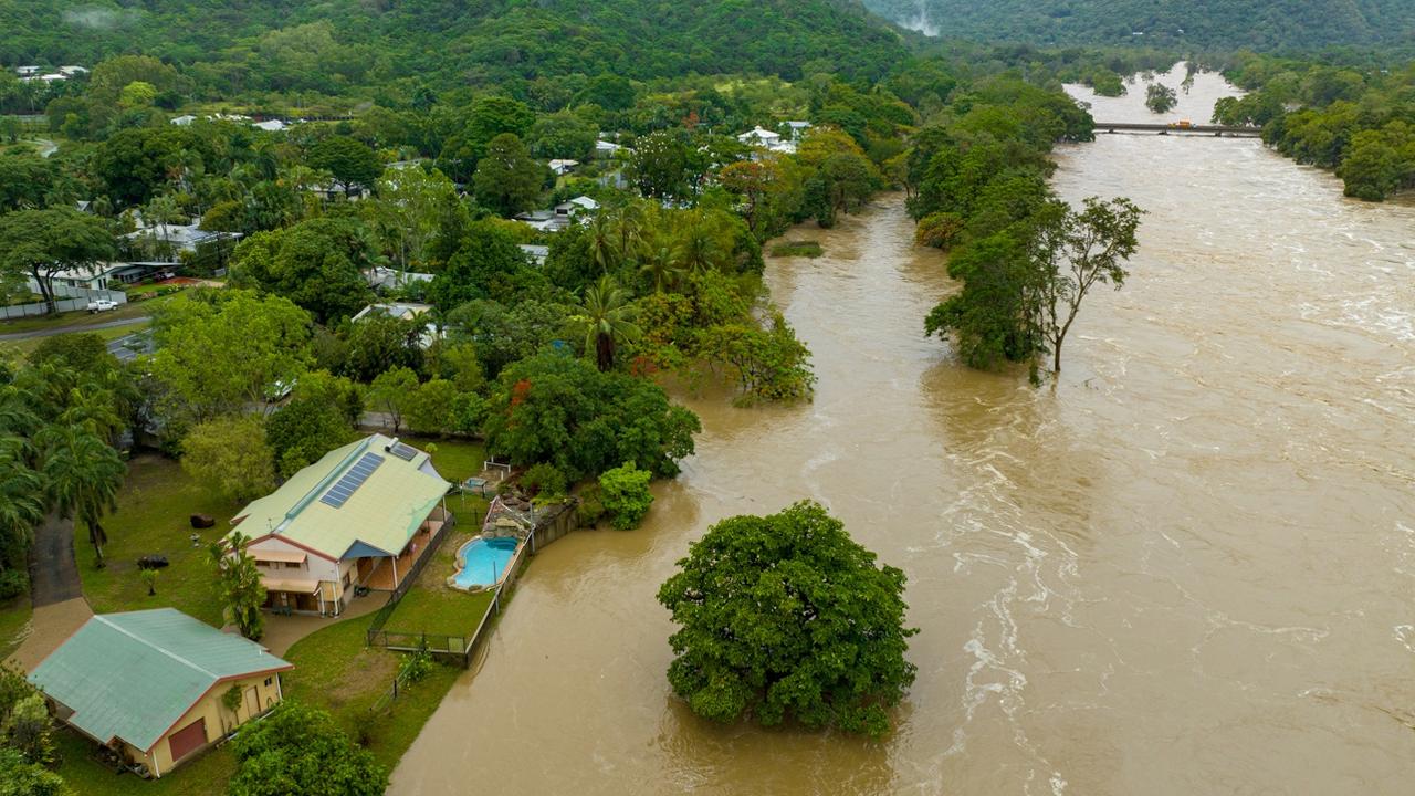
Record-breaking rains and floods for Far North
Skies are set to clear as flood levels and rainfall totals reach recording-breaking heights across the Far North.
Intense and widespread rain is predicted to ease before the afternoon while almost a metre of rain was recorded overnight at several Far North locations, with floodwaters and rainfall totals reaching record-breaking levels not seen since the 1970s – or 1913 at one flood gauge.
Bureau of Meteorology spokesman Daniel Hayes said record-breaking rain totals were already dissipating.
“Already the rain has really dropped off around Cairns, it did continue a bit longer up towards the Daintree and Cape Tribulation but even in those areas it’s subsided quite a bit,” Mr Hayes said.
Mr Hayes said Kuranda railway station surpassed the previous December rainfall record three times in the last week alone, recording 517mm in the 24 hours to 9am Monday morning, 510mm to 9am on Sunday, and 450mm on December 14, as Ex-Cyclone Jasper made its way past the coast.
“Before last week the record was 244mm which was on December 31, 1974,” Mr Hayes said.
Barron River at Myola recorded a peak of 14.09m overnight, levels not seen since 1913, while further downstream at Cairns Airport another record was broken.
“In the lower reaches of Barron River, around the airport, we peaked at 4.4m which is well above the previous record of 3.8m in 1977, there will probably be another peak (Monday) afternoon at high tide but it is not expected to reach above levels already recorded,” Mr Hayes said.
While it is still not fully understood how this flood compares to previous year’s data, the SBS spoke to James Cook University geohydrologist Professor Jonathan Nott who said the levels had reached record heights “by a substantial amount”.
Several places have also recorded massive rainfall totals since the arrival of Ex-Cyclone Jasper off the Far North Queensland coast with Black Mountain, Baird and Myola rain stations all recording over two metres of rain, closely followed by Yandill (west of Cape Tribulation) and Daintree Village, which recorded 1813mm since last week.
Close to a metre of rain fell in the 24 hours to 9am this morning at Baird, which recorded an 870mm total, and Diwan which received 829mm.
While conditions are easing, Mr Hayes said the rain was not completely over but would not completely disappear.
“We’re still expecting to see major flooding through Daintree and the Barron at least until the end of (Monday),” he said.
“There will be general easing of widespread areas of rain and intense heavy rainfall but still ongoing risk of showers and thunderstorm so still be some quite intense rainfall as they occur, particularly in the areas north of Cairns towards Weipa and Kowanyama but it’s not coming down across such a widespread area all at once.”
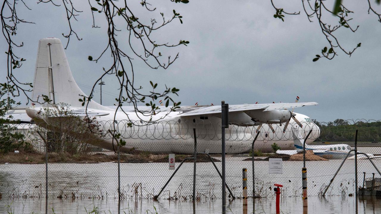
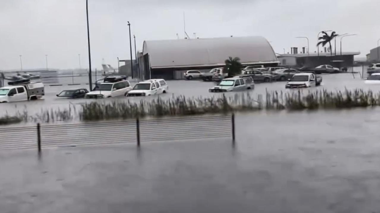
Latest on Cairns Airport closure
Cairns Airport will remain closed on Monday while the organisation assesses the runway and clears “significant debris”.
In a statement, the airport said flooding at the aerodrome and general aviation sections had subsided.
Flooding at the airport is unprecedented, and Sunday was the first time the airport’s levee bank was breached.
Once debris is cleared, the airport will be in a position to assess its runway infrastructure, “to determine its serviceability”.
“This will take some time. As such, we can confirm that operations will not recommence at Cairns Airport today,” an airport spokeswoman said.
“Please do not travel to the airport today.”
All flights scheduled for Monday have been cancelled or delayed.
Please contact your airline directly for information about specific flights.
“We also wish to reiterate that our domestic and international terminals, including the car parks, have not been adversely impacted,” the spokeswoman said.
Another update will be provided at 4pm on Monday.
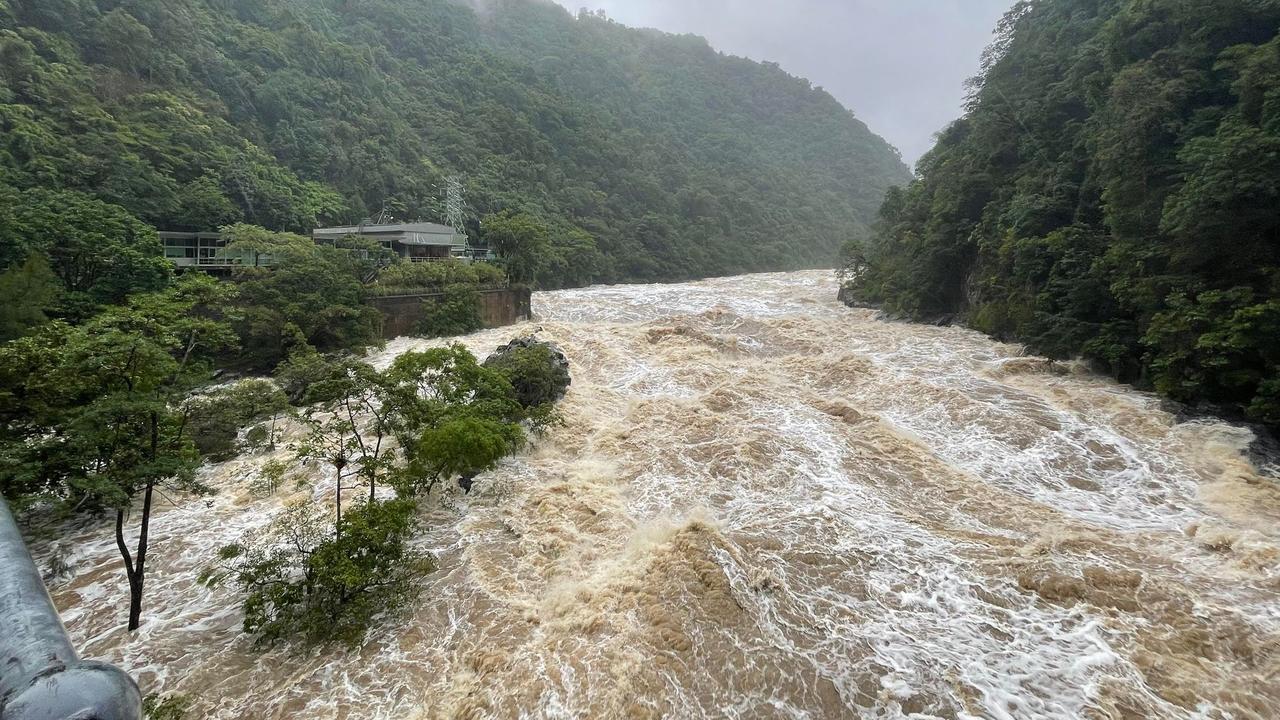
Trough from ex-cyclone smashes Far North
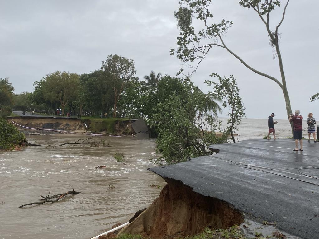
Daintree Village, 120km north of Cairns, is experiencing record-breaking flood levels.
Rainfall tallies are now metres above the 2019 flood levels and heavy rain and flash flooding are predicted to continue into early afternoon across the Far North Coast, according to the Bureau of Meteorology.
A coastal trough linked to Ex-Cyclone Jasper is inundating Far North Queensland between Hope Vale and Cairns with heavy rain and potential thunderstorms predicted for Monday morning, easing into the afternoon and possibly reducing below warning levels by evening.
Daintree River at Daintree Village peaked at 14.85 metres at around 4am Monday morning, 2.25 metres above 2019 flood levels, is expected to remain above major flood levels throughout the day.
Latest tracking map from the Bureau of Meteorology shows a coastal trough linked to Ex-Cyclone Jasper moving across the region from Hopevale to Cairns. Picture: BOM
Six hourly rainfall totals of 150 to 200mm are likely across the coast and six hourly totals of 300mm are possible between Hope Vale and Palm Cove, most likely coinciding with thunderstorms.
Severe weather warnings continues for the North Tropical Coast, Tablelands and Peninsula with a severe thunderstorm warning also issued for the Peninsula.
Major flood warnings remain for Herbert River, Daintree River and Mossman River, Barron River and Murray River as significant rainfall totals are recorded in under 24 hours from 9am Sunday to 4am this morning.
Significant rainfall totals across Far North Queensland from 9am Sunday to 4am Monday:
• Yandill (west of Cape Tribulation): 654mm
• Myola: 635mm
• Daintree Village: 586mm
• Mossman Treatment Plant: 581mm
• Port Douglas: 357mm
• Cairns Airport: 305mm
Historic flood not seen in 100 years
It has been a century since the Barron River at Myola last experienced a flood of this proportion, BOM data shows.
At 5pm on Sunday, the river gauge above the rainforest village of Kuranda peaked at a height of 14.09m, falling to 12.85m this morning at around 3.30am.
That far eclipses other significant floods in March 1977 and when Cyclone Steve hit the Far North in 2000.
The second-greatest flood on record at Myola was in 1913 when the river height reached a peak of 14.76m.
The greatest flood on record at Myola was two years prior to that, in 1911, where the river peaked at 15.37m.
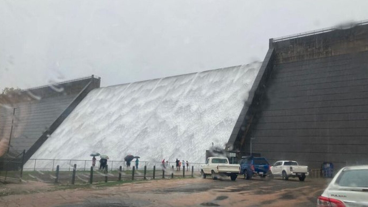
According to the BOM, Tinaroo Dam, constructed in 1958, has little effect on large floods in the Barron River.
Sunday 8pm: Cairns’ water supply critically low
The Cairns region is 14 hours from running out of water if weather prevents the council from clearing infrastructure blockages and residents don’t turn off the taps, mayor Terry James said.
Water intake pipes at treatment plants have been blocked by debris washed into the system by extremely heavy rainfall in the past 72 hours.
Mr James said the council, alongside QFES personnel, would attempt to unblock the pipes at first light on Monday.
“If we can’t unblock it, we will run out of water in the reservoirs by 10am tomorrow,” he said.
“We’re stressing to people to use water for emergency purposes only – as drinking water, to save or preserve life.”
The region has a series of interconnected reservoirs that can hold about 250ML.
The region’s average daily use is about 65ML, meaning the reservoirs hold little more than four days’ supply when they are full but the intakes at the treatment plants are blocked.
Mr James said the reservoir levels were at 30 per cent, and falling fast.
If they are totally depleted tomorrow, residents would need to rely on bottled water or other supply stored within their homes.
“It is an emergency,” he said.
“If we run out of supply from the reservoirs, there is no contingency plan.”
More Coverage

Originally published as Far North Qld floods: Mossman-Mt Molloy Road, Rex Range now open
Join the conversation

Review: Addams Family brings spooky charm to Cairns stage
Despite the pre-show warning of a ‘frightful’ evening, I still screamed when jump-scared by a member of the ensemble waiting in the wings to freak out the audience. READ THE REVIEW.
Read more

Qld youth crime crisis: ‘We still have a long way to go’
Six months after the introduction of the state government’s tough new laws for serious youth offenders, the results are in.
Read more

‘Vigilante’ bashes ‘pedophile’ in Grindr ‘honeytrap’
A young tradie ‘decided he was judge, jury and executioner,’ when creating a fake ‘honeytrap’ Grindr profile to lure a man to a secret rendezvous before ambushing and bashing the victim.
Read more

‘It’s happened’: Minister caught out on divisive youth jail consultation
The Youth Justice Minister has walked back on her comments about consulting Cairns councillors over a controversial youth detention centre proposed for the southside. What was said.
Read more

‘He made me shave his genitalia’: Disability support worker speaks out
Police are investigating claims an Cairns-based NDIS recipient is targeting independent women support workers for the purpose of sexual gratification.
Read more

Inside Far North early intervention program for at-risk kids
A Far North adventure-based service has been tasked with mentoring the region’s at-risk kids under the state government’s early intervention schemes. How they’ll do it.
Read more