
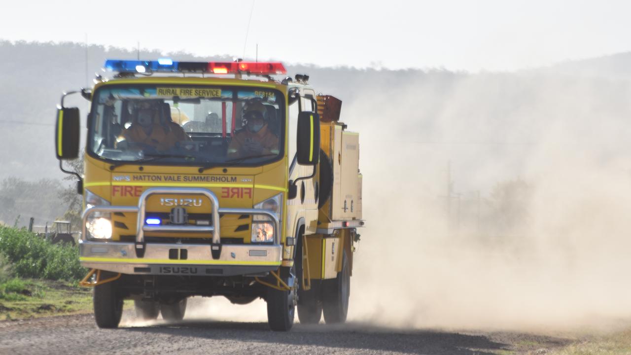
Far North weather: Road closures and flood risks impact Cairns region
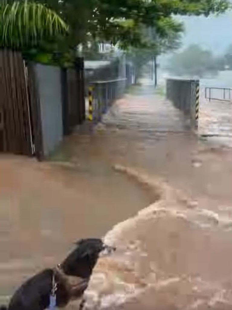
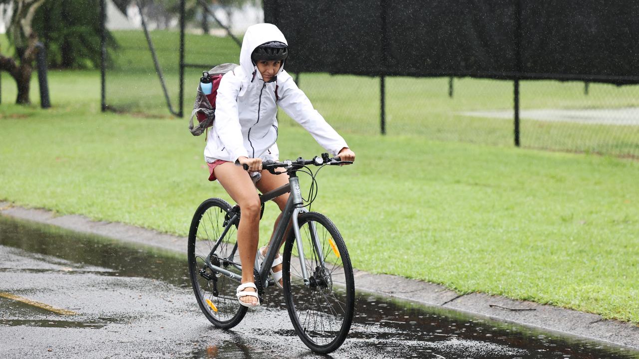
Cairns streets have turned to torrents of brown water after a short sharp deluge pummeled the city, causing event cancellations and the early pick up of schoolchildren.
Cairns
Don't miss out on the headlines from Cairns. Followed categories will be added to My News.
Cairns streets have turned to torrents of brown water after a short sharp deluge pummeled the city, causing event cancellations and the early pick up of schoolchildren.
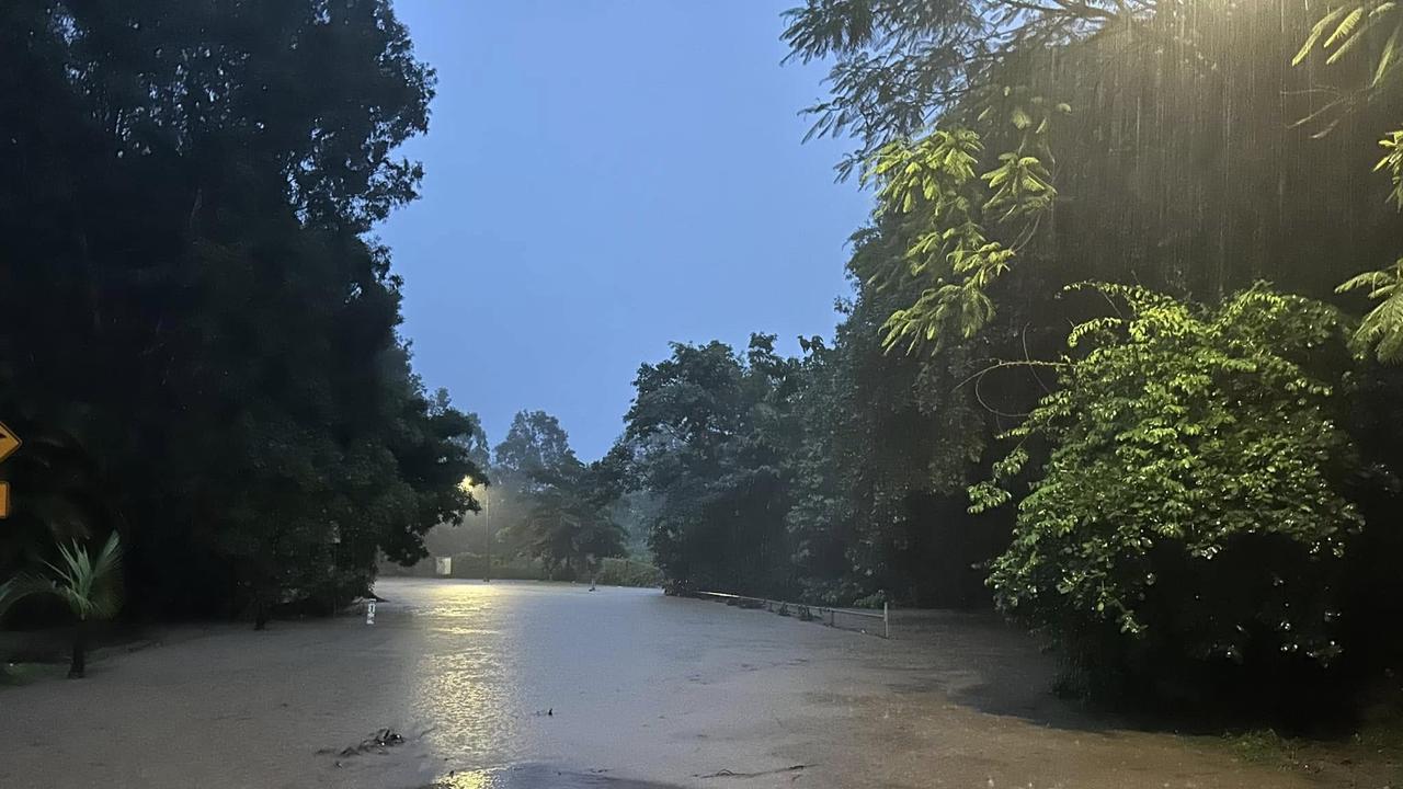
At 1pm the torrential downpour overwhelmed CBD drains, causing stormwater systems to back up and create knee deep puddles in some places.
It was a similar story in the suburbs as water drained across streets in Edge Hill.
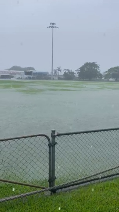
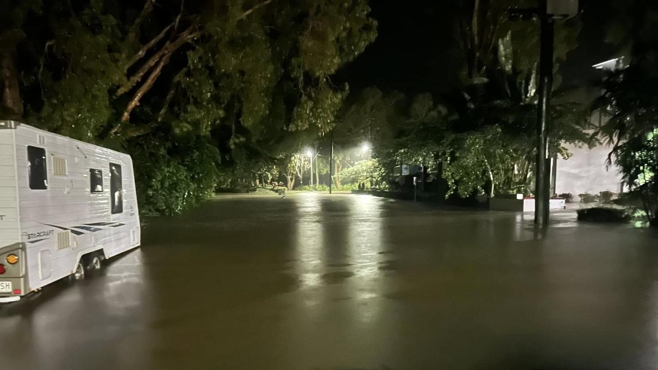
Collins Ave in the Cairns Botanic Gardens was covered by water while roads such as Mayers St were turned into what appeared to be a large brown lake.

Greenslopes St and Reservoir Rd were also affected.
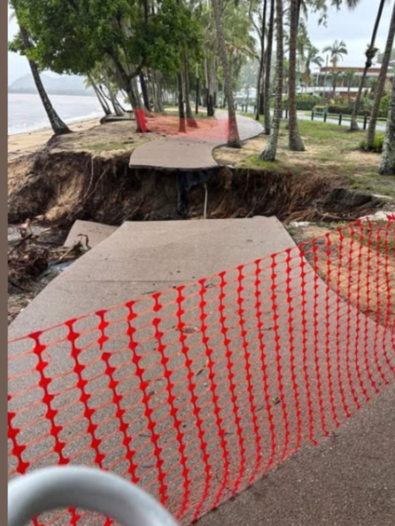
At the Northern Beaches, McGregor Rd was awash with water and erosion at Clifton Beach has decimated the waterfront after constant and heavy overnight rain combined to make a four day total at the Cairns Airport of 323.4mm.
In the 24 hours to 9am Tuesday, 164mm of rain was dropped on already waterlogged ground and between 12.30pm and 2pm and 2pm a further 80mm smashed the city.
The council has issued a “stay informed” flood warning for areas between Palm Cove and Babinda.
Over the week the tropical low designated 13U dropped in excess of 700mm across a large number of sites between Ayr and Cairns with the weekly rainfall total (to 3 February) at a Bureau gauge recorded at Cardwell Range with 1697.0 mm.
The Cardwell Range gauge also recorded the highest daily rainfall total for this week, with 626.0 mm in the 24 hours to 9 am on 3 February.
Disaster coordinator for Cairns Regional Council Rhys Newton said areas of Cairns received 160mm in the 24 hours to 9am Tuesday.
“Which is a lot of rain, especially when you consider the saturation point of the ground.
Every bit of water runs off,” he said.
Mr Newton said the council’s advice was for people to heed the warnings and understand
the risk of flash flooding.
“It’s a very dangerous event. If you don’t need to be on the road, don’t be driving on
the road,” he said.
“If it’s flooded, forget it.”
Mr Newton said the region had “turned the last corner” when it came to this rainfall
event, but warned there was still potential for heavy falls on Wednesday.
“This next 24 hours can still see isolated falls of rain of between 50-100mm – that’s a
substantial amount of water especially in our environment at the moment,” he
said.
Rainfall totals from Thursday onwards are forecast to decrease.
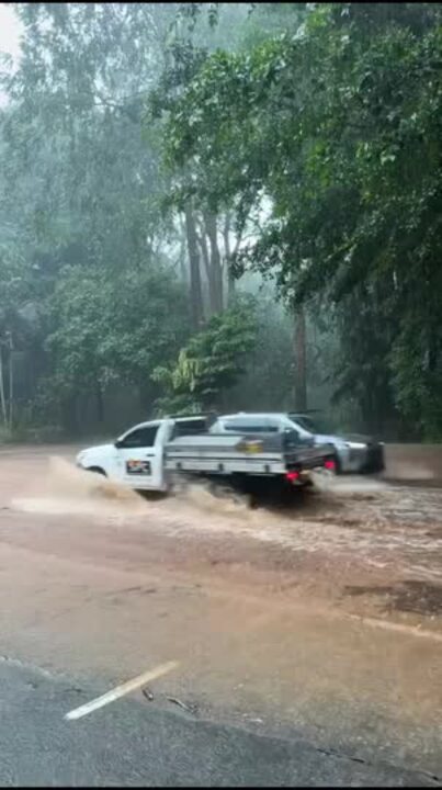
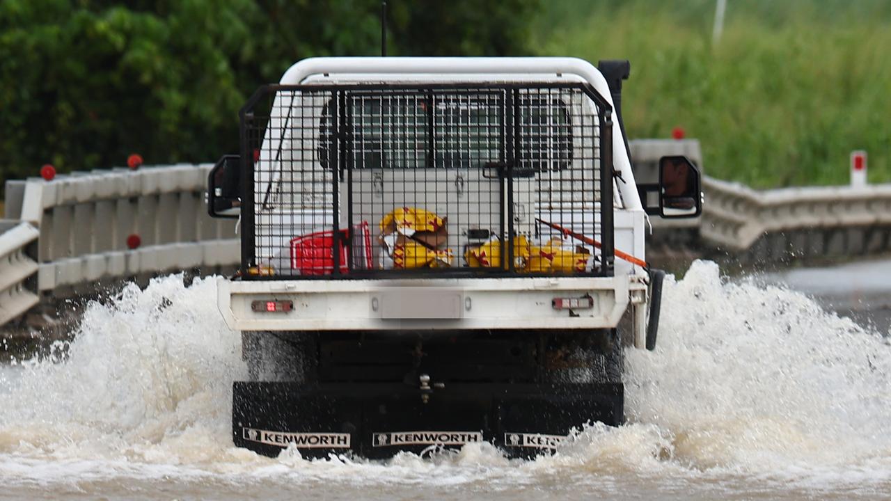
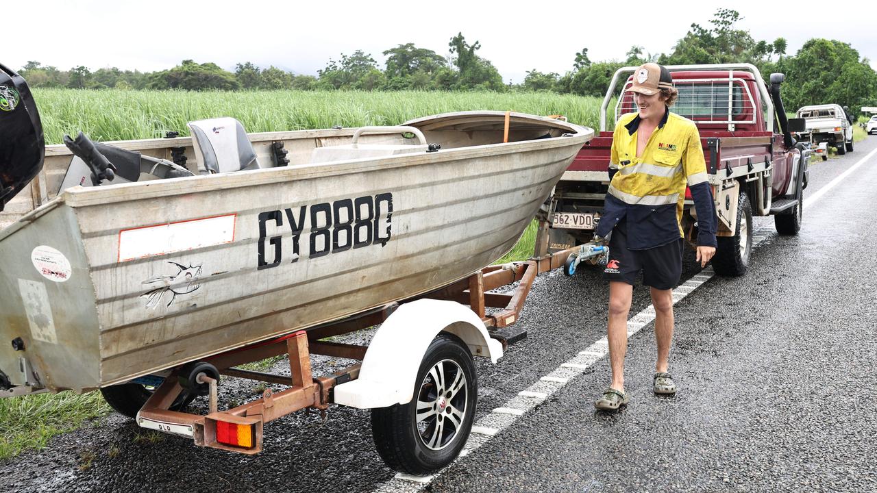
Traffic was impacted in several areas across the region on Tuesday morning after heavy rainfall caused flash flooding on key routes, leading to delays and hazardous conditions.
The commute into the city took twice as long as usual, with some experiencing delays which turned a typical 20-minute trip into an hour or longer.
Just after 1pm on Tuesday, Cairns Regional Council issued a stay informed flood warning from Palm Cove to Babinda.
A number of streets in Cairns City are experiencing minor flooding, but people who are parked in the city are urged to check on their cars and move them if necessary.
Over the past week, high rainfall totals have saturated the Mulgrave and Russell catchments, which has caused river level rises and flooding.
A council spokesman said several low-lying roads across the region had temporarily closed due to flooding.
“Closures could be impacted by tide movements which are set to peak around 2pm today,” he said.
Heavy rainfall is expected to continue along the tropical east coast and inland areas, potentially causing further flooding.
The situation is being closely monitored and updates will follow as needed.
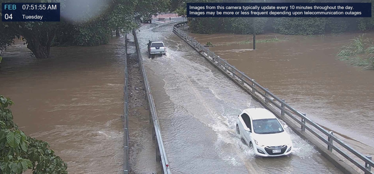
This comes as numerous roads were flooded and caused long delays for commuters.
The Captain Cook Hwy at Ellis Beach was closed for several hours from 6.30am due to water across the road, while the stretch of highway at Palm Cove between Veivers Road to Palm Cove Boulevard is reduced to one lane.
The Kuranda Range was also temporarily reduced to one lane in multiple locations due to multiple landslips and trees down.
Just before 9am, the highway at Ellis Beach was re-opened to one lane, however, Queensland Police stated rocks were on the road, and advised drivers to proceed with caution.
Dunne Road at Yorkeys Knob was closed to all traffic just before 10.30am on Tuesday after heavy rain caused additional flooding to the road.
In Freshwater, Brinsmead Road and Stratford Connection Road was also closed at 10.40am due to water over the road.
Lake Morris Road in Mooroobool also remained closed due to a landslip, allowing emergency vehicle access only.
Bureau of Meteorology senior meteorologist Miriam Bradbury said the Cairns region had experienced significant rainfall throughout Monday afternoon and heavy rainfall overnight across flood-affected areas.
“Throughout Monday, rainfall continued across flood-affected areas,” she said.
“However the intensity of the rain did gradually begin to ease.
“Six-hour rainfall totals through Monday generally peaked in the 50-100 mm range, which is much lower than what we saw across the weekend.”
From 9am Monday to 5am on Tuesday, widespread rainfall of 80mm to 120mm fell between Townsville and Cairns.
The senior meteorologist said the highest totals in the area were recorded near Innisfail, Tully, and Ingham, with some locations seeing heavier falls, such as 167mm at Clyde Road near Babinda.
Despite the intensity easing compared to the weekend’s deluge, river levels remained high in flood-impacted zones.
“Major flooding continued along several river catchments, including those in the (North Queensland) region, like the Herbert River,
Burdekin River, and Haughton River,” Ms Bradbury said.
Flood warnings are in effect, with moderate warnings for areas like the Ross River catchment, which is not expected to reach major flood levels.
“Ongoing heavy rainfall since Monday last week has led to significant river level rises and flooding in the Mulgrave-Russell catchment area,” Ms Bradbury said.
Showers, with the potential for heavy rainfall, are expected to continue in the coming days, which could lead to further rises in river and creek levels.
Authorities are closely monitoring the situation.
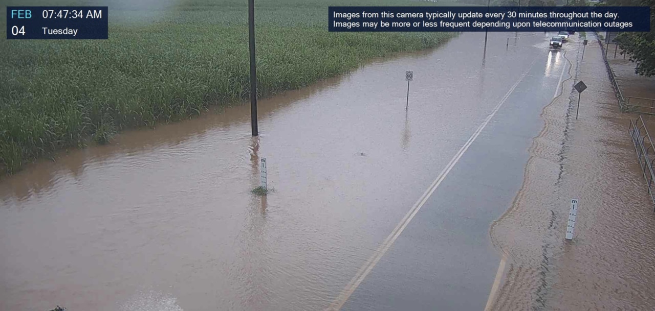
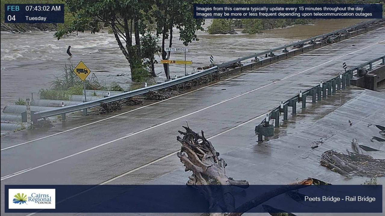
This includes minor flooding at Peets Bridge and likely at Gordonvale early Tuesday morning, according to the Bureau.
The Mulgrave River at Peets Bridge were at 5.05m and rising, with minor flooding on Monday, February 3, both are likely to remain above the minor flood level into Tuesday.
The ongoing flood risks were accompanied by a severe weather warning for heavy rainfall, particularly between Cardwell and Townsville, including areas like Ingham and Rollingstone.
“The risk of further localised heavy falls was expected to continue through Tuesday, though it would likely ease later in the afternoon,” Ms Bradbury said.
Looking ahead, further rainfall is expected across northeast Queensland, with a forecast for more locally heavy falls between Cairns and Townsville.
“The region will see continued showers and thunderstorms through the week, which could prolong existing flooding and potentially cause new areas of concern,” she said.
The rain could be lighter than what was seen on the weekend, but with the rivers already swollen, any additional rainfall will exacerbate the flood situation.
This comes as the emergency alert for Cardwell, issued just before midnight on Sunday, February 2, has now been cancelled.
Earlier, the Cassowary Coast Regional Council, issued an emergency warning due to dangerous flooding in low-lying areas of Cardwell.
Residents were advised to move to higher ground immediately, as the flooding posed a potential threat to life and property.
More Coverage


Originally published as Far North weather: Road closures and flood risks impact Cairns region
Join the conversation
Cops chase arsonist after series of suspicious fires
Tablelands CIB officers are on the hunt for a serial fire bug, and are appealing for information following suspicious fires lit in bushland surrounding Mareeba.
Read more

68yo charged in FNQ shooting following police standoff
A 68-year-old man has been charged following an alleged shooting incident of another man at a remote Far North Queensland property.
Read more

Four years jail for ‘cowardly pursuit’ that ended ‘great’ dad’s life
A teenager who tried to pick a fight with a father then chased the man onto a busy road where he was struck and killed, should be out of jail before the end of the year.
Read more
‘Ludicrous’: Councillor speaks out over ‘greenwashing’ of carbon credits
Cairns Regional Council will sell its carbon credits to major global polluters with angry councillors claiming mayor Amy Eden is greenwashing the city’s environmental credentials.
Read more

What dropped transgender service could mean for Qld
A desperate plea to create a transgender social service has been issued to community leaders after the Cairns Sexual Health Clinic suddenly dropped their “lifeline” adult support group.
Read more

Nation’s brightest business voices reveal key to success
From Olympic medallists to multinational CEOs, Australia’s finest have revealed their secret to success in a multi-day Queensland convention.
Read more