
Bureau of Meteorology closely watches tropical low forms off the coast of Queensland
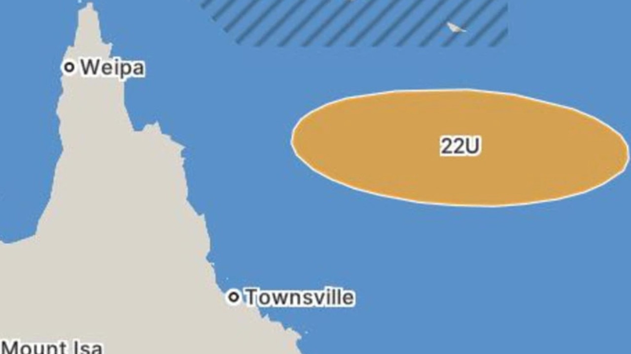
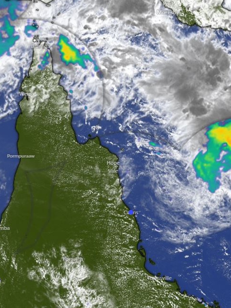
A tropical low, designated 22U, has formed over the northern Coral Sea, and the Bureau of Meteorology says there is a high chance it could develop into a tropical cyclone by Monday.

Cairns
Don't miss out on the headlines from Cairns. Followed categories will be added to My News.
Residents of Far North Queensland are being warned a tropical cyclone could form by Monday, as tropical low 22U has developed over the northern Coral Sea.
On Friday, the Bureau of Meteorology increased its assessment to a ‘high chance’ of it strengthening into a tropical cyclone.
The system is currently located about 400 km northeast of Cairns, well off the Queensland coast, and is not expected to directly affect the Far North state at this time.
Senior Bureau Meteorologist, Jonathan How said, there are several possible scenarios.
“The system could either drift further south over the Coral Sea or move east towards New Caledonia and Vanuatu,” he said.
The low is expected to move slowly east and southeast over the next week.
“While the chance of it becoming a cyclone is currently low, it will increase to moderate by Saturday and high by Monday,” Mr How said.
The Bureau will continue to monitor the situation, and Queenslanders are advised to stay informed for updates on potential cyclone development in the coming days.
This comes after he Bureau of Meteorology said on Thursday it was closely monitoring the system, which could potentially become a tropical cyclone by late Sunday, February 23.
At time of the original reporting on February 21, the tropical low was still in its “early stages”, characterised by the Bureau as a disorganised cluster of thunderstorms in the northern Coral Sea.
However, senior meteorologist Kimba Wong said it was beginning to take shape, with the chances of cyclone development expected to increase over the next few days.
“While it’s still in a low-pressure state, the system is expected to intensify, particularly from Saturday into Sunday, with a moderate chance of cyclone formation,” she said.
With the system currently still in the early phases of development, Ms Wong said it was showing signs of strengthening.
“By late Sunday into early next week, the likelihood of it becoming a tropical cyclone increases significantly, reaching about 55 to 60 per cent.”
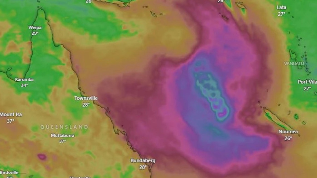
The tropical low is expected to move in an east-to-southeast direction over the coming days, but its exact path remains uncertain for now.
“Even if the system doesn’t fully develop into a cyclone it could still have a significant impact on the Queensland coast, particularly in the form of strong winds and heavy rainfall,” Ms Wong said.
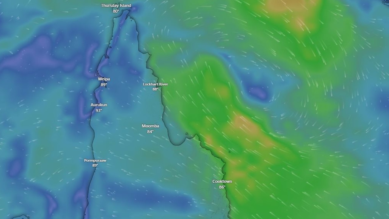
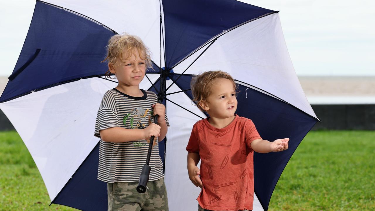
For now, residents in the wet tropics should brace for increasing wind strength and showers from Friday to Saturday, as the low-pressure system interacts with a high-pressure system in the Tasman Sea.
“This will cause a ‘pressure squeeze,’ resulting in stronger south-easterly winds along the east coast and an increase in showers, particularly in the tropical north,” Ms Wong said.
Ms Wong said although the rainfall forecast doesn’t suggest an immediate risk of river flooding, authorities are urging residents to remain vigilant.
“The region remains saturated from recent rainfall, so even moderate rainfall could worsen conditions, however, the immediate risk of severe flooding appears low,” she said.
The senior meteorologist said as recovery efforts continued across the region following recent floods, further rainfall from the tropical low could delay reconstruction and hinder ongoing efforts in the hardest-hit areas.
“The situation remains fluid and the Bureau of Meteorology will continue to monitor the development of the tropical low closely in the coming days,” she said.
The Bureau of Meteorology also confirmed the next cyclone will be named ‘Alfred’, after the next name in-line ‘Anthony’ was removed due to its association with the current Prime Minister of Australia.
“The Bureau has changed the next cyclone name from Anthony, as this name represents a current prominent person in Australia,” a spokesman said.
“We have moved to the next name on the list which is Alfred.”
Keeping in-line with the predetermined alphabetical list, the next names for a cyclone would be Alfred and Bianca.
“When a name matches a prominent person of the time, we reorder to the next name starting with that same letter to avoid any confusion,” the Bureau spokesman said.
Looking ahead the forecast becomes increasingly uncertain, Ms Wong said.
“The uncertainty in the forecast position and strength of the system increases as we head towards the end of next weekend, the first weekend of March,” she said.
“It’s starting to look a little too far ahead to say with certainty what the system will be doing at that stage.”
However, there are some indications the system may curve back towards the Queensland coast.
“It could potentially approach the coastline during the course of the end of next week into the weekend.”
The exact location of any potential coastal crossing is still uncertain, Ms Wong said.
“At this stage, the location of any potential coastal crossing is so uncertain that it’s not worth speculating where it may cross. It could be almost anywhere.”
With cyclone season in full swing, the meteorologist offered a reminder to residents, particularly along the east coast of Queensland, to refresh their knowledge of cyclone preparedness.
“Make sure your properties are secure and you’re prepared for potential cyclone impacts,” she said.
“Keep an eye on any issued warnings and forecasts as the system develops.”
More Coverage


Originally published as Bureau of Meteorology closely watches tropical low forms off the coast of Queensland

Mountain bike rider in fatal crash identified as Cairns legend
A legend of the Far North mountain bike community who tragically died in a fatal crash on a well-known trail has been remembered as a much-loved and respected Cairns figure.

Man injured escaping house fire
A man has been taken to hospital in a stable condition after falling while trying to escape a house fire in Far North Queensland.

Scomo sells quest to send rockets into space from western Cape York
Cape York’s economy is primed to turn its thrusters on, emerging as a key player in the $640bn global space industry, former prime minister Scott Morrison says.
‘Outrageous’: Leaders react to possible crocodile cull
A wildlife expert has warned culling Queensland’s crocodile population “only creates a false sense of security”.
New Pope has ‘fond memories’ of Far North Queensland
Cairns Bishop Joe Caddy says newly elected Pope Leo XIV has visited Far North Queensland and once told him to “make friends with the poor”.

Safety issues outside Cairns Hospital exposed
Nurses in Cairns are on the verge of quitting their jobs due to ongoing safety concerns, feeling forced to choose between personal safety and parking fines.