Severe weather set to hit Australia from Tasmania to Northern Territory
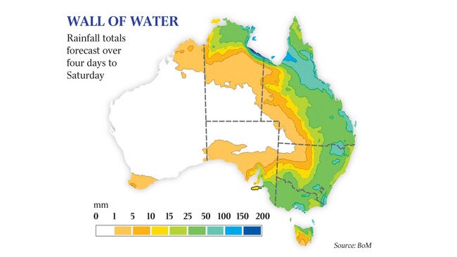
Floods, hail and destructive winds will hit the eastern states over the next four days as Tropical Cyclone Owen intensifies.
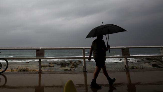
Floods, hail and destructive winds will hit Australia’s eastern states over the next four days, with Tropical Cyclone Owen intensifying in the Gulf as it slowly heads towards land, with Victoria likely to experience its wettest day in a year today.
The Bureau of Meteorology has issued severe weather warnings in several states, with Victoria bearing the brunt of thunderstorms bringing damaging hail and falls of more than 100mm in 24 hours, particularly in central and northeastern regions.
In many parts of Victoria and northern Tasmania, daily falls are expected to exceed December’s monthly average.
Melbourne is likely to be hit with flash flooding today while the extreme rain is predicted to cause rapid river flooding in catchments including the Yarra, Goulburn, Thomson, Latrobe and Barwon rivers before it slowly clears tomorrow, as the fierce low-pressure system heads north along the NSW coast.
Hail warnings have been issued to fruit growers, with Victorian farmers desperately trying to harvest good wheat and grain crops before the deluge arrives.
Meanwhile, Tropical Cyclone Owen is intensifying in the Gulf of Carpentaria, and is expected to strengthen from a category-2 last night to a category-3 cyclone by this morning.
The bureau has a cyclone warning in place from Cape Shield in the Northern Territory to Burketown in Queensland, including Groote Eylandt, Borroloola and Numbulwar, as the system tracks west before it is forecast to turn and head south and east towards Queensland.
“The advice from the Bureau of Meteorology is that people in those areas should expect destructive gale-force winds into Thursday as TC Owen moves south,” regional controller Travis Wurst said.
The BOM expects Cyclone Owen will reach category-3 strength, bringing with it massive downpours and winds gusts up to 224km/h.
There remains a possibility the cyclone could gather strength and head east towards the southwestern coastline of Cape York and east towards Cooktown and the Cairns region tomorrow and at the weekend.
The BOM’s manager of extreme weather James Taylor said to have two extreme weather patterns pushing against each other at the same time was unusual but not unprecedented.
He said north Queensland and the Territory-Queensland border area should brace for dumping rain and cyclonic winds tomorrow and the weekend as the wet season roars into full swing.
Victoria, northern and eastern Tasmania and southwest South Australia face the most severe weather in the next two days, as moisture from Cyclone Owen in the north is sandwiched by a low-pressure system moving across the Bight.

Women egged in anti-Semitic attack at Bondi Beach
Three men allegedly set upon a number of women on Saturday night in Sydney's east, throwing eggs at them, with police believing they were targeted because of the clothes they were wearing.

Nation ‘must not go down road’ of faith-based parties: PM
Parties founded on religion would undermine social cohesion, according to Anthony Albanese, as he reminded rogue senator Fatima Payman that she owed her election to Labor pre-selection.